Cairngorms National Park Map | Top Hikes, Villages, Attractions & Travel Tips
Navigate Cairngorms National Park with ease, find the best hikes, villages, attractions, and travel tips using this detailed map guide.
Author:Callum FraserDec 11, 202587 Shares86.8K Views
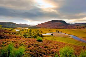
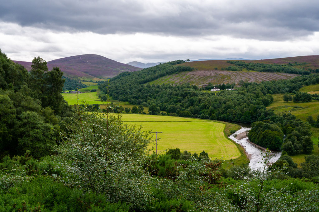
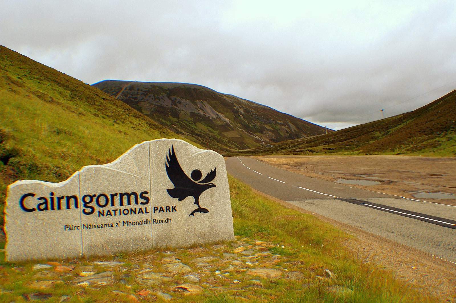
Set in the heart of the Scottish Highlands, Cairngorms National Park offers spectacular scenery with high peaks, deep woodlands, and quiet lochs. Its wide-open spaces and rich natural beauty make it ideal for outdoor activities such as hiking, cycling, and leisurely walks.
A detailed Cairngorms National Park map is key to a safe and rewarding visit, it guides you to top trails, helps you find wildlife hotspots, prevents you from getting lost, and ensures you make the most of your time in the park.
Quick Facts About Cairngorms National Park
- Location:Scottish Highlands, in the northeast of Scotland
- Size:4,528 km² (1,748 sq mi) - the largest national park in the UK
- Established: 2003, expanded in 2010 to include Perth & Kinross
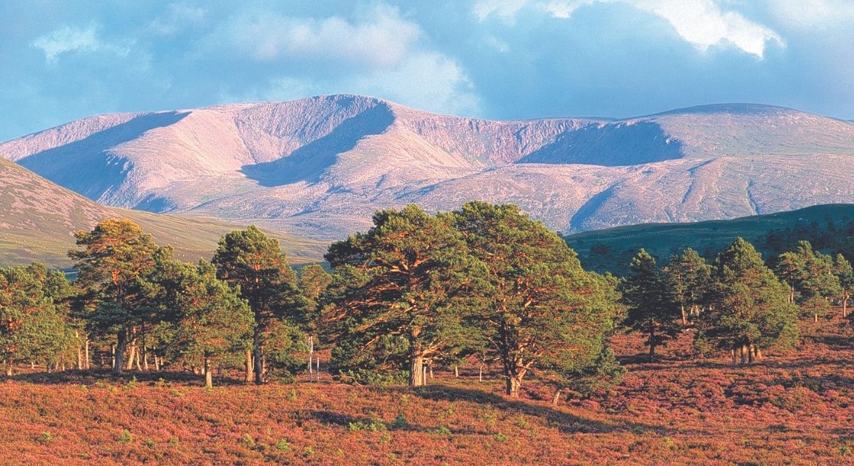
- Mountains:Home to five of Scotland’s six highest mountains, including Ben Macdui, Braeriach, Cairn Toul and Cairn Gorm
- Landscapes:High mountain plateaus, deep glens, ancient Caledonian pine forests, lochs, moorlands and rivers
- Wildlife:Habitat for red squirrels, red deer, golden eagles, ospreys, capercaillie and the very rare Scottish wildcat
- Conservation:About one quarter of the UK’s rare and endangered species live here; nearly half the park is considered “wild land”
- People:Around 18,000 residents live within the park in towns and villages such as Aviemore, Ballater, Braemar, Grantown-on-Spey, Kingussie, Newtonmore and Tomintoul
- Visitors:About 1.9 million tourism visits each year (2018 figure)
- Dark Skies:Tomintoul and Glenlivet are part of an International Dark Sky Park, offering incredible stargazing
Geographical Overview Of Cairngorms National Park
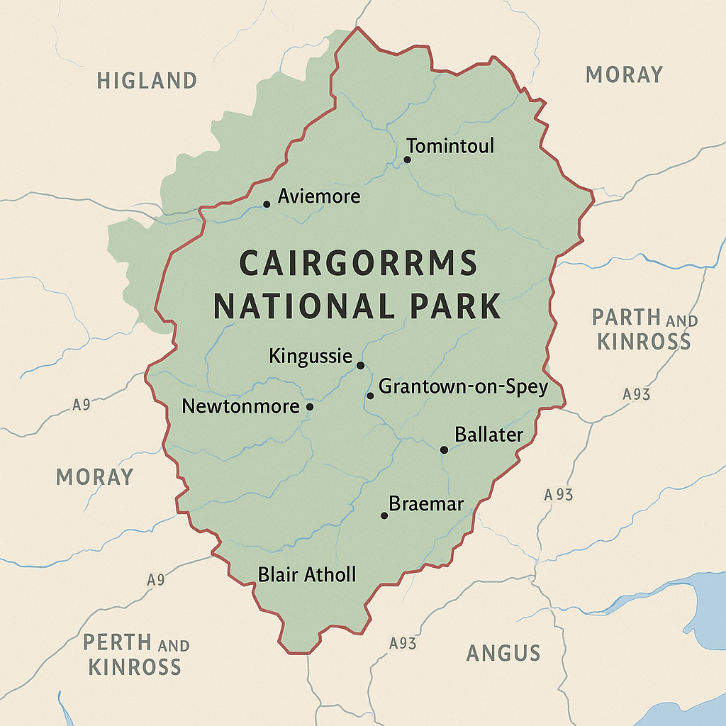
Cairngorms National Park is located in the northeast of Scotland. It covers parts of several council areas, including Highland, Aberdeenshire, Moray, Perth and Kinross, and Angus. With a total area of over 4,500 square kilometers, it is the largest national park in the United Kingdom. The park is named after the Cairngorms mountain range, one of the most famous in Scotland.
These mountains are part of the Grampian range and include five of the six highest peaks in the UK, such as Ben Macdui, Braeriach, and Cairn Gorm. The region is also an important part of Scottish culture, reflecting the deep connection between the land, local traditions, and the people who live there.
The landscape is shaped by:
- High mountain plateaus
- Deep glens and river valleys
- Lochs and wetlands
- Ancient pine forests, especially in areas like Glenmore and Rothiemurchus
Major rivers like the River Spey, River Dee, and River Don flow through the park, supporting rich wildlife and local communities. The park also includes moorlands, farmland, and protected nature reserves.
Due to its wide range of landscapes, Cairngorms offers many outdoor activities, from mountain climbing to bird watching, and is home to rare species and fragile ecosystems that are protected by law.
History Of Cairngorms National Park
The idea of creating a national park in the Cairngorms began in the 20th century, as people grew more aware of the area’s natural importance. Discussions about protecting the Highlands started in the 1930s, but it wasn’t until much later that real steps were taken.
In 2003, Cairngorms National Park was officially established by the Scottish Parliament, becoming the second national park in Scotland after Loch Lomond and The Trossachs. The original park boundary included areas in Highland, Moray, Aberdeenshire, and Angus, each rich in landscapes, wildlife, and Scottish customs and traditionsthat continue to shape the identity of the region today.
In 2010, the park was expanded to include parts of Perth and Kinross, including the town of Blair Atholl and areas around Glenshee and Spittal of Glenshee. This expansion made Cairngorms the largest national park in the UK.
The park is managed by the Cairngorms National Park Authority (CNPA), which works to:
- Protect natural landscapes and wildlife
- Support local communities
- Encourage responsible tourism
- Promote sustainable development
Today, the park is not only a place of natural beauty but also a living landscape where people live, work, and visit, all while respecting the environment.
The Main Hub Of Cairngorms National Park
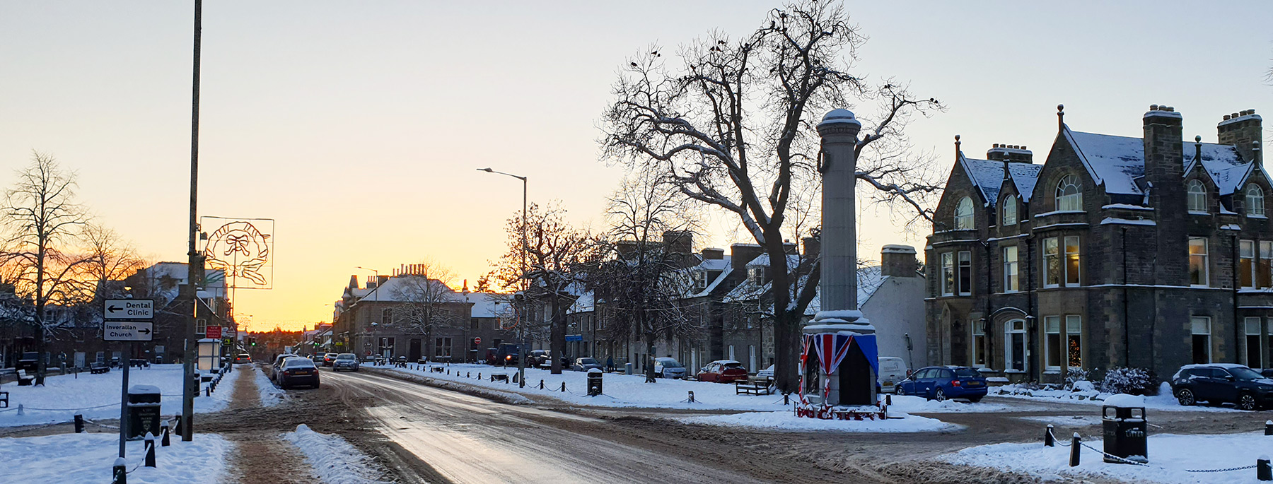
Aviemore is the most developed and busiest town in the park. It serves as the main visitor base because of its central location, good transport links (including a railway station), and access to popular outdoor areas like Glenmore Forest, Loch Morlich, and Cairn Gorm Mountain. Many guided tours, accommodation options, and outdoor equipment shops are found here, which makes Aviemore the unofficial capital for tourism in the park.
Towns And Villages To Spot On A Cairngorms Map
Aviemore
Aviemore is the busiest and most popular town inside Cairngorms National Park. It is often the first place visitors go when they arrive, thanks to its easy transport links, including a railway station. The town is well known for outdoor activities like hiking, mountain biking, and especially skiing and snowboarding in the winter months.
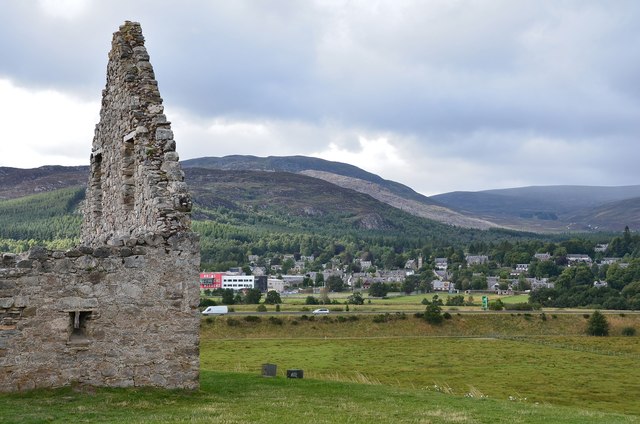
Ballater
Ballater is a small, charming village located on the eastern edge of the park, along the River Dee. It is closely linked to the British Royal Family because of its location near Balmoral Castle, the Queen’s summer home. Many buildings in Ballater even carry royal signs, showing past visits by members of the royal family.
Braemar
Braemar sits deep in the southern part of the Cairngorms and is best known for its strong Scottish traditions. Every year, it hosts the famous Braemar Highland Games, which the Royal Family often attends. The village is surrounded by mountains and is close to many hiking routes, including the ones leading into the heart of the Cairngorms.
Kingussie
Kingussie is a peaceful town located on the western edge of the national park. It is not as busy as Aviemore, which makes it a good choice for visitors who prefer a quieter experience. Kingussie has lovely views of the surrounding hills and is home to local attractions like the Highland Folk Museum, where you can learn about life in the Highlands in the past.
Grantown-on-Spey
Grantown-on-Spey is a traditional Highland town located in the north of the park, beside the River Spey. It’s a great place for people who enjoy fishing, as the river is well known for salmon. The town is also surrounded by woodlands and hills, with many walking and cycling trails nearby.
Newtonmore
Newtonmore is a small village located south of Kingussie and is known for its strong community spirit and outdoor activities. It’s home to the Wildcat Centre and the fun Wildcat Trail, a walking path that circles the village and includes wildcat sculptures hidden along the way.
Tomintoul
Tomintoul is one of the highest villages in the Highlands and sits in a quiet, open area of the park. It's part of the Glenlivet Estate and is close to whisky distilleries, making it popular with visitors interested in Scotland’s famous drink. The village is small but has a lovely high street with shops, a museum, and a few places to eat.
Blair Atholl
Blair Atholl is located at the southern edge of the Cairngorms and became part of the national park during its 2010 expansion. It is known for Blair Castle, one of the most historic castles in Scotland, and for being the entry point to Glen Tilt, a stunning glen with riverside walks and mountain trails.
Regions Within The Park
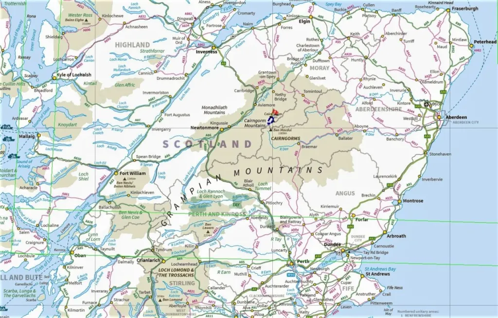
When you’re reading a Cairngorms map, you’ll see the park divided across these administrative areas:
- Highland:Central and western parts of the park, including Aviemore, Kingussie and Newtonmore. Forests, lochs and the core of the Cairngorms range.
- Aberdeenshire:Eastern area including Ballater and Braemar, Royal Deeside and mountains like Lochnagar.
- Moray:Quiet northern area around Tomintoul and Glenlivet, with open moorlands, farmland and whisky country.
- Perth and Kinross:Southern gateway around Blair Atholl and Glenshee, with deep glens and big hills such as Beinn a’ Ghlo.
- Angus:Southeast corner with wild glens like Glen Clova and Glen Doll, ideal for quieter walks and photography.
Total Area Of Cairngorms National Park
The park covers:
- 4,528 km² (1,748 sq mi)
- Around twice the size of the Lake District National Park
- About 6% of Scotland’s land area
Within this space you’ll find mountains, forests, lochs, rivers, moorlands, farmland and historic villages, one of the most diverse landscapes in Scotland.
Major Roads And Transportation In Cairngorms National Park
Main Roads Through The Park
The park is connected by several A-roads, which are the main routes for cars, buses, and coaches. These roads are often shown on maps and are the best way to access towns, trailheads, and scenic areas.
A9 - The Main North-South Route
The A9 is the busiest road passing near the western side of the park. It connects Inverness to Perth and runs close to towns like Kingussie, Newtonmore, and Aviemore. Many visitors use this road to enter the park by car or coach. It is also the main road used for long-distance travelthrough the Highlands.
A93 - The Snow Roads Scenic Route
The A93 runs from Perth through Blairgowrie, then into the heart of the park via Glenshee, Braemar, and Ballater, and continues towards Aberdeen. This road offers some of the most stunning mountain views and is part of the official Snow Roads Scenic Route, a popular drive for visitors who enjoy photography and quiet landscapes.
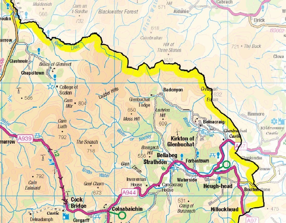
A939 - The Lecht Road
This road connects Grantown-on-Spey to Tomintoul and passes through the Lecht ski area. It’s a high-altitude route with amazing views, especially in winter when snow covers the hills. It is narrow in places, so drivers should take care.
A95 - River Spey Route
The A95 runs through the northern edge of the park, following the River Spey. It links Grantown-on-Spey to Aberlour and further east to Keith, passing through whisky country. This road is used for visiting distilleries and fishing spots.
Railways And Train Stations
Several towns within the park are served by train, making it easy to arrive without a car. Trains are also useful for moving between parts of the park and reaching nearby cities.
- Aviemore Railway Station is the busiest and most useful for visitors. It is on the main Highland line between Inverness and Edinburgh/Glasgow, with frequent services.
- Kingussie, Newtonmore, and Carrbridge also have train stations on the same line. These small stations are perfect for visitors staying in quieter areas.
- Blair Atholl in the south of the park also has a station, providing access to southern glens and walking routes.
Buses And Coaches
Local and long-distance buses serve many of the towns in the Cairngorms. The bus network is more limited in remote areas, so checking timetables in advance is important.
- Stagecoach and ScotRail buses run between Aviemore, Grantown-on-Spey, Ballater, and Braemar.
- Citylink coaches stop in Aviemore, Kingussie, and Newtonmore as part of longer routes between Inverness and Perth or Edinburgh.
- Some services are seasonal and may run more frequently during the summer or around school holidays.
Airports Near The Park
The nearest major airports to Cairngorms National Park are:
- Inverness Airport (about 45 minutes from Aviemore)
- Aberdeen International Airport (about 1.5 to 2 hours from Ballater)
- Edinburgh Airport (about 2 to 3 hours by road from southern parts of the park)
From these airports, visitors can take trains, rental cars, or buses into the park.
Cycling And Active Travel
Cycling is popular in Cairngorms, with many roads and trails suited for bikes. National Cycle Network Route 7 passes through the park and links with Aviemore, Kingussie, and Newtonmore. In towns like Aviemore, there are bike rental shops and marked cycling paths. Some routes are shared with cars, but others run through forests and off-road tracks for a quieter experience.
Most Useful Types Of Maps For Cairngorms Visitors
Here are the most valuable maps you can use in the park, each serving different needs:
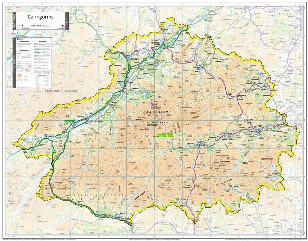
1. Official Cairngorms Park Map
- Created by the Cairngorms National Park Authority (CNPA)
- Shows park boundaries, major towns, paths, and key visitor spots
- Available at visitor centres and online in PDF format
2. Ordnance Survey (OS) Explorer Maps
- Most detailed physical maps for outdoor use in the UK
- Scale: 1:25,000 (4 cm = 1 km)
- Great for serious hiking, camping, and navigation
- Maps covering Cairngorms include: OS Explorer OL57, OL63, OL58
3. Interactive Online Maps
- Websites like WalkHighlands, CNPA, and OutdoorActive offer digital maps
- Useful for trip planning before your visit
- Show GPX trail downloads, elevation data, and trail reviews
4. Walking And Hiking Trail Maps
- Highlight short and long trails with clear start/end points
- Some maps focus on safe routes for families or beginners
- Examples include maps of Glenmore, Loch an Eilein, and Ryvoan Pass
5. Mountain Biking Maps
- Include trail grades, technical sections, and terrain types
- Popular biking zones include Laggan Wolftrax and Glenlivet Bike Trails
6. Wildlife & Nature Maps
- Mark spots where rare animals are often seen
- Useful for photographers and nature lovers
- Include loch-side bird hides and red deer viewing areas
7. Visitor Centre & Local Area Maps
- Found in towns like Aviemore, Braemar, and Ballater
- Provide simple maps with facilities, picnic areas, parking, etc.
Digital Vs Physical Maps - Which Should You Use?
Both digital and paper maps have benefits. The best choice depends on your activity.
Digital Maps
- Easy to zoom and search
- Can track your location using GPS
- Offer trail reviews and GPX downloads
Downsides:
- Batteries can die
- Signal may be poor or unavailable in valleys
Physical Maps
- Don’t rely on batteries
- Show wide areas at once
- Work in any weather (especially waterproof ones)
Best Tip:Carry both. Use digital maps for planning and checking your location, but keep a physical OS map in your bag in case your device fails.
Best Places To Get A Cairngorms Map (Free & Paid)
You can find good Cairngorms maps both online and in shops.
Free Sources
- Cairngorms.co.uk offers downloadable PDF maps
- WalkHighlands.co.uk has free trail maps
- Visitor centres hand out basic printed maps
Paid Sources
- Buy OS Explorer maps in outdoor stores like Cotswold Outdoor or Blacks
- Local gift shops in Aviemore, Braemar, and Kingussie sell trail maps
- Online stores like Amazon and the Ordnance Survey website
Also, many mobile apps offer premium maps you can use offline:
- OS Maps App
- ViewRanger
- OutdoorActive
Top Locations Often Highlighted On Cairngorms Maps
Maps of Cairngorms National Park often highlight places that are well-loved by visitors and locals alike. These locations are great for hiking, sightseeing, water activities, and enjoying Scotland’s natural beauty. Here’s a closer look at the most featured places and trails.
Cairn Gorm Mountain
Cairn Gorm is one of the highest mountains in the park and a popular place for walking, skiing, and snowboarding. It also has a funicular railway, which takes visitors up near the summit. From the top, you can see wide views of the mountains and valleys. It’s a great spot for both summer hikes and winter sports.
Loch Morlich
Loch Morlich is a beautiful freshwater loch with a sandy beach, something rare in the Highlands. You can enjoy kayaking, canoeing, paddleboarding, or just relaxing by the shore. The beach is surrounded by forests and mountains, making it perfect for walking and taking pictures. It’s very close to Aviemore and easy to reach.
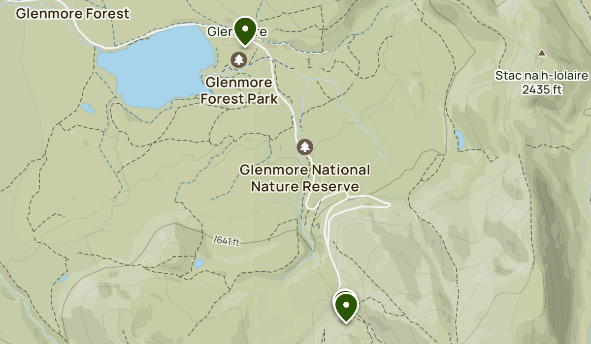
Glenmore Forest Park
Glenmore Forest is full of tall pine trees and quiet trails. It’s one of the best places in the park for easy family walks and nature spotting. You can often see red squirrels, birds, and even reindeer nearby. There are visitor facilities, picnic spots, and paths for all levels of walkers.
Rothiemurchus Estate
Rothiemurchus is a large private estate that welcomes visitors to enjoy its woodlands, lochs, and wildlife. You can walk, bike, fish, or even try quad biking here. The estate is well-known for its beautiful forest trails and peaceful views. It’s close to Aviemore and good for a half-day or full-day visit.
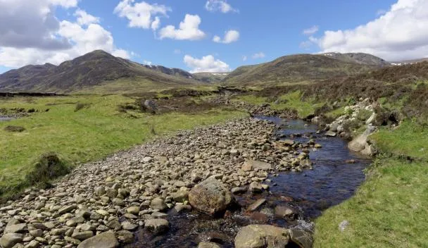
Lairig Ghru
Lairig Ghru is a famous mountain pass that cuts through the Cairngorms. It’s a tough, long-distance route, often used by experienced hikers. The trail passes between tall mountains and offers views of rocky landscapes and deep valleys. It’s challenging but rewarding for those looking for a serious adventure.
Lochnagar
Lochnagar is a striking mountain in the southern part of the park. It’s known for its royal connections, Queen Victoria loved this area. The mountain has steep cliffs and clear views from the top. It’s a popular climb for walkers who want a challenge, and it’s also great for wildlife watching along the way.
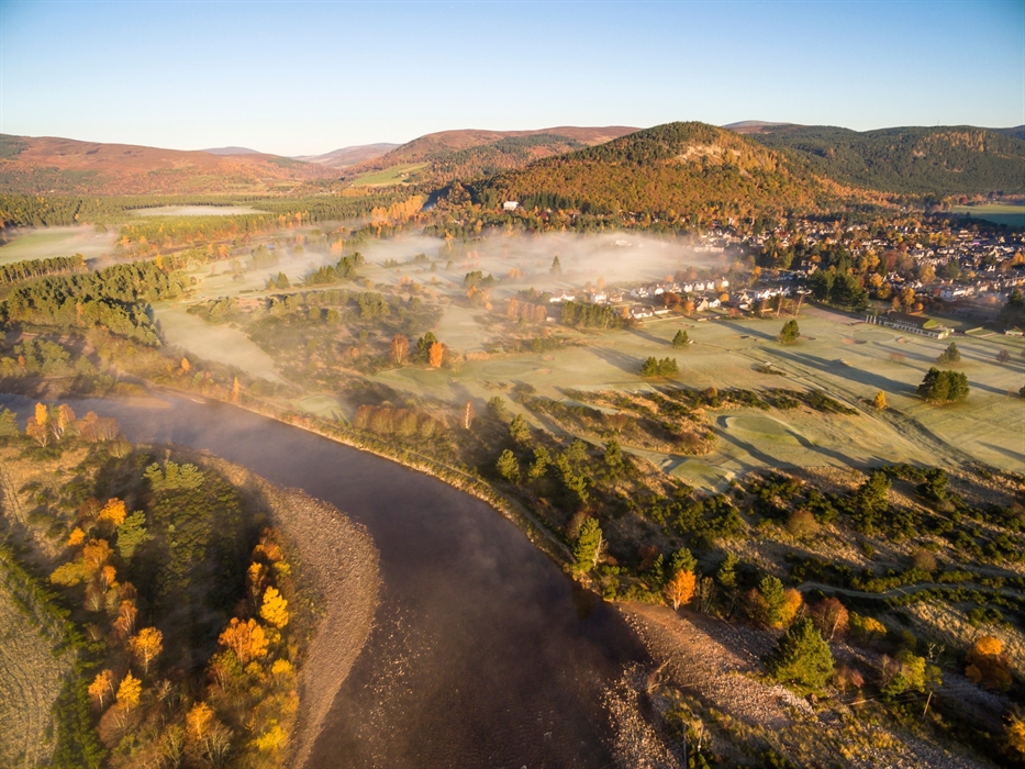
Ballater And Braemar
These two towns sit on the Royal Deeside and are often used as gateways to the eastern part of the park. They have nearby castles, rivers, walking routes, and plenty of local charm. Ballater and Braemar are perfect for staying overnight and exploring nearby trails like those around Lochnagar or Glen Muick.
Top Trails To Look For On Cairngorms National Park Map
Trails in the Cairngorms offer something for everyone, short walks, day hikes, or multi-day treks. These popular routes are often shown on most maps of the park.
Ryvoan Pass Trail
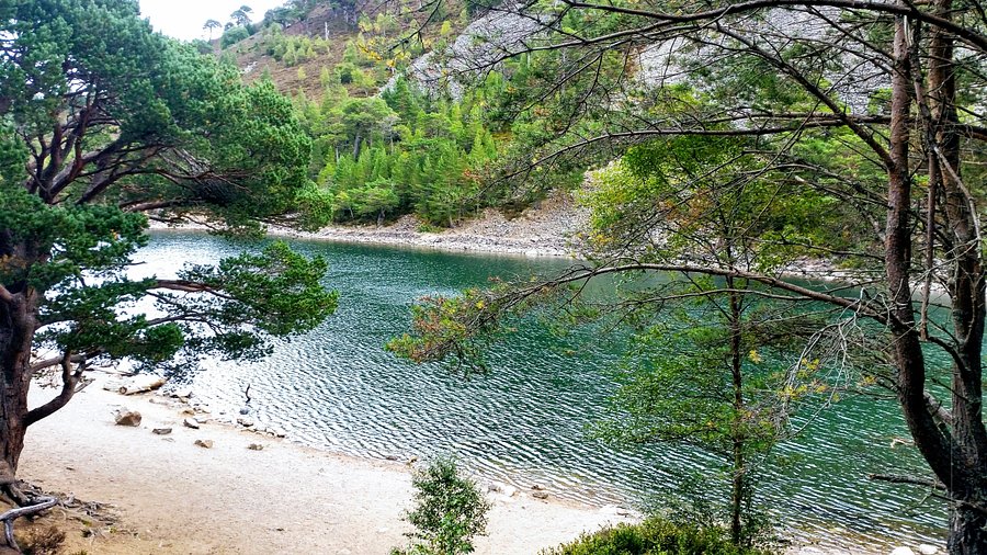
This is a moderate trail that takes you from Glenmore to the remote Ryvoan Bothy. The path passes Lochan Uaine (the Green Loch), which is a beautiful small loch with green water. The trail is well-marked and suitable for walkers of most levels.
Meall A' Bhuachaille
This hill is one of the easier peaks to climb in the Cairngorms. The name means "Hill of the Herdsman" in Gaelic. The trail gives you a great view of Glenmore and the surrounding area. It’s a good choice for those wanting to try a mountain walk without going too far or too high.
Ben Macdui
Ben Macdui is the second-highest mountain in the UK and a serious climb for experienced hikers. The route often starts from Cairn Gorm Mountain. On a clear day, you can see miles of mountain scenery. It's a long, tough walk, so good preparation and a map are very important.
The Speyside Way
The Speyside Way is a long-distance walking and cycling trail that runs from Aviemore through whisky country. It follows the River Spey and passes towns, distilleries, and farmlands. Parts of the trail are gentle and flat, making it good for beginners too.
Wildcat Trail (Newtonmore)
This is a well-marked circular walk around the village of Newtonmore. It takes you through woodland, open fields, and riverbanks. Along the way, you’ll see signs and sculptures of wildcats. It’s a fun and easy trail, perfect for families and first-time visitors.
Glen Derry And Derry Lodge
This peaceful trail runs through a quiet glen with views of pine forests, rivers, and surrounding hills. Derry Lodge, a former hunting lodge, is a common stopping point for hikers. It’s a popular start for longer mountain routes or an enjoyable low-level walk on its own.
Things To Do In Cairngorms National Park
Cairngorms National Park is full of outdoor adventures, peaceful nature, and unique Scottish experiences. Whether you want to climb mountains, watch wildlife, or enjoy local food, there’s something for everyone in this beautiful part of Scotland.
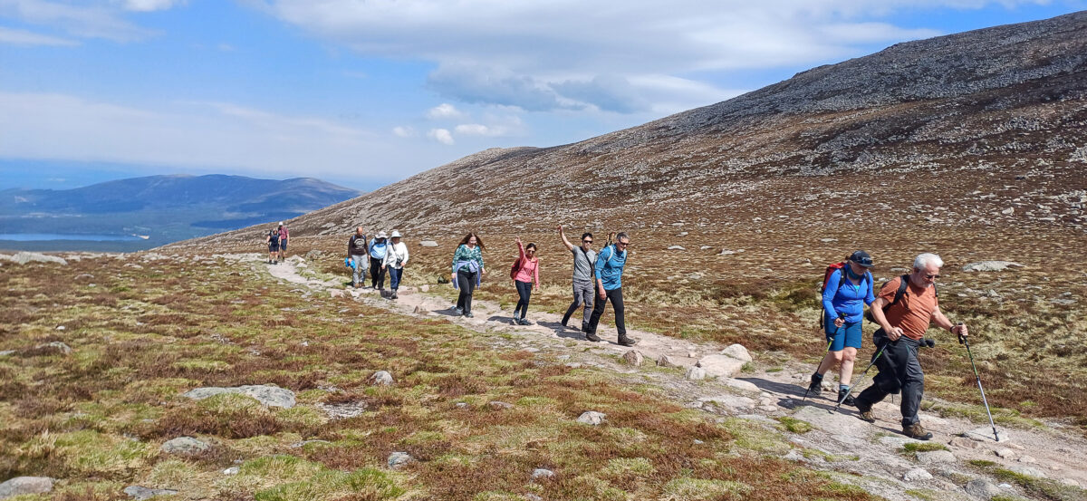
1. Hiking And Hillwalking
Walking is one of the best ways to enjoy the Cairngorms. The park has hundreds of trails, from short woodland paths to long mountain hikes. You can climb peaks like Ben Macdui or take easier walks through forests and along rivers. Popular routes include the Lairig Ghru, Meall a’ Bhuachaille, and the Ryvoan Pass.
2. Wildlife Watching
Cairngorms is one of the best places in the UK to see wildlife. You may spot red squirrels, red deer, golden eagles, or even the rare Scottish wildcat. Visit areas like RSPB Insh Marshes, Abernethy Forest, or join a guided wildlife safari for the best chance to see animals in their natural home.
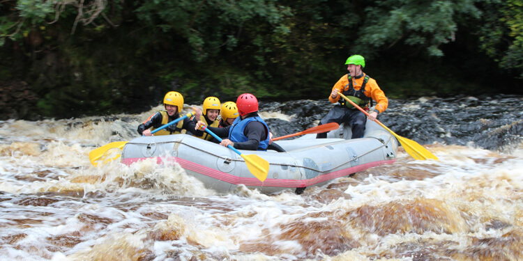
3. Visit Lochs And Rivers
The park is home to many beautiful lochs (lakes) and rivers. Loch Morlich is famous for its sandy beach and water sports like kayaking and paddleboarding. The River Spey is well-known for salmon fishing and gentle walks along its banks. These spots are perfect for picnics, swimming, or relaxing by the water.
4. Winter Sports
In winter, Cairngorms becomes a playground for snow lovers. You can go skiing, snowboarding, or snowshoeing in places like Cairngorm Mountain Resort, The Lecht, or Glenshee Ski Centre. These areas offer slopes for beginners and advanced skiers, as well as equipment rental and lessons.
5. Visit Castles And Historic Sites
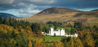
The park is full of history, with castles, old bridges, and ancient ruins. Balmoral Castle, the summer home of the Royal Family, is located near Ballater. You can also visit Braemar Castle and Blair Castle, both rich in history and set in beautiful landscapes. These sites give a deeper look into Scotland’s past.
6. Cycling And Mountain Biking
There are many cycling routes in the park, from smooth roads to off-road mountain trails. Trails around Glenlivet, Laggan Wolftrax, and Rothiemurchus Forest are popular with mountain bikers. Families can enjoy safe, easy rides along old railway lines and quiet forest paths.
7. Enjoy Local Food And Whisky
After a day outside, many visitors enjoy local Scottish food and drink. Towns like Aviemore, Grantown-on-Spey, and Braemar have cosy cafes and restaurants serving local dishes. You can also visit distilleries such as The Glenlivet to taste famous Scotch whisky and learn how it’s made.
8. Camping And Stargazing
The Cairngorms are perfect for camping under the stars. There are well-equipped campsites and wild camping spots (where allowed) where you can enjoy quiet nights in nature. The park is also a great place for stargazing, thanks to its dark skies and low light pollution, especially in areas like Glenlivet and Tomintoul.
9. Visit Museums And Visitor Centres
To learn more about the local culture and wildlife, visit places like the Highland Folk Museum in Newtonmore or the Cairngorms National Park Visitor Centre in Grantown-on-Spey. These places are good for families and help you understand the area better before heading outdoors.
10. Horse Riding And Reindeer Trekking
Unique to this area, you can enjoy a reindeer walk at the Cairngorm Reindeer Centre, where you can meet and feed a tame herd. There are also horse-riding experiences through forests and moorlands, giving a peaceful and scenic way to explore the landscape.
Attractions To Visit In Cairngorms National Park
1. Cairn Gorm Mountain
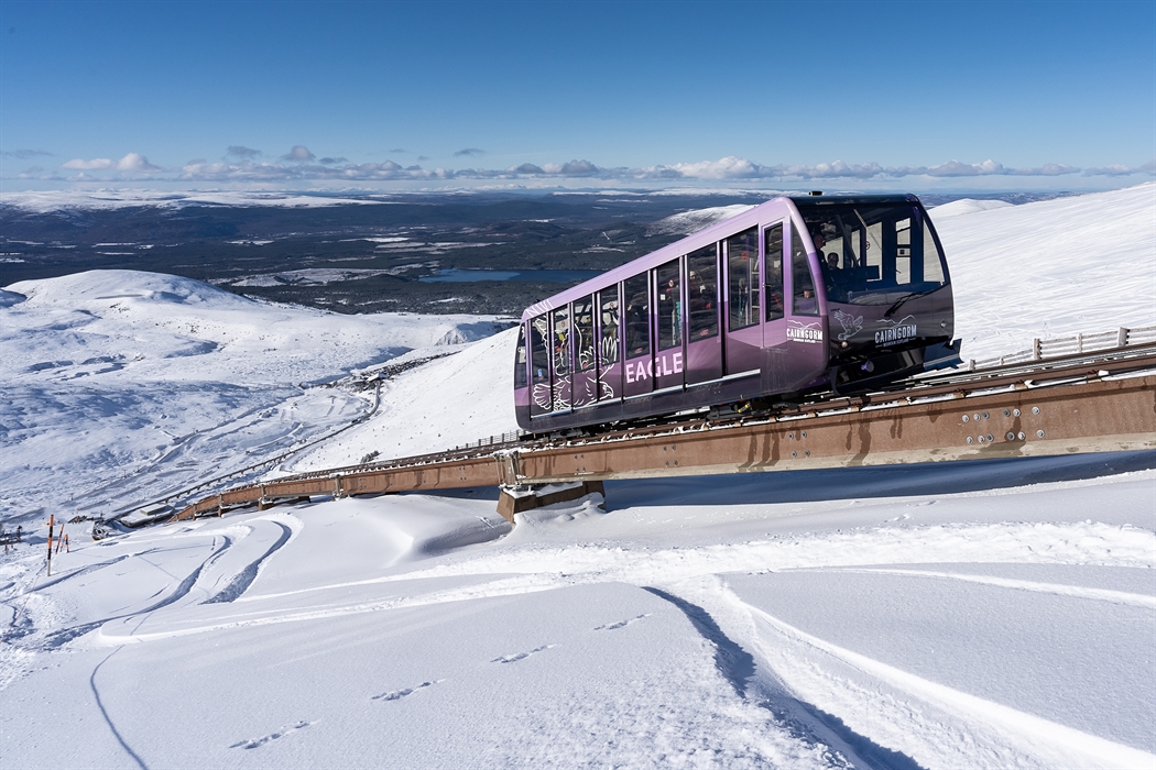
Cairn Gorm is one of the highest mountains in the UKand a well-known feature of the park. You can hike to the top or take the funicular railway part of the way. The views are wide and beautiful, and in winter, the area becomes a popular ski resort. It’s also a good spot to see rare mountain plants and birds.
2. Loch Morlich
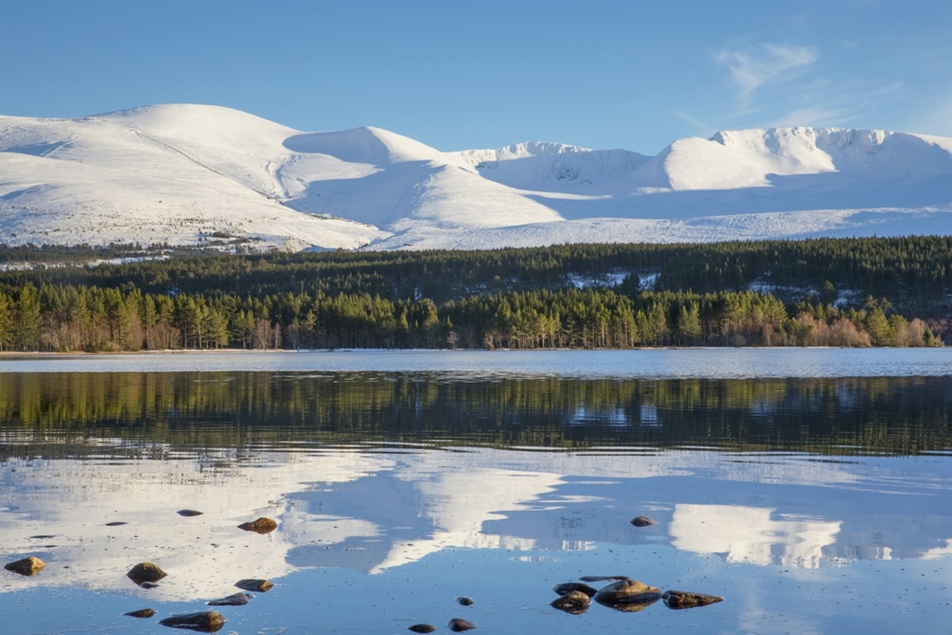
Loch Morlich is a peaceful lake with a sandy beach, surrounded by forests and mountains. It’s a great place for swimming, canoeing, paddleboarding, or just relaxing by the water. There are walking and cycling paths nearby, and the loch is close to Glenmore Forest and Aviemore.
3. Glenmore Forest Park
This large forest is perfect for easy walks, cycling, and spotting wildlife. You’ll find tall pine trees, quiet paths, and clear lochs. It’s home to red squirrels, deer, and many birds. Glenmore is great for families and is close to other major spots like Loch Morlich and Cairn Gorm.
4. Balmoral Castle
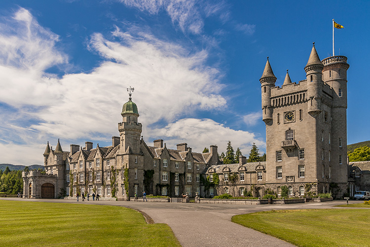
Balmoral Castle is the Scottish holiday home of the Royal Family. It is open to the public during certain times of the year. Visitors can walk through the gardens and learn about the royal history of the area. The castle is near Ballater and surrounded by beautiful countryside.
5. Highland Wildlife Park
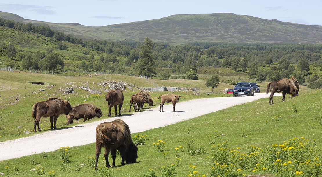
Located near Kingussie, this wildlife park is home to animals from the Scottish Highlandsand other cold regions of the world. You can see polar bears, wildcats, red pandas, wolves, and more. Part of the park is a drive-through safari, making it fun for all ages.
6. Rothiemurchus Estate
Rothiemurchus is a large estate near Aviemore that welcomes visitors for outdoor activities. You can go walking, cycling, quad biking, clay shooting, or fishing. It’s also a good place to see ancient pinewoods and visit a working farm shop with local food and crafts.
7. The Glenlivet Distillery
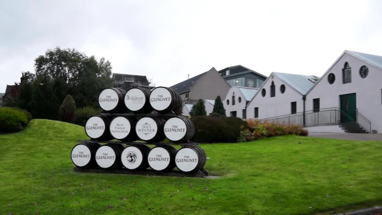
The Glenlivet is one of the most famous whisky distilleries in Scotland. Located in the northern part of the park, it offers guided tours, tastings, and a chance to learn how whisky is made. The distillery sits in a quiet valley surrounded by hills, making it a peaceful and scenic stop.
8. Braemar Castle
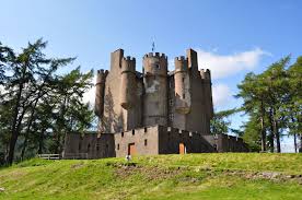
This historic castle is run by the local community and has been carefully restored. It’s located near Braemar and has a rich past linked to clan battles, royalty, and Jacobite history. Visitors can explore the rooms, learn from guides, and enjoy views of the surrounding hills.
9. Highland Folk Museum
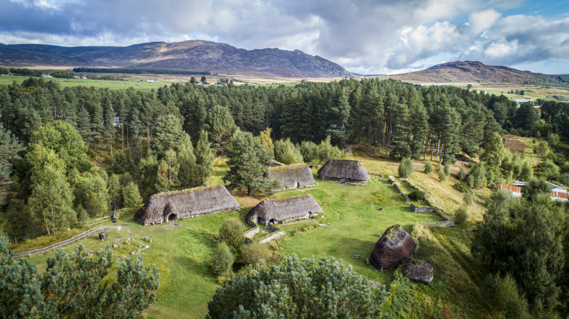
The Highland Folk Museum in Newtonmore is an open-air museum that shows how people lived in the Highlands hundreds of years ago. You can walk through old houses, see how people cooked and farmed, and even watch live demonstrations. It’s a fun and educational place for families and school groups.
10. Cairngorm Reindeer Centre
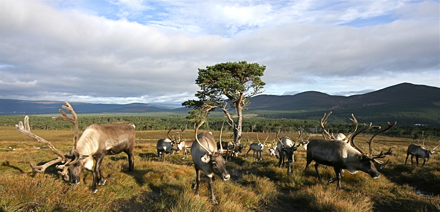
Located near Glenmore, this is the only place in the UK with a free-ranging herd of reindeer. You can visit the centre, meet the reindeer, and join guided walks into the hills to see them in their natural setting. It’s a unique and magical experience, especially for children.
How To Read And Use A Cairngorms Map Safely
Knowing how to read a map properly can prevent accidents.
- Learn to read contour lines for hills and valleys
- Use the legend to understand symbols (e.g., bothy, viewpoint, parking)
- Practice using a compass with the map
- Mark emergency exits or shelter areas
- Always let someone know your route
Most accidents in the Cairngorms happen because hikers get lost or misjudge distance. A map helps you stay prepared.
People Also Ask
Where Is Cairngorms National Park Located?
the Scottish HighlandsThe Cairngorms National Park is located in the Scottish Highlands, 127 miles north of Edinburgh and 140 miles north of Glasgow.
What City Is Near Cairngorms National Park?
Key towns. Aviemore, Kingussie, Grantown-on-Spey and Ballater. Inverness is the closest city to the north of the park, roughly 30 minutes away, and Aberdeen is only an hour away from the east side. The park stretches across a number of regions including parts of Aberdeenshire, Moray, Highlands, Angus, and Perthshire.
What Is The Closest Airport To Cairngorms?
AberdeenThe nearest airports to the Cairngorms National Park are at Aberdeen (to access the east of the Park) and Inverness (to access the west).
Final Thoughts
Cairngorms National Park is a beautiful place full of wild nature, quiet paths, and amazing views. But because the park is so big, it’s easy to lose your way or miss out on great places.
Using the right Cairngorms National Park map can help you plan better, stay safe, and enjoy your trip more confidently.
Jump to
Quick Facts About Cairngorms National Park
Geographical Overview Of Cairngorms National Park
History Of Cairngorms National Park
The Main Hub Of Cairngorms National Park
Towns And Villages To Spot On A Cairngorms Map
Regions Within The Park
Total Area Of Cairngorms National Park
Major Roads And Transportation In Cairngorms National Park
Most Useful Types Of Maps For Cairngorms Visitors
Digital Vs Physical Maps - Which Should You Use?
Best Places To Get A Cairngorms Map (Free & Paid)
Top Locations Often Highlighted On Cairngorms Maps
Top Trails To Look For On Cairngorms National Park Map
Things To Do In Cairngorms National Park
Attractions To Visit In Cairngorms National Park
How To Read And Use A Cairngorms Map Safely
People Also Ask
Final Thoughts

Callum Fraser
Author
Callum Fraser isn't just a writer about Scotland; he's a product of its rugged landscape and rich history. Born and raised in Perthshire, with the Highlands as his backyard, his love for the nation's stories was kindled by local storytellers and long walks through ancient glens.
This passion led him to pursue a degree in Scottish History from the University of Edinburgh. For over 15 years, Callum has dedicated himself to exploring and documenting his homeland, fusing his academic knowledge with essential, on-the-ground experience gained from charting road trips through the Cairngorms, hiking the misty Cuillins of Skye, and uncovering the secrets of traditional recipes in his family's kitchen.
As the Editor-in-Chief and Lead Author for Scotland's Enchanting Kingdom, Callum's mission is simple: to be your most trusted guide. He combines meticulous research with a storyteller's heart to help you discover the authentic magic of Scotland — from its best-kept travel secrets to its most cherished traditional recipes.
Latest Articles
Popular Articles