Scottish Highlands Map Guide | Regions, Routes, And How To Use Them
Use a Scottish Highlands map to plan realistic journeys, avoid navigation errors, and stay safe in remote landscapes.
Author:Callum FraserDec 17, 2025
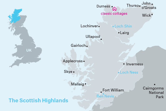
Your Scottish Highlands Map And Travel Guide
The Scottish Highlands rise wild and ancient in northern Scotland - a land of jagged mountain peaks, mirror-still lochs, and valleys carved by ice and time. Here, red deer wander lonely moors, mist clings to cliffsides, and history echoes through ruined castles and battlefields.
But this stunning wilderness comes with a challenge: vast distances, winding single-track roads, and countless hidden gems scattered across remote landscapes. Without proper planning, you might miss the region's best-kept secrets or find yourself lost in the backcountry.
That's where a good Scottish Highlands mapbecomes essential. Whether you're hiking Ben Nevis, driving the North Coast 500, or searching for the perfect viewpoint over Loch Ness, the right map helps you navigate safely, discover more, and make the most of your Highland adventure.
Quick Facts About The Scottish Highlands
- Location: The Highlands cover the northern and western parts of Scotland.
- Size: It’s the largest region in Scotland, making up nearly half of the country’s land area.
- Highest Mountain: Ben Nevis, the UK’s tallest mountain, is found here. It stands at 1,345 metres (4,413 feet).
- Population: The Highlands are sparsely populated, with many small towns and villages spread across wide areas.
- Lochs: Loch Ness, home to the famous monster legend, is located in the Highlands.
- Language: Scottish Gaelic is still spoken in some areas, alongside English.
- Wildlife: The region is home to red deer, golden eagles, otters, and other rare animals.
- Popular Routes: The North Coast 500 is a famous scenic drive around the Highlands.
- Historic Sites: The area is rich in castles, battlefields, and ancient ruins.
- Climate: The Highlands have a cool, wet climate, with snowfall common in winter.
History Of The Scottish Highlands
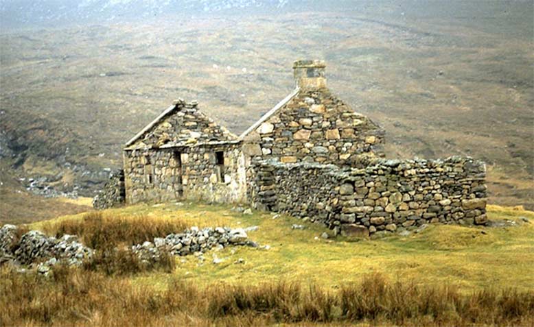
The Scottish Highlands have a long and powerful history, shaped by ancient clans, fierce battles, and a deep connection to land and tradition. This rugged region holds stories of resistance, cultural pride, and survival.
Early Settlements And Celtic Roots
People have lived in the Highlands for thousands of years. Ancient stone circles, burial mounds, and standing stones still dot the landscape. Around 500 AD, Celtic tribes, including the Picts and Scots, became the main people living in the region.
They brought with them Gaelic language and culture, which still influence the Highlands today.
The Rise Of The Clans
By the Middle Ages, the Highlands were ruled by clans, large family groups with shared ancestry. Each clan had a chief, a tartan, and its land. Clans often supported each other in times of war but also fought for territory.
Some of the most famous Highland clans include:
- Clan MacDonald
- Clan Campbell
- Clan MacLeod
- Clan Fraser
These clans shaped Highland life and identity for hundreds of years.
Conflicts And The Jacobite Risings
The Highlands saw many battles, especially during the Jacobite uprisings in the 17th and 18th centuries. These were efforts to return the Catholic Stuart kings to the British throne.
The most famous was the Battle of Culloden in 1746, near Inverness. It was the last major battle on British soil. The Jacobites, many of them Highlanders, were defeated by British government forces.
This battle marked a turning point in Highland history.
The Highland Clearances
After Culloden, the British government feared more uprisings. They banned Highland dress, Gaelic languagein public, and clan gatherings.
Then came the Highland Clearances during the 18th and 19th centuries. Landowners forced many Highlanders off their land to make room for sheep farming. Thousands were evicted from their homes.
Many people moved to cities or emigrated to Canada, the USA, Australia, and beyond. These events left deep scars and changed Highland life forever.
Modern Revival And Cultural Pride
In the 20th century, people began to reconnect with Highland traditions. There was a renewed interest in:
- Scottish Gaelic language
- Tartan and kilts
- Clan history and genealogy
- Highland gamesand music
Today, the Highlands are celebrated for their strong culture, dramatic history, and proud heritage.
Geographical Overview Of The Scottish Highlands
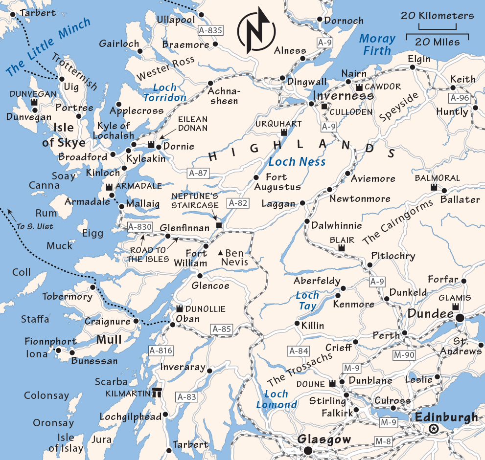
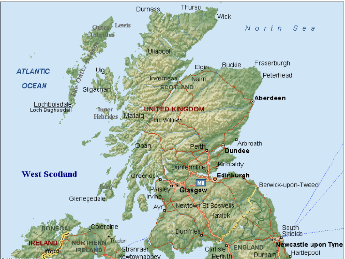
The Scottish Highlands cover a large part of northern Scotland. This region is known for its rugged landscapes, including high mountains, deep glens, large lochs, and long stretches of coastline. The Highlands start roughly north and west of a line from Fort William to Nairn. It's a region with fewer people but plenty of open space and natural beauty.
Key features of the Highlands include:
- Ben Nevis - the highest mountain in the UK
- Loch Ness - one of the most famous lakes in the world
- Isle of Skye - known for dramatic cliffs and coastal views
- Cairngorms National Park - packed with wildlife and hiking trails
Capital Of The Scottish Highlands
The Highlands don’t have a capital city in the same way a country does. However, Inverness is often called the “Capital of the Highlands.”
Inverness is the largest city in the region and serves as the main hub for travel, business, and services. It's located near Loch Ness and is known for its riverside charm, historical sites, and strong Gaelic heritage.
Towns And Small Cities On The Map Of Scottish Highlands
Inverness
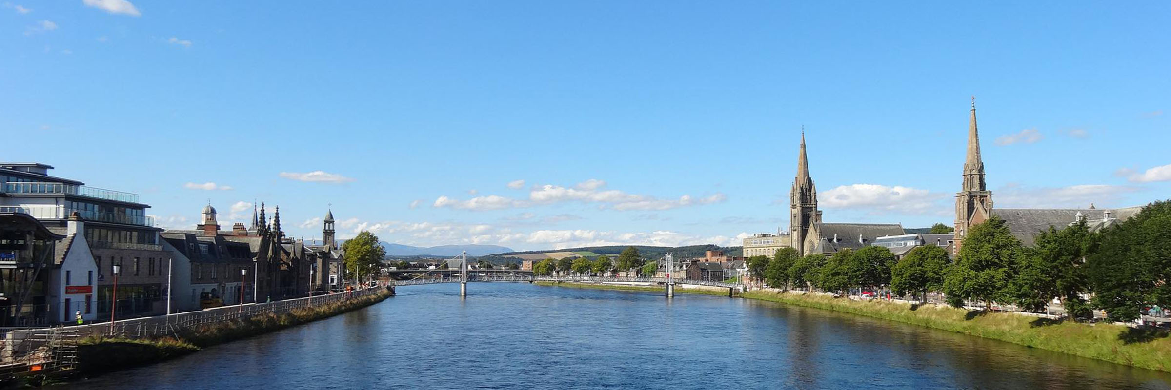
Inverness is the largest city in the Highlands and often seen as its capital. It sits at the mouth of the River Ness, close to the famous Loch Ness. This city is a popular base for visitors because it has good transport links, shops, hotels, and cultural spots. Inverness Castle, the nearby Caledonian Canal, and the riverside paths make it a great place to explore before heading into more remote parts of the Highlands.
Fort William
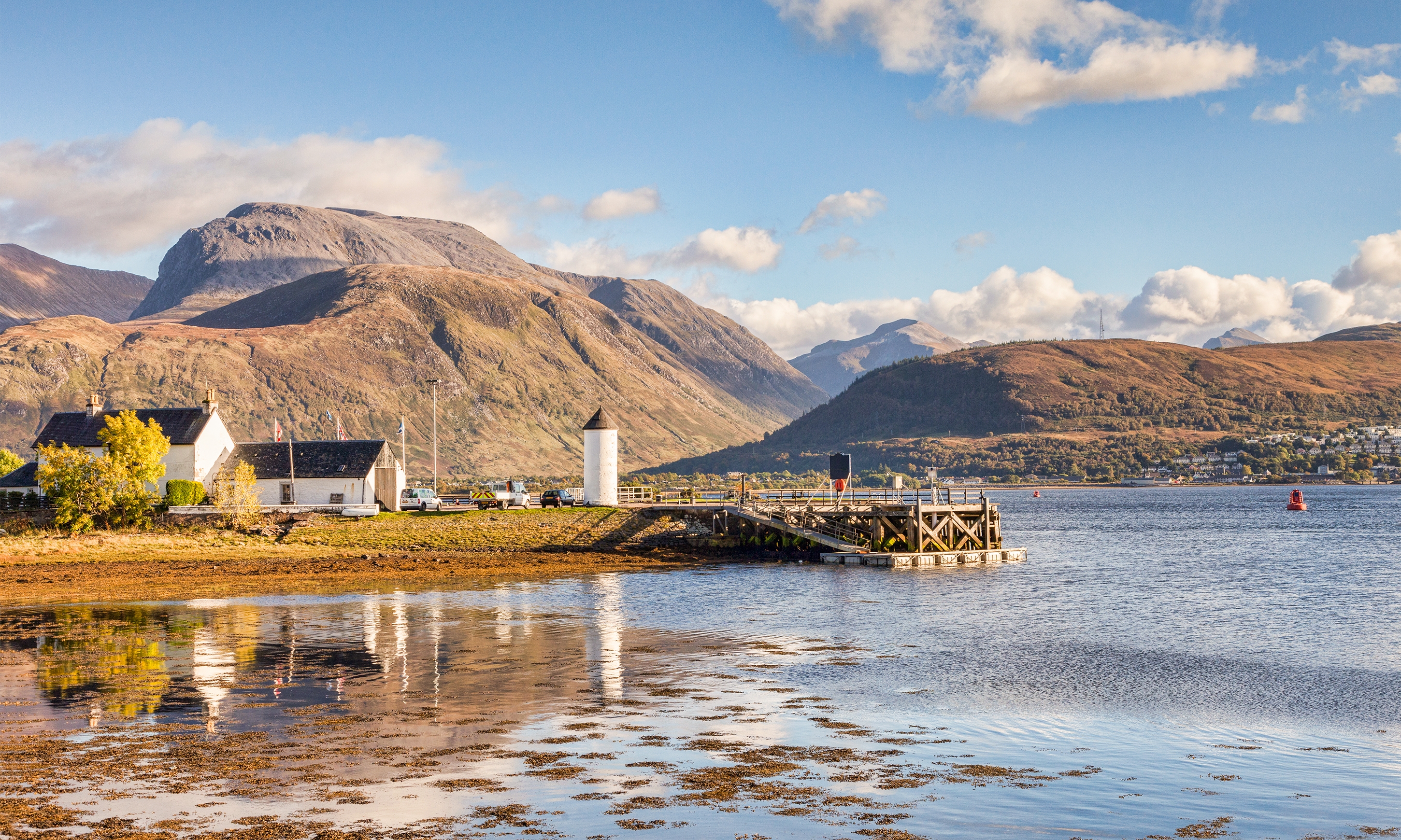
Fort William lies at the foot of Ben Nevis, the tallest mountain in the UK. It is one of the busiest towns in the Highlands, especially among hikers and outdoor lovers. Fort William is a starting point for many walking trails, including the West Highland Way. It also offers access to the scenic Jacobite Steam Train and the dramatic landscapes of Glen Nevis.
Ullapool
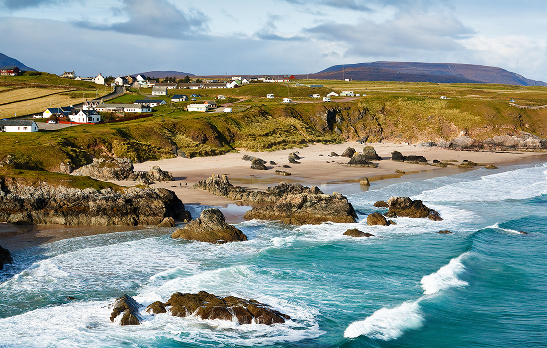
Ullapool is a small fishing town on the northwest coast. Though small, it has a lively feel with music, art, and a strong community spirit. Ullapool is also the main ferry port to the Isle of Lewis, making it a useful stop for those travelling to the Outer Hebrides. The area around Ullapool is perfect for quiet walks, sea views, and spotting wildlife.
Ullapool Harbour Map
The Ullapool Harbour map shows the layout of this busy port village on Scotland’s west coast. It highlights key spots like the ferry terminal, marina, fishing docks, and nearby streets such as Shore Street.
You’ll also see:
- CalMac ferry routes to the Isle of Lewis
- Car parks and public toilets near the harbour
- Walking paths along the shore with great views
- Shops, cafés, and tourist services close to the water
- Harbourmaster’s office and slipways for small boats
The map is useful for visitors, sailors, and locals. It helps you find your way around, plan your walk, or catch the ferry with ease.
Thurso
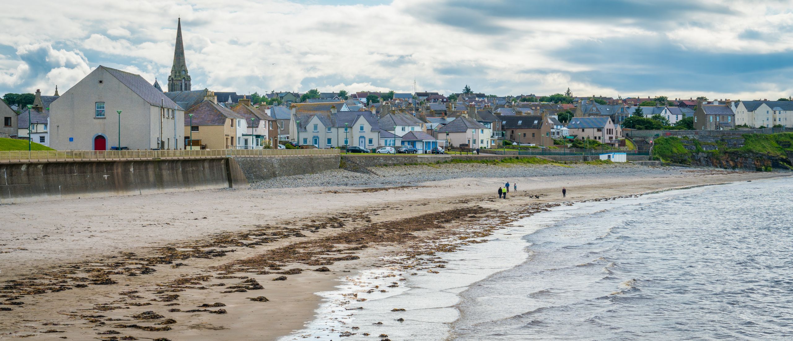
Thurso is the northernmost town on mainland Scotland. It sits by the Pentland Firth and is close to Scrabster, the ferry port to Orkney. Thurso has a mix of history, coastal views, and surfing spots. Many travellers pass through Thurso while driving the North Coast 500 route. Its quiet streets and dramatic coastline offer a peaceful break in the far north.
Aviemore
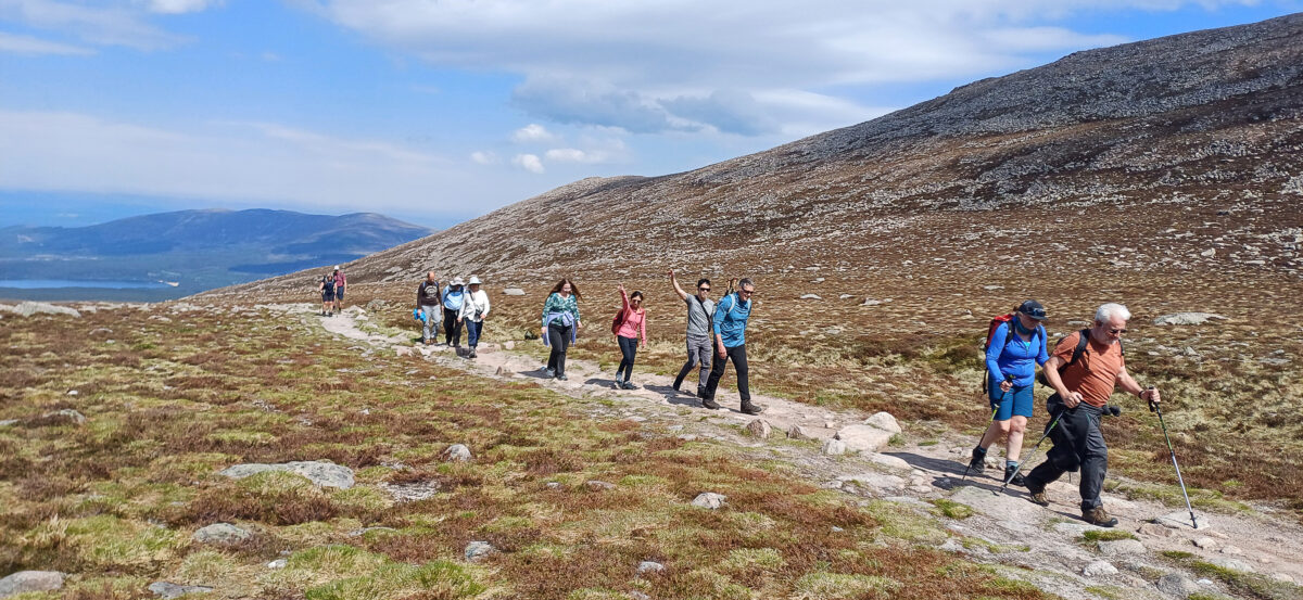
Aviemore is found in the eastern Highlands, inside the Cairngorms National Park. It is a popular town for winter sports like skiing and snowboarding, but also offers fun in every season. Many families visit Aviemore for its walking paths, wildlife parks, and outdoor centres. Its location in the middle of mountain landscapes makes it a great stop for nature lovers and adventure seekers.
Aviemore Area Map
The Aviemore area map shows the layout of this Highland town in the Cairngorms National Park. It helps visitors find key places like the village centre, train station, shops, and nearby attractions.
Main roads like the A9 are marked, along with popular spots such as:
- Cairngorm Mountains:for skiing, hiking, and the funicular railway
- Rothiemurchus Estate:great for walks and outdoor activities
- Loch Morlich:a loch with a sandy beach and watersports
- Reindeer Centre:a family-friendly stop nearby
Maps also show car parks, paths, and viewpoints, making it easy to plan your trip. Whether walking or driving, the Aviemore map helps you enjoy both the town and its natural surroundings.
Regions On The Map Scottish Highlands
Lochaber
Located in the western Highlands, Lochaber includes Fort William, Ben Nevis, and Glen Coe. It’s ideal for hiking and climbing. The terrain is steep and rugged, so a topographic map is best here.
Skye & Lochalsh
The Isle of Skye is known for its dramatic cliffs and fairy pools. The Skye Bridge links it to the mainland at Lochalsh, near Eilean Donan Castle. Maps of this area often include walking trails and scenic driving routes.
Inverness-shire
This is where you’ll find Inverness, often called the capital of the Highlands. Maps here show both urban areas and natural spots like Loch Ness and Culloden Battlefield.
Wester Ross
Less populated and full of raw beauty, this area includes Torridon, Applecross, and Ullapool. Coastal maps are useful here, as many roads hug the shoreline.
Sutherland
One of the most remote regions, with wild moors and dramatic sea cliffs. Cape Wrath and Durness are highlights. Detailed Ordnance Survey (OS) maps help in navigation.
Caithness
At the far north, Thurso and Wick are key towns. Ferry routes to the Orkney Islands often appear on maps of this area.
Moray
Although often seen as part of northeast Scotland, Moray includes Elgin and the Speyside whisky trail. This region blends cultural stops with beautiful countryside, perfect for themed maps.
Total Area Of The Scottish Highlands
The Scottish Highlands cover a vast and rugged part of northern Scotland. The total area varies depending on how the Highlands are defined by natural geography or administrative boundaries.
- Using the Highland Council area, which covers the largest portion of the Highlands, the total area is approximately 25,656 square kilometers (or 9,906 square miles).
- This makes it the largest council area in the UK, accounting for about one-third of Scotland's total landmass.
Scottish Highlands - Boundaries And Nearby Lands
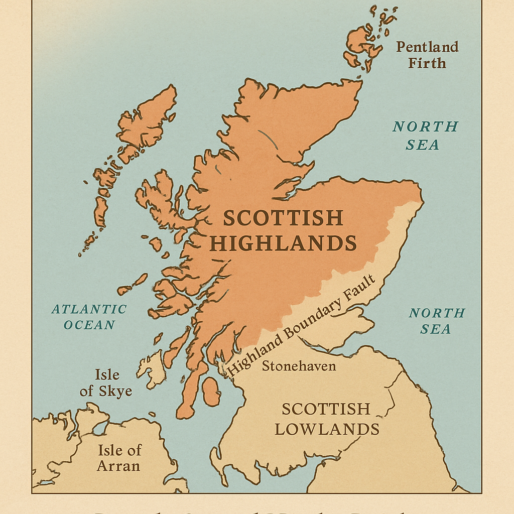
The Scottish Highlands cover much of mainland Scotland's northern and western parts. A natural divide called the Highland Boundary Fault separates them from the Scottish Lowlands in the south. This line runs from the Isle of Arran on the west coast to Stonehaven on the east.
To the east, the Highlands stretch to the North Sea, with quiet coastal towns and rolling farmland. The west reaches out to the Atlantic Ocean, home to sea lochs, rugged cliffs, and islands like Skye and the Outer Hebrides. The northern edge of the Highlands touches the Pentland Firth, just below the Orkney Islands.
Language Of The Scottish Highlands
English is the main language spoken throughout the Highlands, but Scottish Gaelic is still used in some areas, especially in the western parts and islands.
Road signs are often bilingual, showing both English and Gaelic. While most locals speak English fluently, you may hear Gaelic phrases or see Gaelic names for towns, hills, and lochs.
Population Of The Scottish Highlands
The Scottish Highlands are sparsely populated. The total population is around 235,710 people, spread across a wide area.
This low population is one of the reasons the region feels so peaceful and remote. Many villages have fewer than 500 residents, and even the biggest city, Inverness, has a population of just over 60,000.
Currency Of The Scottish Highlands
The official currency used in the Scottish Highlands is the British Pound Sterling (GBP £).
Scottish banks also print their versions of pound notes, which are legal across the UK. You can use both Scottish and English notes in shops, restaurants, and hotels throughout the Highlands.
Dialing Code Of The Scottish Highlands
Phone numbers in the Scottish Highlands usually begin with the UK country code +44. Local area codes vary depending on the town or city. Here are a few examples:
- Inverness - +44 1463
- Fort William - +44 1397
- Ullapool - +44 1854
- Thurso - +44 1847
If you’re calling from abroad, remember to drop the leading 0 from the local code after adding +44.
Map-Based Itineraries
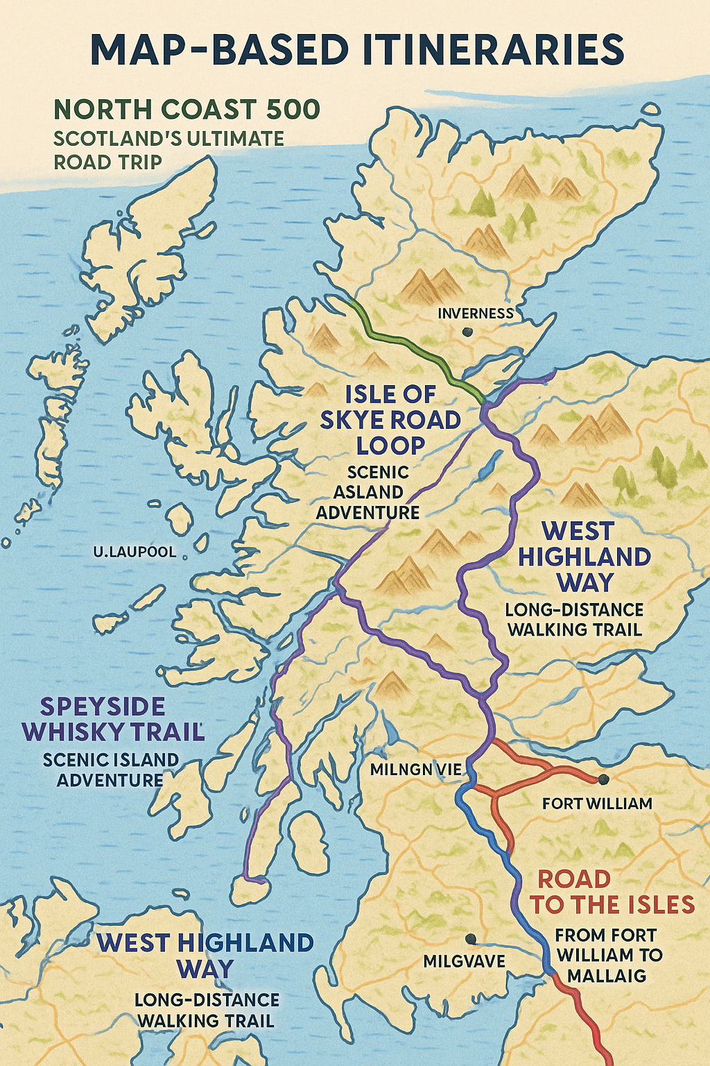
Planning your trip to the Scottish Highlands is easier when you divide your route by region. Using detailed maps for each area helps you find scenic stops, local highlights, and the safest roads or trails.
North Coast 500 - Scotland’s Ultimate Road Trip
The North Coast 500 is a circular driving route that loops around the northern tip of Scotland. It begins and ends in Inverness and takes you through quiet villages, sandy beaches, dramatic sea cliffs, and winding mountain roads. A good NC500 map shows viewpoints, fuel stops, and less crowded places worth visiting along the way.
Speyside Whisky Trail - Tasting And Touring
The Speyside region is home to more than half of Scotland’s whisky distilleries. A regional map helps you find each one and plan your travel by car or public transport. The trail passes through small towns like Dufftown and Craigellachie, offering a mix of whisky tasting and Highland scenery. Maps show not only the distilleries but also nearby attractions and walking paths.
Isle Of Skye Road Loop - Scenic Island Adventure
Skye is one of the most popular parts of the Highlands, known for its dramatic landscapes and natural wonders. A road loop across the island takes you to the Fairy Pools, the Quiraing, the Old Man of Storr, and Dunvegan Castle. Many roads on Skye are narrow and winding. A local map helps you follow the best driving route and avoid getting stuck on difficult single-track roads.
West Highland Way - Long-Distance Walking Trail
The West Highland Way is a 96-mile walking route that starts in Milngavie near Glasgow and ends in Fort William. It passes through lochs, forests, and mountains, making it one of the most scenic hikes in Scotland. A trail map shows important details like camping areas, elevation changes, rest points, and nearby towns. Hikers use these maps to plan each day and stay on the right path.
Road To The Isles - From Fort William To Mallaig
This route runs from Fort William to the fishing port of Mallaig, passing through Glenfinnan and other scenic spots. You can drive it or take the train, which is famous for crossing the Glenfinnan Viaduct. A regional map of the area highlights castles, beaches, viewpoints, and train stations. It’s useful for timing stops and finding quiet spots off the main route.
Major Roads And Transportation
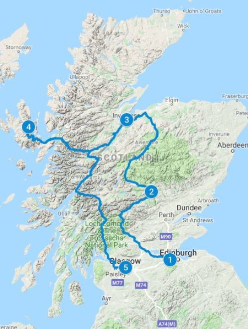
Getting around the Scottish Highlands can be an unforgettable part of the journey but it helps to know which roads and transport options are most useful.
A-Roads - The Main Driving Routes
The Highlands don’t have motorways like those in southern Scotland or England. Instead, the main roads are A-roads long, well-maintained routes that connect towns and remote areas.
- A82 is one of the most important roads. It runs from Glasgow to Inverness, passing through Loch Lomond, Glencoe, and Fort William. It’s scenic but often narrow and winding.
- A9 runs from Perth to Inverness and continues north to Thurso, near the top of the mainland. It’s the busiest road in the Highlands and widely used for long-distance travel.
- A835 connects Inverness to Ullapool, a key route if you're heading to the northwest coast or ferries to the Outer Hebrides.
- A87 takes you to the Isle of Skye, passing through stunning mountain landscapes and lochs.
Driving in the Highlands often means narrow roads, single-track sections, and changing weather. A good map or sat-nav is essential for safe and confident travel.
Public Transport Options
Public transport in the Highlands is limited but reliable in certain areas.
- Trains connect Inverness with cities like Glasgow, Edinburgh, Aberdeen, and Wick. Routes like the West Highland Line (to Fort William and Mallaig) are known for their beauty.
- Buses run between most towns and villages, though they may only operate a few times a day. Operators include Stagecoach, Citylink, and local services.
- Ferries run to the Isle of Skye, Orkney, Mull, and other islands. These are managed by CalMac Ferries and are important for travel between land and sea.
Air Travel In The Highlands
The Highlands also have a few small airports:
- Inverness Airport is the main one, offering flights to London, Manchester, Belfast, and seasonal routes to Europe.
- Wick John O’Groats Airport and Stornoway Airport provide links to remote areas and nearby islands.
Flying can save time when travelling long distances or heading to hard-to-reach parts of the region.
Travel Tips
- Fuel up often: petrol stations can be far apart.
- Use offline maps: phone signal can drop in remote areas.
- Check weather and road updates: snow, fog, or landslides can cause delays.
- Take your time: driving slowly is safer and lets you enjoy the views.
Types Of Maps For The Scottish Highlands
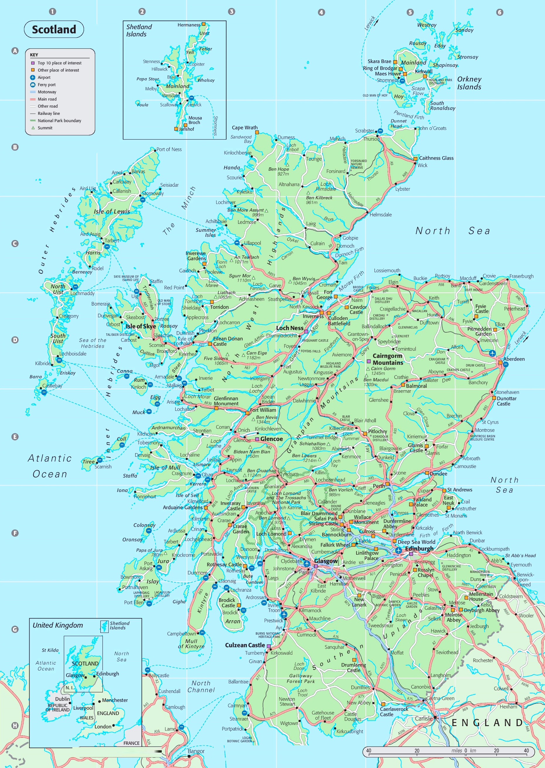
Depending on your purpose, you’ll need a different type of map. Here are the most useful ones:
- Road Maps: Show towns, roads, petrol stations, and rest stops. Ideal for road trips.
- Topographic Maps: Show land features like hills, rivers, and elevation. Best for hiking and camping.
- Digital GPS Maps: Real-time navigation with your phone or GPS device. Useful but depends on signal.
- Historical Maps: Show old clan boundaries, battle sites, and traditional names.
- Custom Travel Maps: Created for specific interests like castles, distilleries, or film locations.
Best Scottish Highlands Maps You Can Use Today
1. OS Explorer Maps
Produced by Ordnance Survey, these maps offer detailed topographic data. They’re perfect for hikers and show footpaths, elevation, and landmarks clearly.
2. Harvey Maps
These are lightweight and waterproof. Many long-distance hikers prefer Harvey maps because they focus on walking routes and terrain detail.
3. Google Maps
Great for quick planning and city navigation. However, it can be unreliable in rural areas without internet access.
4. Komoot
A digital app popular with cyclists and walkers. You can download maps and plan routes based on your fitness level or interest.
5. AllTrails
Useful for finding walking and hiking routes. It includes trail reviews, elevation profiles, and GPS guidance.
6. NC500 Route Maps
These maps cover the North Coast 500, a famous scenic drive around the northern Highlands. They highlight attractions, viewpoints, and fuel stops.
Best Attractions On The Map Of The Scottish Highlands
1. Loch Ness And Urquhart Castle
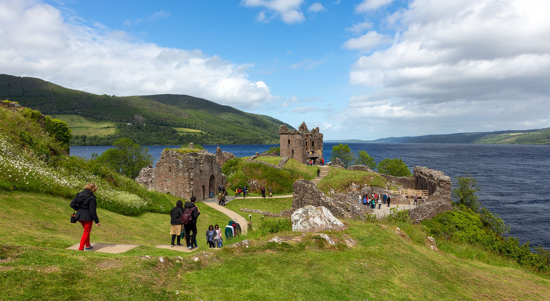
Located just southwest of Inverness, Loch Ness is one of the most famous lakes in the world. It stretches for over 23 miles and is best known for the legendary Loch Ness Monster, affectionately called "Nessie." Maps of the area clearly show the loch’s long, narrow shape running along the Great Glen Fault. Along its western shore, you’ll find the ruins of Urquhart Castle, a historic fortress that offers stunning views over the water. This area is easy to reach via the A82 road and is a major highlight on most Highlands travel maps.
2. Ben Nevis
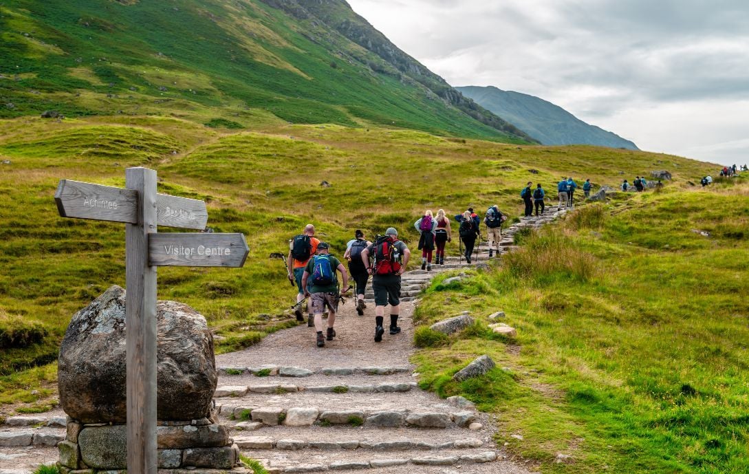
At 1,345 metres (4,413 feet), Ben Nevis is the highest mountain in the UK and a major attraction near Fort William. It’s marked clearly on hiking maps, along with the Mountain Track (also called the Tourist Route) used by most walkers. More advanced climbers can find routes marked on detailed Ordnance Survey maps, showing ridges, contour lines, and summit access. The views from the top stretch across the Highlands, and on a clear day, you can even see parts of the Inner Hebrides.
3. Eilean Donan Castle
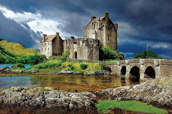
This iconic castle sits where three sea lochs meet Loch Duich, Loch Long, and Loch Alsh, near the village of Dornie. Often featured on postcards and guidebooks, Eilean Donan is clearly shown on any map of the western Highlands. It’s just off the A87 road on the way to the Isle of Skye. Surrounded by water and connected by a stone bridge, the castle is a favorite stop for photographers and history lovers alike.
4. Glenfinnan Viaduct And Monument
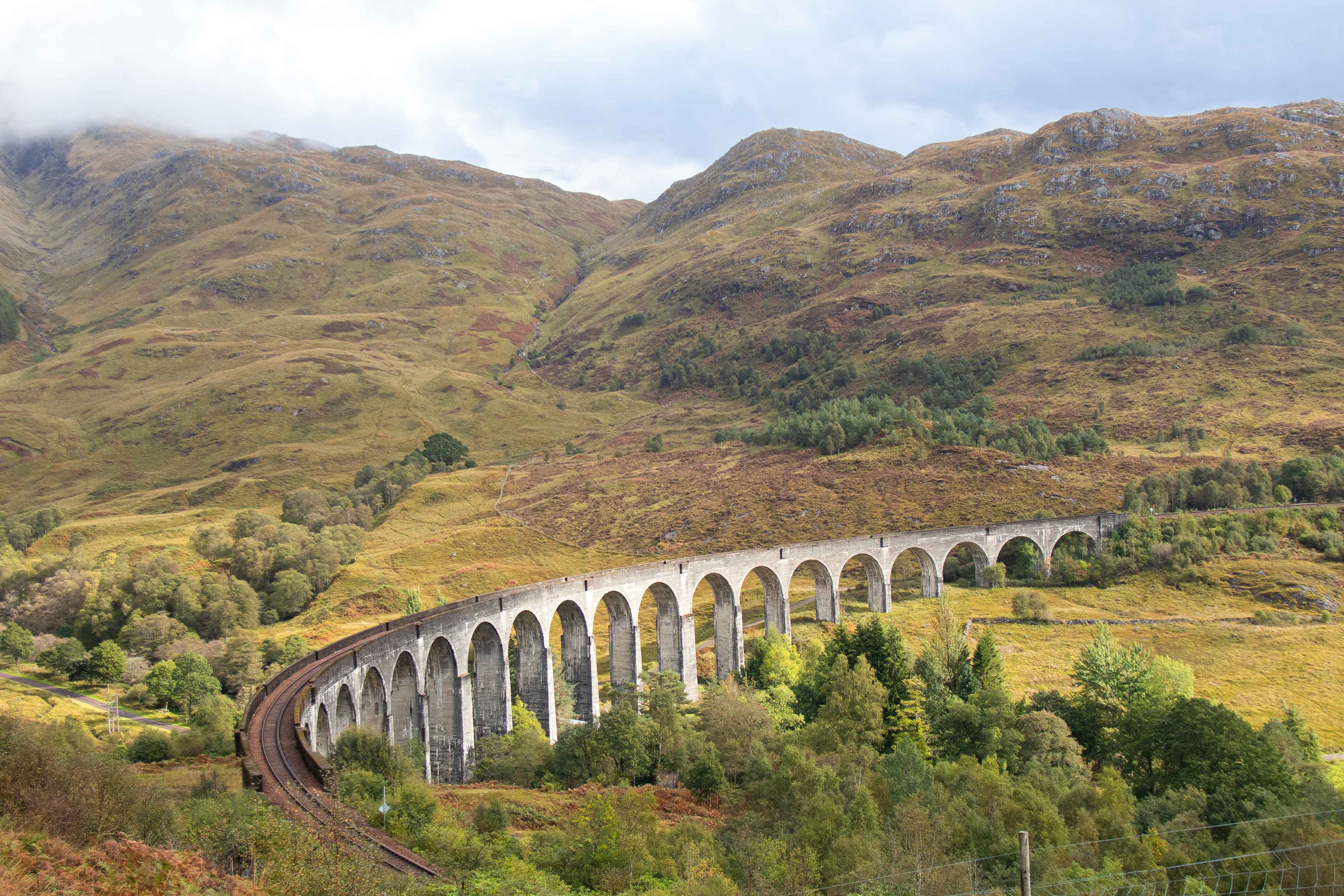
Located west of Fort William, Glenfinnan is known for its 21-arched railway viaduct that carries the Jacobite steam train famous from the Harry Potter films. You can find this on rail route maps and tourist guides. Also nearby is the Glenfinnan Monument, which marks the start of the 1745 Jacobite rising. The site sits along the Road to the Isles (A830) and offers incredible views over Loch Shiel.
5. Cairngorms National Park
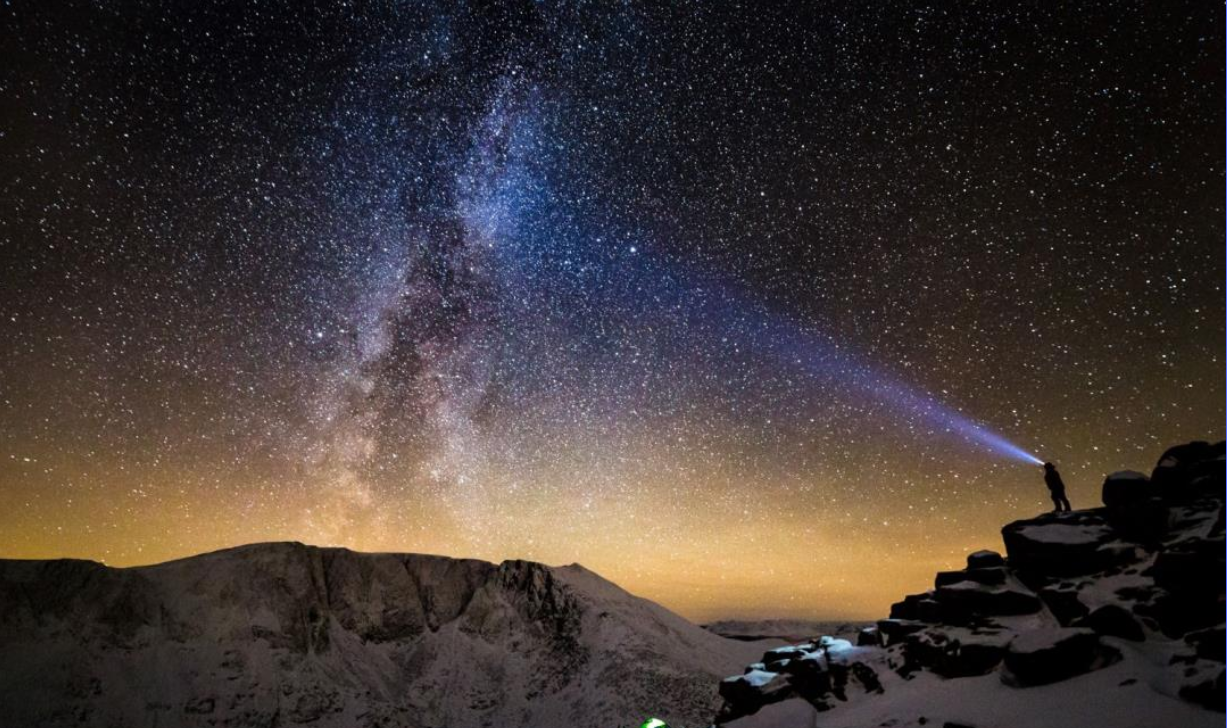
Marked prominently on any detailed Highlands map, Cairngorms National Park covers part of the eastern Highlands. It is home to ancient pine forests, mountain plateaus, and rare wildlife like red squirrels and golden eagles. The town of Aviemore acts as a hub for outdoor activities like skiing, hiking, and mountain biking. Maps of the area show trails, visitor centres, ski lifts, and scenic driving routes through the national park, making it one of the most visited spots among Scotland's national parks.
6. Isle Of Skye
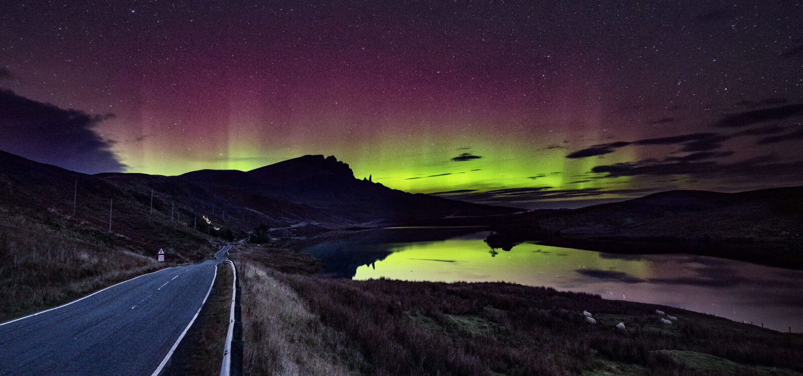
Easily found on a west coast map, the Isle of Skyeis connected to the mainland by the Skye Bridge from Kyle of Lochalsh. It features some of Scotland’s most dramatic landscapes, including the Fairy Pools, the Old Man of Storr, and Quiraing. All these natural wonders are marked on hiking and driving maps of the island. With narrow roads and scattered villages, a local map helps you avoid single-track confusion and plan stops more efficiently.
7. St. Andrew’s Cathedral
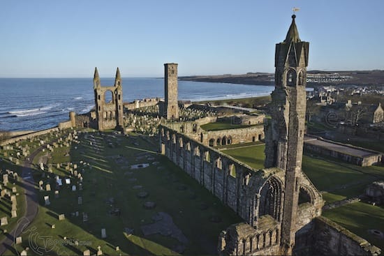
St. Andrew’s Cathedralin Inverness is one of the most important religious landmarks in the Scottish Highlands. Overlooking the River Ness, this striking cathedral stands out for its Gothic architecture, peaceful setting, and cultural significance. Built in the 19th century, it was the first new Protestant cathedral in Scotland after the Reformation. A visit to St. Andrew’s Cathedral is perfect for those who enjoy history, architecture, or quiet reflection. It’s easy to find on a map of the Scottish Highlands and is a short walk from Inverness Castle and city centre attractions.
8. Culloden Battlefield
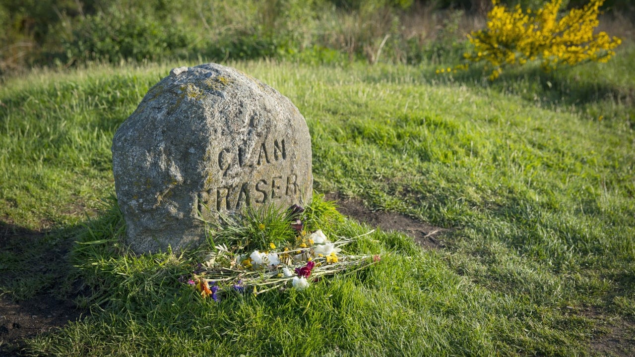
Culloden is the site of the final battle of the Jacobite rising, fought in 1746. It marked a turning point in Scottish history. The battlefield has been preserved with paths and markers, showing where each army stood. The modern visitor centre includes a museum and immersive displays. It’s located just a few miles east of Inverness and marked on Highland maps. Audio guides and battlefield maps enhance your understanding of this historic site.
9. Fairy Pools, Isle Of Skye
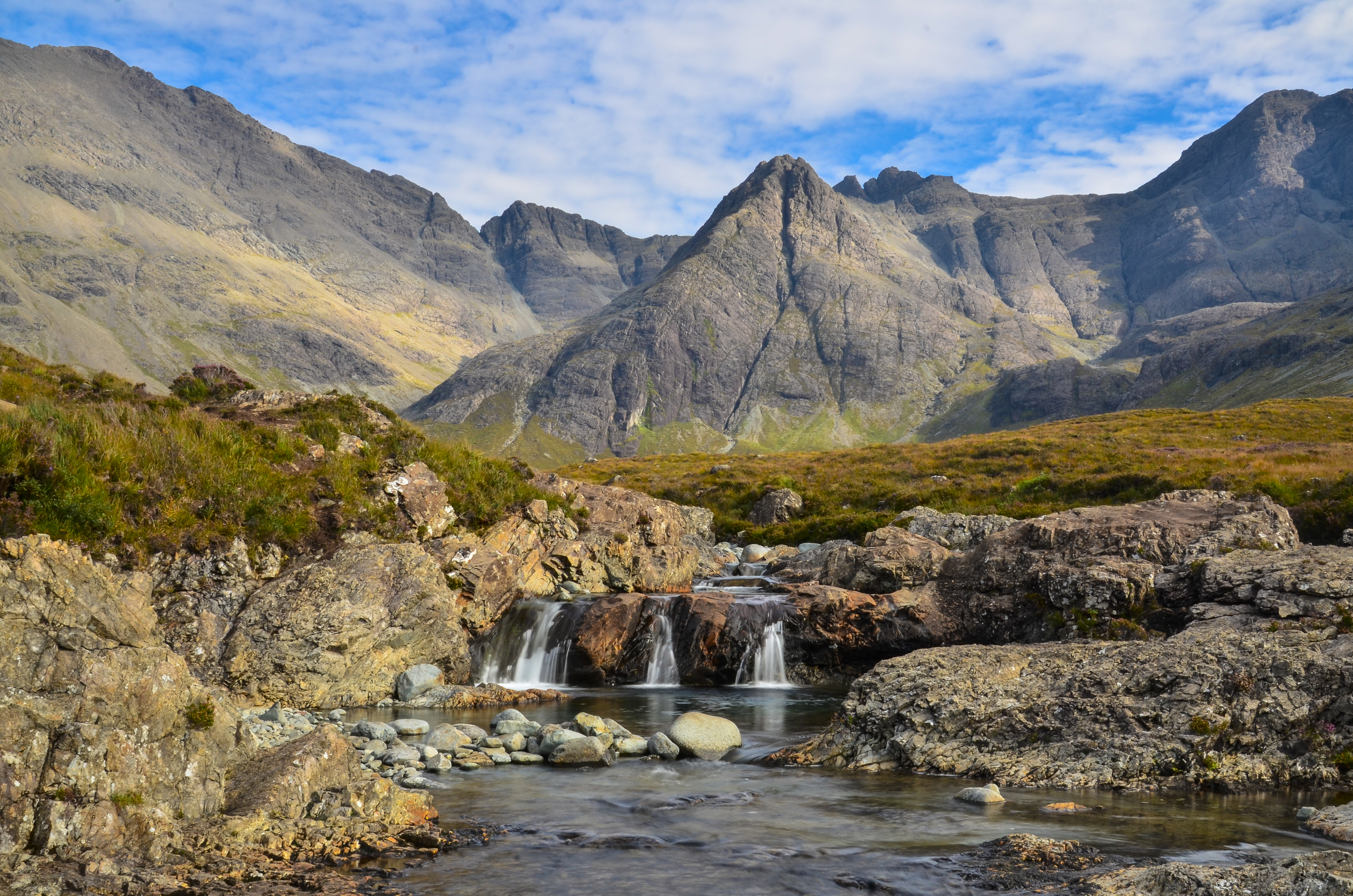
The Fairy Pools are a collection of crystal-clear pools and waterfalls in Glen Brittle, on the Isle of Skye. Set at the foot of the Black Cuillin mountains, they’re a short walk from the road and ideal for photography, wild swimming, or a peaceful hike. On sunny days, the water glows blue and green, making the place feel magical. A local walking map shows the best paths to reach each pool and helps avoid the busiest times.
10. Dunrobin Castle
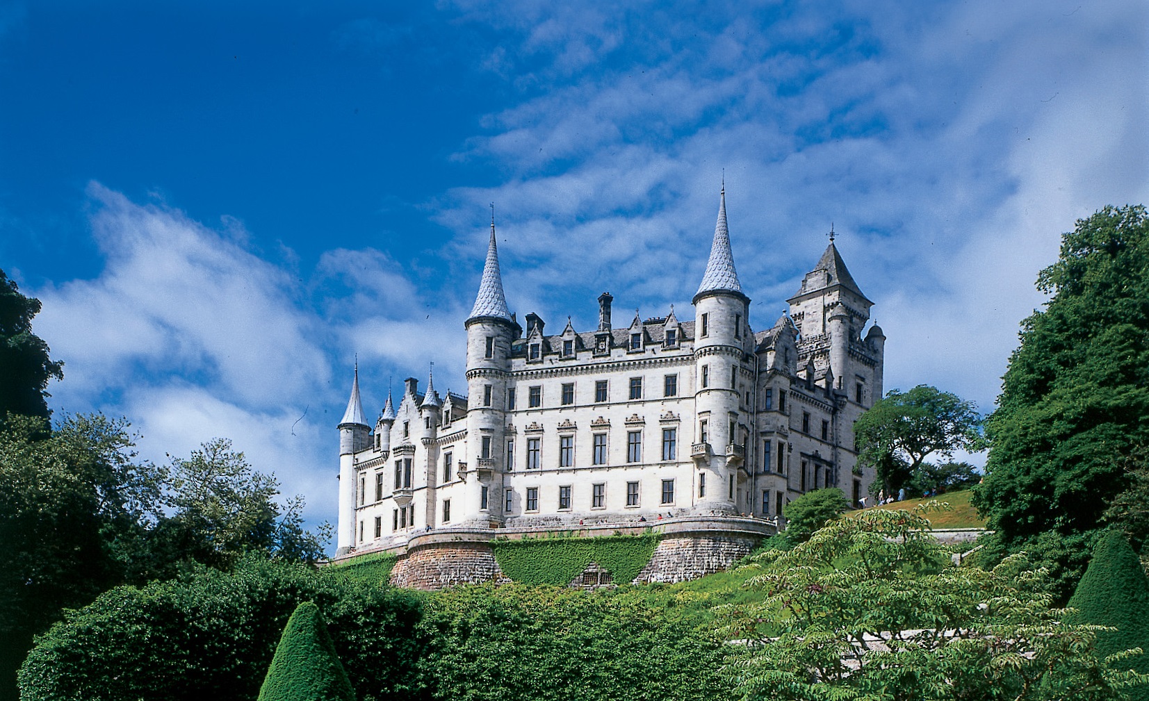
Found just north of the town of Golspie, Dunrobin Castlelooks more like a French château than a traditional Scottish stronghold. It sits along the east coast and is easy to find on historical or driving maps. With its elegant turrets and gardens, the castle overlooks the North Sea and is home to falconry displays and a private museum.
11. Plockton
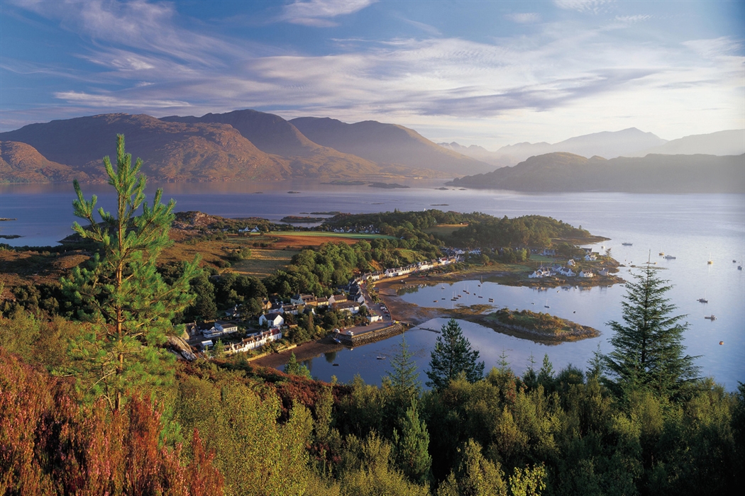
This charming village sits along Loch Carron and is marked on most tourist maps of the west coast. Known for its calm waters and surprising palm trees (thanks to the Gulf Stream), Plockton is a peaceful spotthat feels like a secret getaway. You’ll often find it on scenic route maps leading to the Isle of Skye.
12. Smoo Cave
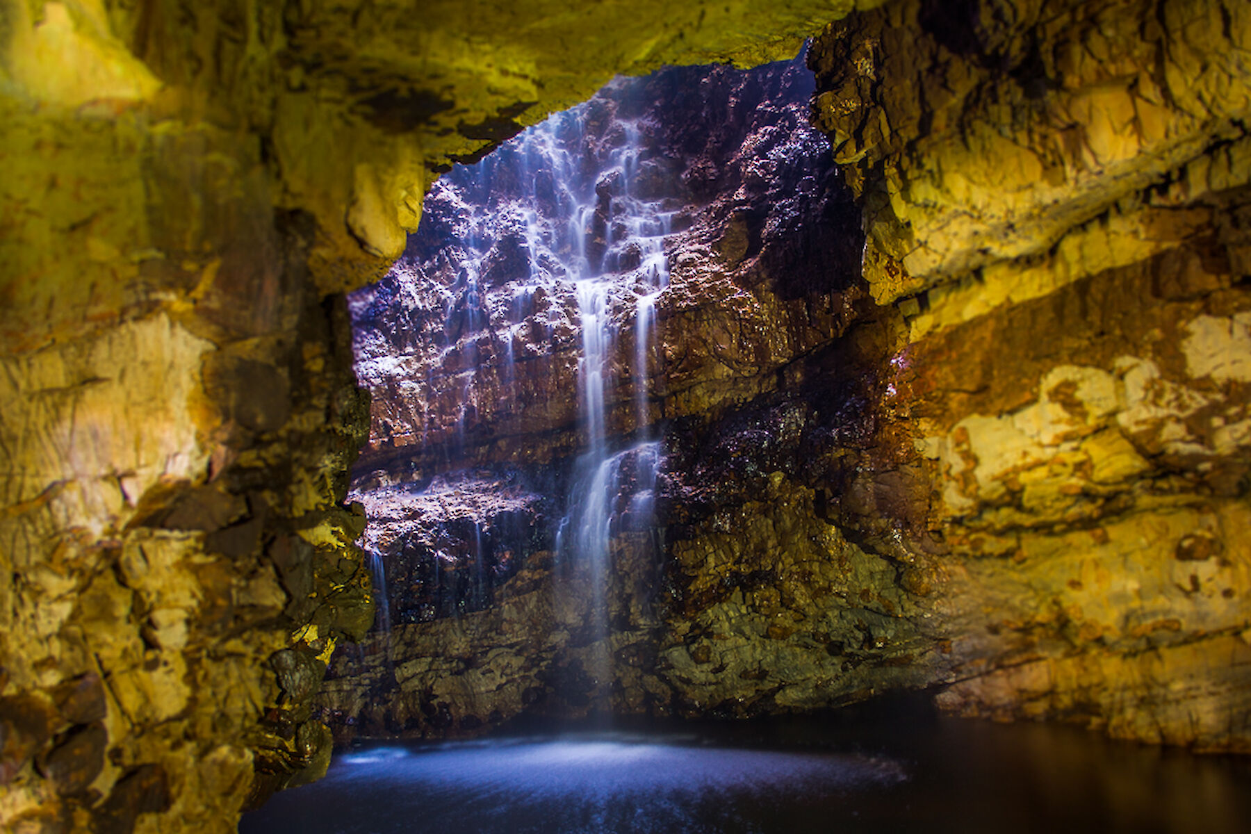
Located near Durness in the far north, Smoo Cave is a sea cave carved into limestone cliffs. It features a waterfall that drops into a deep pool inside the cave. You can explore part of the cave on foot, and in summer, take a short boat ride deeper inside. The cave is part of the North Coast 500 route and is marked on tourist maps of the area. Nearby cliffs and beaches make it a great stop for photographers.
13. Old Man Of Storr
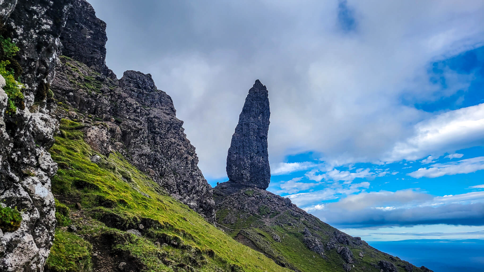
This towering rock formation sits above the Isle of Skye’s east coast and is one of the island’s most famous landmarks. Reaching the Old Man involves a steep uphill walk, but the views over the Sound of Raasay are breathtaking. This is a must-see on any Highland map and is especially popular at sunrise or sunset. On clear days, you can see all the way to the mainland. Trail maps help guide you safely to the summit and back.
14. Glen Coe
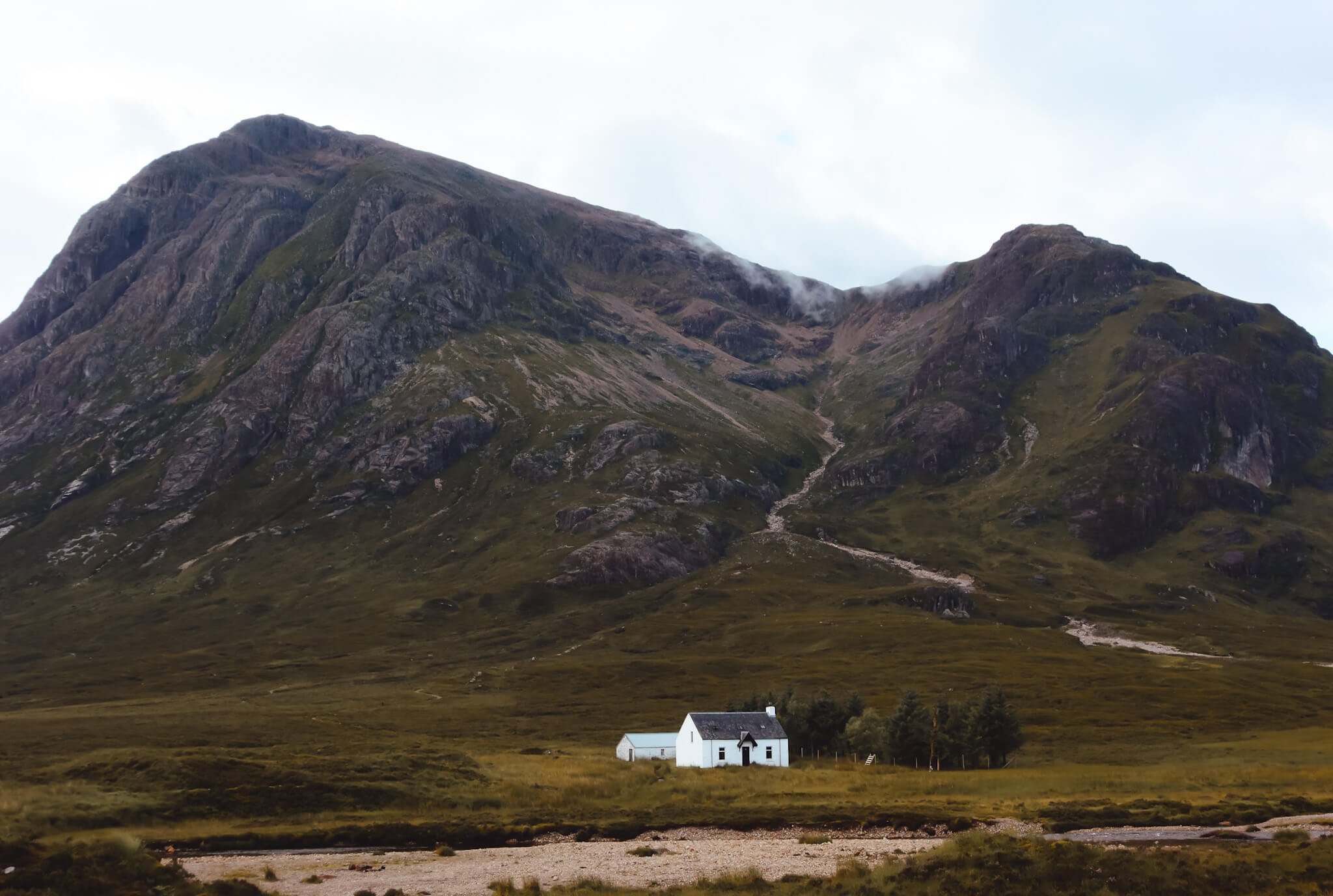
Located along the A82 between Crianlarich and Fort William, Glen Coe is one of Scotland’s most beautiful and haunting glens. It’s known for towering mountains, waterfalls, and its tragic history. The area is well covered on topographic and hiking maps, with plenty of trails for walkers and climbers.
15. John O’ Groats
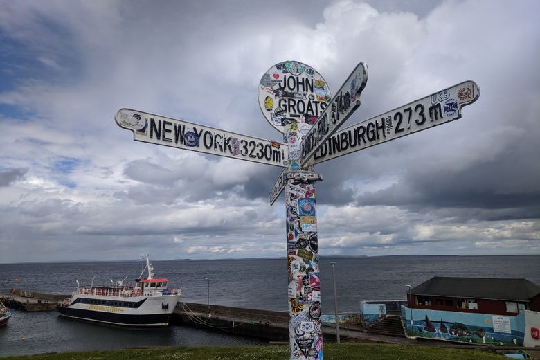
Sitting at the northeastern tip of the mainland, John o’ Groats is known as one end of the famous “Land’s End to John o’ Groats” journey. It’s shown on most UK-wide maps and road atlases. From here, you can take ferries to Orkney or enjoy views of the Pentland Firth.
How To Use A Map Of The Scottish Highlands For Travel
Using a map in the Scottish Highlands is more than just finding your way, it's about planning smarter, staying safe, and enjoying more of the landscape.
Choose The Right Map
Before your trip, pick a map that suits your needs. For walking or hiking, Ordnance Survey Explorer Maps are best. They show detailed paths, terrain, and elevation. For driving, a road atlas or satellite map will help you follow major routes and spot viewpoints, petrol stations, and small towns.
Plan Routes Around Travel Time, Not Distance
In the Highlands, travel isn’t always fast. A short route on the map may take longer than expected due to narrow roads, steep climbs, or winding bends. Use your map to estimate realistic travel times, not just distance.
Look For Landmarks And Rest Stops
Use your map to spot useful stops along the way. Look for signs of castles, waterfalls, picnic spots, and lochs. These can break up long drives and make your trip more enjoyable. Local maps also show parking areas, public toilets, and campsites.
Mark Key Points Before You Go
Before setting off, use a pen or highlighter to mark places you want to visit. This helps you stay on track, especially in areas where mobile signal drops. Knowing your route in advance avoids confusion and lets you enjoy the journey more.
Match Terrain To Activities
If you're planning outdoor activities like hiking, use contour lines and symbols to check terrain. Steep hills, river crossings, or boggy ground can slow your pace. A good hiking map helps you plan safer, more enjoyable routes.
Combine Map Use With GPS
GPS apps can be helpful, but don’t rely on them alone. Many parts of the Highlands have poor signal, especially in glens or remote valleys. Always carry a paper map and know how to read it in case your device stops working.
Weather And Best Time To Visit
The Scottish Highlands have a cool, wet climate that changes throughout the year. Knowing what to expect helps you pack right and plan better.
Spring (March To May)
Spring brings longer days and blooming wildflowers. Temperatures range from 5°C to 12°C (41°F to 54°F). The weather can be unpredictable, with sunny spells mixed with rain and wind. This is a quieter time to visit, with fewer tourists on the roads.
Summer (June To August)
Summer is the warmest and busiest season. Temperatures reach 12°C to 18°C (54°F to 64°F), sometimes higher. Days are very long, with up to 18 hours of daylight in June. This is the best time for hiking and outdoor activities. However, midges (tiny biting insects) are most active from late May to September, especially in still, damp conditions near water.
Autumn (September To November)
Autumn brings beautiful colors to the forests and glens. Temperatures drop to 6°C to 14°C (43°F to 57°F). The weather becomes wetter and windier. Tourist numbers decrease, making it easier to find accommodation. Midges start to disappear by October.
Winter (December To February)
Winter is cold, dark, and often snowy in the mountains. Temperatures range from 0°C to 7°C (32°F to 45°F). Daylight is short, with only 6-7 hours in December. Some mountain roads may close due to snow. However, winter offers stunning snowy landscapes and a chance to see the Northern Lightsin the far north.
Best Times To Visit
- For hiking and outdoor activities:May to September
- For fewer crowds:April, May, September, October
- For winter sports:December to March
- For photography:September and October (autumn colors)
- To avoid midges:October to April
What To Pack
- Waterproof jacket:Rain can happen any day of the year
- Layers of clothing:Temperatures change quickly, especially in the mountains
- Sturdy walking boots:Essential for hiking, even on easy trails
- Warm fleece or sweater:Even summer evenings can be cool
- Midge repellent:If visiting between May and September
- Sun protection:The sun can be strong, even on cloudy days
- Hat and gloves:For spring, autumn, and winter visits
Where To Stay In The Scottish Highlands
The Highlands offer many types of accommodation, from budget hostels to luxury hotels. Your choice depends on your budget, travel style, and where you plan to explore.
Hotels
Most towns have at least one hotel. Inverness, Fort William, and Aviemore have the most options, including chain hotels and independent properties. Hotels offer comfort and usually include breakfast. Prices range from £60 to £200+ per night.
Bed And Breakfasts (B&Bs)
B&Bs are family-run guesthouses found in almost every village. They offer a warm welcome, local knowledge, and a hearty Scottish breakfast. Rooms are usually simple but clean and comfortable. Prices typically range from £40 to £90 per night per person.
Hostels
Hostels are the cheapest option, popular with hikers and backpackers. You can book a bed in a shared room or sometimes a private room. Many have kitchens where you can cook your own meals. The Scottish Youth Hostels Association (SYHA) runs clean, well-maintained hostels across the Highlands. Prices start from £15 to £30 per night.
Self-Catering Cottages
Renting a cottage gives you your own space and kitchen. This works well for families or longer stays. Cottages are found throughout the Highlands, from remote glens to coastal villages. Prices vary widely, from £400 to £2000+ per week depending on size and location.
Camping And Campervan Sites
The Highlands have many campsites, from basic fields to sites with showers and electric hookups. Wild camping is allowed in most areas under the Scottish Outdoor Access Code, as long as you camp responsibly, leave no trace, and stay away from homes and farmland.
Campervan and motorhome travel is very popular. Many car parks and designated areas welcome campervans overnight.
Bothies
Bothies are simple stone shelters in remote areas, free for anyone to use. They have no electricity, running water, or furniture. Bothies are maintained by volunteers and follow a "leave no trace" principle. They're popular with experienced hikers and adventurers.
Booking Tips
- Book ahead during summer (June to August) and major holidays
- Small villages may have limited options, so plan your route with accommodation in mind
- Many places accept pets, but always check first
- Some remote B&Bs and cottages may not have online booking, call them directly
Food And Dining In The Scottish Highlands
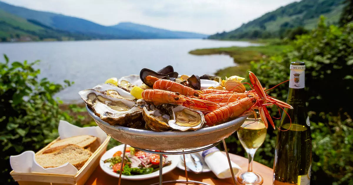
Highland food reflects the region's history and landscape. You'll find hearty meals, fresh seafood, and local ingredients throughout the area.
Traditional Highland Dishes
- Haggis:A savory pudding made from sheep organs, oatmeal, and spices. Often served with "neeps and tatties" (turnips and potatoes)
- Cullen Skink:A thick soup made with smoked haddock, potatoes, and cream
- Scotch Broth:A warming soup with lamb, barley, and vegetables
- Venison:Deer meat, often served as steaks or in stews
- Salmon:Fresh or smoked, caught from Highland rivers and lochs
- Black Pudding:A type of blood sausage, common at breakfast
Where To Eat
- Pubs:Most villages have at least one pub serving food. Expect hearty meals like fish and chips, burgers, and stews. Prices are reasonable, usually £10 to £18 for a main course.
- Restaurants:Larger towns like Inverness, Fort William, and Aviemore have restaurants offering Scottish, Indian, Chinese, and Italian food. Fine dining restaurants showcase local ingredients like langoustines, scallops, and Highland beef.
- Cafés:Small cafés serve soups, sandwiches, cakes, and coffee. They're perfect for a quick lunch during a road trip.
- Hotel Restaurants:Many hotels welcome non-guests for dinner. These often serve the best food in smaller towns.
- Fish and Chip Shops:A British classic. Coastal towns serve especially fresh fish.
Local Specialties To Try
- Smoked fish:Salmon, mackerel, and trout from local smokehouses
- Tablet:A sweet, crumbly candy similar to fudge
- Shortbread:Buttery Scottish biscuits
- Whisky:The Highlands produce some of the world's finest single malt whisky
- Cranachan:A dessert made with cream, oats, whisky, raspberries, and honey
Dining Tips
- Many restaurants close early (by 8 or 9 PM), especially in small villages
- Book ahead for dinner in popular spots during summer
- Pubs often stop serving food by 8 PM
- Supermarkets in larger towns are useful for self-catering or packed lunches
- Tap water is safe to drink and often comes from mountain sources
Shopping For Food
- Supermarkets:Inverness, Fort William, and Aviemore have large supermarkets. Smaller towns may only have a Co-op or Tesco Express.
- Local Shops:Many villages have a small general store selling basics. Prices are higher than in supermarkets, but they're a lifeline in remote areas.
- Farm Shops:Some farms sell fresh meat, eggs, vegetables, and homemade products.
People Also Ask
What Is The Prettiest Village In The Scottish Highlands?
PLOCKTON. Known as the 'Jewel of the Highlands', Plockton sits on a sheltered bay in Wester Ross, overlooking Loch Carron. The village itself has a population of less than 500 people but remains a popular destination for tourists in the area particularly during the summer.
What Makes The Scottish Highlands So Special?
The Scottish Highlands are a nature lovers dream. Far away from metropolitan towns and cities, our local wildlife thrives all year round. North-West Scotland is famous for bird watching with Puffins, Golden Eagles and Herons making a regular appearance.
How Many Days Do I Need To Visit The Scottish Highlands?
A minimum of 3-4 days lets you see key highlights like Loch Ness, Glen Coe, and Fort William. For a fuller experience including the Isle of Skye and North Coast 500, plan 7-10 days. Two weeks allows you to explore more remote areas at a relaxed pace.
Where Exactly Are The Scottish Highlands?
The Highlands lie to the north and west of the Highland Boundary Fault, which runs from Arran to Stonehaven. This part of Scotland is largely composed of ancient rocks from the Cambrian and Precambrian periods which were uplifted during the later Caledonian Orogeny.
Final Thoughts
Travelling through the Scottish Highlands can be one of the most amazing experiences of your life, but only if you’re well prepared. A good map helps you see more, avoid getting lost, and enjoy the land safely.
Every road, loch, and trail tells part of Scotland’s story. With the right map in your hands, you're not just finding your way; you’re following paths that have been walked for hundreds of years.
Jump to
Your Scottish Highlands Map And Travel Guide
Quick Facts About The Scottish Highlands
History Of The Scottish Highlands
Geographical Overview Of The Scottish Highlands
Capital Of The Scottish Highlands
Towns And Small Cities On The Map Of Scottish Highlands
Regions On The Map Scottish Highlands
Total Area Of The Scottish Highlands
Scottish Highlands - Boundaries And Nearby Lands
Language Of The Scottish Highlands
Population Of The Scottish Highlands
Currency Of The Scottish Highlands
Dialing Code Of The Scottish Highlands
Map-Based Itineraries
Major Roads And Transportation
Types Of Maps For The Scottish Highlands
Best Scottish Highlands Maps You Can Use Today
Best Attractions On The Map Of The Scottish Highlands
How To Use A Map Of The Scottish Highlands For Travel
Weather And Best Time To Visit
Where To Stay In The Scottish Highlands
Food And Dining In The Scottish Highlands
People Also Ask
Final Thoughts
Callum Fraser
Author
Callum Fraser isn't just a writer about Scotland; he's a product of its rugged landscape and rich history. Born and raised in Perthshire, with the Highlands as his backyard, his love for the nation's stories was kindled by local storytellers and long walks through ancient glens.
This passion led him to pursue a degree in Scottish History from the University of Edinburgh. For over 15 years, Callum has dedicated himself to exploring and documenting his homeland, fusing his academic knowledge with essential, on-the-ground experience gained from charting road trips through the Cairngorms, hiking the misty Cuillins of Skye, and uncovering the secrets of traditional recipes in his family's kitchen.
As the Editor-in-Chief and Lead Author for Scotland's Enchanting Kingdom, Callum's mission is simple: to be your most trusted guide. He combines meticulous research with a storyteller's heart to help you discover the authentic magic of Scotland — from its best-kept travel secrets to its most cherished traditional recipes.
Latest Articles
Popular Articles