Fife Coastal Path Map - Ultimate Guide To Scotland's Iconic Trail
Don't just walk, experience the Fife Coastal Path! Our comprehensive map guide offers unique insights, attraction highlights, and practical advice for every step.
Author:Callum FraserJun 30, 20257.5K Shares151.7K Views
The Fife Coastal Path, a celebrated Scottish Great Trail, offers an unparalleled journey along Fife's stunning coastline. From the Forth Bridges to the Tay Estuary, this path winds through picturesque fishing villages, ancient ruins, and breathtaking natural landscapes.
For anyone planning to experience this remarkable route, a comprehensive understanding of the Fife Coastal Path mapis not just helpful-it's essential for a truly rewarding adventure.
Navigating the Fife Coastal Path effectively means more than simply knowing the start and end points. It's about understanding the nuances of each section, identifying key points of interest, and being prepared for varying terrains.
This guide aims to provide that comprehensive insight, going beyond basic mapping to offer a strategic approach to exploring this iconic Scottish pathway.
The Fife Coastal Path: An Overview
| Length | 187 km (116 mi) |
| Location | Fife, Scotland |
| Established | 2002 |
| Designation | Scotland's Great Trails |
| Use | Hiking |
| Elevation gain/loss | 1,865 metres (6,119 ft) gain |
The Fife Coastal Path stretches approximately 117 miles (187 km) from Kincardine in the west to Newburgh in the north. Established in 2002, and extended in 2011 and 2012, it's a journey that reveals Fife's rich history, diverse wildlife, and captivating coastal scenery.
With an elevation gain of 1,865 meters (6,119 ft), the route offers a wide range of terrain from level paths to wild and demanding rocky beaches. While the entire path can be walked as one continuous long-distance hike, typically taking between one week and 10 days, it's expertly divided into manageable sections, making it accessible for walkers of all abilities and timeframes.
About 500,000 people use the path every year, with approximately 35,000 walking the entire route.
Key Features Of The Path
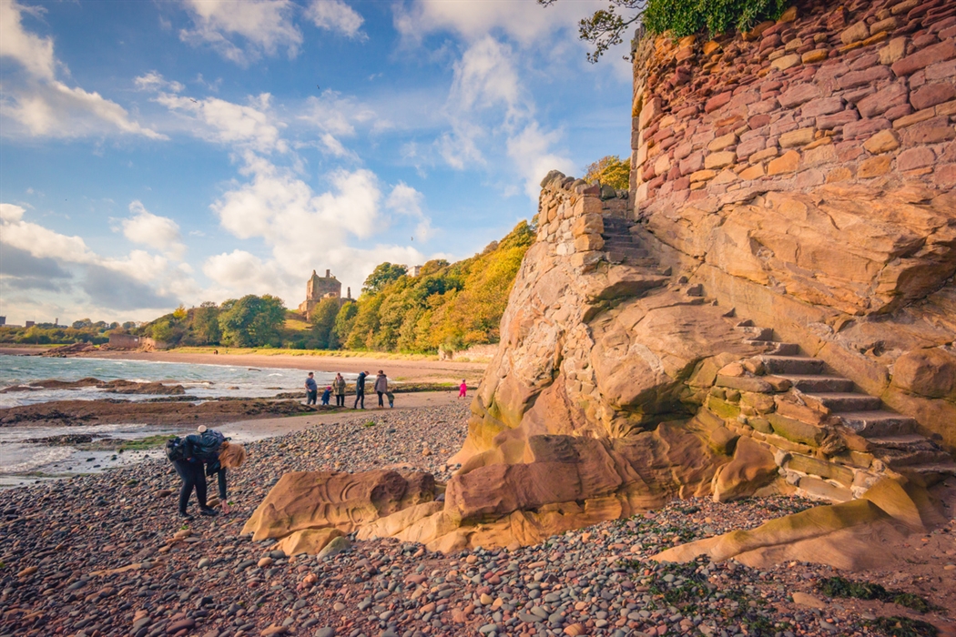
- Diverse Landscapes:The path transitions from rugged cliffs and rocky shores to expansive sandy beaches, tranquil estuaries, and lush woodlands. It passes through the former coal mining towns of central Fife and the cosmopolitan university city of St Andrews. The small fishing villages and harbours of Fife’s East Neuk contrast with the industrial areas of the west.
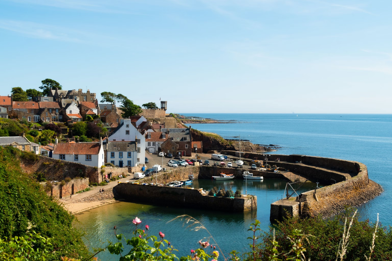
- Historic Villages & Towns:It threads through charming, centuries-old fishing villages like Crail, Anstruther, Pittenweem, and St Monans, each with its unique character and stories. You'll encounter the historic village of Culross and the historic town of Newport-on-Tay, among many others.
- Historical and Natural Attractions:Along the way, you'll encounter ancient castles (such as Aberdour Castle and Macduff's Castle), intriguing sea caves (some with Pictish carvings in the Wemyss Caves), significant geological sites, and abundant wildlife, including various seabirds, seals, porpoises, dolphins, and even puffins. The Harbourmaster's House in Dysart, featured in Outlander, serves as a visitor centre and the head office for the Fife Coast and Countryside Trust. Highlights also include the three iconic bridges spanning the River Forth, 15 major award-winning beaches, the Eden Estuary Nature Reserve, and Tentsmuir beach and forest.
- Accessibility:While some sections present more challenging terrain, much of the path is well-maintained and suitable for a wide range of walkers. The preferred direction is to start from Kincardine-on-Forth, to put the prevailing wind at your back for the greater part of this anti-clockwise circuit around the Fife peninsula.
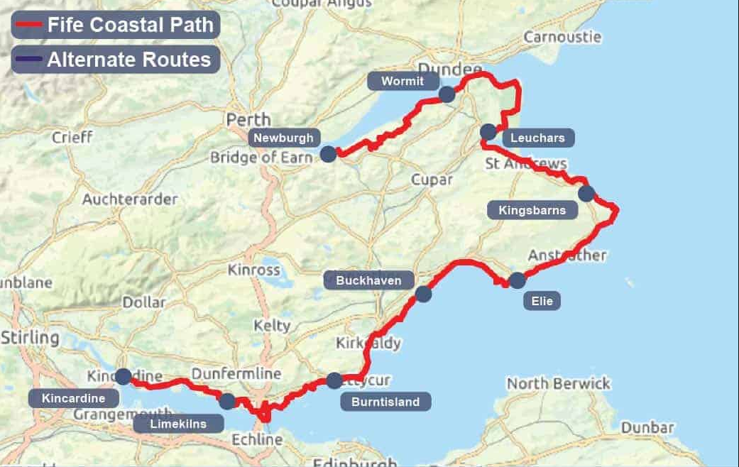
Understanding The Fife Coastal Path Map: Essential Sections And Highlights
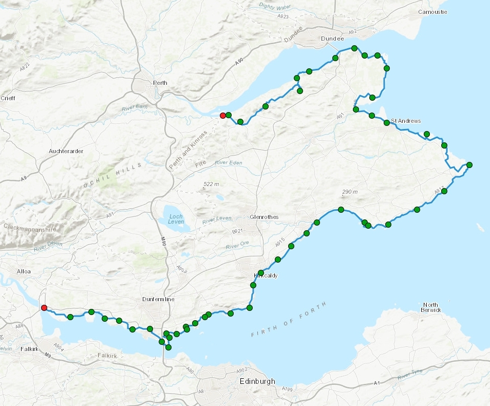
The official Fife Coastal Path map divides the route into several distinct sections. Each offers a unique experience and set of attractions. Understanding these segments is crucial for planning your journey, whether you intend to walk the entire path or focus on specific day hikes.
1. Kincardine To Limekilns
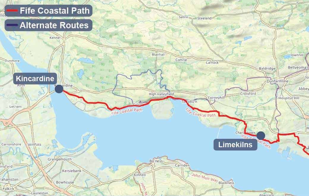
This westernmost section introduces you to the Firth of Forth and offers impressive views of the iconic Forth Bridges. It's a relatively gentle start, often passing through more industrial landscapes before revealing charming coastal villages like Culross and Charlestown. This 16.8-mile (27-km) first section connects to the original bridge-to-bridge route.
2. Limekilns To Burntisland
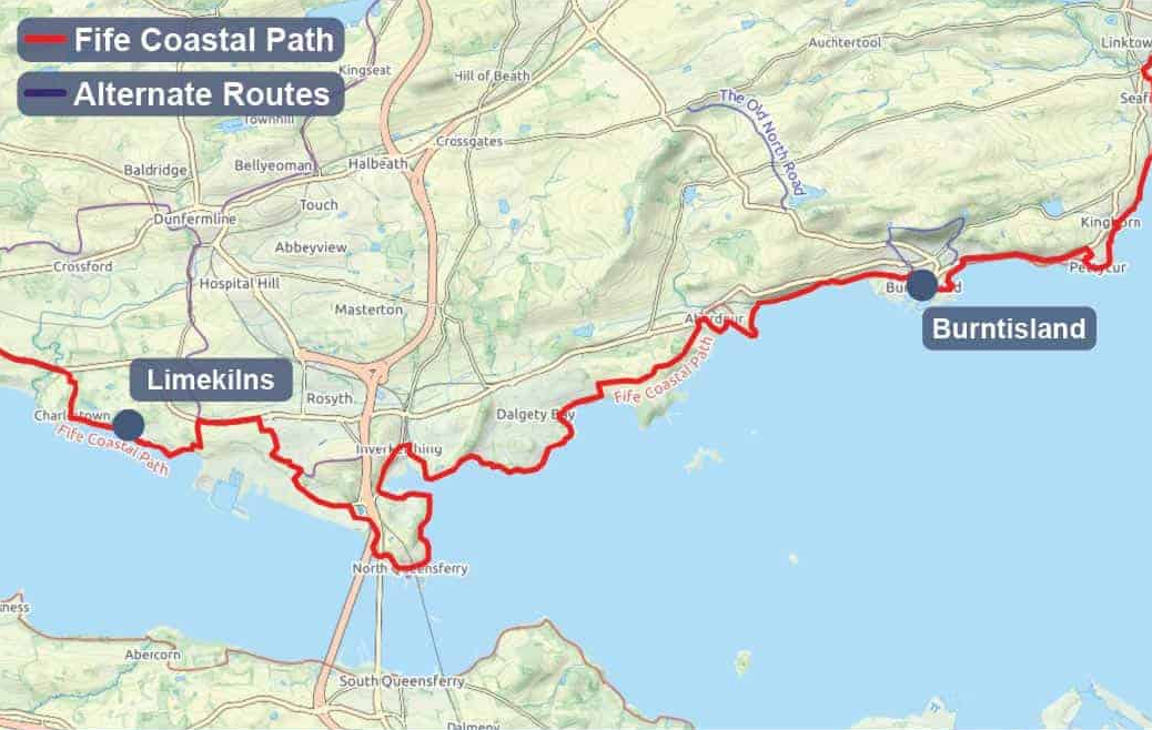
Moving east, this part of the path showcases scenic stretches with views across the Forth. You'll pass through areas like Aberdour, known for its beautiful beach and castle, and reach the vibrant town of Burntisland. Inverkeithing's Hospitum of the Grey Friars is a historic point of interest in this section.
3. Burntisland To Buckhaven
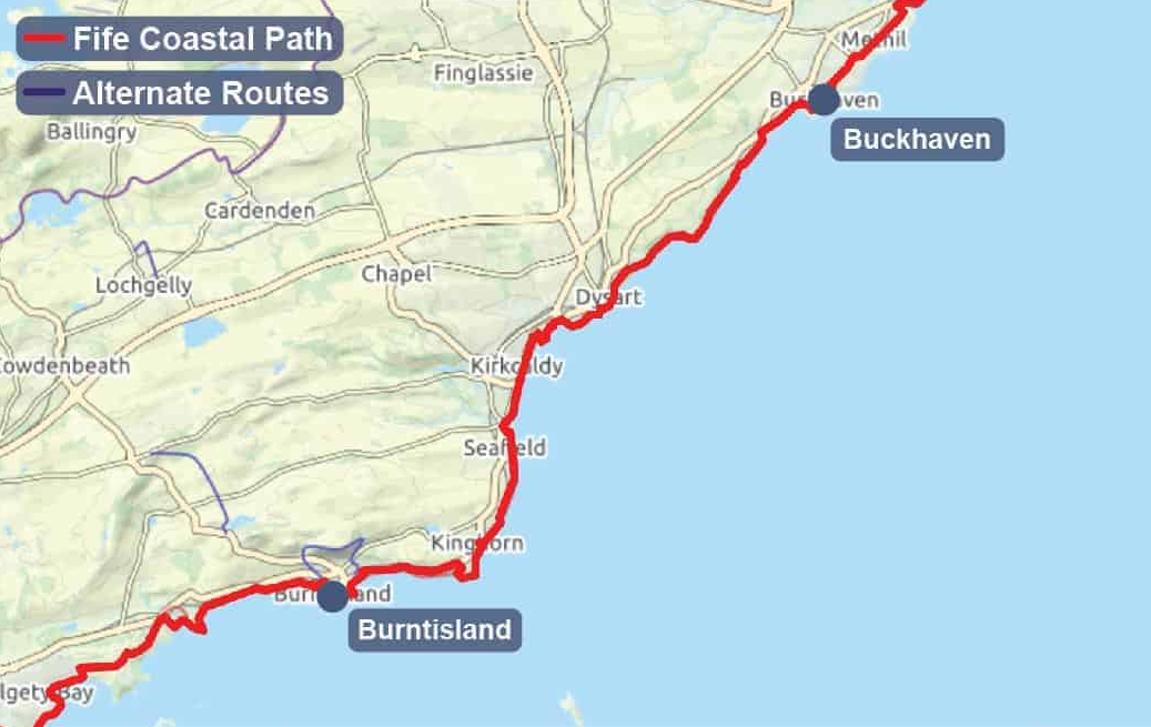
This leg includes the bustling town of Kirkcaldy, where the path sometimes briefly moves away from the immediate coastline. While perhaps less wild than other parts, it provides insights into Fife's industrial heritage, including past collieries, and local life, passing through Dysart and the Wemyss villages.
4. Buckhaven To Elie
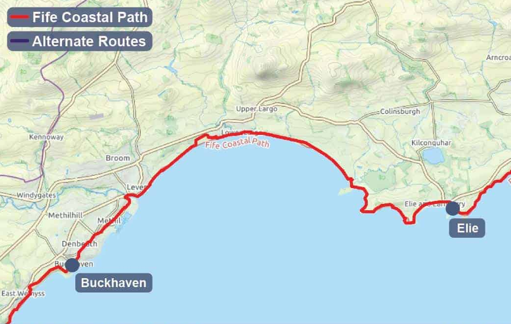
This leg of the journey brings you to the start of the famed East Neuk of Fife, characterized by its picturesque fishing villages. Highlights include the Elie Chain Walk (an optional, adventurous detour for those seeking a thrill) and the charming village of Elie with its lighthouse. This section offers Scotland’s secret via ferrata.
5. Elie To Cambo Sands
Considered by many to be one of the most beautiful sections, this part winds through the heart of the East Neuk. You'll experience the quintessential Fife fishing villages of St Monans, Pittenweem, Anstruther (home to the Scottish Fisheries Museum), and Crail, each offering unique harbours, historic buildings, and opportunities for fresh seafood.
6. Cambo Sands To Leuchars (via St Andrews)
This stretch leads towards the historic university town of St Andrews. It often involves walking along expansive sandy beaches like Kingsbarns Beach, with views out to the North Sea. The section from St Andrews to Leuchars is approximately 5.8 to 6.5 miles (9.3 to 10.5 km) and is relatively flat, following the Eden Estuary.
Highlights include passing by the famous St Andrews golf courses, the Eden Estuary Visitor Centre, and crossing the ancient bridge at Guardbridge. This section is also suitable for cycling. Care is needed when walking near golf courses; walkers should keep to the path, avoid greens and fairways, and avoid distracting players.
7. Leuchars To Wormit Bay
North of St Andrews, this section ventures into a different character of coastline, often flatter and bordering the Eden Estuary, a significant nature reserve, and also passing through Tayport.
8. Wormit Bay To Newburgh
The final leg of the path guides you along the southern banks of the River Tay, culminating in the historic town of Newburgh. This 18.3-mile (29.5-km) final section offers tranquil riverside scenery, contrasting with the dramatic North Sea coast.
Newport-on-Tay, with its historic ferry terminal and Tatha gallery, is a notable stop. Be aware that this section, particularly between Balmerino and Newburgh, can be difficult to reach by public transport.
Fife Coastal Path Attractions: Unveiling Fife's Coastal Wonders
A good Fife Coastal Path map is far more than just lines on paper; it's your essential guide to discovering the myriad attractions and essential features that make this trail truly special. It helps you anticipate the journey ahead, locate key points of interest, and ensures you're prepared for every step.
Beyond the main route, a detailed map illuminates the diverse array of attractions you'll encounter:
1. Aberdour Castle: A Royal Ruin With Garden Views
Located between Burntisland and North Queensferry, Aberdour Castleis one of Scotland’s oldest surviving stone castles. Wander through its 12th-century tower house, restored Renaissance garden, and vaulted kitchens.
Beyond the 12th-century tower house you’ll find:
- A tiered Renaissance garden with yew hedges and an ancient doocot(dovecote).
- Decorative painted ceilings in the east range.
- Panoramic picnic lawns overlooking the Forth.
Open year-round (small admission fee), it’s a favourite on “Coastal Walks Scotland” itineraries and regularly earns five-star Fife Coastal Path reviewsfor its peaceful setting just 300 m off the trail.
2. Macduff's Castle
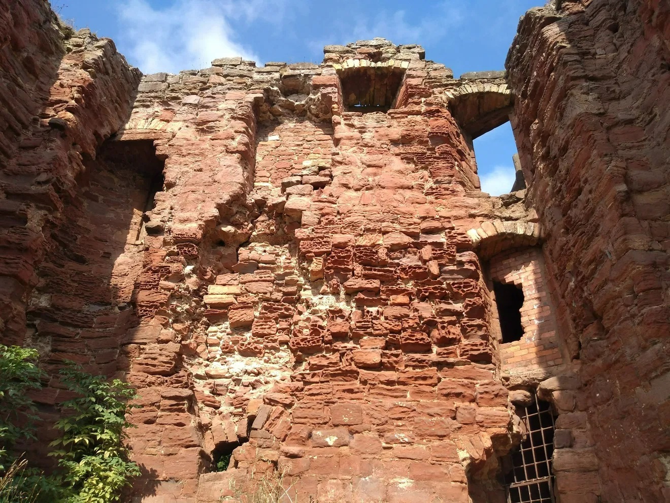
Perched above the surf near East Wemyss, Macduff’s Castleoffers raw, windswept drama. The ruined gatehouse, vaulted cellars, and coastal battery wall tell stories of the once-powerful Earls of Fife. Combine your visit with:
- A stroll to the nearby Wemyss Caves, famous for Pictish carvings.
- A chance to spot Highland cowsgrazing the cliff-top meadows in summer.
- Tide-pooling on the red-sandstone foreshore below the castle.
3. St Andrews Cathedral: Scotland’s Sacred Epicenter
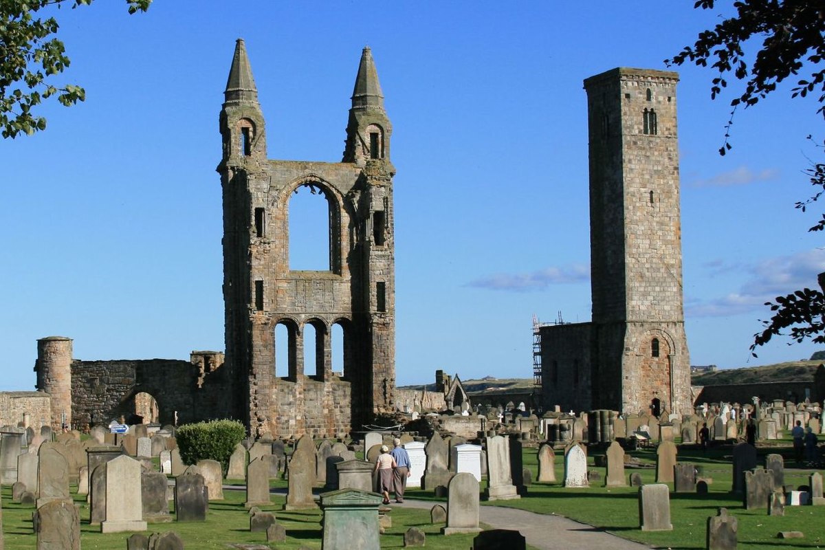
The towering east gable of St Andrews Cathedraldominates the skyline and signals the end (or beginning) of the Fife Pilgrim Way.
Don’t miss:
- St Rule’s Tower- a 156-step climb rewarded with Glenrothes-to-Tentsmuir views.
- The cathedral museum showcasing intricately carved medieval tombstones.
- Linking the visit to the St Andrews to Leucharsstage, where railway, bus, and footpath converge for an easy half-day walk.
4. Pitmilly Estate Ruins
Half-hidden in woodland between Kingsbarns and St Andrews, the Pitmilly estatereveals moss-clad arches, a ruined dovecote, and the ghost footprint of a grand Georgian manor. Expect:
- Peaceful bluebell carpets in late spring.
- A free detour that lets you escape the main path crowds.
- The chance to wild-camp responsibly on nearby common land beneath beech canopies.
5. Eden Estuary Nature Reserve
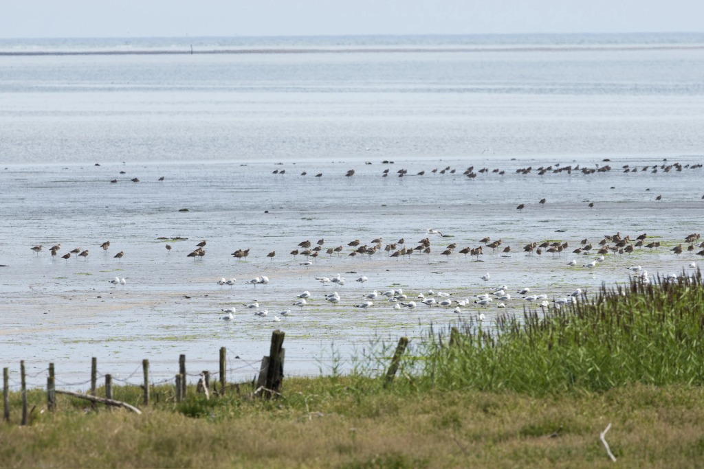
Near Guardbridge, the Eden Estuaryis an internationally important wetland for migratory birds. Facilities include:
- Two wheelchair-friendly bird-hides managed by the Scottish Ornithologists’ Club.
- Spring chances of puffinsrafting offshore; winter flocks of bar-tailed godwits.
- An interpretive board explaining why this section features prominently in “Fife Coastal Path reviews” from bird-lovers.
6. Tentsmuir Forest & Sands
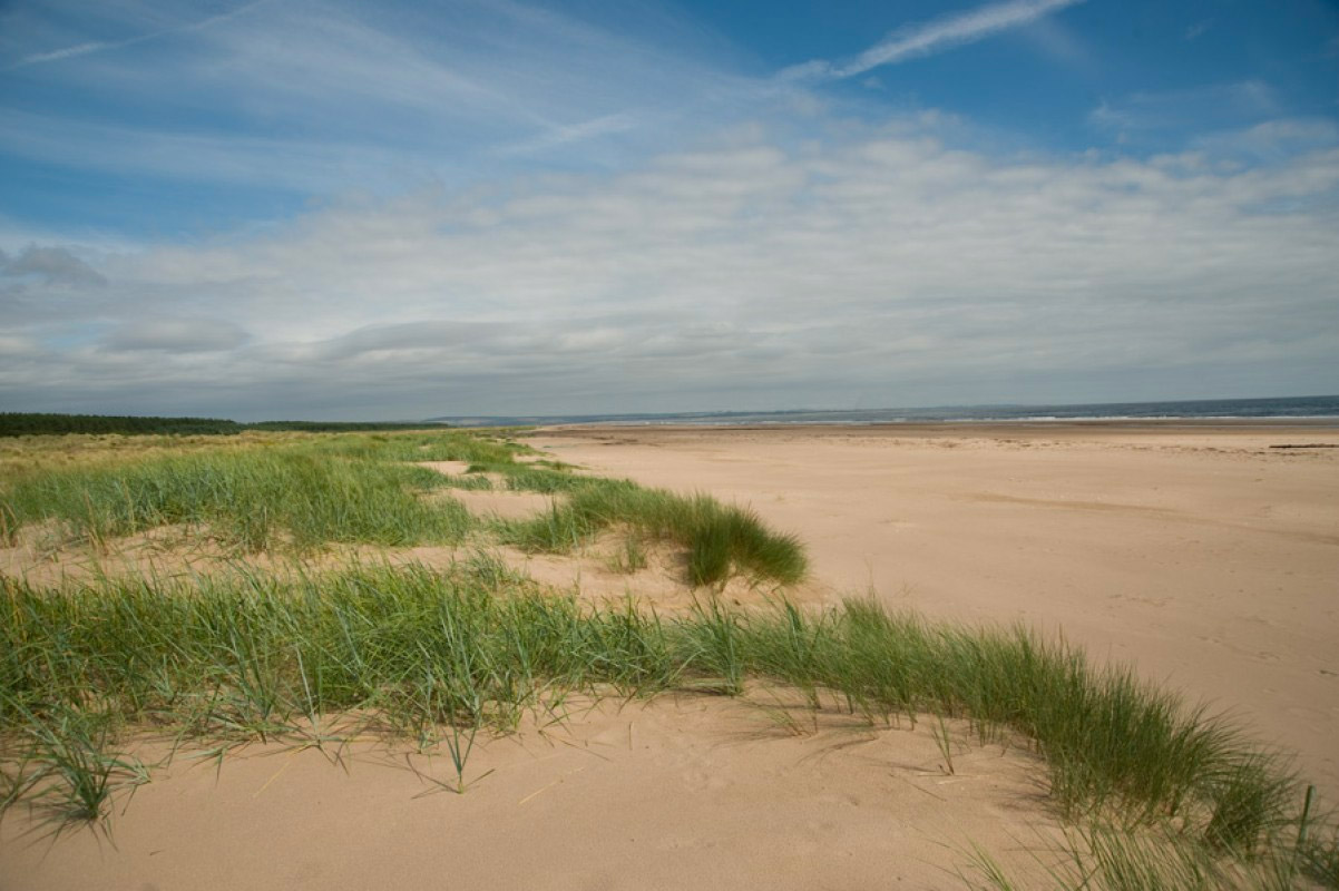
North of Tayport, Tentsmuirblends shifting dunes, WWII anti-tank defences, and a cathedral-quiet Scots-pine plantation. Highlights:
- Haul-out sandbanks where common and grey sealssnooze at low tide.
- Rustic Kinshaldy Beachcafé (summer only) for coffee and Cullen skink.
- Cycling loops that tempt walkers to swap boots for bikes on the return leg.
7. Caiplie Caves
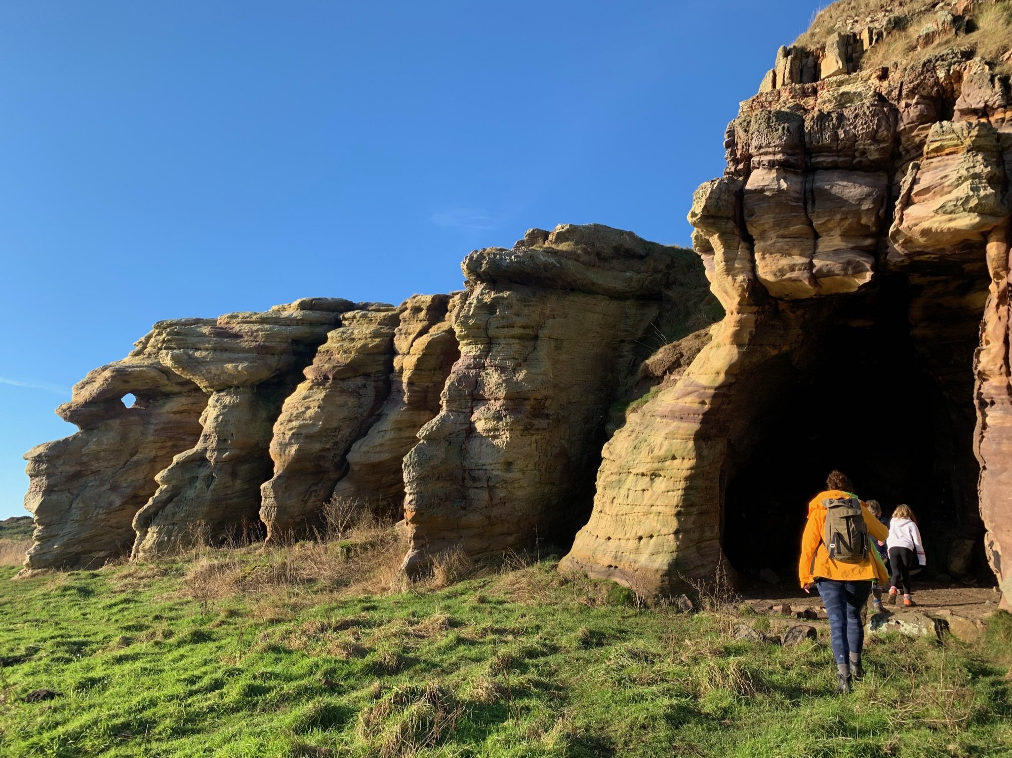
Between Anstruther and Crail, the Caiplie Cavesare sandstone formations that once housed monks and now display early Christian carvings. Plan for:
- Low tide access and grippy footwear — algae makes the ledges slick.
- A sea-stack viewpoint perfect for sunset shots.
- Dog-friendly exploring, though keep pups back from cliff edges.
8. Elie Chain Walk
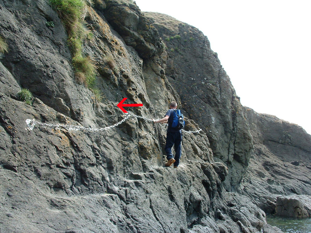
Scotland’s mini-via-ferrata strings eight chain sections along wave-washed basalt. Safety tips:
- Attempt only on a receding low tide and in calm seas.
- Lightweight gloves help on wet, salty chains.
- Bypass path available atop Kincraig Point for less adventurous companions.
9. Pittenweem

Stone wynds, bustling harbour, and an August art festival put Pittenweemon the cultural map. Essential stops:
- St Fillan’s Cave, lit for visitors and steeped in early-Christian legend.
- The Fish Barfor award-winning haddock suppers.
- Harbour-wall murals painted by local schoolchildren-Instagram gold.
10. Crail: Medieval Charm With Harbour Views
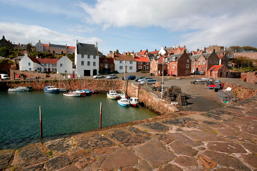
Crailis postcard perfection: white-harled cottages, pantiled roofs, and a tiny harbour lined with lobster creels. Don’t leave without:
- Sampling dressed crab or lobster rolls at the harbourside shack (Easter–Oct).
- Climbing the Doo’cot hill for sweeping East Neuk panoramas.
- Browsing the weekend farmers’ market for smoked mussels, artisan cheese, and craft gin.
11. St Monans: Windmill And Salt Pans By The Sea
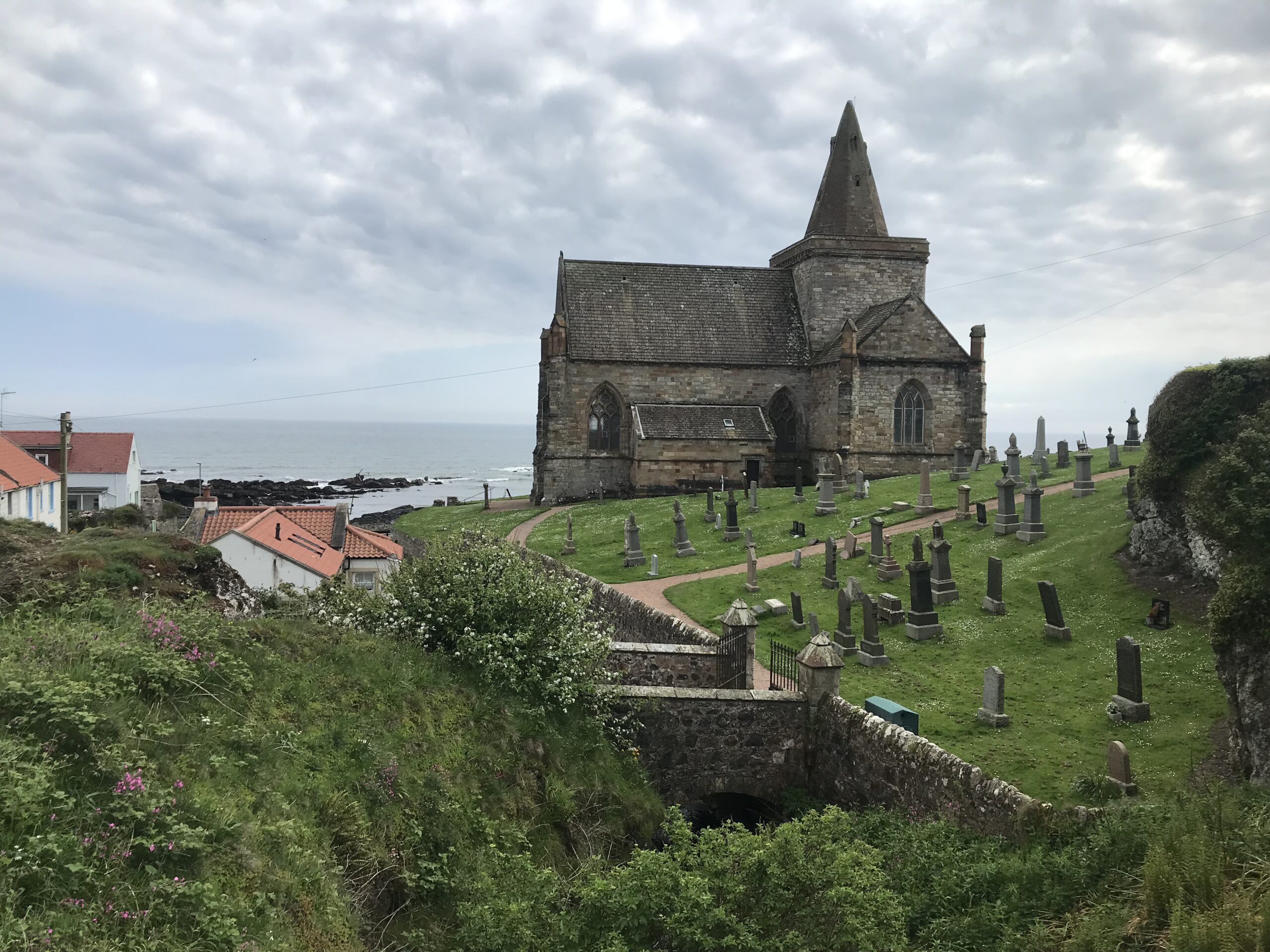
This village features Scotland’s only restored 18th-century windmill, once powering salt production. Pair it with:
- A walk through the grassed-over salt-pans at low tide.
- Coffee at the coastal East Pier Smokehouse, where bagels are filled with kiln-warm salmon.
- Evening light photography of the zig-zag breakwater that juts into the Forth.
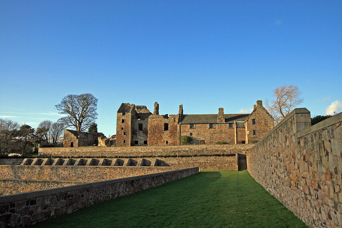
12. Dysart: Historic Harbour & Outlander Setting
The cobbled quays of Dysart Harbourdoubled as 18th-century Le Havre in Outlander. While here:
- Pop into the Harbourmaster’s Housevisitor centre for trail intel and espresso.
- Follow the shoreline east to view Pictish carvings in the Wemyss Caves (torch essential).
- Note the restored 16th-century Pan Ha’ houses, a colourful row once tied to salt-workers.
Accommodation Hubs Along The Fife Coastal Path
While maps rarely highlight accommodations, some key overnight towns include:
- Burntisland, Elie, Anstruther, St Andrews, and Newport-on-Tay– all offer B&Bs, hotels, and self-catering cottages.
- Wild campingis permitted under the Scottish Outdoor Access Code—stick to remote areas, pitch late, and leave no trace.
- Summer bookings:July–August sees high demand; reserve 3–6 months in advance.
Amenities: Cafés, Toilets & Refuel Spots
- Public toilets:In most towns-Aberdour, Elie, Crail, and St Andrews have well-maintained facilities.
- Food & drink:Try fresh langoustines in Anstruther, ice cream in Pittenweem, and organic bakeries in St Monans.
- Shops:Spars and Co-ops in almost every major stop. Don’t miss Crail’s weekend farm market for local produce.
Terrain And Difficulty Markings
The Fife Coastal Path offers a varied walking experience, and a comprehensive map will detail these differences. While many stretches are relatively flat and well-maintained, prepare for sections with uneven rocky paths, occasional steep climbs, and crucially, tidal considerations.
A superior map will use clear markings, often color-coding or symbols, to denote easier, moderate, or more challenging stretches. Always pay close attention to tidal information, as certain foreshore sections, like parts of the Elie Chain Walk and Kingsbarns Beach, can become impassable at high tide. Consulting local tide times is paramount for safe passage.
Public Transport Links
One of the great practical advantages of the Fife Coastal Path is its excellent accessibility via public transport. A well-designed map is invaluable for identifying bus stops and train stations conveniently located near the path. This allows you immense flexibility to easily join or leave specific sections, or to use public transport for return journeys to your starting point.
The entire route from Kincardine as far as Newport-on-Tay is well-served, with the Kincardine to Kirkcaldy section also benefiting from mainline railway access. This network makes it ideal for planning flexible day trips or breaking the full path into shorter, more manageable walks.
For detailed information on routes and timings, external resources like Traveline Scotland or Rome2Rio can provide invaluable assistance.
Trail Markers And Wayfinding
The Fife Coastal Path is renowned for being exceptionally well-signposted, with distinctive waymarkers guiding your way throughout its length.
While this means extensive map-and-compass skills aren't strictly essential for staying on track, carrying a map is still highly recommended as a crucial backup.
It serves to confirm your location, help you anticipate upcoming turns, identify specific points of interest you might otherwise miss, and assist with navigation in less clear sections or if you decide to explore off the main path.
Related Reading: 24 Things To Do In Fife - All You Need To Know In <year>
Fife Coastal Route By Car
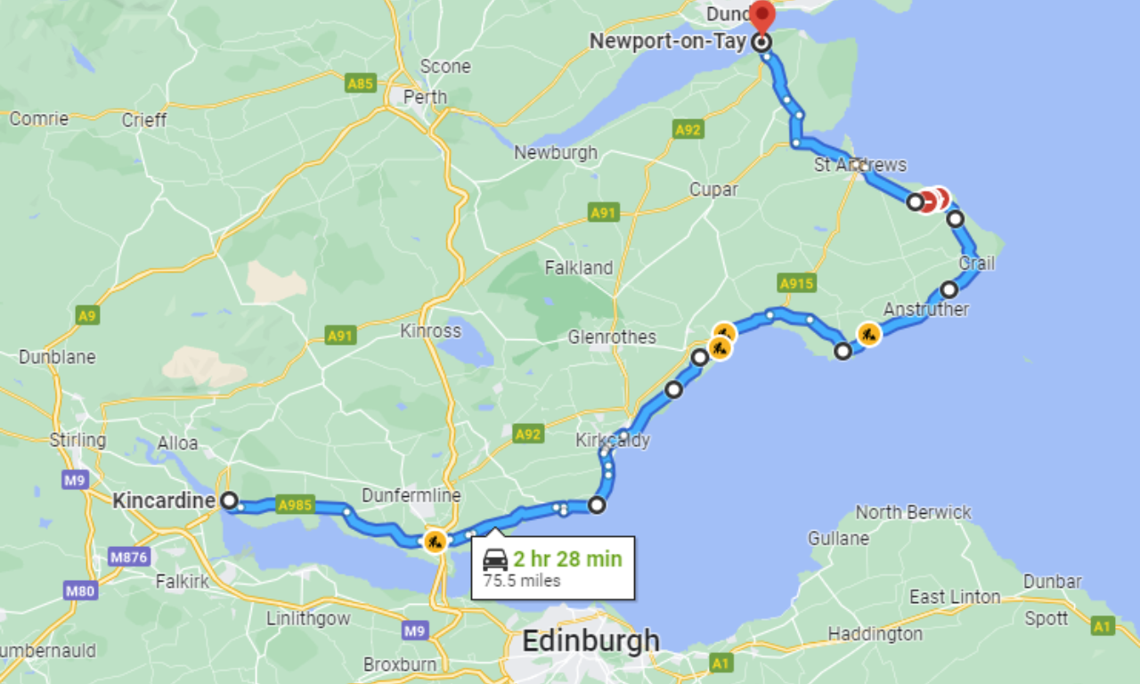
While the Fife Coastal Path is primarily for walkers, a Fife Coastal Route by car offers a fantastic way to explore the region's charm at a different pace. This scenic driving route largely parallels the walking path, allowing you to easily access many of the picturesque towns, historic sites, and viewpoints.
You can drive through charming villages like Culross, Crail, and Anstruther, stopping to explore their unique harbours, historic architecture, and local shops. This is ideal for those with limited mobility, families with young children, or anyone wishing to cover more ground and see more attractions in a shorter timeframe.
Remember to use a road map or GPS for driving, as the walking path often follows narrower, unpaved sections not suitable for vehicles.
Essential Map-Based Preparations
- Check Tide Times:Absolutely crucial for certain foreshore sections, especially around Kingsbarns and the Elie Chain Walk. The official Fife Coast & Countryside Trust website (fifecoastandcountrysidetrust.co.uk) often provides links to tide tables.
- Weather Forecast:Scottish weather is famously unpredictable. A map helps you identify potential shelters or alternative routes in case of sudden changes.
- Footwear and Gear:The varied terrain necessitates appropriate footwear. Your map can inform your gear choices for each section.
- Emergency Information:Note down emergency contact numbers and understand how to describe your location using map references if needed.
The Digital Edge: Online Maps And Apps
While physical maps offer a tangible sense of direction and are invaluable when signal is patchy, digital Fife Coastal Path maps and apps have their own merits:
- GPS Tracking:Many apps offer real-time GPS tracking, showing your exact position on the path.
- Interactive Features:Digital maps often include clickable points of interest, detailed descriptions, and even user-generated content like photos and reviews.
- Offline Access:Download maps before you go to ensure access even without mobile data.
- Route Planning Tools:Easily measure distances, elevation changes, and plan custom itineraries.
Reputable sources for digital maps include the official Fife Coast & Countryside Trust website, as well as popular hiking and outdoor activity apps. Several support services are available from companies like Absolute Escapes, Contours Walking Holidays, and Macs Adventure, offering guided or self-guided tours.
Fife Pilgrim Way: Beyond The Coast
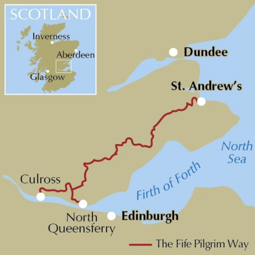
For those interested in a different perspective of Fife, the Fife Pilgrim Way offers an inland alternative. While the Fife Coastal Path sticks to the stunning coastline, the Fife Pilgrim Way, a 64-mile (104 km) route, traverses the heart of Fife, following ancient pilgrim routes to St Andrews.
It offers a more rural experience, moving through rolling farmland, woodlands, and historic towns like Dunfermlineand Ceres, offering a quieter journey with a focus on spiritual heritage and inland landscapes.
While both paths lead to St Andrews, their character and scenery are distinctly different, appealing to varied interests.
Trail Essentials
Start Points: Culross or North Queensferry; both connect by rail and bus
Finish: St Andrews Cathedral precinct
Stages: 7 primary stages
Time Needed: 5-6 days for the full route, or mix-and-match day walks
Fife Coastal Path Reviews: What Walkers Are Saying
Reviews of the Fife Coastal Path consistently highlight its appeal:
- Stunning Scenery:Walkers frequently praise the diverse landscapes, from rugged cliffs to golden beaches, and the picturesque coastal villages.
- Accessibility:Many appreciate that the path is well-maintained and largely accessible, making it suitable for varying fitness levels.
- Historical and Cultural Immersion:The numerous castles, ancient ruins, and charming harbours offer a rich historical and cultural experience.
- Wildlife Spotting:Opportunities to see seals, seabirds, and even dolphins are often mentioned as highlights.
- Well-Marked:The clear signage generally makes navigation straightforward, though a map is still recommended for detailed planning and backup.
- Accommodation and Amenities:The availability of guesthouses, B&Bs, and eateries in towns along the route makes multi-day walks comfortable.
Overall, the Fife Coastal Path is frequently described as a "fantastic journey" and a "wonderful holiday" for those seeking natural beauty, history, and a good walk in Scotland.
The current Fastest Known Time (FKT) for a solo runner to complete the entire path is 23 hours, 16 minutes, 54 seconds, set by Nicola Duncan in 2020.
FAQs About The Fife Coastal Path Map
How Long Does It Take To Walk The Fife Coastal Path?
Walking the full Fife Coastal Pathtypically takes between one week and 10 days, depending on your pace, fitness, and whether you choose to explore towns and attractions along the way. The entire route spans 187 km (116 miles)from Kincardine to Newburgh, and many walkers break it into 8–10 day stages with overnight stops in coastal villages.
What Is The Most Scenic Part Of The Fife Coastal Path?
Many consider the East Neuk-especially between Elie and Crail-the most picturesque, with fishing villages, sea views, and historic sites.
What Coast Is Fife On?
Fife is located on the east coast of Scotland, nestled between the Firth of Forthto the south and the Firth of Tayto the north. The Fife Coastal Path follows the rugged coastline of this historic kingdom, offering panoramic views across the North Sea and inland glimpses of rolling farmland and forest.
Where Is The Coastal Bike Path In Fife?
Cyclists use the NCN Route 76, which runs near the Fife coast. The main coastal path is mostly for walking.
Can You Drive The Fife Coastal Path?
You can’t drive the path itself, but the Fife Coastal Route by carlets you explore towns and trailheads by road.
How Long Is The Coast-to-coast Walk?
Combining the Fife Coastal Path(187 km) with the inland Fife Pilgrim Way(104 km) creates a 291 km loopacross Fife.
A Quick Recap
The Fife Coastal Path offers an extraordinary walking experience, revealing the captivating beauty and rich heritage of Scotland's East Coast. From planning your daily adventure to discovering hidden gems and ensuring your safety, a detailed Fife Coastal Path map is your indispensable companion.
It's not merely a tool for navigation, but a key to unlocking the full potential of this Scottish Great Trail. So, arm yourself with a map, embrace the journey, and prepare to be enchanted by the Kingdom of Fife.
If you found this guide helpful for planning your Fife Coastal Path adventure, consider sharing it with fellow walkers and outdoor enthusiasts!
Jump to
The Fife Coastal Path: An Overview
Understanding The Fife Coastal Path Map: Essential Sections And Highlights
Fife Coastal Path Attractions: Unveiling Fife's Coastal Wonders
Fife Coastal Route By Car
The Digital Edge: Online Maps And Apps
Fife Pilgrim Way: Beyond The Coast
Fife Coastal Path Reviews: What Walkers Are Saying
FAQs About The Fife Coastal Path Map
A Quick Recap

Callum Fraser
Author
Callum Fraser isn't just a writer about Scotland; he's a product of its rugged landscape and rich history. Born and raised in Perthshire, with the Highlands as his backyard, his love for the nation's stories was kindled by local storytellers and long walks through ancient glens.
This passion led him to pursue a degree in Scottish History from the University of Edinburgh. For over 15 years, Callum has dedicated himself to exploring and documenting his homeland, fusing his academic knowledge with essential, on-the-ground experience gained from charting road trips through the Cairngorms, hiking the misty Cuillins of Skye, and uncovering the secrets of traditional recipes in his family's kitchen.
As the Editor-in-Chief and Lead Author for Scotland's Enchanting Kingdom, Callum's mission is simple: to be your most trusted guide. He combines meticulous research with a storyteller's heart to help you discover the authentic magic of Scotland — from its best-kept travel secrets to its most cherished traditional recipes.
Latest Articles
Popular Articles