Map Of Edinburgh - Your Guide To The City’s Best Areas
Find your way around Edinburgh using our comprehensive map. Learn about key neighborhoods, cultural landmarks, and places worth visiting.
Author:Callum FraserJun 03, 20259.7K Shares391.9K Views
Edinburgh isn’t a city you simply walk through; it’s one you unravel. With cobbled streets that twist through ancient quarters, hidden alleyways known as "closes," and abrupt elevation shifts shaped by extinct volcanoes, navigation here is both a necessity and an experience.
Maps are more than a guide in this city, they’re a key to understanding its past and unlocking its many personalities.
Quick Facts About Edinburgh
- Capital City: Edinburgh is the capital of Scotland.
- Population: Around 530,000 people live in the city.
- Language: English is the main language spoken.
- Currency: British Pound (£ GBP).
- Founded: The city dates back to at least the 7th century.
- UNESCO Status: The Old Town and New Town are listed as a UNESCO World Heritage Site.
- Famous Landmark: Edinburgh Castle sits on an ancient volcanic rock and dominates the skyline.
- Festival City: Home to the world’s largest arts festival, the Edinburgh Festival Fringe, held every August.
- Education Hub: The University of Edinburghis one of the top universities in the world.
- Green Spaces: Edinburgh has more trees per head of population than any other UK city.
- Public Transport: Offers buses, trams, and easy walking routes for getting around.
- Royal Connection: The Palace of Holyroodhouse is the official residence of the British monarch in Scotland.
- Arthur’s Seat: An extinct volcano and one of the best viewpoints in the city.
- Climate: Mild but changeable, with frequent rain and cool temperatures year-round.
Geographical Overview Of Edinburgh
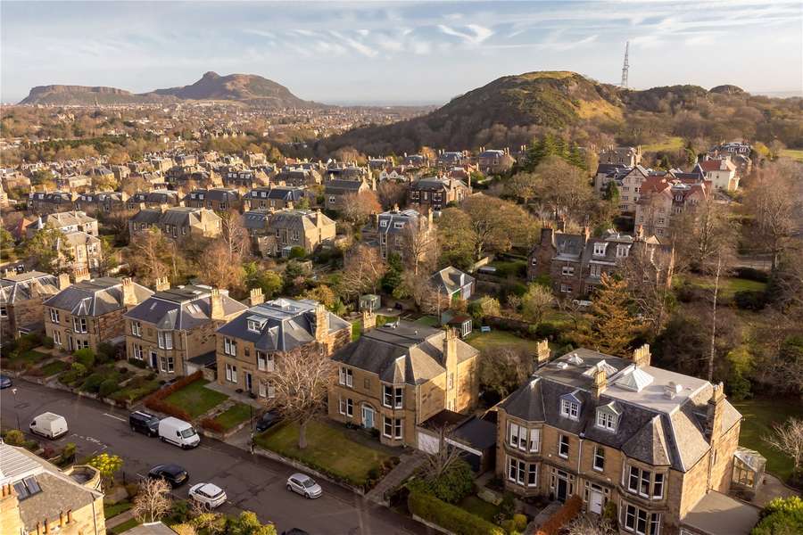
Edinburgh is located in the southeast of Scotland, right on the southern shore of the Firth of Forth a large estuary that opens into the North Sea. The city lies on a series of hills formed by ancient volcanic activity, which gives Edinburgh its dramatic landscape and many great viewpoints.
One of the most well-known hills is Castle Rock, where Edinburgh Castle sits. To the east is Arthur’s Seat, an extinct volcano and one of the city's most popular natural spots. Edinburgh is also surrounded by green spaces, like Holyrood Park, Calton Hill, and the Pentland Hills just to the south.
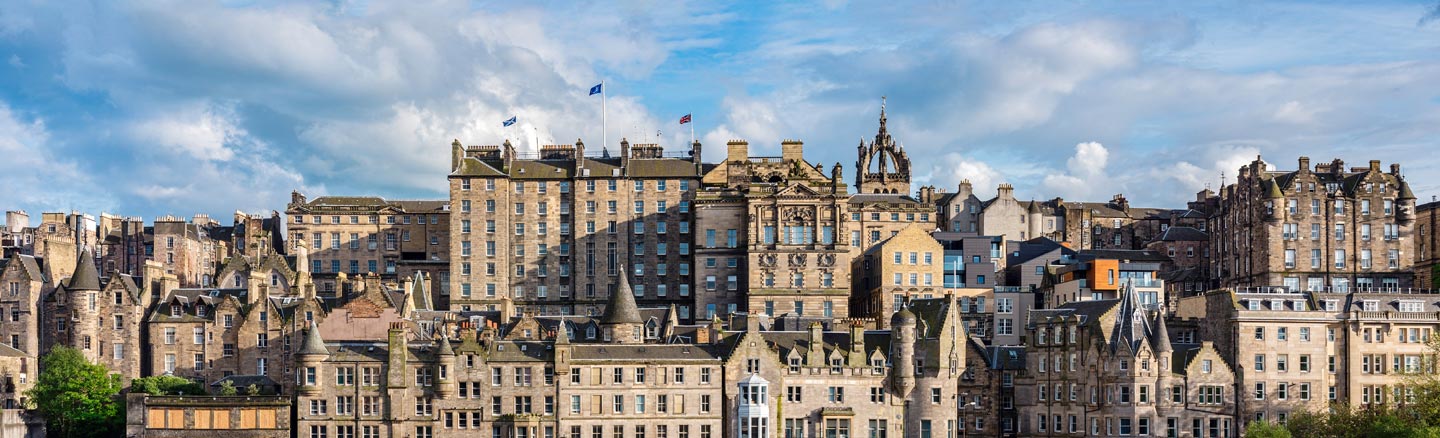
The layout of Edinburgh is quite unique. The Old Town, with its narrow streets and medieval buildings, rises up from the heart of the city. Right next to it is the New Town, built in the 18th century with straight streets, open squares, and elegant Georgian houses. These two parts show the city's long and rich history, and they’ve both been named a UNESCO World Heritage Site.
Edinburgh's location also makes it easy to reach other places in Scotland. You can travelquickly to Glasgow, the Scottish Borders, or the Highlands, either by car or by train.
History Of Mapping Edinburgh
Cartography in Edinburgh dates back to the 16th century, when maps were created as military tools or royal documents. One of the earliest known detailed maps of the city is James Gordon’s 1647 map, which offered a bird’s-eye view of Old Town, complete with its defensive walls and winding closes. These early maps were often more artistic than practical, but they laid the groundwork for later developments.
By the 19th century, Ordnance Survey maps introduced precise measurements and elevation lines, capturing the dramatic topography that makes Edinburgh so distinctive. Georgian expansion and Victorian urban planning brought new neighborhoods into view, including New Town’s perfectly aligned grid a stark contrast to Old Town’s organic chaos.
Today, historical maps are preserved and digitized by institutions like the National Library of Scotland, offering insight into how the city evolved, expanded, and adapted to change.
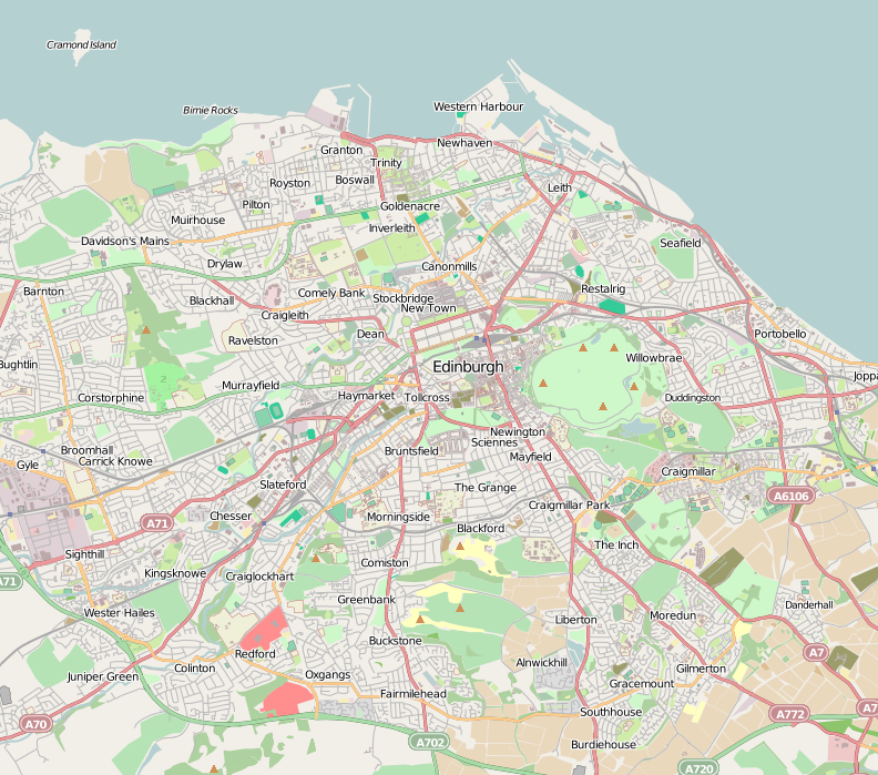
Map Of Edinburgh Cities
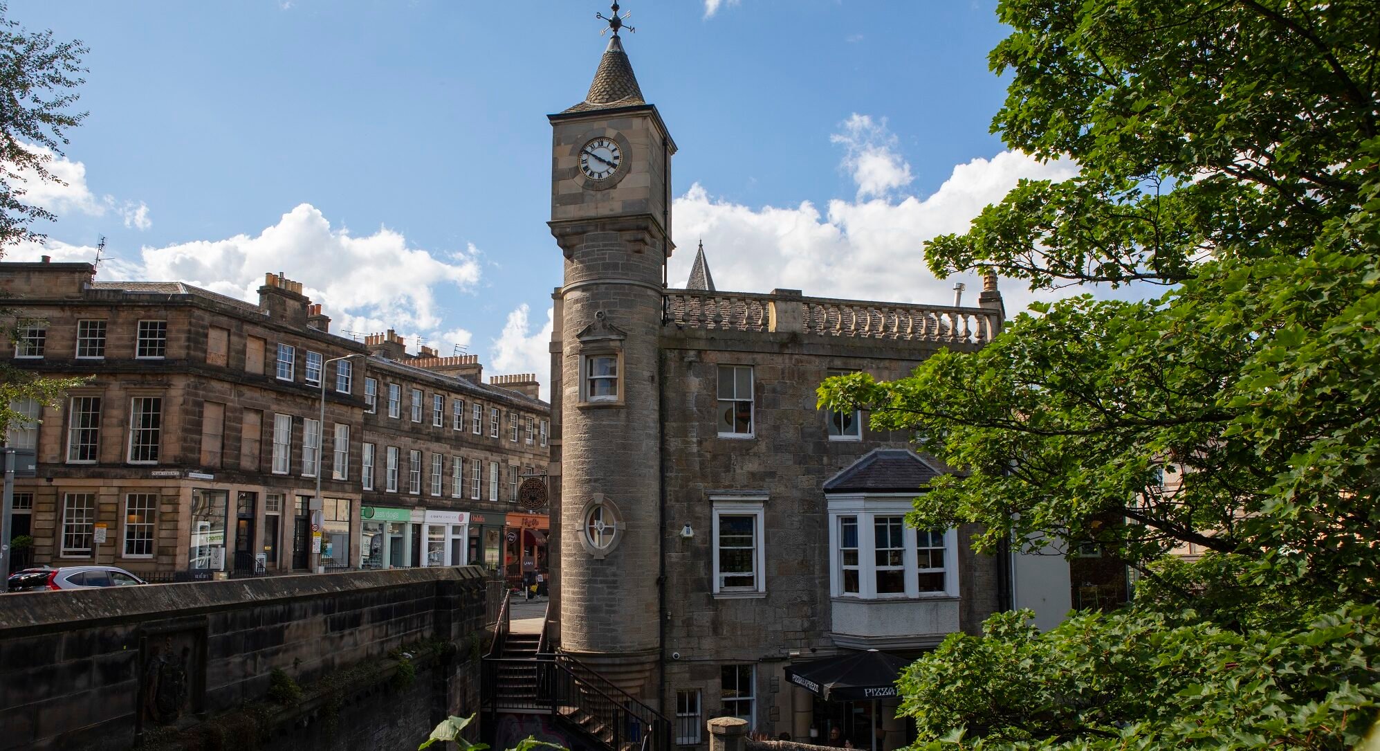
Old Town
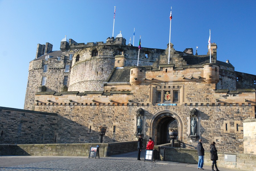
Old Town is the oldest part of Edinburgh. It has narrow streets, tall stone buildings, and a lot of history. Many famous places are found here, like Edinburgh Castle, which sits on a hill, and the Royal Mile, a long street filled with shops, churches, and historic buildings. You’ll also find museums, small restaurants, and hidden alleyways that show what life was like in the past. It’s a popular place for tourists and history lovers.
New Town
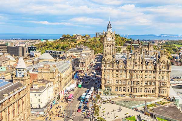
New Town is not actually new it was built in the late 1700s. It was carefully planned, with wide streets and beautiful Georgian buildings. It feels more modern than Old Town but still has a classic look. This area is great for shopping, especially on Princes Street and George Street. Many banks, offices, and hotels are here too. New Town shows Edinburgh’s wealth and style during the time it was built.
Leith

Leith is Edinburgh’s old port by the sea. In the past, it was where ships arrived and goods were traded. Today, it’s a lively area with a lot of character. People go to Leith for its waterfront restaurants, cafés, and art spaces. It’s also home to the Royal Yacht Britannia, a big ship that used to belong to the Royal Family. Leith mixes old and new in a fun and interesting way.
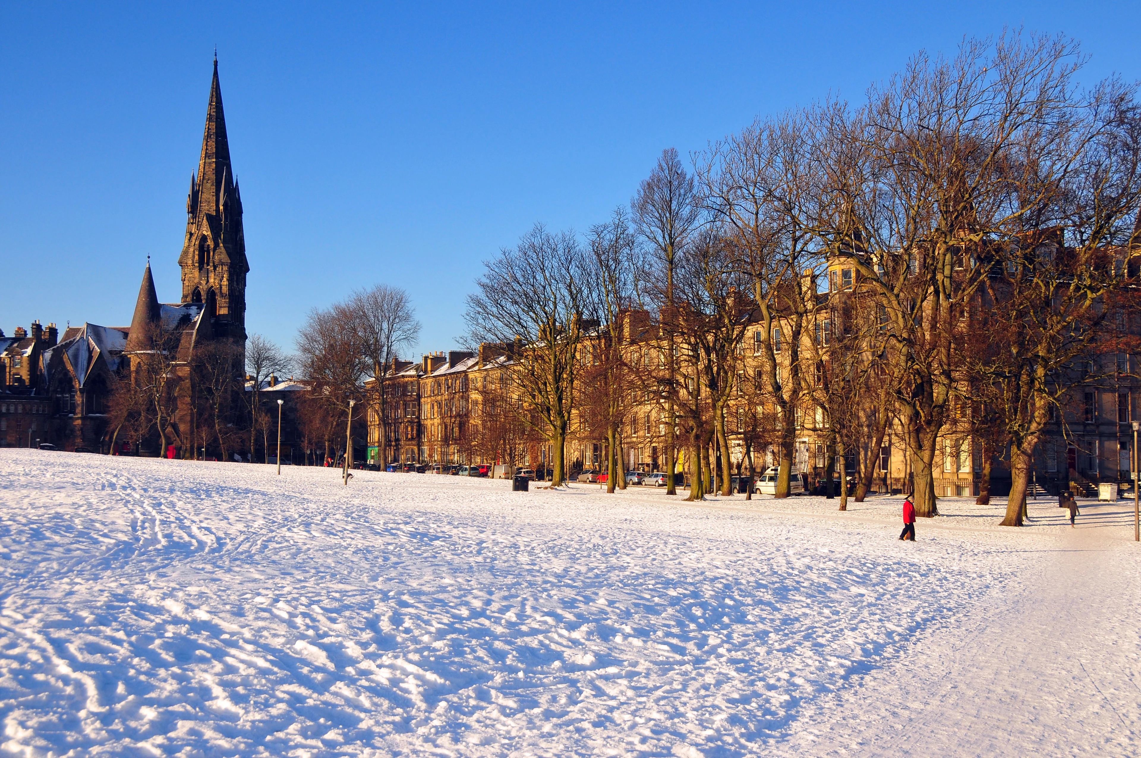
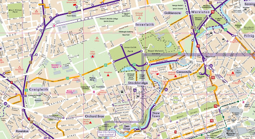
Stockbridge
Stockbridge is just north of the city centre. It feels like a small village even though it’s in the middle of the city. It has quiet streets, lovely old houses, and a peaceful river called the Water of Leith running through it. Stockbridge is known for its Sunday market, second-hand bookshops, and small cafés. Many families and artists like living here.
Morningside
Morningside is a green and quiet part of Edinburgh, located to the south of the city centre. It’s a good place for families, older people, and students. The area has independent shops, cafés, and old-style houses. It feels calm and friendly, and many people enjoy walking through its tree-lined streets. Morningside also has easy access to parks and walking paths.
Marchmont And Bruntsfield
These two areas sit close to The Meadows, one of the biggest green parks in Edinburgh. Marchmont and Bruntsfield are popular with university students and young families. The streets are lined with large stone buildings called tenements, which are common in Edinburgh. These neighbourhoods are also known for their local bakeries, bookstores, and small shops. The mix of green space and city life makes this a great place to live.
Haymarket

Haymarket is near the west side of the city centre. It’s known for the Haymarket Train Station, which is one of the city’s main transport hubs. Many hotels, offices, and restaurants are found here. This area is always busy with people traveling in and out of the city. It’s also close to big sports stadiums and business centres. Haymarket is a good place to stay if you want to be near trains and trams.
Portobello
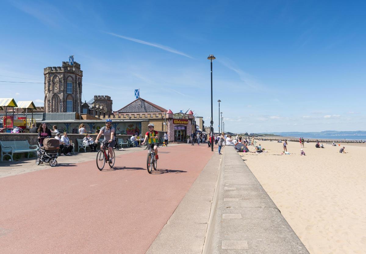
Portobello is Edinburgh’s seaside neighbourhood. It has a sandy beach and a long walkway along the shore, called the promenade. People come here for walks, ice cream, and relaxing by the sea. The area has small shops and a warm community feel. Portobello is especially popular in the summer when locals and tourists enjoy the beach and sea views.
Regions On The Map Of Edinburgh
Edinburgh is divided into several main regions. Each region includes different neighbourhoods and serves a unique purpose in the city. These areas often appear on local maps, transport routes, and travel guides. Knowing the regions can help you move around the city more easily or choose where to stay, live, or visit.
City Centre
The City Centre is the heart of Edinburgh. It includes:
- Old Town
- New Town
- West End
This area is where you’ll find most of the city’s main attractions, such as Edinburgh Castle, the Royal Mile, and many shops, restaurants, and museums. It’s also the busiest part of the city, with lots of buses, trams, and train connections. People come here for sightseeing, shopping, dining, and attending events.
The buildings in Old Town are older and full of history, while New Town has grand Georgian streets. The West End is a mix of culture and business, with theatres and offices.
North Edinburgh
North Edinburgh is located near the Firth of Forth (the water that borders the city). This region includes areas like:
- Leith
- Granton
- Newhaven
- Trinity
This part of the city is close to the sea. Leith is very popular for its harbour, food scene, and art spaces. Newhaven is known for its harbour and seafood restaurants. Granton has many new housing projects, while Trinity is a quieter, more residential area with beautiful old homes.
North Edinburgh is a mix of modern buildings, older houses, and waterfront views. It’s becoming more popular for people looking for new homes or nice places to walk by the sea.
West Edinburgh
West Edinburgh is an important part of the city because it connects to the airport and major roads. This region includes:
- Corstorphine
- Saughton
- South Gyle
This area is more suburban and less crowded than the city centre. Corstorphine is home to Edinburgh Zoo and has a mix of shops, schools, and parks. South Gyle is known for its business parks and shopping centres, and it’s close to Edinburgh Airport and the city bypass road. Saughton has large parks and sports centres. West Edinburgh is good for people who work near the airport or travel often by car.
South Edinburgh
South Edinburgh is a popular region for families, students, and professionals. It includes:
- Morningside
- Marchmont
- University areas
This part of the city is full of classic stone buildings, quiet streets, and green parks. Marchmont is right next to The Meadows, a large open park, and is full of students and young professionals. Morningside is more relaxed, with bookshops, cafes, and family homes. The University areas include George Square and King’s Buildings, where many students attend classes. South Edinburgh feels peaceful and safe, with easy access to the city centre. Many visitors also enjoy an Edinburgh whisky tourhere, which offers a great way to experience Scotland’s famous drink while exploring the local culture.
East Edinburgh
East Edinburgh stretches toward the coast. The main places in this region are:
- Portobello
- Joppa
- Craigentinny
This region is well known for its beach and sea views. Portobello is very popular in the summer, with a long sandy beach, a promenade, and small local shops. Joppa is quieter and mostly residential, while Craigentinny has a mix of homes and green spaces.
East Edinburgh is perfect for people who enjoy the outdoors, walking by the sea, and living in a peaceful setting.
South-East Edinburgh
South-East Edinburgh is more residential, with family homes, schools, and some historic sites. It includes:
- Duddingston
- Liberton
- Gilmerton
Duddingston is home to Duddingston Loch and Dr Neil’s Garden, peaceful spots near Arthur’s Seat. Liberton and Gilmerton have many homes, shops, and schools. Craigmillar Castle, a lesser-known but interesting historic site, is found in this area. This region is great for families and people who want to live in a quiet part of the city but still be close to nature and history. It’s also an ideal place for family adventures, offering plenty of outdoor spaces and activities that everyone can enjoy together.
Population Of Edinburgh
Edinburgh has a population of around 530,000 people, making it the second-largest city in Scotland after Glasgow. The number of people living in the city has been growing steadily in recent years, as more people move here for work, study, or a better quality of life.
Key Facts About Edinburgh’s Population:
- Diverse Mix: Edinburgh is home to people from all over the world. It has strong communities from places like Poland, India, China, and Africa. This cultural mix adds to the city's food, festivals, and daily life.
- Student City: Thousands of students live in Edinburgh during the academic year. The city has several major universities, including the University of Edinburgh, Edinburgh Napier University, and Heriot-Watt University.
- Young Working Population: Many people living in Edinburgh are between the ages of 20 and 40. The city has many jobs in finance, education, tourism, and tech, which attract young professionals.
- Families and Retirees: While parts of the city are busy and urban, many areas are quiet and family-friendly. Some neighbourhoods are also popular with older residents looking for a peaceful place to live.
- Tourism Impact: On top of its regular residents, Edinburgh often welcomes millions of touristseach year especially during summer festivals and holidays. This can make the city feel much busier at certain times.
Edinburgh Economy
Edinburgh is one of the strongest and most important economic centres in Scotland and the United Kingdom. The city’s economy is diverse, with many industries contributing to its growth and success. Over the years, Edinburgh has transformed from a mainly industrial city into a modern hub for finance, technology, tourism, education, and culture.
- Financial Services: One of the most important parts of Edinburgh’s economy is financial services. The city is known as a major financial centre, not just in Scotland but across the UK. Many big banks, insurance companies, and investment firms have offices here. The financial district is mainly around the city centre and is a place where thousands of people work in banking, asset management, and insurance.
- Tourism:Tourism is a big part of Edinburgh’s economy. The city attracts millions of visitors every year, thanks to its rich history, famous landmarks, festivals, and beautiful landscapes. Visitors come to see Edinburgh Castle, the Royal Mile, the Old and New Towns, and attend events like the Edinburgh Festival Fringe and the Royal Edinburgh Military Tattoo.
- Education and Research: Edinburgh is home to several world-famous universities and colleges, such as the University of Edinburgh and Edinburgh Napier University. These institutions not only educate thousands of students but also contribute to the economy through research and innovation. Many research centres focus on medicine, science, technology, and business.
- Technology and Innovation:In recent years, Edinburgh has become a growing hub for technology and digital businesses. Many start-ups and tech companies have set up here, focusing on software development, gaming, cybersecurity, and data science. The city offers support to new businesses through innovation centres and business incubators.
- Creative Industries: Edinburgh has a vibrant creative sector that includes film, television, music, publishing, and design. The city hosts many festivals that celebrate arts and culture, providing jobs and attracting visitors. Local businessesin advertising, architecture, and media also contribute to the economy.
- Retail and Services:Retail is another key part of Edinburgh’s economy. The city centre has many shops, from high-end stores on Princes Street and George Street to smaller independent shops in areas like Stockbridge and Leith. The service industry, including restaurants, hotels, and health care, also supports many jobs in the city.
- Transport and Infrastructure:Edinburgh has good transport links that help the economy thrive. The city has an international airport, a busy railway station, and a tram system that connects different parts of the city. Good transport makes it easier for people to travel for work and tourism, and it supports business growth.
Major Roads And Routes In Edinburgh
Edinburgh has a mix of motorways and major roads that help connect the city to nearby towns, cities, and even other countries. These roads are important for daily travel, long-distance trips, and public transport. Below are the most important roads and routes you’ll find in and around the city.
A720 - Edinburgh City Bypass
The A720, called the Edinburgh City Bypass, runs around the southern edge of the city. It’s used to avoid driving through the busy city centre. This road links different parts of Edinburgh and connects to other major roads like the M8, M9, and A1. The bypass helps drivers get to places like the airport, business parks, and surrounding towns more easily. It also helps reduce traffic in the middle of the city.
M8 - Route To Glasgow
The M8 motorway begins just west of Edinburgh and goes all the way to Glasgow, Scotland’s largest city. It’s one of the busiest roads in the country and is used by many people every day, especially those who travel between the two cities for work. The M8 also connects to other important roads, making it useful for long trips and deliveries.
A1 - Route To The South And England
The A1 starts in central Edinburgh and heads southeast, passing through Portobello and Musselburgh. It’s the main route from Edinburgh to England, eventually reaching cities like Newcastle and London. It’s used by people who live in the suburbs and by those travelling to the Scottish Borders and beyond. Parts of the A1 are dual carriageway, making it a fast and smooth route.
M9 - Route To Stirling And The Highlands
The M9 runs northwest from Edinburgh toward Stirling and the Highlands. This road is important for reaching central and northern Scotland. It’s also used to reach places like Falkirk, Perth, and Inverness. The M9 connects with the M8 and the A720, making it easy to move between key Scottish regions.
A90 - Route To Forth Bridge And Fife
The A90 leads north out of Edinburgh and crosses the Forth Road Bridge into Fife. This route is used by people heading to towns like Dunfermline, Perth, and Dundee. It’s one of the main roads for reaching the northern part of the country. The A90 is also part of the route to Aberdeen in northeast Scotland.
A702 - Route To The South-West And Borders
The A702 begins in Edinburgh and heads southwest through towns like Biggar before connecting with the M74 near Abington. This road is used by travellers heading to southern Scotland and northern England. It also offers a scenic drive through the countryside and smaller villages.
A8 - Route To The Airport And West Edinburgh
The A8 runs from the city centre through Corstorphine and out toward Edinburgh Airport. It’s an important road for people going to the airport or to areas like South Gyle, a popular business and shopping district. The A8 also leads to the M8 motorway.
Currency Of Edinburgh
Edinburgh uses the Pound Sterling (£), which is the official currency of the United Kingdom. The symbol is £, and the currency code is GBP (Great British Pound).
Common Notes And Coins:
- Banknotes: £5, £10, £20, and £50
- Coins: 1p, 2p, 5p, 10p, 20p, 50p, £1, and £2
In Edinburgh, you can use bank cards, credit cards, and contactless payments in almost all shops, restaurants, taxis, and buses. ATMs (cash machines) are available across the city if you need to withdraw cash.
Even though Scotland is part of the UK, some Scottish banks print their own versions of banknotes (like from the Bank of Scotland or Royal Bank of Scotland). These are legal and accepted across Scotland, but may not be as easily accepted in other parts of the UK.
Dialing Code Of Edinburgh
The dialing code for Edinburgh is 0131 if you are calling from within the UK. When calling from another country, you need to use the international dialing code for the UK, which is +44, and then remove the first zero.
Example:
- Calling from the UK: 0131 123 4567
- Calling from abroad: +44 131 123 4567
Edinburgh’s phone code is important for calling local businesses, hotels, universities, and homes in the city.
Language Of Edinburgh
The main language spoken in Edinburgh is English. It is the language used in schools, businesses, shops, public signs, and transport.
However, Edinburgh is a multicultural city, and you may also hear other languages, such as:
- Scottish Gaelic:An old Scottish language. It is not widely spoken in Edinburgh but appears on some street signs and public buildings.
- Scots:A traditional dialect that some locals speak. It sounds different from standard English.
- Other common languages spoken due to immigration and tourism include Polish, Urdu, Arabic, Mandarin, and Punjabi.
Tourists will have no problem getting around the city using English, and most signs and services are provided in English.
Flag Of Edinburgh
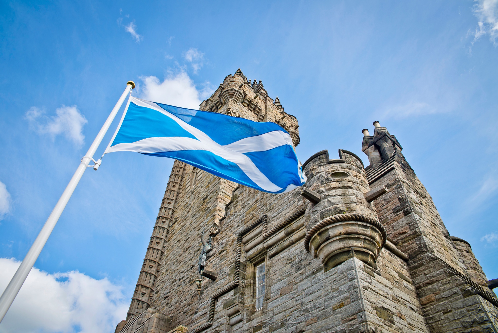
Edinburgh has its own city flag, although it is not as widely used as the Scottish flag or the Union Jack of the UK.
Description Of The Edinburgh Flag:
- The city flag shows a castle on a hill, which represents Edinburgh Castle, the most famous landmark in the city.
- The background is white, and the castle is often shown in black or dark grey.
- It’s based on the city’s coat of arms, which also includes a maiden (representing Saint Margaret) and other historic symbols.
You’ll mostly see the Saltire (the blue and white Scottish flag) flying on buildings, but the Edinburgh flag is used during official city events or on council buildings.
Government Of Edinburgh
Edinburgh is governed by the City of Edinburgh Council, which is in charge of local services like:
- Schools
- Roads
- Public transport
- Parks
- Housing
- Rubbish collection
The council is made up of elected councillors, and they meet at the City Chambers on the Royal Mile. Elections take place every five years, and people living in the city can vote if they meet the legal requirements.
Edinburgh As A Capital City:
- Edinburgh is the capital of Scotland.
- It is home to the Scottish Parliament, located at the bottom of the Royal Mile, near Holyrood Palace.
- The First Minister of Scotland works here, making it the centre of political power for Scotland.
- Although the UK Parliament is in London, the Scottish Parliament has power over areas like education, health, law, and transport in Scotland.
The city also works closely with the UK Government, especially in areas like national defence and foreign policy, which are controlled from London.
Total Area Of Edinburgh
The total area of Edinburgh is about 264 square kilometers (or 102 square miles). This makes it one of the largest cities in Scotland by land area.
Although the city is compact compared to other capital cities around the world, it includes a mix of urban zones, green parks, and coastal areas. The city stretches from the shores of the Firth of Forth in the north to the Pentland Hills in the south.
Types Of Maps Of Edinburgh (And How To Use Them)
Edinburgh’s complexity means there’s no single perfect map. Depending on your needs, tourism, transport, hiking, or historical interest, different types of maps offer different strengths.
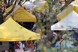
- Edinburgh Festival Map:Issued each summer, this map is a survival guide for August’s festival season. It charts venues for the Fringe, Book Festival, and International Festival, helping attendees hop between performances. It’s also useful for those looking to enjoy scottish festivals for food lovers, as many events across the city celebrate local cuisine alongside the arts.
- Street Maps: Best for general orientation and navigation, especially in New Town and suburban areas. Available online and in print.
- Public Transport Maps: Useful for navigating trams, buses, and regional train connections. Lothian Buses and Edinburgh Trams each provide downloadable route maps.
- Walking & Cycling Maps: These are essential for navigating pedestrian-friendly areas, walking trails, and bike paths like the Water of Leith Walkway and Union Canal.
- Tourist Maps: Distributed at hotels, visitor centres, and transport hubs. These highlight landmarks, museums, galleries, and restaurants.
- Historical Overlay Maps: These maps compare modern Edinburgh with historical layouts, useful for students, researchers, or anyone curious about the city’s transformation.
Edinburgh’s Borders And Neighboring Countries
Edinburgh is located in the southeast of Scotland, along the southern shore of the Firth of Forth. It is the capital city of Scotland, which is part of the United Kingdom (UK).
What Borders Edinburgh?
Although Edinburgh is a city, it shares its boundaries with other local council areas:
- West Lothian (to the west)
- Midlothian (to the south)
- East Lothian (to the east)
- The Firth of Forth (to the north)
These areas are not countries but neighboring council regions or local government areas. Many people who work in Edinburgh live in these nearby towns and commute daily.
Neighboring Countries:
- Scotland is a country within the UK.
- The UK includes England, Wales, Scotland, and Northern Ireland.
- Edinburgh does not directly border another country, but it is about 75 miles north of the border with England, which lies south of Edinburgh.
National Parks And Landscapes Near Edinburgh
Holyrood Park
Holyrood Park is located right in the heart of Edinburgh. Even though it is not a national park, it feels like one because of its large open space, dramatic landscapes, and natural beauty. The park covers around 650 acres and is full of hills, cliffs, lochs (small lakes), and walking paths.
One of the most famous features of Holyrood Park is Arthur’s Seat, an ancient volcano that rises above the city. From the top, you get amazing views of Edinburgh and beyond. It’s a popular place for both locals and tourists who want to go for a hike or enjoy the fresh air.
Pentland Hills Regional Park
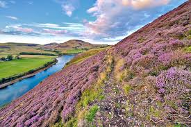
Just south of Edinburgh lies the Pentland Hills Regional Park. It takes only a short drive or bus ride from the city centre to get there, making it a popular destination for day trips.
The Pentland Hills offer a calm and quiet escape from the busy city. The park has miles of paths for walking, hiking, running, and cycling. The hills range in size, so there are both easy walks and more challenging hikes. There are also several reservoirs where you can enjoy the views or go fishing.
Loch Lomond And The Trossachs National Park
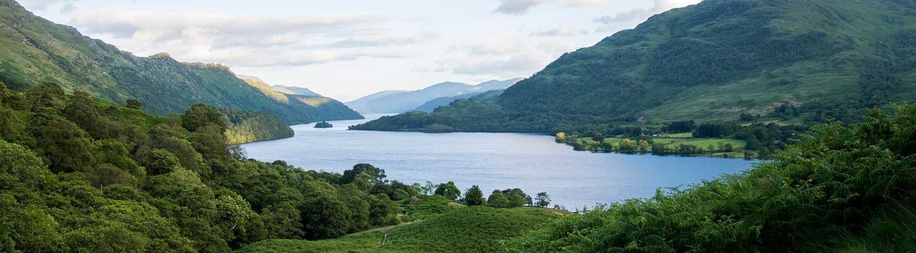
This is one of Scotland’s two official national parks and is located about 1.5 to 2 hours west of Edinburgh by car. It is known for its natural beauty and wide variety of outdoor activities.
At the centre of the park is Loch Lomond, the largest lake in Britain by surface area. The surrounding area includes mountains, forests, rivers, and peaceful villages. It is a perfect place for camping, kayaking, boat trips, and walking through the woods or up hills called munros (Scottish mountains over 3,000 feet).
Cairngorms National Park
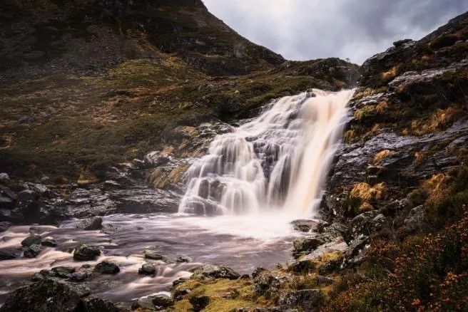
The Cairngorms National Park is about 2.5 to 3 hours north of Edinburgh and is the largest national park in the UK. It covers a huge part of the Scottish Highlands and offers some of the wildest and most stunning scenery in the country.
This park is famous for its tall mountains, deep forests, wide rivers, and rare animals. In winter, it’s a favourite place for skiing and snowboarding, especially around the Cairngorm Mountain area. In other seasons, people come for hiking, climbing, mountain biking, and birdwatching.
Top Places To Visit On The Edinburgh Map
1. Edinburgh Castle
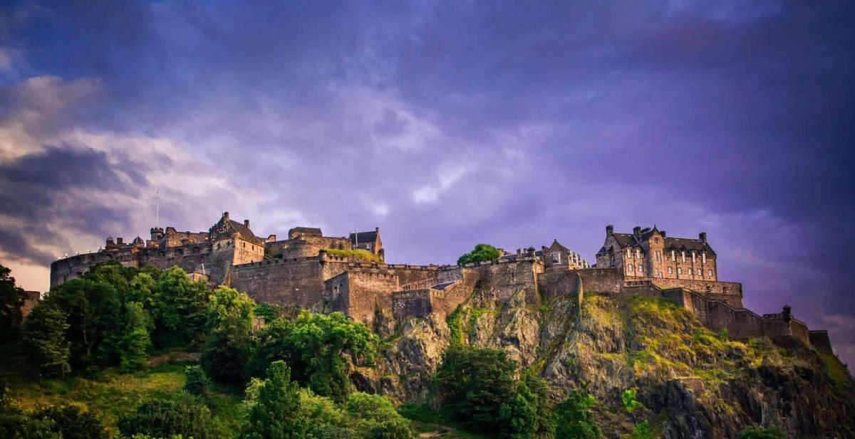
Edinburgh Castle is one of the most famous landmarks in Scotland. It sits on top of Castle Rock, a volcanic hill right in the centre of the city. The castle has stood for centuries and was once a royal residence, military stronghold, and prison. A visit here gives you a deep sense of Scottish historyand power.
2. The Royal Mile
The Royal Mile is a long street that stretches between Edinburgh Castle and Holyrood Palace. It’s one of the busiest and most historic streets in the city. The Royal Mile is full of old buildings, narrow closes (alleyways), souvenir shops, traditional pubs, churches, and museums. It's a great place to take a walking tour or just wander around. The street gives you a glimpse into medieval Edinburgh and how people lived hundreds of years ago.
3. Palace Of Holyroodhouse

This is the official Scottish residence of the British monarch. Located at the bottom of the Royal Mile, the palace is open to the public when the royal family is not in town. You can walk through the grand rooms, see artworks, and visit the ruined Holyrood Abbey next door. The palace also has beautiful gardens and is closely tied to the story of Mary, Queen of Scots.
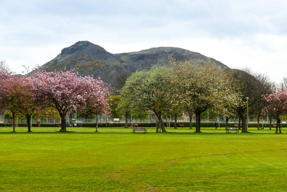
4. Arthur’s Seat
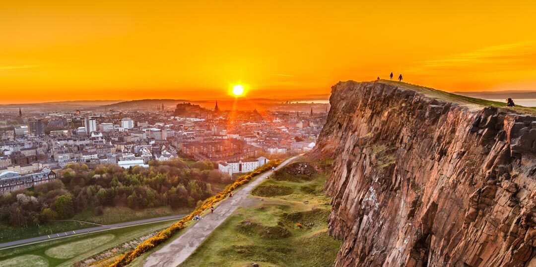
Arthur’s Seat is a huge hill located in Holyrood Park, not far from the city centre. It’s actually an ancient volcano and the highest point in Edinburgh. The hike to the top takes about 30 to 60 minutes, depending on the path you choose. From the summit, you can see the whole city and beyond. Locals and tourists alike love this spot for fresh air, exercise, and stunning views. It’s a must-see for nature lovers.
5. Calton Hill
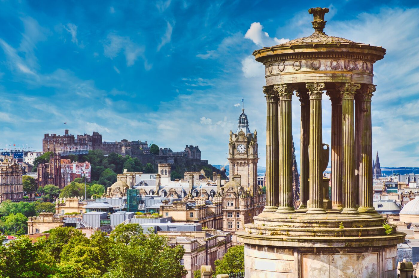
Calton Hill is another high point in Edinburgh, known for its unique monuments and panoramic views. You’ll find the National Monument (which looks like a mini version of the Parthenon), the Nelson Monument, and the Dugald Stewart Monument. It’s a popular place for photography, especially at sunset or sunrise. From here, you can see the city skyline, Arthur’s Seat, and the sea beyond Leith.
6. Princes Street Gardens
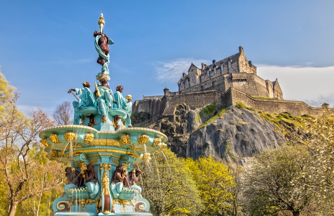
Right between the Old Town and New Town, Princes Street Gardens is a peaceful green space where people relax, walk, or enjoy lunch outside. The gardens were once a loch (lake) but were turned into a park in the 19th century. You’ll see seasonal flower displays, a historic fountain, and a great view of the castle above. It's a favourite spot for both locals and visitors to rest during a busy day.
7. Scott Monument
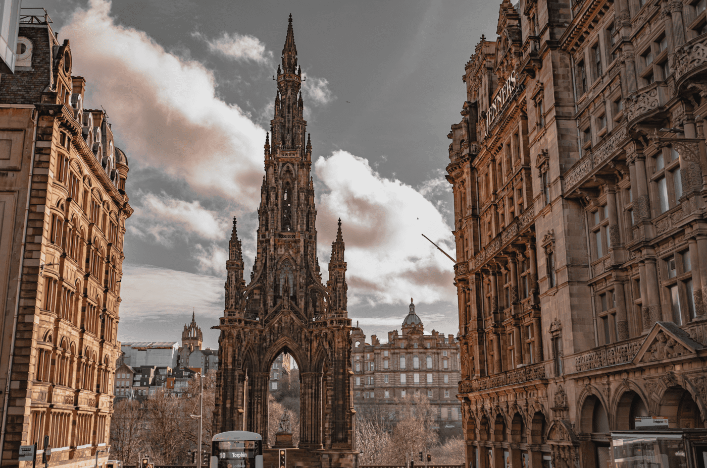
Standing in the middle of Princes Street Gardens, the Scott Monument is a tall, gothic tower built to honour Sir Walter Scott, one of Scotland’s most famous writers. The monument is black due to years of pollution, giving it a dramatic look. Visitors can climb over 280 steps to reach viewing platforms at the top. Along the way, there are statues and information panels about Scott’s life and work.
8. National Museum Of Scotland
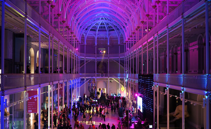
This is one of the best museums in the UK and completely free to enter. It has exhibitions on Scottish history, science and technology, animals, space, fashion, and more. It’s a great place for families, with interactive displays and something for all ages. The museum building itself is also beautiful, with a large, light-filled Victorian hall. Don’t miss the rooftop terrace for great city views.
9. St Giles’ Cathedral
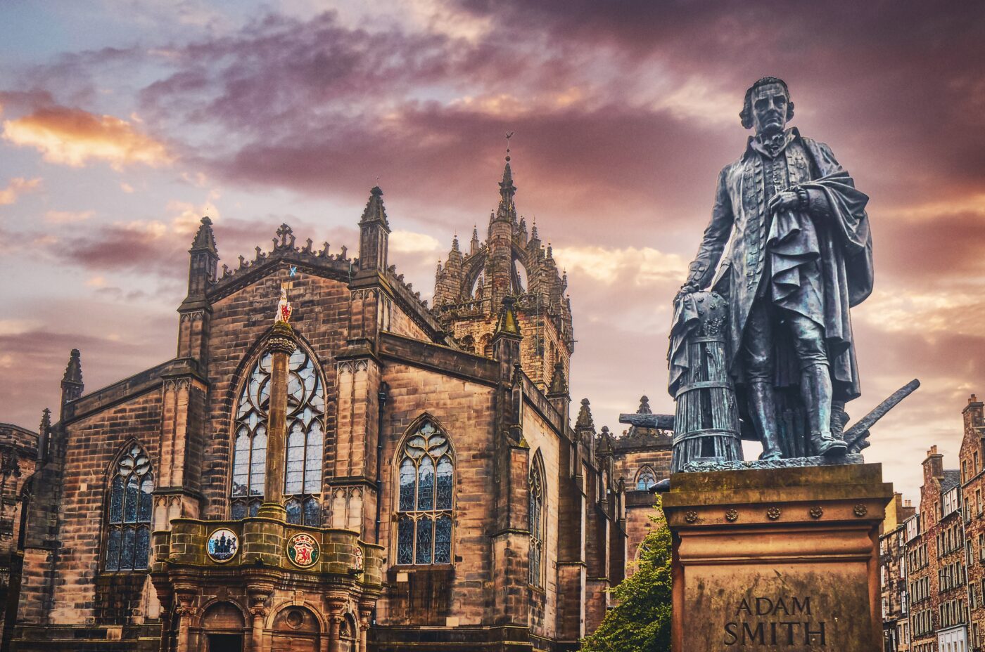
Located on the Royal Mile, St Giles’ is a striking medieval church with a rich history. It has beautiful stained glass windows, a grand pipe organ, and a crown-shaped spire. Inside, you’ll find the Thistle Chapel, which is the home of Scotland’s oldest and highest order of chivalry. It’s a peaceful place to sit and reflect during your tour of the city centre.
10. The Scotch Whisky Experience

Next to Edinburgh Castle, this is a great place to learn about Scotland’s most famous drink. The Scotch Whisky Experience offers guided tours that explain how whisky is made, how it should be tasted, and the different styles from around the country. There’s also a ride that takes you through the whisky-making process and a room with one of the largest whisky collections in the world.
11. Camera Obscura And World Of Illusions

This fun and unusual attraction is full of visual tricks, optical illusions, and interactive displays. It’s a great choice for families and kids. The highlight is the Camera Obscura itself an old device that projects a live 360-degree view of the city onto a table inside a dark room. It’s been entertaining visitors since the 1800s.
12. The Meadows
The Meadows is a large public park just south of the city centre. It’s surrounded by university buildings and student housing, so it’s always full of life. People come here to play football, cycle, walk dogs, or have picnics. In spring, the cherry blossom trees are a lovely sight. It’s a relaxing escape from the busy city streets.
13. Leith And The Shore
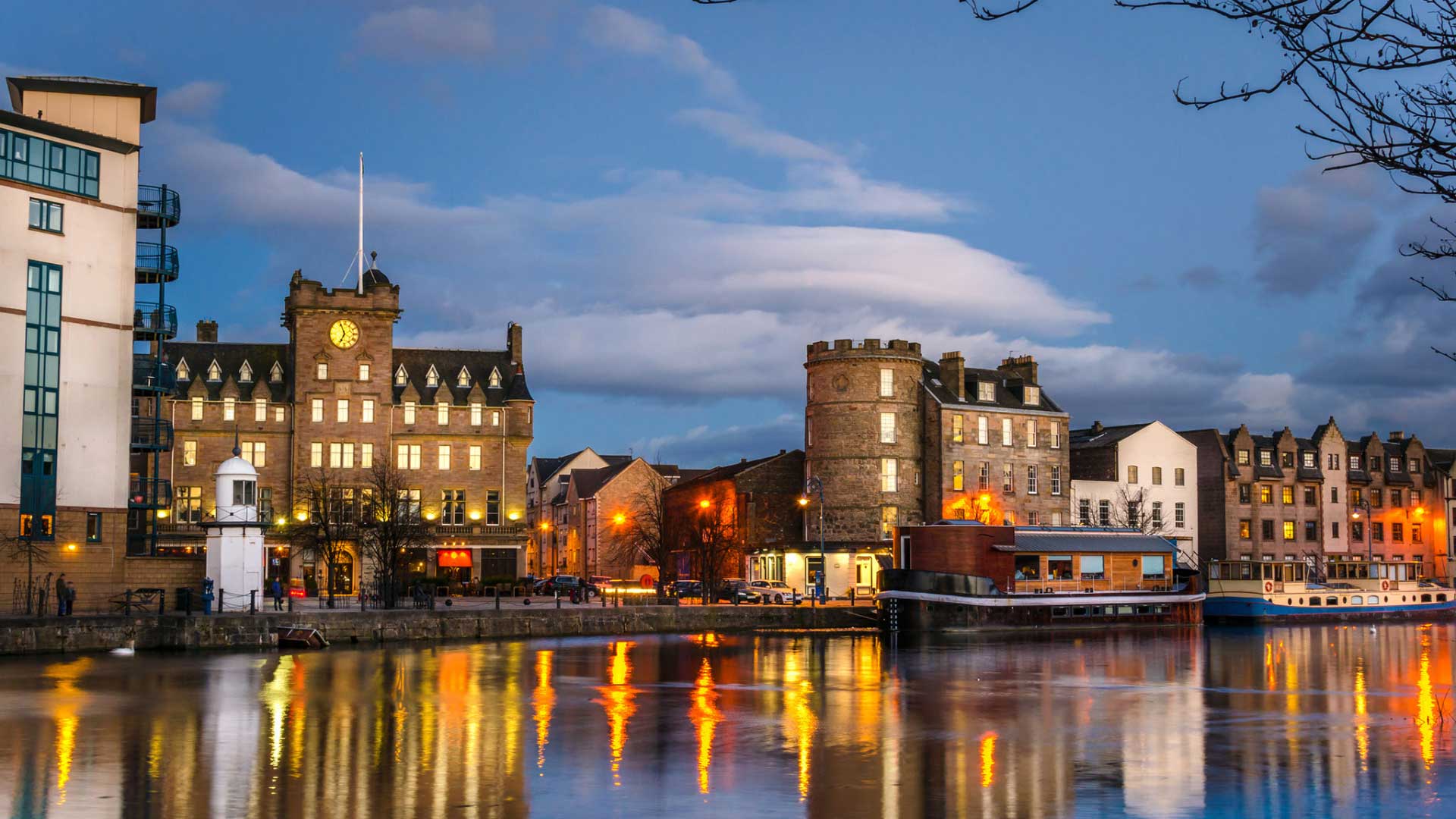
Leith is Edinburgh’s historic port area and has seen a big transformation in recent years. The Shore is the most popular part, with cobbled streets, waterfront restaurants, and stylish bars. It’s home to the Royal Yacht Britannia, which you can visit to see how the royal family lived at sea. Leith also has art galleries and local markets, making it a great spot for a day out.
14. Stockbridge Market
Stockbridge is a trendy area with a village feel, located just north of the city centre. On Sundays, it hosts a popular market with local food, handmade crafts, and fresh produce. The area also has lovely walks along the Water of Leith, old stone houses, cosy cafes, and small boutiques. It’s perfect for those looking for a quieter, more local experience.
15. Royal Botanic Garden Edinburgh
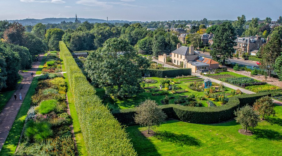
Just a short walk or bus ride from the centre, the Royal Botanic Garden is a peaceful place filled with plants from all over the world. It covers over 70 acres and includes glasshouses, ponds, flower beds, and wooded areas. It’s free to enter (except the glasshouses) and is great for a slow afternoon. There are also exhibitions, a shop, and a cafe on site.
Where To Find And Buy Maps Of Edinburgh
- National Library of Scotland (NLS):Offers one of the largest online map collections in Europe, with high-resolution scans of Edinburgh through the ages.
- VisitScotland iCentres:Found near Waverley Station and the Royal Mile, these centres offer free printed maps.
- Blackwell’s and Golden Hare Books:Great for buying walking maps, illustrated maps, and guidebooks.
- Stallholders on the Royal Mile:Often sell historical or themed maps as souvenirs.
- Online Retailers:Etsy and local artist websites provide creative, hand-drawn versions.
People Also Ask
Where Can I Get A Free Map Of Edinburgh?
You can pick up free paper maps at Edinburgh’s main train stations, tourist information centres (iCentres), and many hotels. They’re also downloadable from VisitScotland or the Edinburgh City Council website.
What Is The Nicest Area Of Edinburgh?
- Stockbridge
- Morningside
- Costorphine
- New Town
- The Grange
- Murrayfield
- Old Town
What Is The Coldest Month In Edinburgh, Scotland?
The coldest months of the year are January and February, with average lows of 33.8°F (1°C) and highs that rarely exceed 44.6°F (7°C). There is often fog and heavy precipitation in autumn and winter.
What Is The Best App For Navigating Edinburgh As A Tourist?
Citymapper is excellent for combining public transport and walking routes. The VisitScotland app is also great for attractions and hidden spots.
Final Thoughts
Edinburgh is a city full of stories, and maps help you understand them. They show how the city has changed from old, narrow streets to modern transport routes while highlighting its culture, history, and natural beauty.
Planning a weekend trip, working on a project, or just getting around town? A good map makes everything clearer and helps you enjoy the city more confidently.
Jump to
Quick Facts About Edinburgh
Geographical Overview Of Edinburgh
History Of Mapping Edinburgh
Map Of Edinburgh Cities
Regions On The Map Of Edinburgh
Population Of Edinburgh
Edinburgh Economy
Major Roads And Routes In Edinburgh
Currency Of Edinburgh
Dialing Code Of Edinburgh
Language Of Edinburgh
Flag Of Edinburgh
Government Of Edinburgh
Total Area Of Edinburgh
Types Of Maps Of Edinburgh (And How To Use Them)
Edinburgh’s Borders And Neighboring Countries
National Parks And Landscapes Near Edinburgh
Top Places To Visit On The Edinburgh Map
Where To Find And Buy Maps Of Edinburgh
People Also Ask
Final Thoughts

Callum Fraser
Author
Callum Fraser isn't just a writer about Scotland; he's a product of its rugged landscape and rich history. Born and raised in Perthshire, with the Highlands as his backyard, his love for the nation's stories was kindled by local storytellers and long walks through ancient glens.
This passion led him to pursue a degree in Scottish History from the University of Edinburgh. For over 15 years, Callum has dedicated himself to exploring and documenting his homeland, fusing his academic knowledge with essential, on-the-ground experience gained from charting road trips through the Cairngorms, hiking the misty Cuillins of Skye, and uncovering the secrets of traditional recipes in his family's kitchen.
As the Editor-in-Chief and Lead Author for Scotland's Enchanting Kingdom, Callum's mission is simple: to be your most trusted guide. He combines meticulous research with a storyteller's heart to help you discover the authentic magic of Scotland — from its best-kept travel secrets to its most cherished traditional recipes.
Latest Articles
Popular Articles