Scottish Borders Map: Cities, Roads, And Must-See Landmarks
Plan your next adventure using a Scottish Borders map featuring towns, scenic roads, and must-see landmarks across the region.
Author:Callum FraserDec 12, 202515.1K Shares201.6K Views

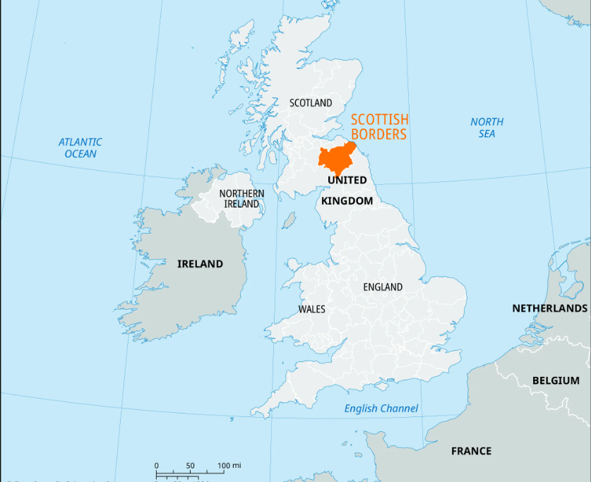
The Scottish Borders mapis useful for anyone planning to visit the south of Scotland. This area is known for its hills, rivers, old towns, and historic landmarks. With a detailed map, it’s easier to find scenic drives, quiet villages, and ancient abbeys. It also helps locals and visitors understand the land's layout and easily plan their journeys.
Quick Facts About The Scottish Borders
- Location:Southeastern Scotland, bordering England to the south.
- Historic Sites:Home to four famous abbeys Melrose, Jedburgh, Dryburgh, and Kelso.
- Tweed Origin:The River Tweed runs through the region and gave its name to tweed fabric.
- Rugged Landscape:Known for rolling hills, farmlands, forests, and moorlands.
- Popular Activities:Walking, cycling, fishing, and visiting heritage sites.
- Key Towns:Galashiels, Hawick, Peebles, Kelso, Jedburgh, Selkirk, and Melrose.
- Crafts & Culture:Rich in textile heritage and traditional Scottish crafts.
- Border Reivers:Once home to the infamous raiders during the 13th-17th centuries.
- Easy Access:Around 1.5 hours' drive from Edinburgh or Newcastle.
- Events:Hosts the annual Common Ridings historic horseback festivals unique to the Borders.
Historical Evolution Of Scottish Borders Maps
Maps of the Scottish Borders have changed a lot over time, reflecting both technological progress and changing political borders. Early maps were hand-drawn and based on rough observations. As centuries passed, cartographers began using more accurate tools, and maps became key tools for understanding the land, ownership, and local identity.
Medieval Beginnings
In the early medieval period, maps of Scotland were rare and often symbolic. They didn’t show accurate distances or details but were used more for religious or general geographic knowledge. During this time, the Borders region was not shown as a separate area. Instead, it appeared as part of broader Scottish or British territories.
16th And 17th Centuries: The First Real Detail
By the 1500s and 1600s, mapmakers like Timothy Pont began surveying Scotland in more detail. Pont’s work, later published by Joan Blaeu in the 17th century, offered some of the first reliable maps of the Scottish Borders. These maps began showing rivers, hills, and settlements with greater accuracy. They were still hand-drawn but offered more detail for landowners and government officials.
Military And Political Importance
In the 18th century, as conflicts and border control became more important, maps of the Scottish Borders were used for military planning. The Acts of Union in 1707 brought Scotland and England under one parliament, but the Borders kept their unique identity. Maps helped track roads, troop movements, and land ownership, especially after the Jacobite risings.
19th Century - The Ordnance Survey
One of the biggest changes came in the 1800s with the arrival of the Ordnance Survey. This government-led effort produced detailed, standardized maps for the whole of Great Britain. The Scottish Borders were mapped down to the inch, showing farms, footpaths, forests, and buildings. These maps are still valued today for historical research and land studies.
20th And 21st Century: From Paper To Digital
In the 20th century, map printing became more advanced and widely available. Road maps, tourist maps, and walking guides all featured the Borders. In recent years, digital mapping has taken over. Online platforms like Google Maps and OS Maps now offer satellite views, terrain maps, and GPS tracking. This shift has made it easier than ever to navigate the Borders.
Today’s Use
Today, Scottish Borders maps are used by hikers, historians, drivers, local councils, and tourists. You can choose from historical maps, topographic hiking maps, or interactive digital tools. The evolution of these maps tells a story of changing needs from border defence to heritage tourism and outdoor recreation. The region is also known for its famous Scottish people, whose history and legacy are often highlighted in these maps and local guides.
Overview Of The Scottish Borders
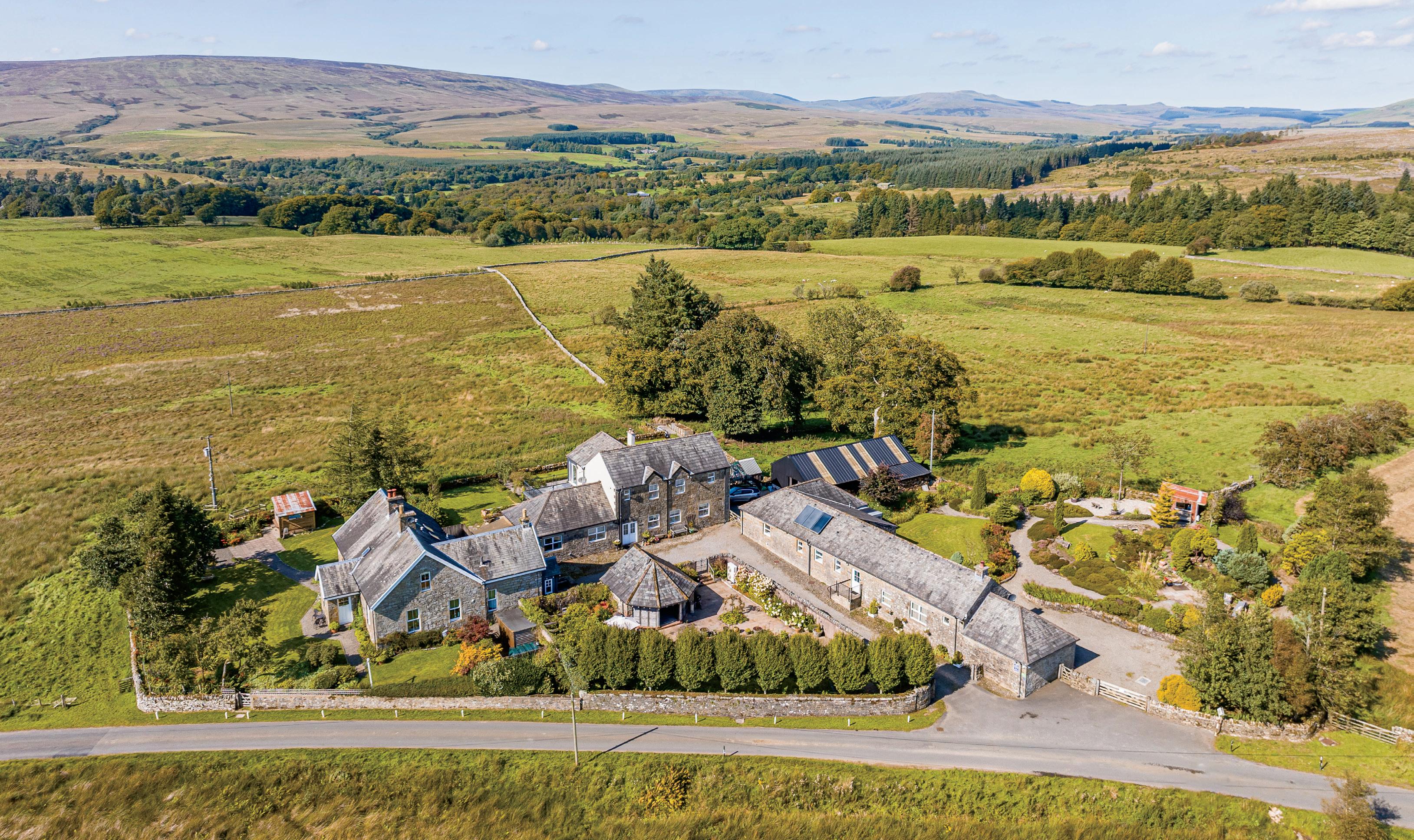
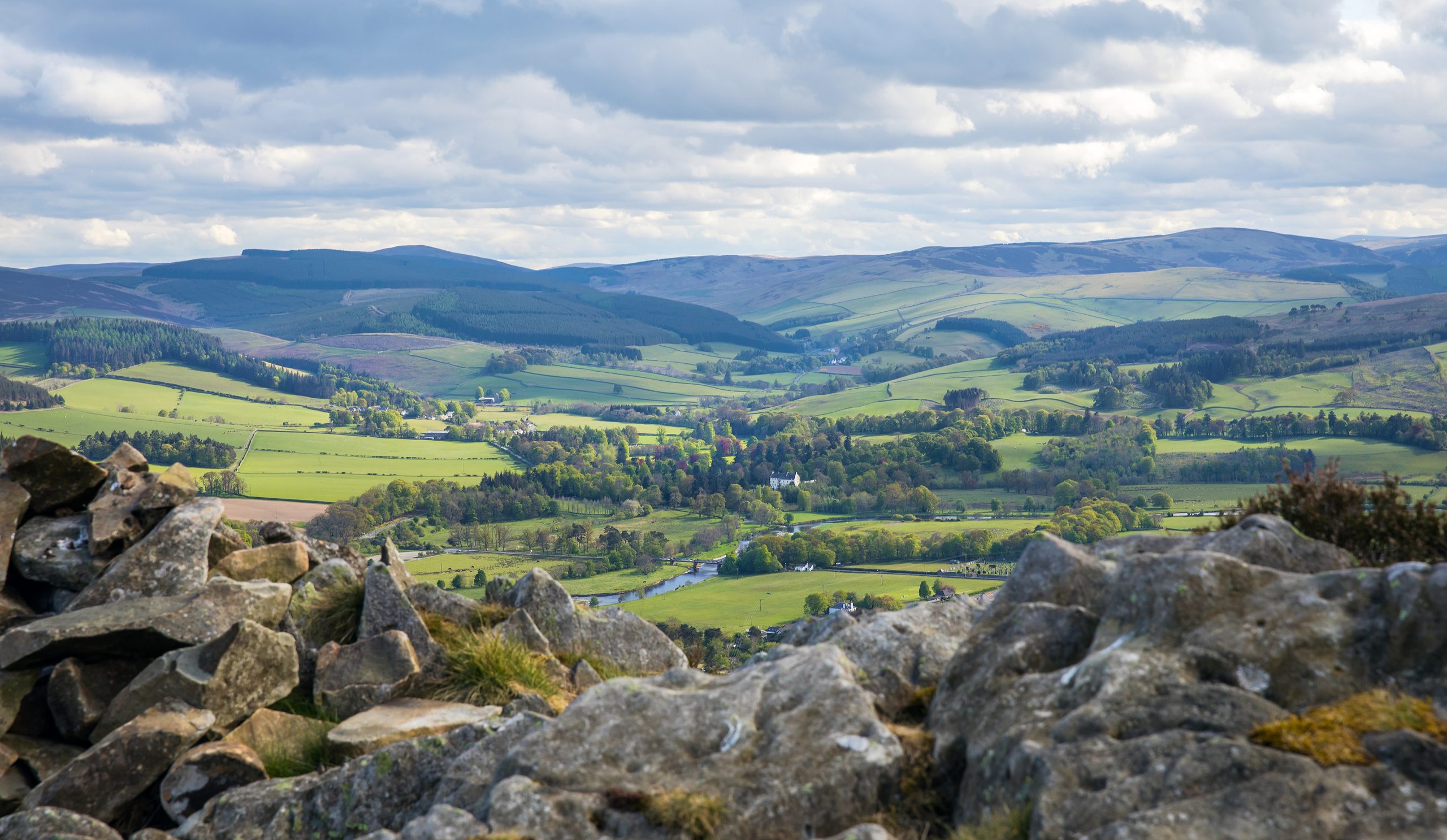
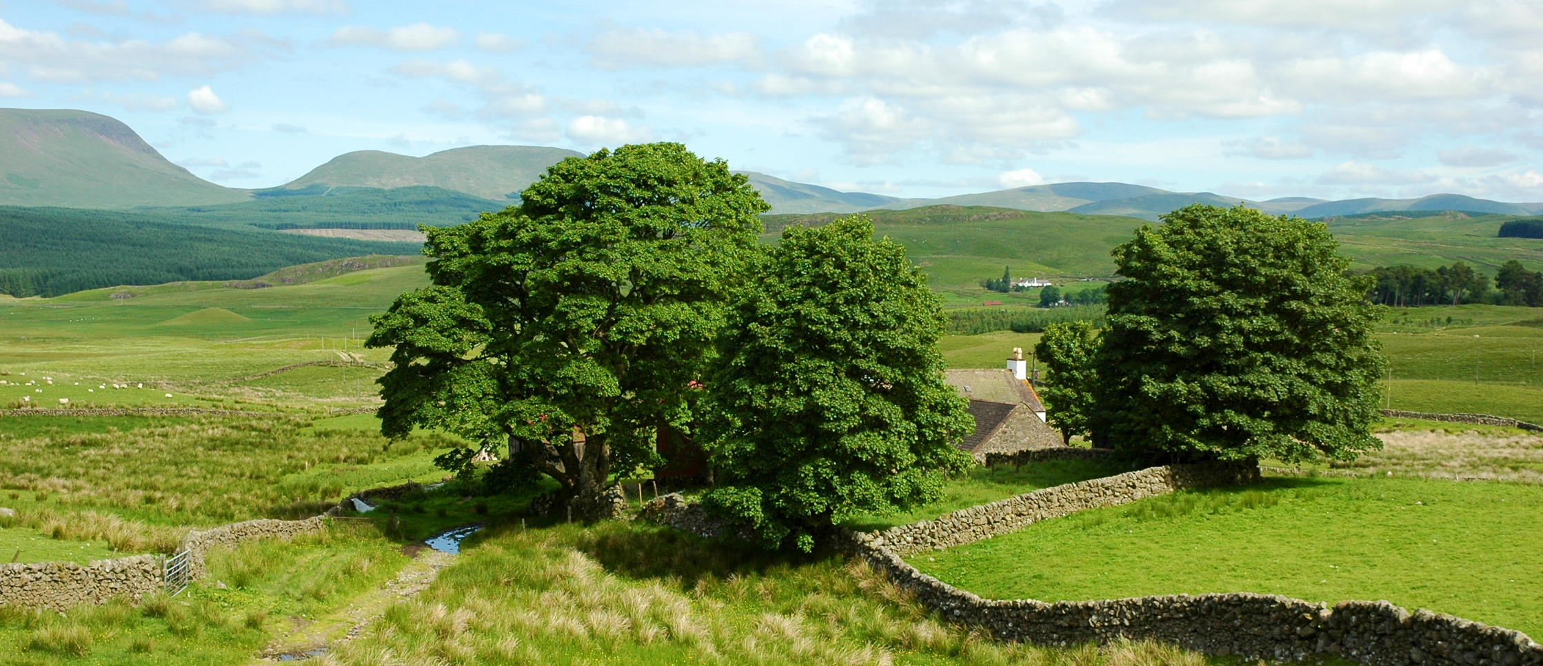
The Scottish Borders is a quiet and scenic region in the south of Scotland. It covers an area of around 1,800 square miles and shares a long border with England. The region is known for its mix of rolling hills, rivers, forests, and old market towns. It is a place rich in history, culture, and natural beauty.
Geography
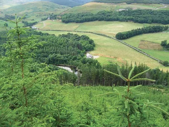
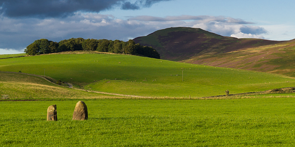
The Borders lies between Edinburgh and the north of England. Its landscape includes the Cheviot Hills to the south and the Southern Uplands in the central and northern parts. The River Tweed runs through the region, shaping the land and supporting wildlife and farming. The mix of farmland, valleys, and wooded areas makes it one of Scotland’s most peaceful rural areas.
Culture And Heritage
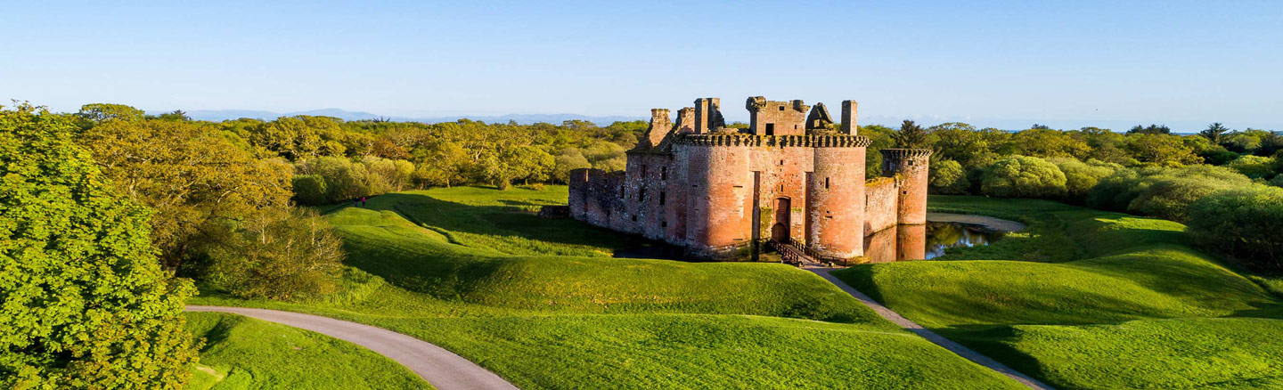
The Scottish Borders has a long and rich history. For centuries, it was the site of battles and raids between Scotland and England. The region’s identity is shaped by the Border Reivers, who were families that raided across the border between the 13th and 17th centuries. Many castles and fortified towers from this time still stand today.
Cultural traditions like the Common Ridings, held every summer in towns across the Borders, celebrate this unique heritage. Horse riders parade through the countryside to honour the region’s past and its people’s connection to the land.
Economy And Lifestyle
The Borders economy is based on farming, forestry, tourism, and textiles. Small businesses and local craftsmanship remain important. The area is known for producing high-quality wool and tweed fabrics.
Many people choose to live in the Borders for its relaxed lifestyle, friendly towns, and easy access to both Edinburgh and northern England.
What Counties Are In The Scottish Borders?
Berwickshire

Berwickshire lies in the eastern part of the Scottish Borders, close to the North Sea coast. The county is named after the historic town of Berwick-upon-Tweed, which was once part of Scotland but is now in England. Today, Berwickshire includes towns like Duns, the county town, and Eyemouth, a busy fishing port.
It also includes Coldstream, which sits near the English border. This area is known for its peaceful countryside, rolling hills, and scenic coastline with rugged cliffs and hidden beaches. Berwickshire has a strong agricultural tradition, and its market towns play an important role in the local economy.
Roxburghshire
Roxburghshire is located in the southern part of the Scottish Borders. It was once one of the most powerful and populated counties in southern Scotland. Important towns like Kelso, Jedburgh, Hawick, and Melrose lie within its historic boundaries. This area is especially known for its strong Border traditions, including Common Ridings annual festivals that celebrate the history of border patrols by horsemen.
Roxburghshire played a key role in the history of the Anglo-Scottish wars. Many abbeys and castles were built here, some of which are now popular tourist attractions. The River Tweed flows through the county, bringing life to rich farmland and supporting one of Scotland’s best-known salmon fishing industries.
Selkirkshire
Selkirkshire is a small but historically important county in the central Borders. The town of Selkirk sits high above the Ettrick Water and was one of the earliest Royal Burghs in Scotland. Selkirkshire is closely associated with Sir Walter Scott, the famous writer who served as sheriff-depute of the county for over 30 years. His presence left a lasting impact on local identity, literature, and tourism.
This area is more rugged and less populated than others, with vast stretches of woodland and open hill country. Border reivers clans who raided across the border in medieval times were once active in Selkirkshire. Many local traditions, including the Selkirk Common Riding, continue to honour this bold and independent past.
Peeblesshire
Peeblesshire lies in the western part of the Scottish Borders, with the town of Peebles at its heart. This historic county is known for its natural beauty, especially the hills, rivers, and forests that define the landscape.
The River Tweed also flows through Peeblesshire, supporting fishing, farming, and outdoor activities. The area is popular with walkers, cyclists, and mountain bikers, especially around Glentress Forest, one of the best mountain biking centres in the UK.
Key Towns And Villages
Galashiels
Galashiels is often seen as the main town of the Scottish Borders. It lies along the small river called Gala Water. The town is important because it has good transport links, including the Borders Railway, which connects it to Edinburgh. Galashiels has many shops, restaurants, and heritage centres that show the town’s rich history. It was once famous for its textile industry, especially wool and knitwear, and some of those traditions continue today. The town is lively and often a starting point for visitors exploring the Borders.
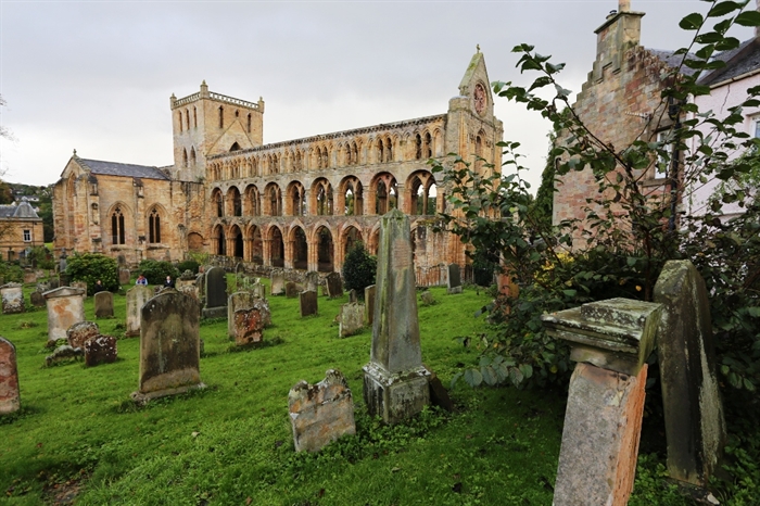
Melrose
Melrose is best known for the beautiful ruins of Melrose Abbey, a historic monastery founded in the 12th century. The town sits on the banks of the River Tweed, which adds to its scenic charm. Melrose has a strong place in Scottish history and culture, attracting many walkers and tourists. The famous Southern Upland Way walking trail passes nearby, making Melrose a popular stop for hikers. You can also find museums, local shops, and cafes that create a welcoming atmosphere.
Peebles
Peebles is located in the western part of the Borders and is known for its lovely riverside setting along the River Tweed. The town has a strong arts and crafts scene, with galleries and local markets showcasing the work of Border artists. Just outside Peebles is Glentress Forest, one of the best places in Scotland for mountain biking. This makes Peebles popular with outdoor lovers who enjoy both nature and culture. The town itself offers a mix of independent shops, historic buildings, and friendly community events.
Hawick
Hawick is a key town in the Borders’ wool and knitwear trade. For centuries, it has been a centre for producing high-quality woollen goods, especially famous for its knitwear and cashmere. Hawick also has a strong sporting culture, especially in rugby. The town hosts the annual Common Riding, a traditional festival where horse riders honour the town’s history and protect its boundaries. Hawick’s streets include shops, museums, and theatres, making it a lively cultural hub.
Jedburgh
Jedburgh lies close to the border with England. It is famous for its large ruined abbey, one of the four great Border abbeys. The abbey dates back to the 12th century and is a highlight for visitors interested in medieval history. Jedburgh also has a historic castle jail, which shows how the town was once a place of conflict and law enforcement during border wars. Today, Jedburgh is a quiet town with museums, small shops, and cosy cafes, giving visitors a taste of Border life and history.
Kelso
Kelso is a charming town built around one of Scotland’s most attractive market squares. It lies near where the River Tweed and River Teviot meet, creating a scenic spot loved by locals and tourists. Kelso is home to Floors Castle, the largest inhabited castle in Scotland, which has beautiful gardens and parklands open to visitors. The town has many local shops, restaurants, and a strong sense of community. Kelso is also a good base for exploring the surrounding countryside and rivers.
Selkirk
Selkirk is an important historic town in the Scottish Borders. It sits above the Ettrick Water river and has deep connections to the famous Scottish writer Sir Walter Scott. The town was once a key site during the Border reiving period, when local families were involved in raids and conflicts. Selkirk celebrates this history with festivals and cultural events. Today, it offers a mix of historic buildings, shops, and quiet natural areas. Visitors often enjoy walking trails and the peaceful atmosphere.
Borderlines And Neighboring Regions
The Scottish Borders is a region in the southeast of Scotland. It shares its southern border with England. This border has a long and often difficult history. For many centuries, the line between Scotland and England was a place of battles, raids, and changing control. This history is important because it shaped much of the culture and identity of the Borders area.
On maps, the border is usually marked clearly, showing the division between Scotland and England. It runs roughly from the east coast near Berwick-upon-Tweed to the west, close to the Cheviot Hills. The border is not just a political line but also a cultural boundary where two countries meet.
Neighboring regions to the Scottish Borders include:
- To the north:The Scottish region of the Lothians, which includes areas like Edinburgh and Midlothian.
- To the west:Dumfries and Galloway, another scenic part of southern Scotland known for its rolling hills and coastlines.
- To the south:Northumberland and Cumbria, counties in England with their own rich histories and landscapes.
- To the east:The North Sea coastline stretches along the eastern edge of the Borders, providing access to coastal towns like Eyemouth.
These neighboring regions connect the Scottish Borders to both Scotland and England, creating a unique mix of influences. Maps of the Borders often show these nearby areas to help travelers understand where the Borders sit with the rest of the country.
Natural Landmarks On The Map
The Scottish Borders is full of beautiful natural places. Maps show many of these landmarks, which help people enjoy and understand the area better. Here are some of the main natural landmarks you will see on a Scottish Borders map:
The River Tweed
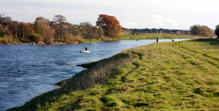
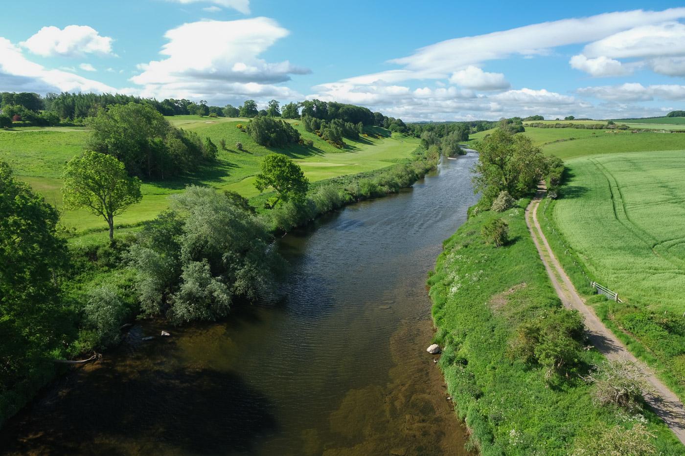
The River Tweed is the biggest and most famous river in the Borders. It flows across the region from west to east and ends in the North Sea. The Tweed is known for its salmon fishing and pretty river valleys. Many towns, like Melrose and Kelso, sit along the river. The Tweed shapes much of the landscape and life in the Borders.
The Cheviot Hills
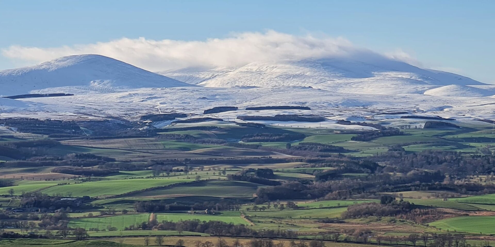
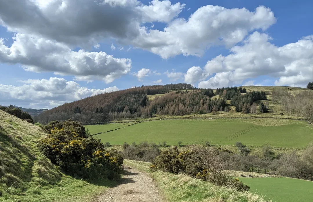
The Cheviot Hills are on the western edge of the Borders and also form part of the border with England. These hills are rounded and green, perfect for hiking and walking. They are wild and open, giving a feeling of being deep in nature. Maps often mark the Cheviots because they are a key outdoor area in the region.
The Eildon Hills
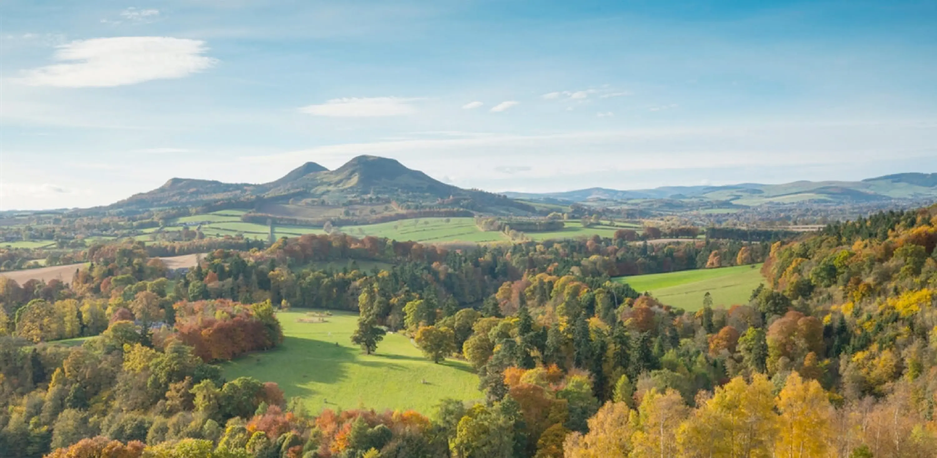
Near Melrose, the Eildon Hills stand out with three big peaks. These hills are easy to spot on any map of the Borders. They are linked to old stories and legends, adding mystery to their beauty. Visitors like to climb the hills for great views of the surrounding countryside.
Glentress Forest

Glentress Forest is near Peebles and is famous for mountain biking. It has many well-marked trails through thick woodland. Glentress is a popular spot for people who love nature and sports. Maps show the forest clearly because it is a top place for outdoor fun in the Borders.
The River Teviot
The River Teviot flows through Kelso and meets the Tweed. It is smaller than the Tweed but very important to the area. The Teviot adds to the green valleys and peaceful spots in the Borders. Towns and villages along the river often have nice riverside walks.
Leaderfoot Viaduct
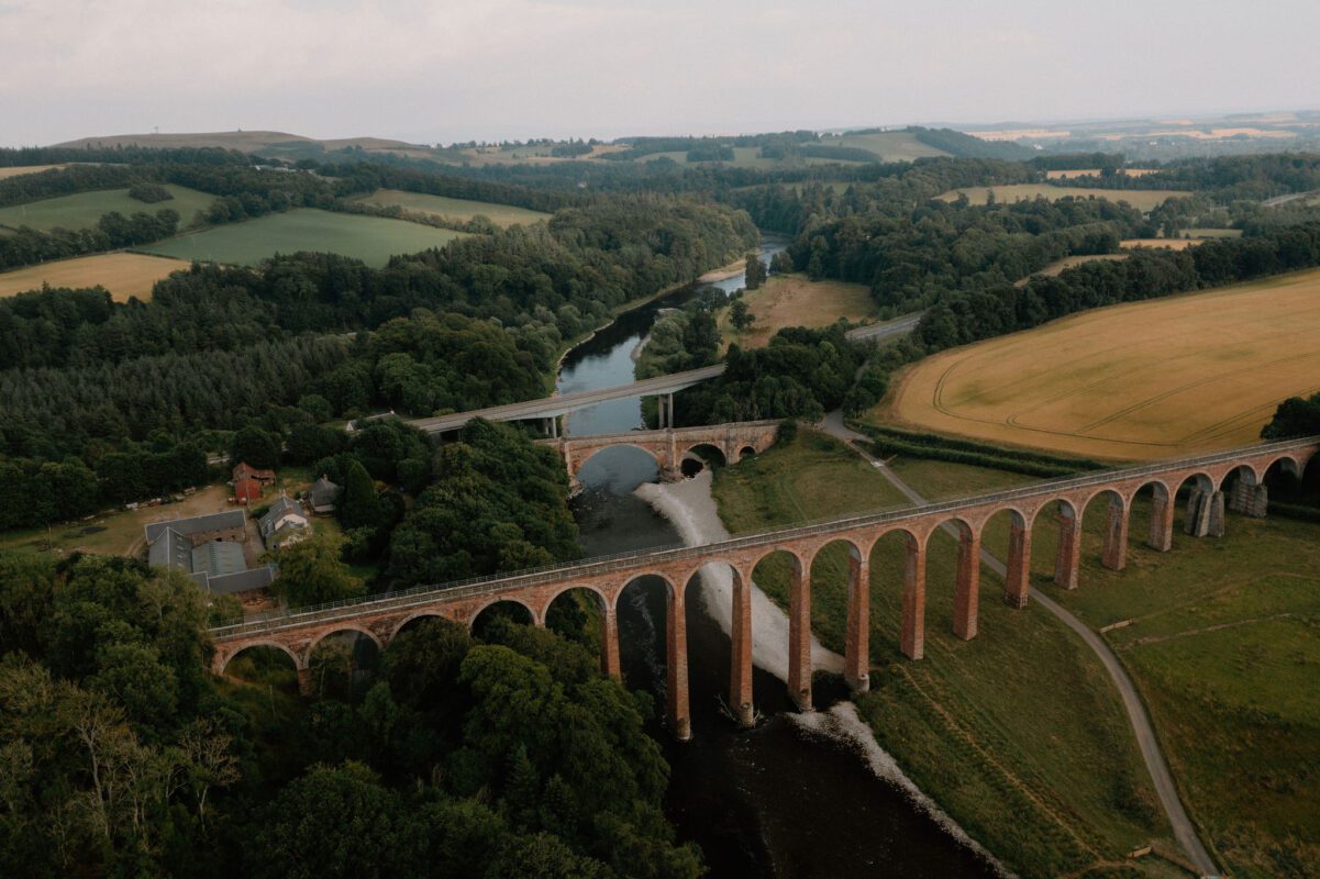
The Leaderfoot Viaduct is an old railway bridge over the River Tweed near Melrose. While it is a man-made structure, it is often marked on maps because of its impressive size and beauty. It blends well with the natural surroundings and is a favorite spot for visitors and photographers.
Language And Literature
The main language spoken in the Scottish Borders is English. However, in some rural areas, you may still hear Scots being spoken a traditional dialect that has been used in the region for hundreds of years. Scots words can sometimes appear in street names, poems, and local sayings.
The Scottish Borders has a rich history of writing and storytelling. One of the most famous writers connected to the area is Sir Walter Scott, who lived at Abbotsford House near Melrose. His poems and novels were inspired by the Borders’ landscapes, people, and history. You can visit his home, which is now a museum.
Many old ballads and folk tales from the Borders talk about battles, love, and the lives of Border reivers families who lived by raiding across the Anglo-Scottish border in the past.
Also See - Greatest Scottish Poets Of All Time
Total Area Of Scottish Borders
The Scottish Borders covers around 4,732 square kilometers (about 1,827 square miles). It’s one of the larger council areas in Scotland. The region stretches from the Lammermuir Hills in the north to the Cheviot Hills in the south, and from the Berwickshire coast in the east to the Ettrick Forest in the west.
This large area includes quiet countryside, rolling hills, peaceful rivers, forests, and small towns. Because it’s so spread out, having a map of the Borders is very useful for planning visits or road trips.
Population Of Scottish Borders
The Scottish Borders has a population of about 115,000 people. Most of the population lives in small towns like Galashiels, Hawick, Peebles, and Kelso. There are also many villages and rural communities scattered across the countryside.
The population is older than the Scottish average, with many people choosing the area for its peaceful lifestyle. It’s also a popular retirement destination because of the beautiful scenery and slower pace of life.
Major Roads And Transportation
The Scottish Borders does not have any motorways, but the region is well connected through A-roads and B-roads, making travelby car or bus quite easy. These roads link the Borders to Edinburgh, northern England, and other parts of Scotland.
Travelling by road is the most flexible way to get around, especially if you plan to visit small towns, villages, or the countryside.
A7 - Edinburgh To Carlisle
The A7 is one of the main roads through the Borders. It starts in Edinburgh and travels south through Galashiels, Selkirk, and Hawick, before crossing into Carlisle in northern England. This road passes through scenic valleys and wooded areas, making it a beautiful drive. It is a key route for people commuting and moving goods between Scotland and England.
A68 - Edinburgh To Northumberland Via Jedburgh
The A68 also begins in Edinburgh and heads south, passing through places like Lauder, Earlston, and Jedburgh. It continues into Northumberland in England. This road is used often by people heading to or from Newcastle and is one of the most direct links between the Borders and northeast England.
A1 - East Coast Road Near Berwick-upon-Tweed
The A1 is a major route that runs just outside the eastern edge of the Borders region. It connects Edinburgh to Newcastle, passing through Berwick-upon-Tweed, which is right on the border between Scotland and England. While not directly within the central Borders, it’s an important road for reaching the coast or heading south quickly.
A72 - Connecting Peebles And Galashiels
The A72 runs across the western Borders and is a useful road for local travel. It links Peebles to Innerleithen, Walkerburn, and eventually Galashiels. The road follows the River Tweed in parts and offers a peaceful countryside drive. It’s a common route for visitors heading to Glentress Forest and the Tweed Valley.
A701 - Peebles To Edinburgh
The A701 runs from Dumfries in the south, through Moffat and Tweedhopefoot, and connects to Edinburgh in the north. In the Borders area, it links to towns like Broughton and West Linton. This road is often used by people travelling from the western Borders to the capital.
Public Transport In The Scottish Borders
Although the Borders is mostly rural, there are good public transport options for people who don’t drive.
Borders Railway
The Borders Railway is the only train line in the region. It runs from Edinburgh Waverley to Tweedbank, passing through towns such as Stow, Galashiels, and Eskbank. It’s a fast and easy way to reach the Borders from Edinburgh. Many people use it for daily commuting or short trips.
The railway line reopened in 2015 and has helped boost tourism and travel between the city and the Borders.
Bus Services
Borders Buses is the main bus company in the region. They run regular services between towns such as:
- Peebles to Galashiels
- Kelso to Berwick-upon-Tweed
- Jedburgh to Hawick
Buses also connect to major cities like Edinburgh and Carlisle. While buses are useful, they may not run as often in very rural areas, so checking timetables is important.
Tourist Places To Visit On The Scottish Borders
The Scottish Borders is full of interesting places to visit. From ancient abbeys to peaceful forests and stunning viewpoints, there is something for everyone.
Melrose Abbey
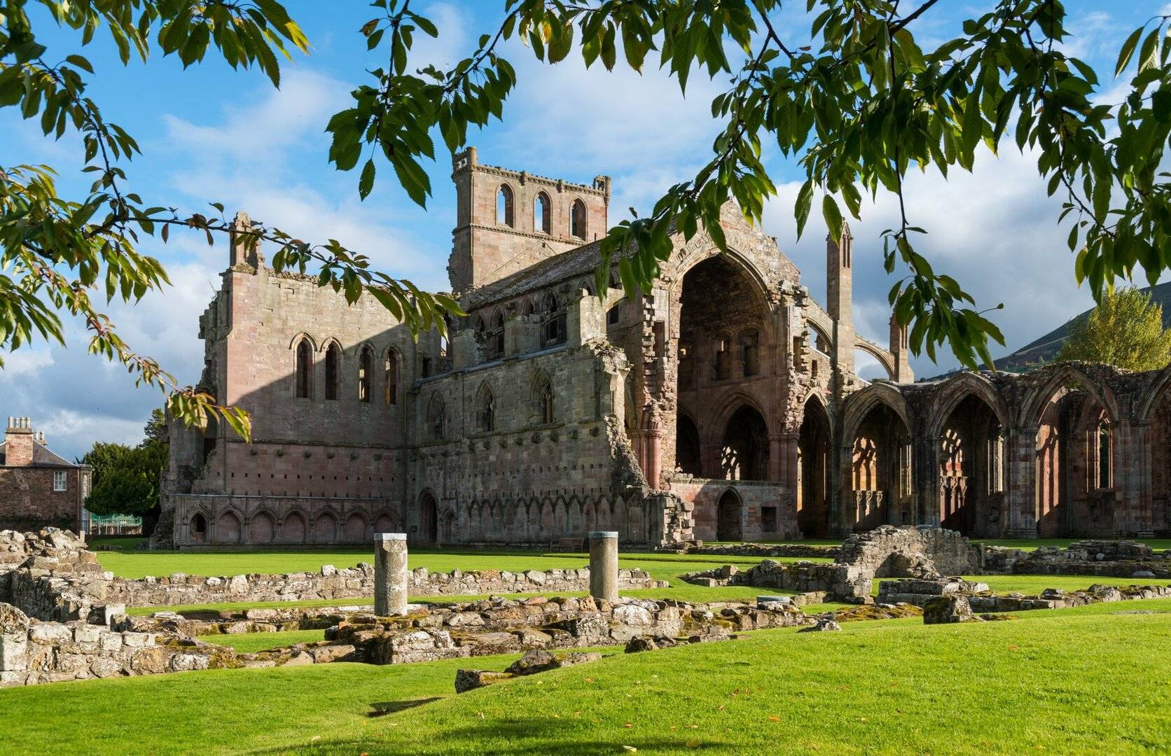
Melrose Abbeyis one of the most famous historical sites in the Borders. Built in the 1100s, it is now a beautiful ruin with amazing stonework. It is believed to be the final resting place of Robert the Bruce’s heart. The abbey sits near the River Tweed and is surrounded by peaceful gardens.
Jedburgh Abbey
Jedburgh Abbey is another impressive ruin with a long history. It was founded in the 12th century and shows how grand churches once looked in Scotland. The abbey also has a visitor centre that tells the story of its religious and royal connections.
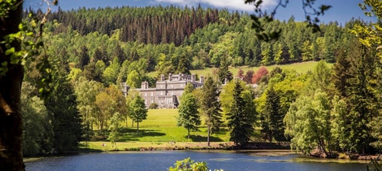
Floors Castle, Kelso
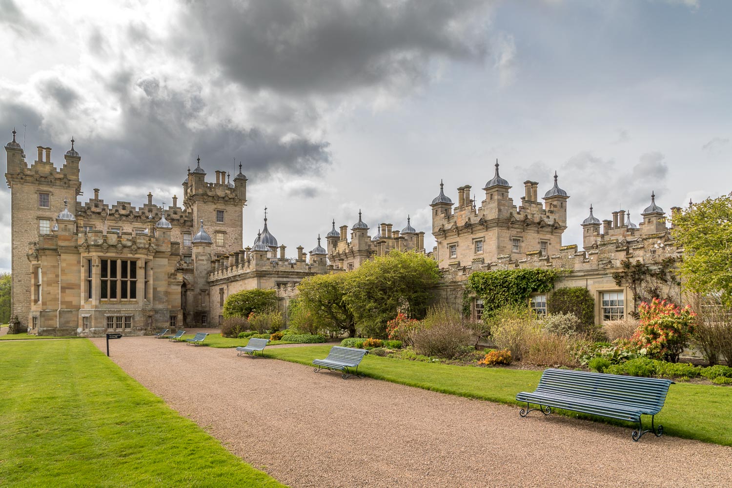
Floors Castle is the largest lived-in castle in Scotland. Located near Kelso, it has elegant rooms, a large estate, and lovely gardens. Visitors can tour the inside of the castle, walk around the grounds, and stop by the café and gift shop.
Abbotsford House

Abbotsford House was the home of famous writer Sir Walter Scott. The house is filled with antiques, books, and personal items. Outside, you can enjoy the beautiful gardens and woodland trails. There’s also a visitor centre and tearoom.
Scott’s View

This is one of Sir Walter Scott’s favourite spots. It’s a quiet viewpoint that overlooks the Tweed Valley and the Eildon Hills. The view is especially beautiful at sunrise or sunset. It's an ideal place for photography or simply relaxing.
Traquair House

Traquair House is the oldest lived-in house in Scotland, with parts dating back to the 1100s. It has many interesting rooms, a chapel, and a brewery. The house also hosts festivals, markets, and other events throughout the year.
Glentress Forest
Located near Peebles, Glentress is one of the best places in the UK for mountain biking. There are trails for beginners and experts, along with walking paths and picnic spots. You can also rent bikes or get lessons.
Eildon Hills
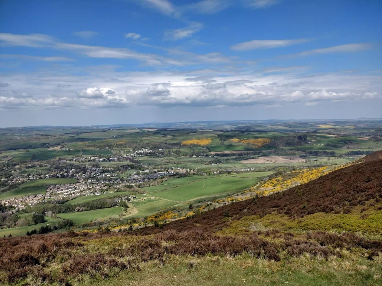
The Eildon Hills are a group of three peaks near Melrose. They are easy to climb and offer amazing views of the surrounding countryside. The hills are also linked to local myths and Roman history.
St Abbs Head National Nature Reserve
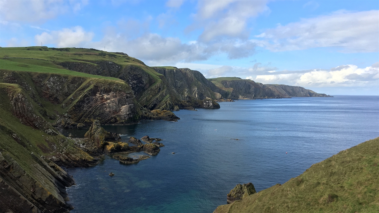
This nature reserve is located on the coast and is known for its cliffs, seabirds, and wild flowers. It’s a great place for birdwatching and walks by the sea. The small village of St Abbs nearby is also worth visiting.
Tweed Valley Forest Park
This is a large forested area that includes several woodland sites. It’s perfect for cycling, hiking, and wildlife watching. The park stretches along the River Tweed and has visitor centres and outdoor activities for families.
Selkirk And Bowhill House
Bowhill House is a grand country house near Selkirk, surrounded by gardens, woodland, and a deer park. The house has art collections, historical furniture, and children’s play areas. Guided tours are available during the open season.
Hawick Museum And Wilton Lodge Park
This museum shares stories of Hawick’s past, especially its links to knitwear, motorcycling, and art. It’s located inside Wilton Lodge Park, a peaceful green space with a walled garden, riverside walks, and playgrounds.
Peebles High Street
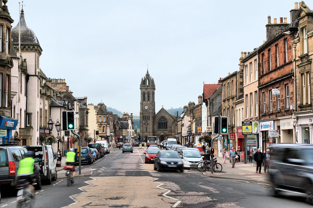
Peebles has a lovely High Street full of independent shops, cafés, and art galleries. It’s a good place to enjoy a relaxed walk, stop for coffee, or buy local crafts and gifts.
Eyemouth Harbour
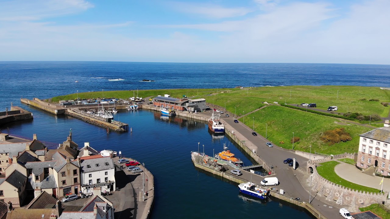
Eyemouth is a small fishing town on the coast. The harbour is still active and is fun to walk around. The Eyemouth Maritime Museum tells the story of the sea and the people who lived by it. You can also see fishing boats and enjoy fresh seafood.
Southern Upland Way
The Southern Upland Way is a long-distance walking trail that stretches across southern Scotland. Parts of the trail pass through the Borders, offering scenic walks through hills, forests, and farmland. It’s ideal for serious walkers and nature lovers.
Places To Eat In The Scottish Borders
The Scottish Borders has a wide variety of places to eat, from fine dining restaurants to casual cafés and cosy pubs. Many places use fresh, local ingredients from the region.
The Hoebridge (Gattonside)

Located near Melrose, The Hoebridge offers modern Scottish food in a friendly setting. The menu changes with the seasons and uses ingredients from local farms and producers. It’s a favourite spot for locals and visitors alike.
The Townhouse (Melrose)
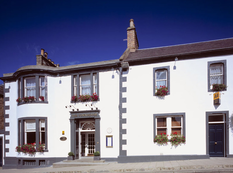
This elegant restaurant sits in the centre of Melrose. It serves traditional dishes with a modern twist. The setting is stylish, and the service is warm and welcoming. It’s a great place for a special meal.
The Tontine Hotel (Peebles)
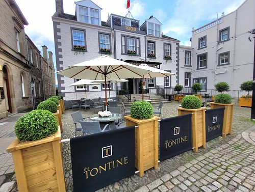
The Tontine Hotel has a cosy restaurant and bar that serve hearty meals, including Scottish favourites. With views over the River Tweed, it’s a relaxing place to enjoy lunch or dinner.
The Horseshoe Inn (Eddleston)
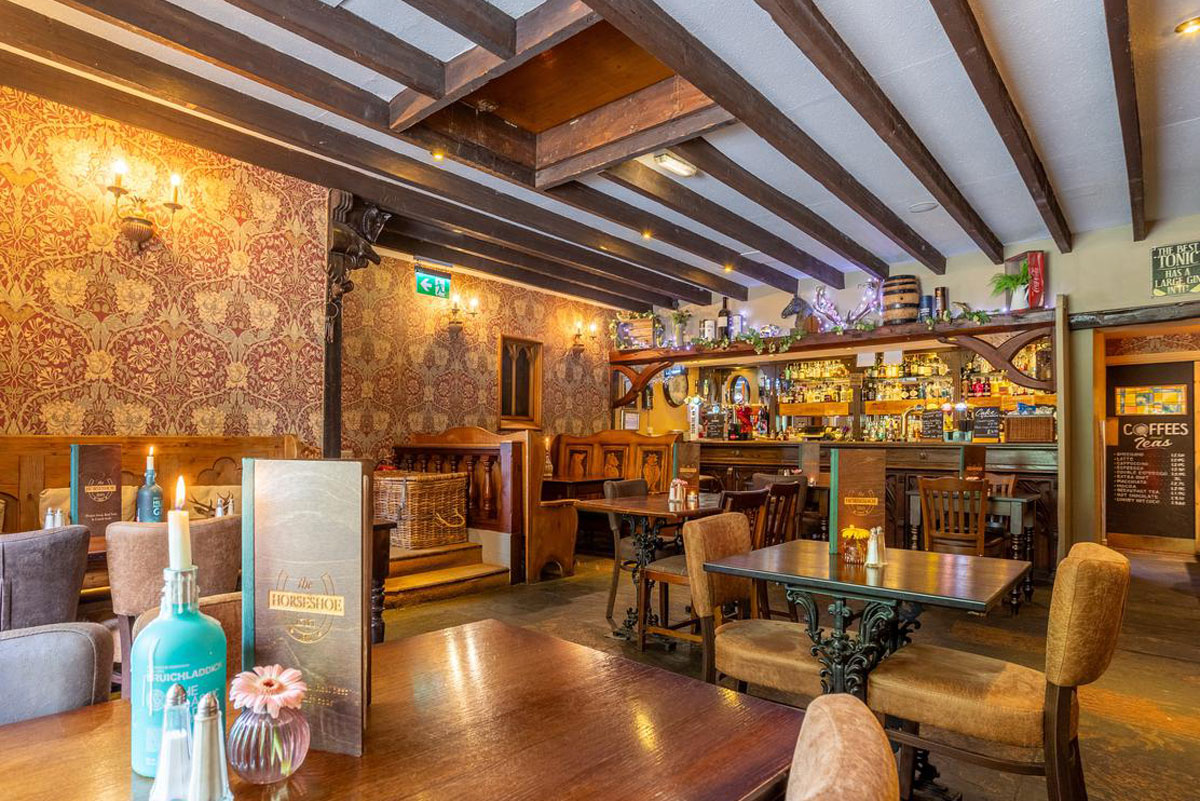
Just north of Peebles, The Horseshoe Inn is known for its award-winning food. You can choose from fine dining in the restaurant or more casual meals in the bar. The menu features local game, seafood, and vegetables.
Osso (Peebles)
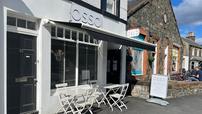
Osso is a modern and creative restaurant that has earned recognition in food guides like the Michelin Guide. It offers inventive dishes made with Scottish ingredients, served in a relaxed and stylish setting.
Ship Inn (Eyemouth)
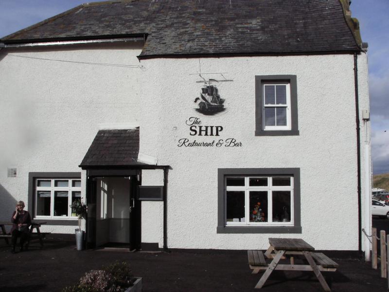
This cosy inn by the harbour is known for its fresh seafood, especially locally caught fish. It’s a perfect place to enjoy a meal after visiting the seaside or exploring Eyemouth.
Coltmans Delicatessen (Peebles)

Coltmans is a popular spot for brunch, coffee, or picking up local produce. It’s part café, part deli, and offers homemade food including soups, sandwiches, and baked goods. You can also buy Borders cheeses, meats, and preserves to take home.
How To Travel To And Around The Scottish Borders
Getting to and moving around the Scottish Borders is simple, but it helps to plan ahead, especially if you want to visit more rural areas.
Getting To The Scottish Borders
By Train
The Borders Railway is the main train line in the region. It runs between Edinburgh and Tweedbank, with stops at:
- Newcraighall
- Brunstane
- Eskbank
- Newtongrange
- Gorebridge
- Stow
- Galashiels
- Tweedbank
This route is fast, scenic, and ideal if you're coming from Edinburgh.
By Bus
Several long-distance bus services connect the Borders with nearby cities such as:
- Edinburgh
- Carlisle
- Berwick-upon-Tweed
Borders Buses and Scottish Citylink operate many of these routes. You can also take local buses once you're in the Borders.
By Car
Driving is one of the easiest ways to reach the region, especially from:
- Edinburgh (via A7, A68, or A1)
- Newcastle (via A1 or A68)
- Glasgow (via M8 and A72)
There are no motorways in the Borders, but the A7, A68, and A72 are major roads that make travel smooth.
By Air
The nearest major airports are:
- Edinburgh Airport - around 1 hour by car or train.
- Newcastle Airport - about 1.5 hours by car.
When To Travel And What To Pack
Spring (March To May)
Spring in the Scottish Borders is a season of fresh beginnings. As the cold of winter fades, the countryside comes to life with bright green grass, colourful wildflowers, and baby lambs playing in the fields. Rivers and streams run full, and gardens begin to bloom, making it a lovely time for nature lovers. The weather is still cool, especially in the mornings and evenings, but the days grow longer and more pleasant. Places like Melrose Abbey and Dawyck Botanic Garden become more enjoyable to visit without the summer crowds.
Summer (June To August)
Summer is the warmest and busiest time of year in the Scottish Borders. With long daylight hours, sometimes as much as 17 hours of light there’s plenty of time to enjoy the outdoors. The landscape is at its greenest, and the weather is usually mild and pleasant. Towns like Kelso, Peebles, and Melrose come alive with visitors, festivals, and local events, including the famous Common Ridings, which celebrate the region’s history and traditions.
Autumn (September To November)
Autumn in the Scottish Borders brings calm, beauty, and rich colour to the landscape. The leaves on trees turn golden, orange, and red, especially in wooded areas like Tweed Valley Forest Park. The air becomes cooler and fresher, perfect for long walks or countryside drives. The changing season gives the region a peaceful, reflective mood, making it ideal for a quiet holiday away from busy crowds.
Winter (December To February)
Winter in the Scottish Borders is cold but peaceful. Snow may dust the hills and higher areas, while towns become quiet and calm. Shorter days and colder temperatures make it a slower time, but the peacefulness adds a special charm. Many towns decorate their streets and shops for Christmas, and events such as festive markets or lights make the season feel warm despite the cold.
What To Pack
Your packing list depends on when you visit and what you plan to do.
All-Year Essentials
- Comfortable walking shoes or boots- For uneven paths and historic sites.
- Layers of clothing- Weather can change quickly, so wear layers.
- Raincoat or waterproof jacket- Showers are common, even in summer.
- Umbrella- Handy for sudden rain.
- Daypack or backpack- Useful for hikes or day trips.
- Map or offline navigation app- Some rural areas have limited signal.
Extras By Season
Spring & Autumn
- Light fleece or jumper
- Waterproof shoes or boots
- Scarf and gloves (especially in the evenings)
Summer
- Sunglasses and suncream
- Light jacket for cooler evenings
- Refillable water bottle
Winter
- Thermal layers
- Warm coat
- Hat, gloves, and scarf
- Sturdy shoes with good grip (some paths may be icy)
People Also Ask
What Is The Scottish Borders Known For?
The Scottish Borders is famous for its rich history, beautiful landscapes, and historic sites like Melrose Abbey and Floors Castle. It also has strong cultural traditions and outdoor activities such as hiking, mountain biking, and fishing.
Which Counties Make Up The Scottish Borders?
The Scottish Borders covers the historic counties of Berwickshire, Roxburghshire, Selkirkshire, and Peeblesshire. These areas each have their own unique heritage and landscapes.
What Is The Best Map For Walking In The Borders?
For walkers, OS Explorer maps are ideal, especially when covering areas like Melrose, Jedburgh, or St. Mary’s Loch. They offer detailed topography, rights of way, and landscape features critical for navigation.
Which English City Is Closest To The Scottish Border?
Berwick-upon-TweedBerwick-upon-Tweed (/ˈbɛrɪk/), sometimes known as Berwick-on-Tweed or simply Berwick, is a town and civil parish in Northumberland, England, 2.5 mi (4 km) south of the Anglo-Scottish border, and the northernmost town in England.
What Outdoor Activities Can I Do In The Scottish Borders?
Visitors can enjoy hiking, mountain biking in Glentress Forest, fishing in the River Tweed, and walking along the Southern Upland Way trail.
Final Thoughts
A Scottish Borders map is more than just a travel tool; it helps bring the region to life. From winding back roads to historic towns and peaceful valleys, the map makes it easier to see how everything connects.
If you're planning a weekend escape or learning more about the area, having a clear view of the Scottish Borders can turn a good trip into a great one.
Jump to
Quick Facts About The Scottish Borders
Historical Evolution Of Scottish Borders Maps
Overview Of The Scottish Borders
What Counties Are In The Scottish Borders?
Key Towns And Villages
Borderlines And Neighboring Regions
Natural Landmarks On The Map
Language And Literature
Total Area Of Scottish Borders
Population Of Scottish Borders
Major Roads And Transportation
Tourist Places To Visit On The Scottish Borders
Places To Eat In The Scottish Borders
How To Travel To And Around The Scottish Borders
When To Travel And What To Pack
People Also Ask
Final Thoughts

Callum Fraser
Author
Callum Fraser isn't just a writer about Scotland; he's a product of its rugged landscape and rich history. Born and raised in Perthshire, with the Highlands as his backyard, his love for the nation's stories was kindled by local storytellers and long walks through ancient glens.
This passion led him to pursue a degree in Scottish History from the University of Edinburgh. For over 15 years, Callum has dedicated himself to exploring and documenting his homeland, fusing his academic knowledge with essential, on-the-ground experience gained from charting road trips through the Cairngorms, hiking the misty Cuillins of Skye, and uncovering the secrets of traditional recipes in his family's kitchen.
As the Editor-in-Chief and Lead Author for Scotland's Enchanting Kingdom, Callum's mission is simple: to be your most trusted guide. He combines meticulous research with a storyteller's heart to help you discover the authentic magic of Scotland — from its best-kept travel secrets to its most cherished traditional recipes.
Latest Articles
Popular Articles