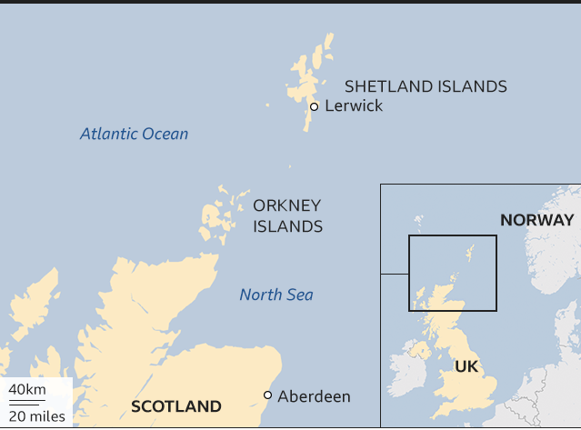
Shetland Islands Map: Towns, Regions & Travel Tips
Get to know the Shetland Islands with a detailed map featuring towns, key regions, and smart travel tips to help plan your visit with ease.
Author:Callum FraserJun 23, 2025595 Shares119K Views
The Shetland Islands are a group of remote, beautiful islands at the top of Scotland. A good map of Shetland doesn’t just show roads and towns, it shows how the islands connect, where the sea cuts in, and how nature shapes the land. It helps visitors and locals understand the place better and travelwith confidence.
Quick Facts About The Shetland Islands
- Location: Far north of mainland Scotland, halfway between Scotland and Norway
- Number of Islands: Over 100 islands, but only around 16 are inhabited
- Main Island: The largest island is called Mainland
- Capital: Lerwick
- Population: Around 23,000 people
- Language: English is spoken, with traces of old Norn in place names
- Wildlife: Known for Shetland ponies, puffins, seals, and seabirds
- Climate: Cool summers, mild winters, and lots of wind
- Famous Exports: Wool, knitwear, seafood (especially salmon and mussels)
- Transport: Reached by ferry or flights from mainland Scotland
- Culture: Strong Norse roots, celebrated in events like Up Helly Aa
- Unique Features: No trees in many areas, dramatic cliffs, and long summer days
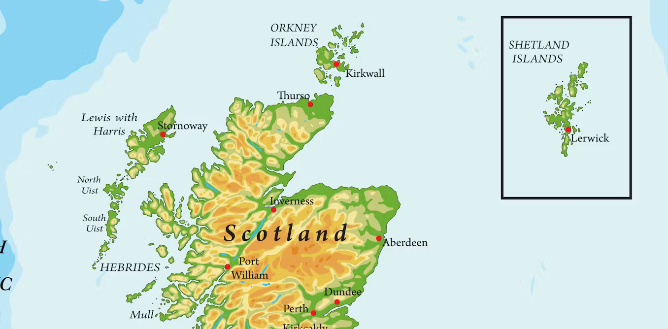
Geographical Overview Of Shetland Islands
The Shetland Islands are a group of over 100 islands located in the North Atlantic, about 170 km (105 miles) north of mainland Scotland. These islands are where the North Sea meets the Atlantic Ocean, giving the area a strong maritime character.
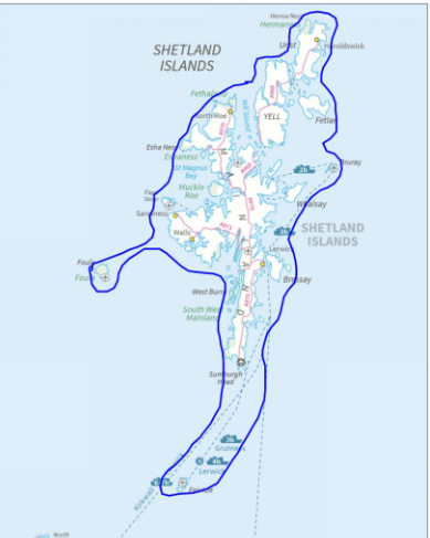
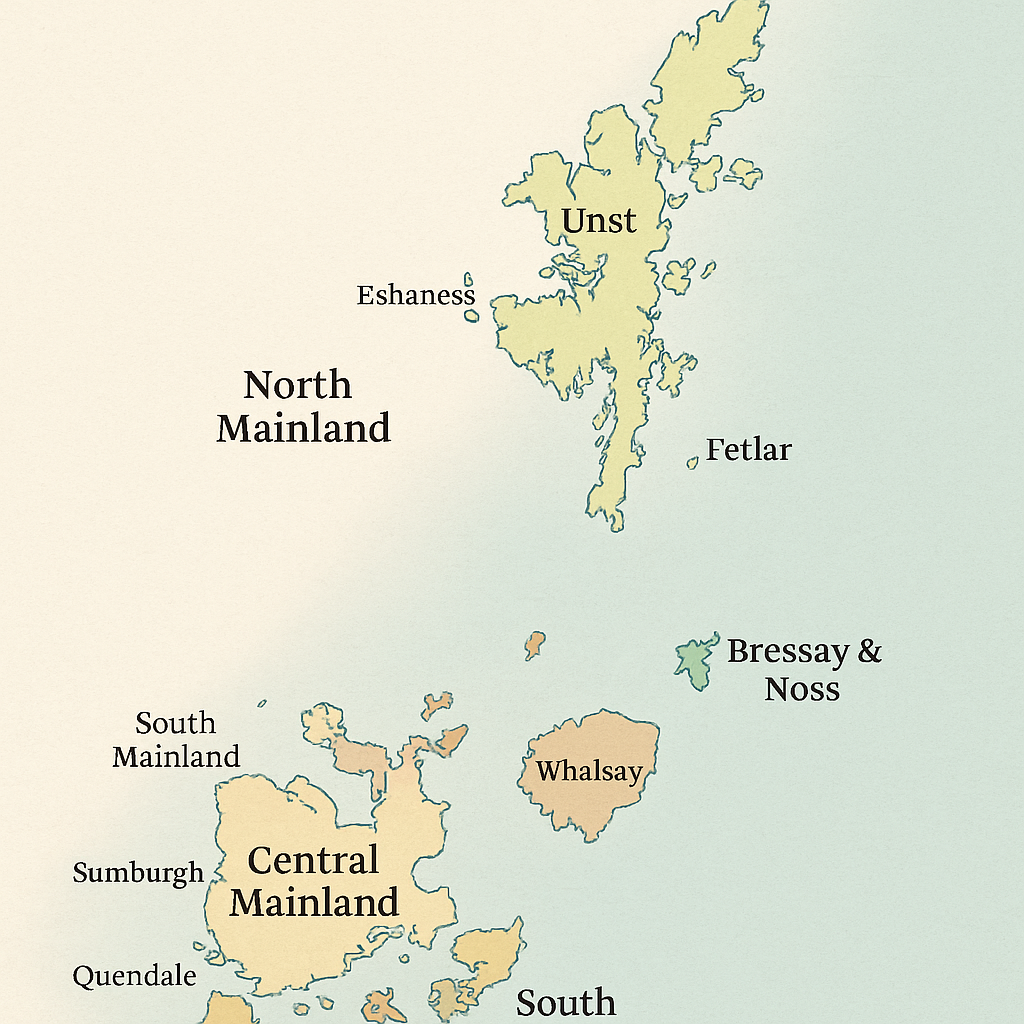
Shetland is the northernmost part of the United Kingdom. The main island, known as Mainland, is the largest and most populated. The other islands are scattered around it, including Yell, Unst, Bressay, Whalsay, and Fetlar. Only about 16 of the islands are inhabited.
The landscape is made up of dramatic cliffs, rolling hills, quiet beaches, and rocky coastlines. There are very few trees due to strong winds and salty air. Instead, you’ll find open moorland, peat bogs, and green fields filled with sheep and ponies. The islands are shaped by glaciers and the sea, giving them a rugged and remote beauty.
History Of Shetland Islands
Shetland’s history is long and layered, going back thousands of years. The earliest known people lived here around 4,000-5,000 years ago, leaving stone circles, burial cairns, and brochs, tower-like structures unique to Scotland.
Later, Shetland became part of the Norse world. From the 9th century, Vikings arrived from Norway and settled the islands. They brought their language, culture, and laws. This Norse influence was so strong that Norway ruled Shetland for over 500 years.
In 1469, Shetland was pledged as part of a dowry when the King of Denmark and Norway gave the islands to Scotland. Since then, Shetland has been part of Scotland and the UK, but its strong Norse roots are still seen in place names, traditions, and local pride.
Capital Of Shetland Islands
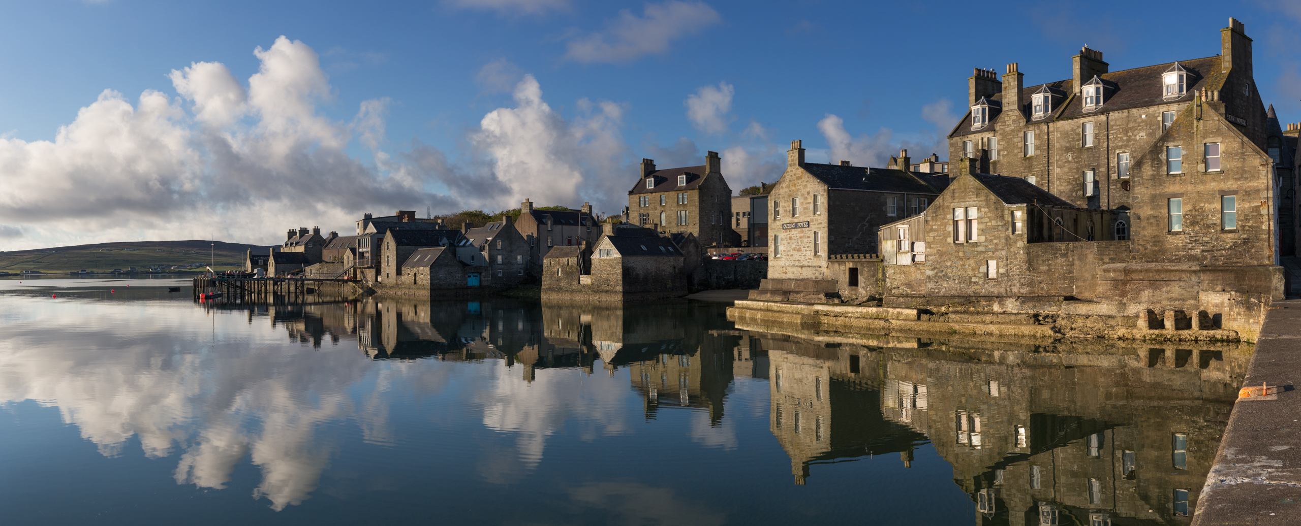
The capital of the Shetland Islands is Lerwick. It is located on the east coast of Mainland and is the islands’ largest town. Lerwick has a population of around 7,000 people, making it the main hub for travel, trade, and culture in Shetland.
Lerwick is a working harbour town with fishing boats, ferries, and cruise ships docking regularly. The town has narrow streets, old stone buildings, and a busy waterfront. It's home to Shetland Museum and Archives, Clickimin Broch, and several local shops, pubs, and art galleries.
The town also hosts the famous Up Helly Aa festivalevery January, where locals dress as Vikings and carry flaming torches through the streets in one of Scotland’s most dramatic fire festivals.
Regions On The Map Of Shetland Islands
The Shetland Islands are made up of many islands and areas, each with its own unique feel. On the map, the main regions are usually grouped by geography and the largest islands. These areas differ in landscape, wildlife, history, and community life. Here's a closer look at the key regions you’ll find across the map of Shetland.
South Mainland
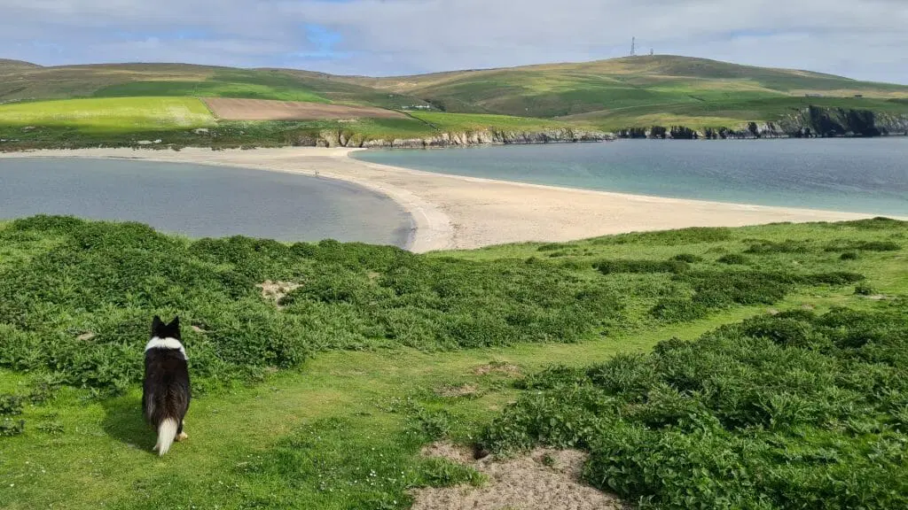
South Mainland is the southern part of the largest island in Shetland. It’s where you’ll find Sumburgh Airport, the main air link to the rest of Scotland. The area also includes Quendale, with wide sandy beaches, and St. Ninian’s Isle, famous for its tombolo, a natural sand causeway that links the island to the mainland.
South Mainland is rich in archaeology and history, with sites like Jarlshof, showing remains from thousands of years ago. The region feels quiet and open, with big skies and lots of sheep farms.
Central Mainland
This area is where most people in Shetland live. It includes Lerwick, the capital and busiest town, and Scalloway, the old capital on the west coast. Central Mainland has the most services, shops, and schools in the islands.
Roads here are better connected, and the landscape has green hills, deep inlets (called "voes"), and rolling farmland. It’s a practical and well-connected part of Shetland but still close to the sea and nature.
North Mainland
North Mainland feels wilder and more remote. It includes Brae, an important town for oil industry jobs, and Eshaness, a famous spot for dramatic cliffs formed by old volcanoes.
The area also stretches up to North Roe, where the land becomes rugged and hilly. North Mainland is perfect for people who love walking, nature, and peaceful views. You’ll see sea stacks, caves, and seabirds along the coast, with fewer houses and more open space.
Yell
Yell is one of the larger islands, just north of Mainland, reached by ferry. It’s long and narrow, with quiet roads and open moorland. The island has several small villages like Mid Yell, which has a school and services.
Yell is known for wildlife, especially otters, and birdwatchers often visit in spring and summer. The pace of life here is slow, and the landscapes feel untouched and peaceful.
Unst
Unst is the northernmost inhabited island in the UK. It has amazing Viking history and dramatic natural scenery. Places like Baltasound are quiet but have essentials like a post office and shop.
The island also has Hermaness Nature Reserve, home to puffins, gannets, and stunning sea cliffs. Unst feels remote and magical, with strong Norse roots and a small but welcoming community.
Fetlar
Fetlar is known as "The Garden of Shetland" because it’s greener and softer than other islands. It’s smaller and less visited, which makes it perfect for those looking for calm and space.
Birdlife is a big reason to visit, with rare birds like red-necked phalaropes and great skuas found here. The ferry from Unst or Yell brings visitors to this peaceful island with open land, quiet beaches, and simple beauty.
Bressay And Noss
Bressay is just across the water from Lerwick and easy to reach by a short ferry ride. It’s great for walking and offers lovely views back across the water to the capital. Noss, a smaller island nearby, is a national nature reserve.
In summer, it’s full of seabirds like puffins, fulmars, and guillemots. Both islands offer beautiful cliffs, coastal paths, and peaceful surroundings while still being close to town life.
Whalsay
Whalsay is often called “The Bonnie Isle” and has a strong fishing tradition. It’s home to a busy harbour and fishing fleet. The island also has a golf course, a school, and a close-knit community.
Fishing is a major part of life here, and the people are known for being hardworking and proud of their heritage. Whalsay is small but lively, with beautiful views and lots of local character.
Towns And Villages Of Shetland Islands Cities
Lerwick
Lerwick is the capital of Shetland and the largest town. It’s found on the east coast of the Mainland island. With around 7,000 residents, Lerwick is the heart of business, travel, and culture in the islands.
The harbour is always busy with ferries, fishing boats, and sometimes cruise ships. The town has shops, schools, a museum, and even a music and arts venue called Mareel. It’s also where the famous Viking fire festival, Up Helly Aa, is held each January.
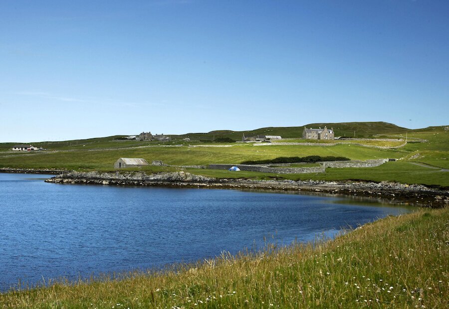
Scalloway
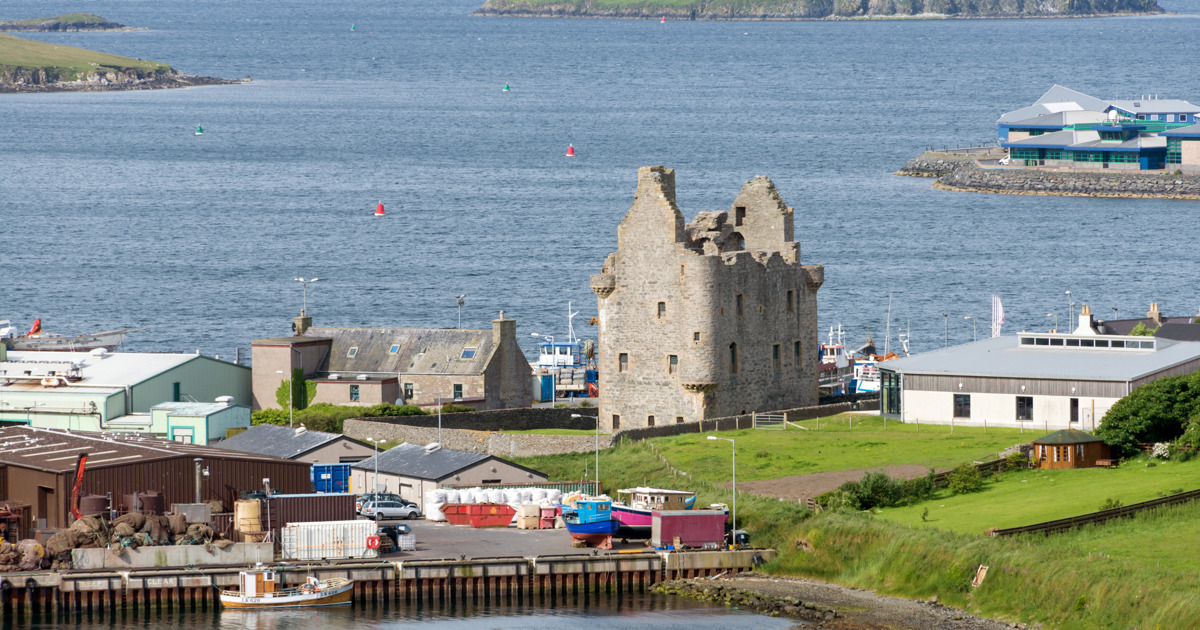
Scalloway was the old capital of Shetland before Lerwick took over in the 18th century. It sits on the west coast of Mainland, only a short drive from Lerwick. Scalloway is a peaceful fishing village with a historic harbour and its castle, Scalloway Castle, built in the early 1600s.
It has a small marina, a college campus, and beautiful sea views. The village also played a key role in World War II as a base for the secret "Shetland Bus" missions between Norway and Scotland.
Brae
Brae is a small town in the north of Mainland. It’s near Sullom Voe, one of the largest oil terminals in Europe, which brings important jobs to the area. Brae has grown because of this industry and now has a high school, a health centre, shops, and places to eat. It’s also near scenic places like Mavis Grind, where the North Sea and Atlantic Ocean are only a few metres apart.
Hillswick
Hillswick is a small, scenic village on the north-west coast of Mainland. It’s known for its dramatic sea cliffs, peaceful beach, and views of St Magnus Bay. There’s a beautiful old hotel by the sea and a wildlife sanctuary that cares for seals and other marine animals. Hillswick is a popular stop for people who love nature, walking, and birdwatching.
Sandwick
Sandwick is a growing village in the south of Mainland. It sits between Lerwick and Sumburgh Airport, making it a convenient place to live or visit. The community has a school, shops, and sports facilities. It’s also close to Hoswick, a small nearby area known for its knitwear shops and coastal walks. Sandwick is a family-friendly area with strong local spirit.
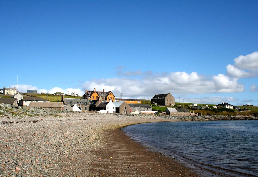
Baltasound (Unst)
Baltasound is the main village on the island of Unst, which is the northernmost inhabited island in the UK. This makes Baltasound the northernmost village in Britain. The area is quiet and remote but full of history, with Viking sites and beautiful natural views. You’ll find a small airport, a post office, and even a bus service. It’s a good base for exploring Hermaness Nature Reserve, known for puffins and dramatic cliffs.
Mid Yell (Yell)
Mid Yell is the main settlement on the island of Yell, located just north of Mainland. It has a school, a health centre, and a ferry terminal connecting it to other islands. Mid Yell sits by a long, sheltered voe (inlet), making it a calm and beautiful place to live. It’s also a good place for spotting otters and seabirds. Yell itself is peaceful and covered with moorland, giving it a wild, open feel.
Population Of Shetland Islands
The Shetland Islands have a population of about 23,000 people. Most live on Mainland, with Lerwick alone home to nearly one-third of the total. The rest of the population is spread across other inhabited islands such as Yell, Unst, Whalsay, and Bressay.
People in Shetland often live in small, tight-knit communities. Many families have lived on the islands for generations, and there’s a strong sense of identity. Daily life often revolves around fishing, farming, local crafts, oil-related jobs, and tourism.
Types Of Shetland Islands Map

Different maps show different sides of Shetland. Depending on what you're looking for, here are the main types of maps available:
- Political Map: Shows towns, villages, roads, and ferry routes. Good for planning travel or understanding how the islands are connected.
- Topographic Map: Displays the shape of the land, hills, valleys, cliffs. Ideal for hikers, climbers, and anyone interested in terrain.
- Tourist Map: Includes points of interest, museums, historic sites, walking routes, and scenic spots. Usually designed with visitors in mind.
- Wildlife & Nature Map: Highlights nature reserves, bird-watching areas, and places with rare plants or animals.
- Historical Map: Focuses on Viking sites, old settlements, and archaeological digs. Useful for those interested in the islands’ past.
- Geological Map: Used by scientists or rock enthusiasts to show the different rock types and fault lines across Shetland.
Each map has its purpose, and combining them can offer a full picture of Shetland, both natural and man-made.
Digital Mapping & GPS In Shetland
Digital maps have their place, but they’re not foolproof in Shetland. Remote areas may have no signal, and fog can affect GPS accuracy.
Recommended tools:
- OS Maps App: Reliable topography and trail info
- Komoot: Good for cyclists and walkers
- ViewRanger: Strong for route planning offline
Use satellite view cautiously, cloud cover often obscures Shetland. Always carry a paper map as backup, especially when hiking.
Transportation Networks Across The Islands
Getting around the Shetland Islands is a unique experience. Although the islands are remote, the transport system is well-organized and connects even the farthest communities.
- Road Travel: Most islands have well-maintained roads, especially on Mainland. Roads are often single-track, with passing places for vehicles to let each other by. Renting a car is the most flexible way to travel.
- Ferries: Ferries are essential in Shetland. Inter-island ferries connect Mainland with places like Yell, Unst, Fetlar, Whalsay, and Bressay. The services are regular and run year-round.
- Air Travel: Small planes operate flights between Tingwall Airport (near Lerwick) and outer islands like Foula and Fair Isle. These are mostly used by locals or visitors on tight schedules.
- Buses: Shetland has a reliable public bus system linking major towns and villages. While it may not cover every small road, it’s affordable and useful for getting around.
- Cycling & Walking: Many visitors choose to cycle or walk. The roads are quiet and the views are stunning, making it perfect for slow travel.
Shetland’s transport system may seem simple, but it’s efficient, and a map helps a lot in planning your route across sea and land.
Total Area Of Shetland Islands
The Shetland Islands cover a total area of about 1,468 square kilometers (or 567 square miles). This includes more than 100 islands, although only around 16 are inhabited.
- Mainland, the largest island, makes up about 60% of the total land area.
- The rest is made up of smaller islands like Yell, Unst, Fetlar, and Bressay.
The coastline stretches for over 1,600 kilometers, thanks to the many inlets, fjords (voes), and bays. This makes Shetland one of the most coastal regions in the UK, and a map clearly shows just how broken and dramatic the land shapes are.
Despite their size, the islands feel much bigger because of the space, open views, and sea all around.
Natural Wonders On The Map Of Shetland Islands
The Tombolo At St. Ninian’s Isle
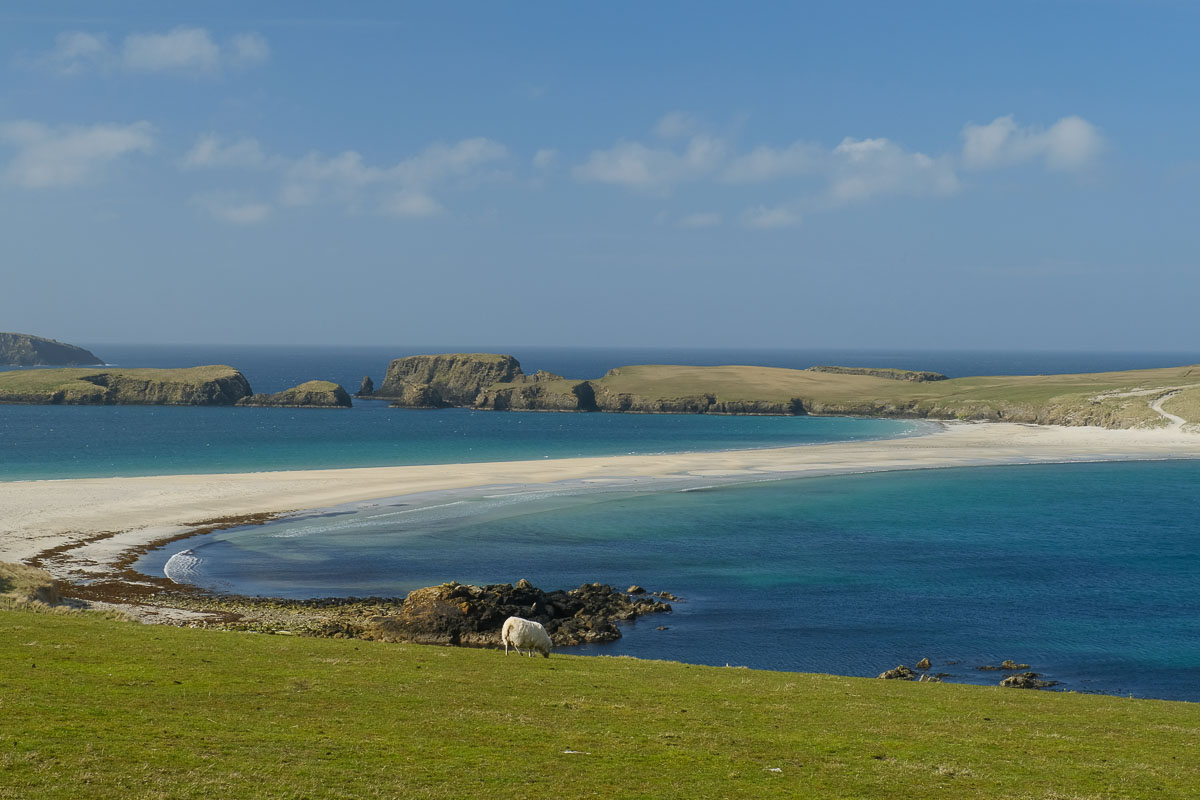
This is one of the most famous natural sights in Shetland. A tombolo is a narrow strip of sand that connects an island to the mainland. The one at St. Ninian’s Isle is a perfect example and one of the best in Europe. It looks like a golden path across the sea. Visitors can walk across this sandy stretch to reach the island, where they’ll find peaceful views and ruins of an old chapel.
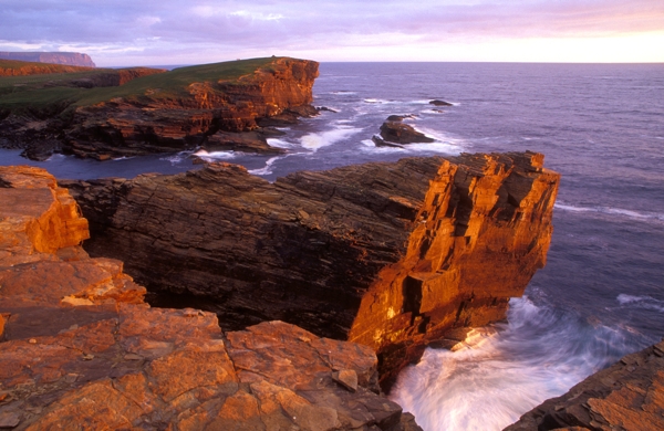
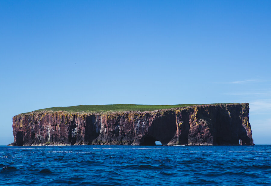
The Cliffs Of Eshaness
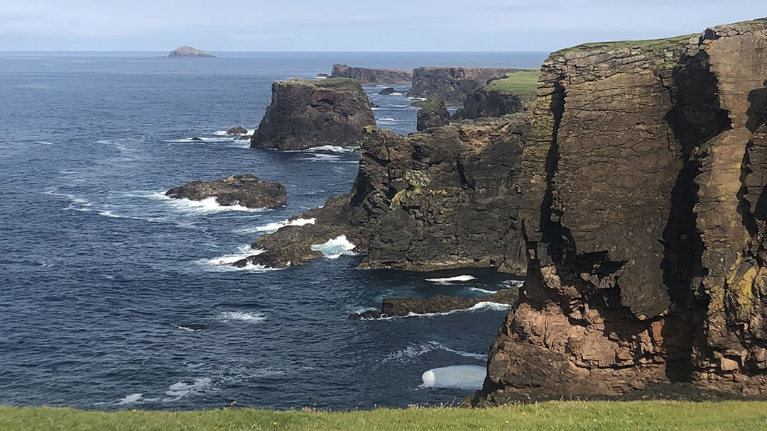
The Eshaness Cliffs on the northwest coast of Mainland are tall, dark, and powerful. These cliffs were created by volcanic eruptions over 350 million years ago. Today, they rise straight out of the sea and are shaped by strong waves and wind. The views from the top are stunning, with sea stacks, blowholes, and deep inlets. It's a favorite place for walkers, photographers, and people who love geology.
Hermaness Nature Reserve
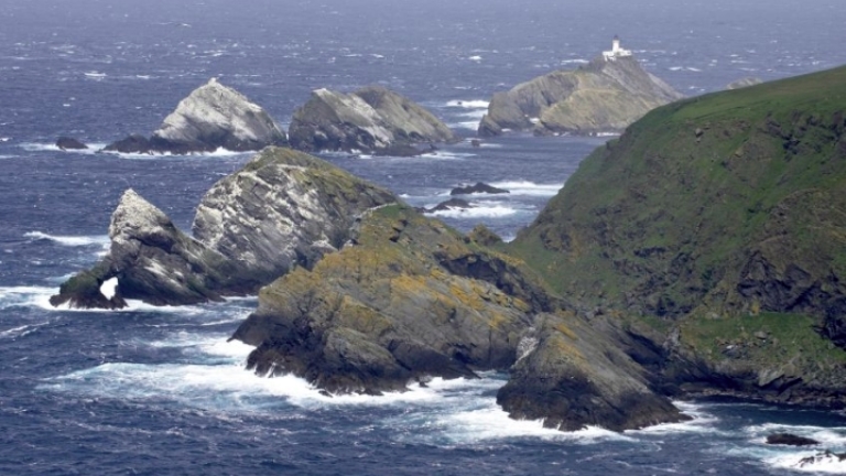
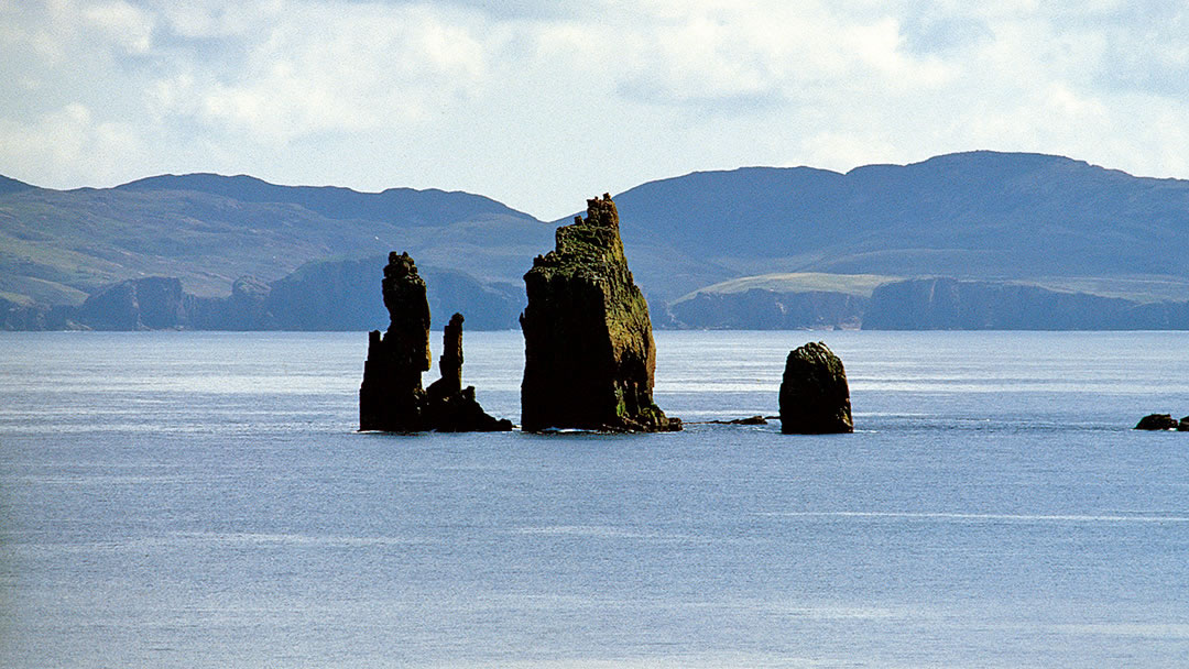
Found at the northern tip of Unst, this wild nature reserve is home to thousands of seabirds, including puffins, gannets, fulmars, and skuas. The cliffs here are high and dramatic, and the land is covered in moorland. From the reserve, you can also see Muckle Flugga, one of the most famous lighthouses in the UK. Hermaness is a peaceful, untouched place that shows Shetland’s raw natural beauty.
The Sea Caves Of Papa Stour
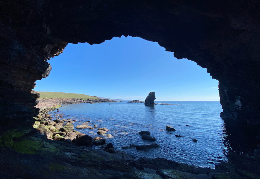
Papa Stour is an island on Shetland’s west coast, known for its amazing sea caves. These caves are some of the biggest and most beautiful in Britain. Many visitors go by kayak or boat to see the caves from the water. Inside, you’ll find clear blue pools, echoing chambers, and even natural arches. It’s a magical experience, especially when sunlight shines through the sea water.
The Mousa Broch And Its Natural Setting
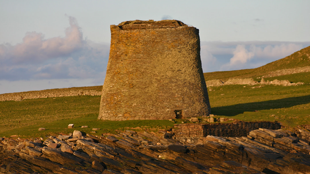
While the Mousa Broch is man-made, it stands in a quiet natural area filled with wildlife. This ancient stone tower is over 2,000 years old and still nearly complete. Around it, visitors often see seals, seabirds, and sometimes even otters along the shore. The island of Mousa is peaceful and green, with easy walking paths and sea views all around.
Foula Island
Foula is one of the most remote inhabited islands in the UK. On the map, it lies far west of Mainland Shetland, standing almost alone in the sea. The island has some of the tallest sea cliffs in Britain, reaching over 1,200 feet. It’s also home to large seabird colonies, with birds like bonxies and guillemots nesting on the cliffs. Foula is hard to get to, but it offers a feeling of pure wilderness that’s hard to match.
Must-Visit Locations For Map-Savvy Travelers
- Scalloway:Scalloway was once the capital of Shetland and is now a peaceful village with colourful houses and a quiet harbour. The highlight here is Scalloway Castle, built in the early 1600s. It’s a great spot for people who love history. The village also has a small museum and lovely coastal views. It sits just west of Lerwick and is easy to reach by road.
- Sumburgh Head:At the southern tip of Mainland, Sumburgh Head is famous for its lighthouse and nature reserve. From April to August, you can see puffins nesting in the cliffs. There's a visitor centre inside the lighthouse buildings where you can learn about local wildlife and history.
- St. Ninian’s Isle:St. Ninian’s Isle is connected to Mainland by a natural sand bridge called a tombolo. It’s a rare and beautiful place to visit. You can walk across the sand when the tide is low to reach the island. There are old church ruins and views of the sea all around. It’s peaceful, scenic, and perfect for walking or taking photos.
- Jarlshof:Jarlshof is one of the most important archaeological sites in Shetland. It has remains from different times in history, from the Stone Age to the Viking era. You can see stone houses, walls, and even a Norse longhouse. A small visitor centre explains the history of the site.
- Hermaness (Unst):Hermaness is a wild and beautiful nature reserve on Unst, the northernmost island in the UK. The cliffs are tall and dramatic, and they are home to thousands of seabirds like gannets and puffins. You can take a long walk to the coast and see the sea crashing against the rocks.
- Eshaness Cliffs:The Eshaness Cliffs are on the northwest coast of Mainland. These cliffs were formed by volcanic eruptions millions of years ago and have strange shapes and dark rocks. They’re great for walking and taking photos, especially when the sea is rough. The nearby Eshaness Lighthouse is also worth seeing.
- Fetlar: Fetlar is often called the “Garden of Shetland” because of its green fields and soft landscapes. It’s quieter than some other islands, making it a good place for birdwatching and peaceful walks. Red-necked phalaropes, a rare bird, are found here. There are also beaches, hills, and a small museum. You can reach Fetlar by ferry from Yell or Unst.
- Bressay & Noss:These two islands are just east of Lerwick and are easy to visit. Bressay is good for walking and has lovely views back toward the mainland. You can also visit old churches and a lighthouse. From Bressay, you can take a small boat to Noss, a nature reserve famous for its seabird colonies, cliffs, and peaceful walking trails.
- Muckle Flugga:Muckle Flugga is one of the most famous landmarks in Shetland. It’s a tall lighthouse sitting on a rocky island at the very top of Unst nand the edge of the UK. You can’t visit the lighthouse itself, but you can get a good view of it from the Hermaness cliffs.
- Mousa Broch:Mousa is a small uninhabited island off the east coast of Mainland, best known for the Mousa Broch the best-preserved Iron Age tower in the world. This round stone building stands over 13 metres tall and has been standing for around 2,000 years.
- Papa Stour:Papa Stour is a rugged island off the west coast of Mainland, known for its sea caves, natural arches, and geological features. It’s perfect for adventurous travelers and those who enjoy coastal walks. The island is rich in folklore and has historic sites, including old Viking settlements.
How To Use The Map Of Shetland Islands
1. Find The Main Islands
Start by locating Mainland, the largest island where most of the population lives. From there, look for the other main islands:
- Yell, Unst, and Fetlar in the north
- Bressay near Lerwick
- Whalsay to the east
- Papa Stour and Foula to the west. Each island has its charm and key features marked on most maps.
2. Look For Settlements And Roads
Most towns and villages in Shetland are small, but important to know when traveling. A map will show places like:
- Lerwick (the capital)
- Scalloway, Brae, Sandwick, and more.You can also see the network of single-track roads, bridges, and ferry crossings that connect the islands.
3. Identify Ferry Routes
Maps of Shetland often show ferry lines between islands. These routes are essential for moving between places like Yell, Unst, and Fetlar. Knowing where ferry terminals are located helps when planning day trips or island hopping.
4. Spot Natural Landmarks
Many maps highlight key natural features, like:
- Cliffs (e.g., Eshaness)
- Nature reserves (e.g., Hermaness)
- Ancient ruins (e.g., Jarlshof). These are useful for hikers, nature lovers, and photographers who want to plan scenic routes.
5. Use Walking Trail Maps
Special tourist maps often include walking routes, especially near coastal paths, nature reserves, and archaeological sites. These can help you enjoy quiet parts of Shetland without getting lost.
6. Understand Distances And Scale
Shetland may look small on a map, but driving or walking between places can take longer than expected due to narrow roads and weather conditions. Check the map’s scale to estimate travel times.
7. Offline Maps Are Handy
Phone signal can be weak in remote areas. It's smart to download offline maps or carry a printed map if you're going to less-traveled islands like Foula, Papa Stour, or Fair Isle.
Interesting Facts About The Shetland Islands
1. Shetland Is Closer To Norway Than To London
The Shetland Islands may be part of Scotland, but they're actually much closer to Norway than to the UK’s capital. Located about 170 km (105 miles) from the coast of Norway and over 950 km (590 miles) from London, Shetland’s location has strongly influenced its culture, traditions, and even its language.
2. The Famous Shetland Ponies Come From Here
Shetland ponies are one of the most iconic animals in the world, and they come from these islands. These small, sturdy ponies have lived in Shetland for over 2,000 years. They were once used for pulling carts and carrying heavy loads across rough terrain. Today, they’re mostly known for their cute looks and gentle nature, often seen in paddocks along the roadside or on farms across the islands.
3. Up Helly Aa Is One Of The World’s Most Unique Festivals
Held every January in Lerwick, Up Helly Aa is a massive fire festival where locals dress up as Vikings, carry flaming torches, and march through the town. The event ends with the dramatic burning of a Viking-style longship. It’s a celebration of Shetland’s Viking past and is entirely organized by volunteers.
4. There Are Over 100 Islands In The Archipelago
Shetland is made up of over 100 islands, although only about 16 are currently inhabited. The rest are untouched, wild, and full of birds, seals, and wildflowers. The largest island is simply called "Mainland," which holds most of the population and the capital, Lerwick.
5. You Can See The Northern Lights From Shetland
Because Shetland is so far north, it's one of the best places in the UK to see the Aurora Borealis, or Northern Lights. These glowing green and purple lights dance across the night sky in winter, especially from November to February. While sightings aren’t guaranteed, clear skies and low light pollution make Shetland an excellent place for stargazing and sky-watching.
6. Shetland Has Its Own Dialect With Norse Influence
Locals often speak a dialect known as Shetlandic, which is a form of Scots with many words and place names borrowed from Old Norse. This is a result of centuries of Norse rule, from around 800 to 1469. You’ll see signs with words like "voe" (bay), "geo" (a sea inlet), or "holm" (small island).
7. Puffins And Seabirds Thrive Across The Islands
Shetland is a birdwatcher’s paradise. Each summer, thousands of puffins return to breed on the steep cliffs of places like Sumburgh Head, Hermaness, and Noss. These colorful birds dig burrows in the ground and are surprisingly small in real life. In addition to puffins, you can see gannets, guillemots, razorbills, and even sea eagles, making the islands a key spot for birdlife in Europe.
8. Mousa Broch Is The Best-Preserved Iron Age Tower In The World
The Mousa Broch is an ancient round stone tower built around 2,000 years ago. It stands nearly 13 meters (43 feet) high and is still mostly intact, something rare for buildings of its age. Located on the uninhabited island of Mousa, it can be reached by boat during summer.
9. The Oil Industry Transformed Shetland In The 1970s
In the 1970s, oil was discovered in the North Sea, and Shetland’s quiet economy changed almost overnight. The construction of Sullom Voe Terminal, once one of Europe’s biggest oil ports brought money, jobs, and new infrastructure to the islands.
10. Shetland Is Wild, Peaceful, And Full Of Natural Beauty
One of the most remarkable things about Shetland is how untouched it feels. You can walk for hours without meeting anyone, surrounded by sea views, heather-covered hills, and ancient ruins. From high cliffs and quiet beaches to deep lochs and open moorland, the islands offer a peaceful escape for anyone who loves nature.
People Also Ask
Where Are The Shetland Islands Located?
The Shetland Islands are in the far north of Scotland, between mainland Scotland and Norway. They sit in the North Sea and are the northernmost part of the United Kingdom.
Who Controls Shetland?
The Shetland Islands Council is the local authority for the Shetland Islands, one of the 32 council areas of Scotland.
How Many Islands Make Up Shetland?
There are more than 100 islands in Shetland, but only about 16 are inhabited. The rest are small, wild, and full of birds and sea life.
What Are Shetland Ponies Known For?
Shetland ponies are small, strong horses native to the islands. They are friendly, tough, and used to cold weather. People love them for their cute look and gentle nature.
What Language Do People Speak In Shetland?
People speak English, but many locals also use a Shetland dialect that includes old Norse words. This mix gives the islands a unique sound and feel.
Final Thoughts
Maps bring the Shetland Islands to life. They help you see hidden roads, quiet harbours, and the wide spaces between each island. With the right map, it’s easier to plan your journey, find the best views, and feel more connected to this unique part of Scotland.
Jump to
Quick Facts About The Shetland Islands
Geographical Overview Of Shetland Islands
History Of Shetland Islands
Capital Of Shetland Islands
Regions On The Map Of Shetland Islands
Towns And Villages Of Shetland Islands Cities
Population Of Shetland Islands
Types Of Shetland Islands Map
Digital Mapping & GPS In Shetland
Transportation Networks Across The Islands
Total Area Of Shetland Islands
Natural Wonders On The Map Of Shetland Islands
Must-Visit Locations For Map-Savvy Travelers
How To Use The Map Of Shetland Islands
Interesting Facts About The Shetland Islands
People Also Ask
Final Thoughts

Callum Fraser
Author
Callum Fraser isn't just a writer about Scotland; he's a product of its rugged landscape and rich history. Born and raised in Perthshire, with the Highlands as his backyard, his love for the nation's stories was kindled by local storytellers and long walks through ancient glens.
This passion led him to pursue a degree in Scottish History from the University of Edinburgh. For over 15 years, Callum has dedicated himself to exploring and documenting his homeland, fusing his academic knowledge with essential, on-the-ground experience gained from charting road trips through the Cairngorms, hiking the misty Cuillins of Skye, and uncovering the secrets of traditional recipes in his family's kitchen.
As the Editor-in-Chief and Lead Author for Scotland's Enchanting Kingdom, Callum's mission is simple: to be your most trusted guide. He combines meticulous research with a storyteller's heart to help you discover the authentic magic of Scotland — from its best-kept travel secrets to its most cherished traditional recipes.
Latest Articles
Popular Articles