Dumfries And Galloway Forest Park Map For Hikers & Visitors
Your essential Dumfries and Galloway Forest Park map guide. Find the best trails, wildlife spots and Dark Sky locations across Scotland’s largest forest park.
Author:Callum FraserDec 11, 202549.8K Shares803.5K Views
Galloway Forest Park, often called Dumfries and Galloway Forest Park, is a vast landscape of rugged hills, mirror-still lochs, deep forests, and some of Europe’s darkest skies. With so much ground to cover, a detailed Dumfries and Galloway Forest Park mapcan make all the difference.
This guide shows you how to use that map to find the best hikes, bike routes, wildlife spots, and stargazing areas across the park. Get ready to explore one of Scotland’s wildest and most beautiful places.
Quick Facts About Dumfries And Galloway Forest Park
- Location:Dumfries and Galloway, southern Scotland
- Size:774 square kilometers (299 square miles), the largest forest park in the UK
- Established:1947
- Governing Body:Forestry and Land Scotland
- Visitor Numbers:Over 800,000 visitors annually
- Visitor Centres:Three main centres at Glentrool, Kirroughtree, and Clatteringshaws, each receiving around 150,000 visitors per year
- Dark Sky Status:First UK Dark Sky Park, designated in 2009, known for some of the darkest skies in Europe, ideal for stargazing
- Terrain:Includes the Galloway Hills and the highest peak in the Southern Uplands, Merrick (2,766 ft)
- Outdoor Activities:Offers hillwalking, rock climbing, ice climbing, mountain biking (part of the 7stanes network), fishing, and scenic drives
- Timber Production:Produces about 500,000 tons of timber annually, with a large portion of non-native tree species like Sitka spruce dominating the forest
- Wildlife:Home to red deer, wild goats, red kites, otters, and rich birdlife
- Cultural Note:Subject of a BBC documentary series "The Forest" aired in 2018, highlighting life in and around the park
Geographical Overview Of Dumfries And Galloway Forest Park
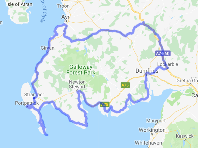
Dumfries and Galloway Forest Park is located in the southwest of Scotland. It covers a large area of about 774 square kilometers (299 square miles), making it the biggest forest park in the UK. The park lies mainly within the historic counties of Kirkcudbrightshire and Wigtownshire, inside the Dumfries and Galloway council area.
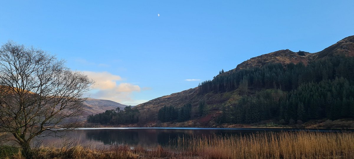
The landscape is full of hills, forests, and lochs, including part of the Galloway Hills. The park is known for its rough but beautiful terrain, perfect for hiking, biking, and wildlife watching.
It also has special status as the first Dark Sky Park in the UK, meaning it has very little light pollution, ideal for stargazing. The park was created in 1947 and is managed by Forestry and Land Scotland.
Towns And Small Cities Around The Forest Park
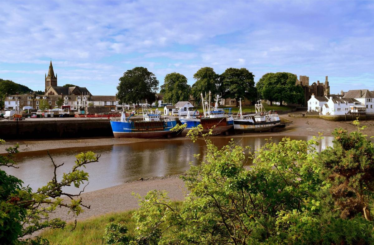
Dumfries
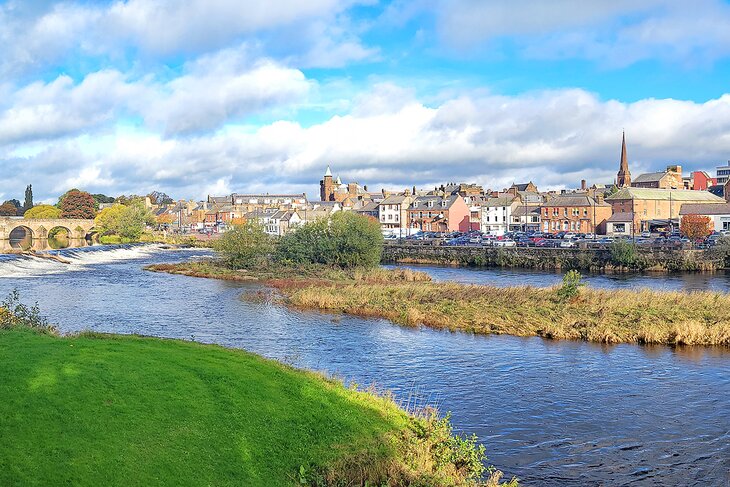
Dumfries is the largest town near the forest park and acts as the main center for the whole Dumfries and Galloway region. It lies on the banks of the River Nith and has a rich history, including links to the famous Scottish poetRobert Burns.
Dumfries offers a wide range of services, such as shops, restaurants, hotels, and transport connections, making it a convenient place for visitors to stay before or after visiting the forest park. It also has cultural attractions like museums, theaters, and historic buildings.
Stranraer

Stranraer is a coastal town located to the west of the forest park. It is an important ferry port, providing connections to Northern Ireland, which makes it a key travelhub in the region. The town has a mix of modern amenities and historic sites, including old castles and a harbor area popular with visitors.
Stranraer is surrounded by beautiful countryside and is close to the Rhins Peninsula, known for its scenic coastal walks and wildlife. Visitors often use Stranraer as a base for exploring the western parts of Dumfries and Galloway and the nearby forest park. While it has a more relaxed pace than larger Scottish cities, Stranraer offers plenty for those looking to enjoy coastal charm and local history.
Castle Douglas

Castle Douglas is a small market town known as the "Food Town" because of its many local food producers and specialty shops. It has a lively town center with cafes, bakeries, and farmers’ markets that attract visitors interested in fresh, local produce.
The town is located north of the forest park and serves as a good stopping point for travelers exploring the area. Castle Douglas also hosts events and festivals throughout the year, celebrating local culture and food. Its friendly atmosphere and charming streets make it a pleasant place to visit.
Newton Stewart
Newton Stewart is a small town situated close to the northern edge of Galloway Forest Park. It is often called the "Gateway to the Galloway Hills" because of its location near popular hiking and biking trails. The town offers essential services such as shops, accommodation, and cafes, making it a convenient base for outdoor enthusiasts.
Newton Stewart has a quiet, welcoming feel and is surrounded by beautiful countryside, including rivers and forests. It’s a great place to relax after a day of adventure in the forest park.
Kirkcudbright
Kirkcudbright is a historic town located near the coast, east of the forest park. Known as the "Artists' Town," it has a strong creative community and many art galleries and studios. The town features a picturesque harbor, cobbled streets, and old buildings that reflect its long history.
Kirkcudbright is popular with visitors who enjoy culture, history, and seaside views. It also offers access to coastal walks and nearby natural reserves. The town’s unique blend of art, history, and nature makes it a special place to visit when in the Dumfries and Galloway area.
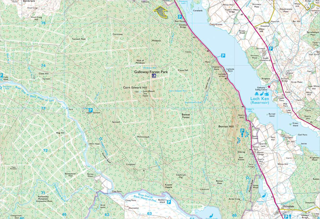
Regions On The Map Of Dumfries And Galloway Forest Park
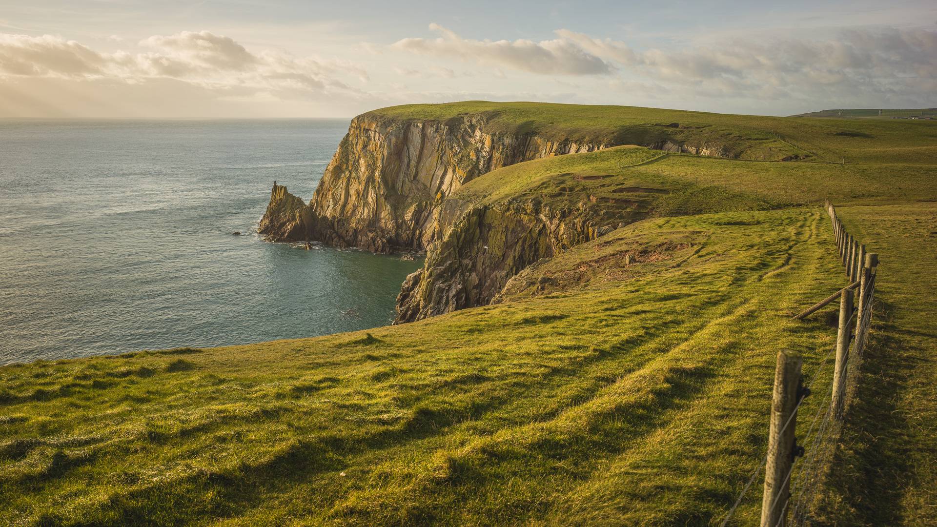
Galloway Hills
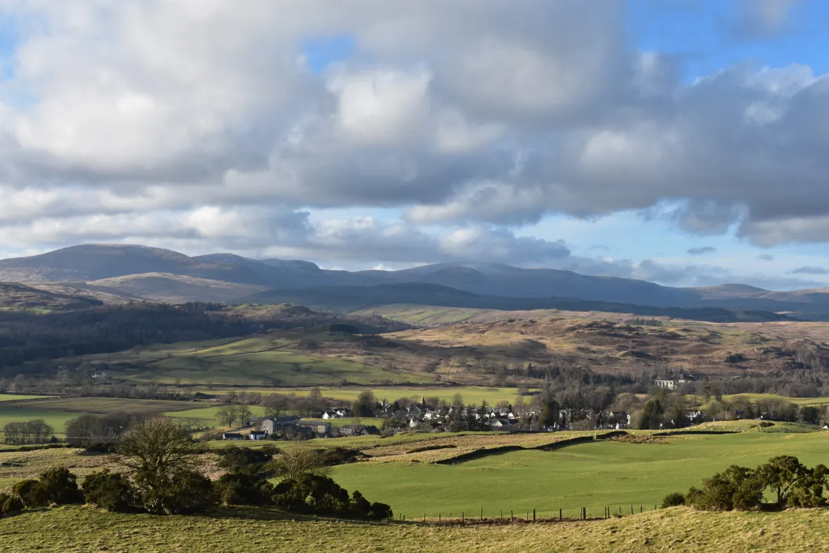
The Galloway Hills are a large, wild area inside Dumfries and Galloway Forest Park. This region has many high hills and open spaces, including Merrick, the highest peak in the Southern Uplands. The hills are rough and rocky, making them popular with serious walkers and climbers.
The landscape is full of heather, streams, and forests. It offers peaceful nature and great views but can be challenging to explore, so visitors should be prepared. The Galloway Hills form the heart of the park’s natural beauty.
Glentrool
Glentrool is a valley area in the northern part of the forest park. It is known for its calm lochs (small lakes), forests, and walking trails. The Glentrool Visitor Centre is a key spot here, providing information, parking, and facilities for visitors.
This region is great for gentle walks, wildlife watching, and enjoying quiet nature. It is less rugged than the Galloway Hills but still offers beautiful scenery and a chance to see deer, birds, and other animals.
Clatteringshaws
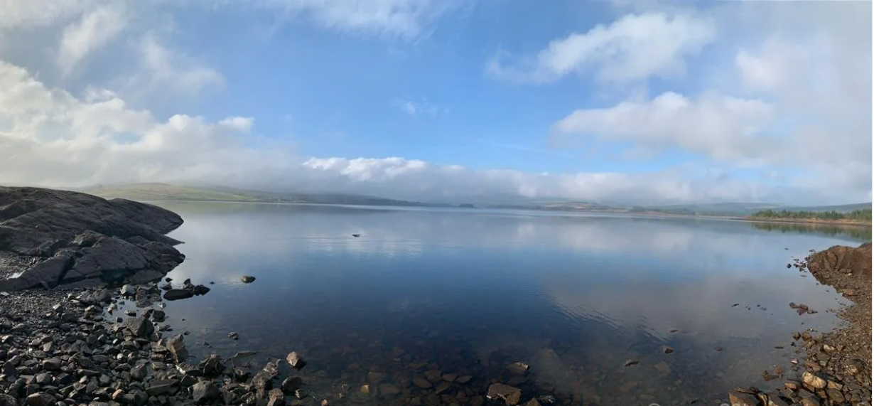
Clatteringshaws is a forested area with a large loch (Clatteringshaws Loch) in the park’s southern part. It is famous for its Dark Sky status, meaning it has very little light pollution, making it perfect for stargazing at night.
The Clatteringshaws Visitor Centre offers information and services for visitors. The area has walking trails, picnic spots, and places to relax by the water. It is a peaceful region where visitors can enjoy both daytime nature and clear night skies.
Kirroughtree
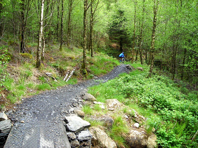
Kirroughtree is a popular area in the forest park known for outdoor activities. It has a visitor centre that acts as a hub for mountain biking, walking, and nature watching. Kirroughtree is part of the 7stanes mountain biking trail network, attracting cyclists of all levels. The area also has family-friendly trails and wildlife hides for spotting animals like red squirrels and deer. Kirroughtree combines adventure with easy access to facilities.
The Rhins Peninsula
The Rhins Peninsula lies to the west of the forest park and is known for its long coastline and scenic views. It includes the Mull of Galloway, the southernmost point of Scotland, famous for its lighthouse and dramatic sea cliffs.
The peninsula has beaches, walking paths, and small villages. While not heavily forested like the main park, it is an important natural and cultural region nearby, offering coastal landscapes and wildlife.
The Machars

The Machars is a low-lying peninsula to the south of the forest park, stretching into the Solway Firth. It is known as the cultural heart of Galloway with rich history, including early Christian sites like Whithorn. The area has a mix of farmland, peatlands, and small woodlands.
The Machars coastline features sandy beaches and mudflats, important for birds and other wildlife. It is a quieter, rural region with many archaeological sites and natural beauty.
Thornhill Uplands
The Thornhill Uplands lie to the northeast of the forest park and include rolling hills, upland glens, and river valleys. This region is known for its scenic landscapes, including the Dalwhat, Shinnel, and Scaur glens.
It also features historic sites like Drumlanrig Castle. The area is less forested but offers peaceful countryside walks and a chance to see traditional farming landscapes. It forms part of the wider Dumfries and Galloway natural region.
Total Area Of Dumfries And Galloway Forest Park
Dumfries and Galloway Forest Park covers a total area of about 774 square kilometers (299 square miles). This makes it the largest forest park in the United Kingdom. Established in 1947, the park includes vast woodlands, hills, lochs, and open spaces, offering a wide range of outdoor activities. Its large size means visitors can enjoy everything from gentle walks to challenging mountain hikes within the park’s boundaries.
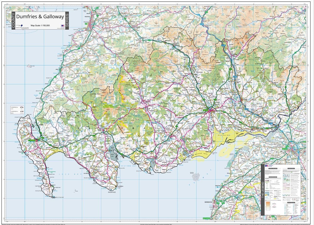
Types Of Dumfries And Galloway Forest Park Map
There are several types of maps available for Dumfries and Galloway Forest Park, each serving different needs:
- Official Visitor Centre Maps:These maps are available at the park’s three main visitor centres (Glentrool, Kirroughtree, Clatteringshaws). They show key trails, visitor facilities, viewpoints, and parking areas. These maps are designed for general visitors and are easy to read.
- Topographic Maps:Ordnance Survey maps at scales like 1:25,000 offer detailed information about the terrain, including contour lines, elevation, and natural features. These are useful for hikers and climbers who need precise navigation.
- Mountain Biking Maps:Specialized maps highlight the 7stanes mountain biking trails within the park, showing trail difficulty, routes, and bike facilities.
- Digital Maps and Apps:Many digital versions of the park maps are available as downloads or through GPS apps. These often include interactive features, GPS tracking, and updated trail information.
- Themed Maps:Some maps focus on specific interests such as wildlife watching spots, Dark Sky viewing areas, or historical sites within the park.
Walking And Hiking Routes
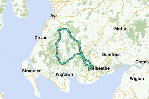
Dumfries and Galloway Forest Park presents a vast network of trails, catering to walkers and hikers of all experience levels. Whether you're seeking a gentle family stroll or an ambitious mountain ascent, understanding how to interpret the park map is key to a safe and enjoyable experience. The map is designed to provide essential information, enabling you to choose routes that match your abilities and interests.
Decoding Trail Information
Trail Grading Symbols
The map provides crucial information about trail lengths and elevation profiles. Knowing the distance helps estimate the time required, while understanding elevation changes prepares you for the physical demands of the route. Contour lines on topographic maps illustrate the steepness of slopes, enabling informed decisions about your capabilities.
Understanding Distance And Elevation
The map uses distinct symbols to indicate trail difficulty. Easy routes are often marked with green circles, signifying gentle terrain suitable for families and casual walkers. Moderate routes, indicated by blue squares, typically involve some inclines and uneven surfaces, ideal for those with reasonable fitness. Challenging hikes, denoted by red diamonds or black diamonds, signify steep ascents, rugged terrain, and longer distances, demanding good physical condition and hiking experience.
Key Map Features
- Waymarking Systems: The park employs a color-coded waymarking system to guide hikers. Each trail is assigned a specific color, with corresponding markers placed along the route. Note the color associated with your chosen trail on the map and follow those markers closely to stay on course.
- Points of Interest (POIs): The map highlights various points of interest along the trails, including scenic viewpoints, waterfalls, historic sites, and unique natural features. Use these markers to plan stops and enrich your hiking experience.
- Safety Considerations:
Popular Hiking Routes
- Family-Friendly: Stroll along the shores of Loch Trool. This easy, relatively flat path offers stunning views of the loch and surrounding mountains. It's ideal for families with young children and those seeking a leisurely walk in nature.
- Moderate Walks: Discover Spout Head Waterfall. This route takes you through forested areas to a picturesque waterfall. It involves some moderate inclines and uneven terrain, providing a satisfying hike for those with a reasonable level of fitness.
- Challenging Hikes: Climb the Merrick. Ascending the Merrick, the highest peak in southern Scotland, is a demanding but rewarding hike. This route involves steep ascents, rocky terrain, and exposure to the elements. It's suitable for experienced hikers with good physical condition and navigational skills.
Additional Tips
- Consult Local Resources: Before embarking on your hike, check with the park's visitor centers or website for updated trail conditions, closures, or safety advisories.
- Respect the Environment: Stay on marked trails to avoid damaging vegetation and disturbing wildlife. Pack out all trash and leave no trace of your visit.
- Be Aware of Wildlife: The park is home to diverse wildlife, including deer, birds, and insects. Observe animals from a distance and avoid approaching or feeding them.
- Enjoy the Journey: Take your time to appreciate the natural beauty of Dumfries and Galloway Forest Park. Pause to admire the views, listen to the sounds of nature, and connect with the wilderness.
Best Forest Trails In Dumfries And Galloway
Loch Trool Loop (Glentrool)
This circular trail around Loch Trool is one of the most popular in Galloway Forest Park. It offers stunning views of the loch, lush woodlands, and the surrounding hills. The route is well-marked, suitable for most abilities, and passes historic Bruce’s Stone, making it perfect for families and history lovers.
Merrick Summit Trail
Climbing the Merrick, the highest peak in southern Scotland, is a must for serious hikers. The trail starts from Glentrool and leads through forests and open hills, rewarding you with breathtaking panoramic views at the top. This route is challenging and best for experienced walkers.
Water Of Trool Trail
A gentle and scenic walk that follows the Water of Trool river, this trail is accessible and ideal for those looking for a shorter, tranquil forest experience. It’s also a great spot for wildlife watching and enjoying the sound of running water.
Cornish Hill Trail
Located near Stinchar Bridge, this trail offers a moderate climb through woodlands up to Cornish Hill. The summit provides excellent views of the surrounding peaks and, on a clear day, even the Isle of Arran. It’s a rewarding walk without being too strenuous.
7stanes Mabie Forest
Mabie Forest, just south of Dumfries, offers a range of walking trails from short family-friendly loops to longer, more challenging routes. The forest is known for its rich wildlife, play areas for children, and scenic picnic spots, making it a great choice for all ages.
Forest Of Ae Car Park
The Forest of Ae, near Dumfries, features well-marked trails through mixed woodland. Walkers can choose from easy strolls to longer hikes, all offering peaceful forest scenery and the chance to spot local wildlife. The area is also popular with mountain bikers.
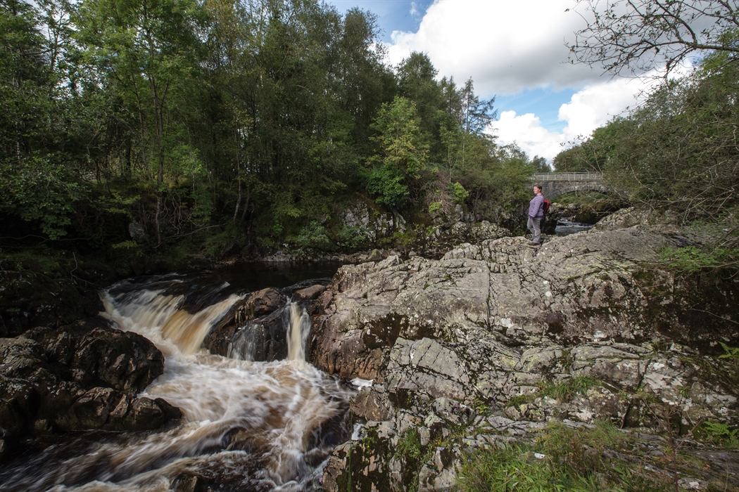
Grey Mare's Tail Waterfall
This dramatic trail leads to one of the UK’s tallest waterfalls. The walk climbs through a steep glen, offering impressive views of the falls and the surrounding hills. It’s a favorite for photographers and those seeking a memorable natural landmark.
Southern Upland Way (Park Section)
Part of Scotland’s famous coast-to-coast long-distance path runs through Dumfries and Galloway Forest Park. Walkers can enjoy a section of the Southern Upland Way, taking in remote forests, open moorland, and historic sites. It’s ideal for those seeking a longer or multi-day adventure.
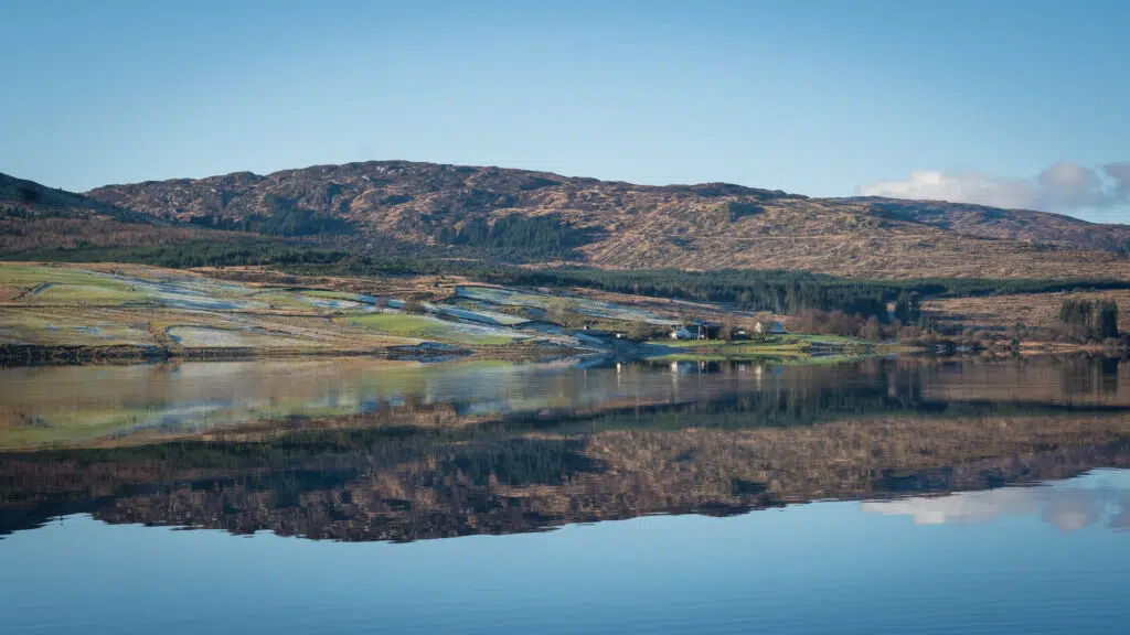
Loch Doon And Loch Riecawr Trails
Located in the northern part of the park, these trails offer peaceful walks along the shores of two beautiful lochs. The area is quiet, scenic, and perfect for those looking to escape the crowds and immerse themselves in nature.
Must-Visit Areas Highlighted On The Map
1. Kirroughtree Visitor Centre
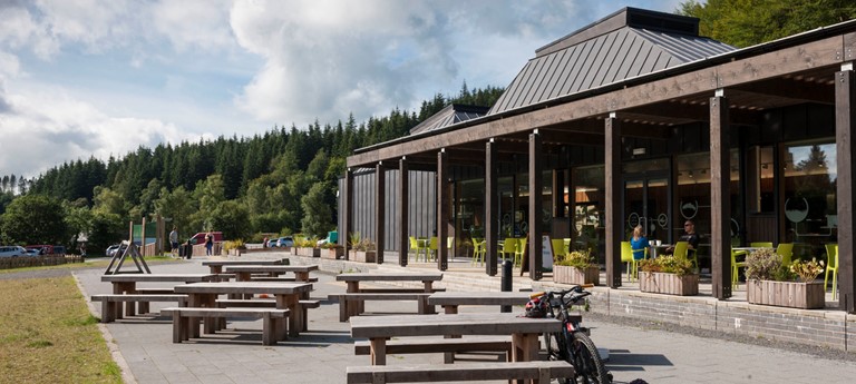
Kirroughtree is the main gateway to Galloway Forest Park and a hub for outdoor fun. It offers a visitor centre with helpful information, a café, and facilities. The area is famous for its mountain biking trails, part of the world-renowned Stane's network. Kirroughtree also has family-friendly walking paths, wildlife hides, and play areas. It’s a great place to start your adventure, with trails for all levels and plenty of opportunities to spot red squirrels and deer.
2. Glentrool Visitor Centre
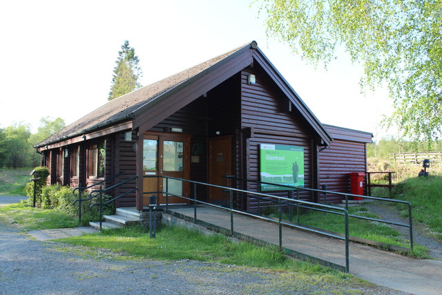
Glentrool Visitor Centre sits near the beautiful Loch Trool and provides access to peaceful woodlands, hills, and historical sites. From here, you can enjoy scenic walks along the loch’s edge or explore forest trails. The centre offers parking, toilets, and information about the local area. It’s also close to Bruce’s Stone, a historic monument commemorating Robert the Bruce’s victory at the Battle of Glen Trool. Glentrool is perfect for those who want to combine nature with a touch of history.
3. Clatteringshaws Visitor Centre
Clatteringshaws is a quieter visitor centre located near a large loch surrounded by woodland. This area is famous for its Dark Sky Park status, making it one of the best places in the UK to stargaze. The centre provides information, refreshments, and parking. Visitors can enjoy gentle walks around the loch, picnic spots, and peaceful surroundings. At night, the clear skies reveal thousands of stars, offering a magical experience for astronomy lovers.
4. Raiders’ Road Forest Drive
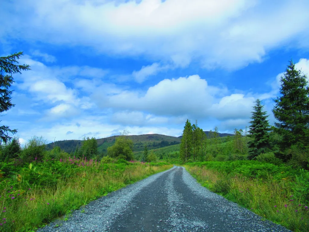
Raiders’ Road is a scenic 10-mile forest drive that winds through Galloway Forest Park. It follows an old drove road used by cattle drovers and is named after local raiders from history. Along the route, you’ll find several picnic spots and viewpoints overlooking rivers and forests. The drive is also known for red kite sightings, as these birds of prey 5. soar above the trees. It’s an easy way to enjoy the park’s beauty from your car, especially for families or those with limited mobility.
5. Wild Goat Park
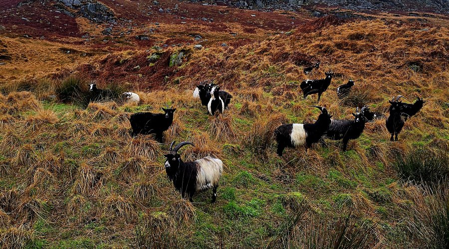
The Wild Goat Park offers a unique chance to see wild goats up close in a natural setting. Located along the Queen’s Way scenic road, this managed area provides safe viewing points and hides. The goats are a rare species in the UK, and the park helps protect their population. Visitors can learn about their habits and importance to the local ecosystem. It’s a great stop for families and wildlife enthusiasts.
6. Red Deer Range
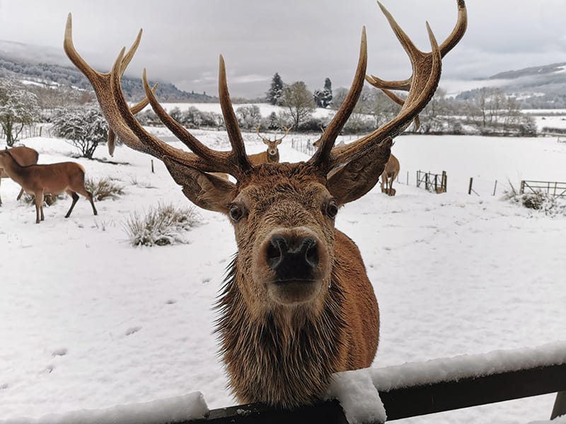
The Red Deer Range is another wildlife attraction where visitors can observe red deer, the UK’s largest land mammal. The range is a managed area designed to protect the deer while allowing people to watch them safely. Guided tours are sometimes available during peak seasons, offering insights into deer behavior and conservation. The range is located near the Queen’s Way and is a highlight for nature lovers visiting the park.
7. Loch Trool
Loch Trool is a stunning freshwater loch surrounded by hills and dense forests. It is a peaceful spot for walking, picnicking, and photography. The loch is also historically significant as the site near the Battle of Glen Trool, where Robert the Bruce fought. Trails around the loch vary from easy walks to more challenging hikes, making it accessible for all visitors. The scenic beauty of Loch Trool makes it one of the park’s most photographed locations.
8. Bruce’s Stone
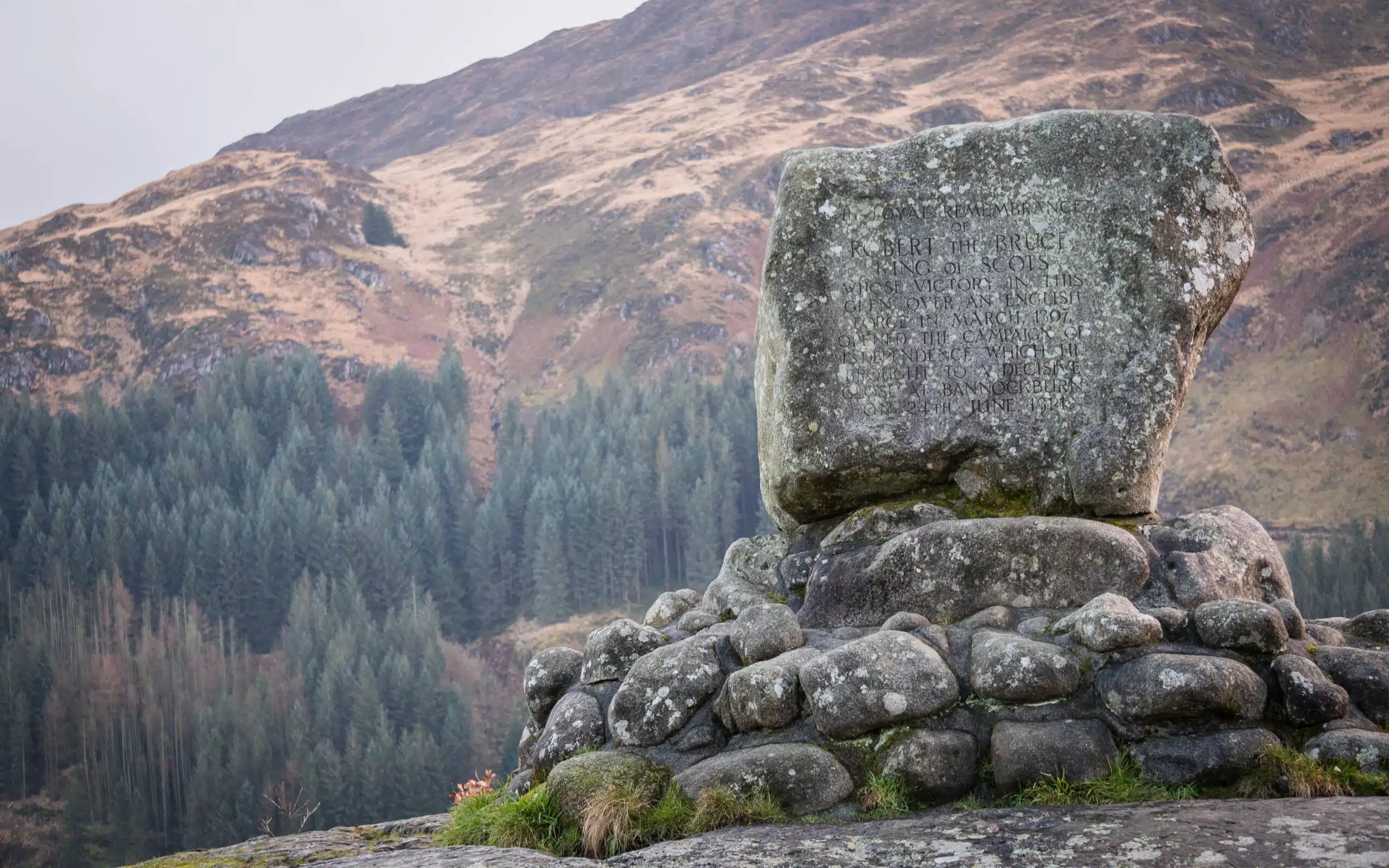
Bruce’s Stone is a historic monument perched on a hill overlooking Loch Trool. It marks the spot where Robert the Bruce is said to have watched his troops during the 1307 battle. The stone offers panoramic views of the loch and surrounding hills. Visitors can reach it by a short but steep walk from the Glentrool Visitor Centre. It’s a must-see for history buffs and those who enjoy breathtaking landscapes.
9. Queen’s Way
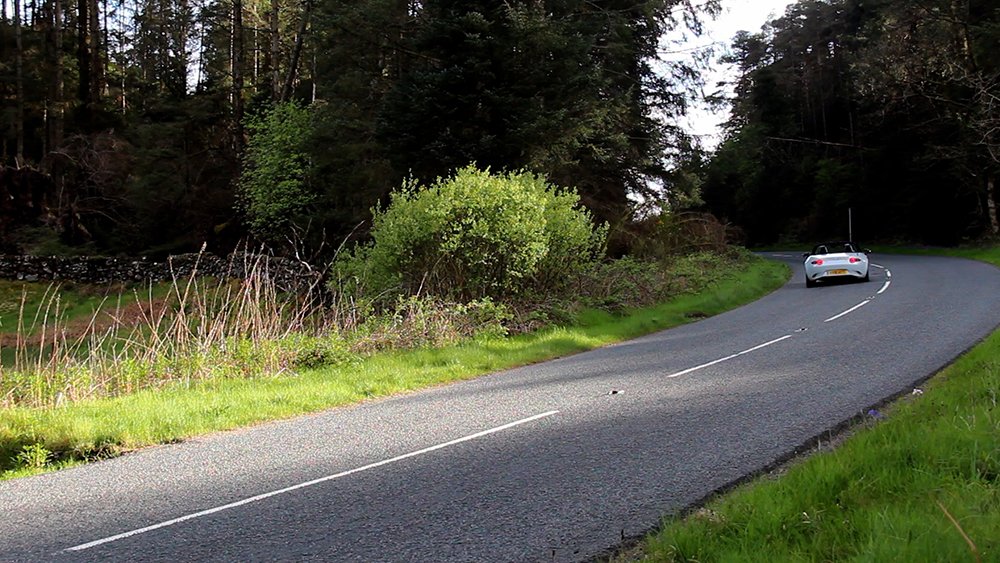
The Queen’s Way is a scenic road stretching from New Galloway to Newton Stewart, passing through parts of the forest park. It offers spectacular panoramic views of hills, forests, and lochs. Along the route, you’ll find picnic areas, wildlife viewing points, and access to walking trails. The road is perfect for a leisurely drive or cycling trip, allowing visitors to experience the park’s diverse landscapes comfortably.
10. Grey Mare's Tail
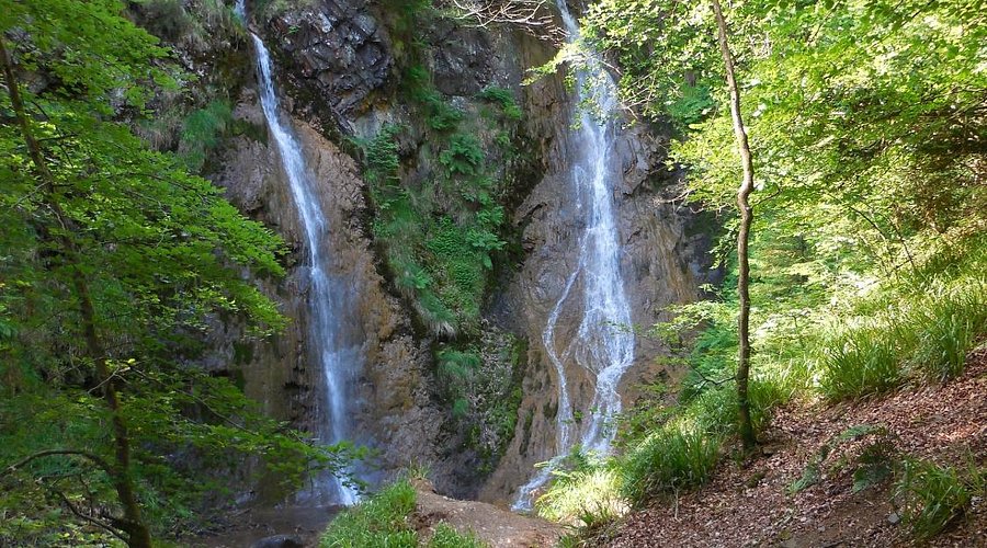
Grey Mare’s Tail is a magnificent waterfall located near the Queen’s Way. It is one of the tallest waterfalls in the UK, dropping over 60 meters (200 feet) through a steep glen. The area has well-marked walking trails that lead to the waterfall’s base and surrounding viewpoints. It’s a popular destination for hikers and nature lovers who want to witness dramatic scenery and enjoy the sounds of rushing water.
Stargazing And Dark Sky Sites In Galloway Forest Park
Galloway Forest Park holds a special place in the UK as the first officially designated Dark Sky Park, recognized in 2009 by the International Dark-Sky Association. This status means the park is protected from light pollution, offering some of the clearest and darkest night skies in Europe.
On a clear night here, you can see over 7,000 stars and planets with the naked eye, and the Milky Way often shines brightly across the sky. The park’s remote location and careful lighting control help preserve these stunning views for visitors and locals alike.
Designated Viewing Points
The park map highlights several key spots perfect for stargazing. One of the most popular is the Clatteringshaws Visitor Centre, which provides easy access to dark skies and facilities for visitors. Another excellent location is near the Kirroughtree Visitor Centre, where special stargazing events are often held.
Low Light Pollution Areas
Beyond the visitor centres, the map shows large areas within the park where light pollution is almost nonexistent. These zones are ideal for those who want to experience truly dark skies.
The park’s policy includes a “core” preservation area where no permanent lighting is allowed, ensuring the sky remains pristine. Visitors are encouraged to use these map areas to find quiet, dark spots for private stargazing sessions.
Tips For Stargazing In Galloway Forest Park
- Check the Weather Forecast:Clear skies are essential for good stargazing. Before heading out, look for nights with little cloud cover and low humidity. It’s a great idea to plan your Scottish vacationaround the darker months when conditions are best for seeing the stars.
- Bring a Red Light Torch:Using a red light helps preserve your night vision, allowing your eyes to adjust to darkness and see stars more clearly.
- Use a Stargazing App:Download apps that help identify stars, planets, and constellations. These tools make it easier to understand what you’re seeing and enhance the experience.
- Dress Warmly:Nights in the park can be cold, even in summer. Wear layers and bring blankets if you plan to stay outside for a long time.
- Attend Dark Sky Ranger Events:The park has trained guides called Dark Sky Rangerswho lead stargazing tours. They use laser pointers to highlight stars and planets and share fascinating stories about the universe. These events, often held at Kirroughtree Visitor Centre, are great for beginners and families.
People Also Ask
What Is Dumfries And Galloway Forest Park Known For?
Dumfries and Galloway Forest Park is the largest forest park in the UK, famous for its vast woodlands, scenic hills, and being the first official Dark Sky Park in the UK. It offers excellent hiking, mountain biking, wildlife watching, and stargazing opportunities.
Where Is The Largest Forest In Scotland?
Galloway Forest Park is a forest park operated by Forestry and Land Scotland, principally covering woodland in the historic counties of Kirkcudbrightshire and Wigtownshire in the administrative area of Dumfries and Galloway. It is claimed to be the largest forest in the UK.
Where Can I Get A Map Of Dumfries And Galloway Forest Park?
Official maps are available at the park’s visitor centres, Kirroughtree, Glentrool, and Clatteringshaws. You can also find digital and printed maps online from Forestry and Land Scotland and other retailers
Final Thoughts
A map of Dumfries and Galloway Forest Park isn't just paper; it's your key to adventure. Know how to read it, and you can easily find peaceful walks, tough climbs, and amazing views.
So grab a map and get out there. If you want a quiet day in nature or an exciting outdoor challenge, this park has something for everyone. Enjoy your time in this beautiful place!
Jump to
Quick Facts About Dumfries And Galloway Forest Park
Geographical Overview Of Dumfries And Galloway Forest Park
Towns And Small Cities Around The Forest Park
Regions On The Map Of Dumfries And Galloway Forest Park
Total Area Of Dumfries And Galloway Forest Park
Types Of Dumfries And Galloway Forest Park Map
Walking And Hiking Routes
Best Forest Trails In Dumfries And Galloway
Must-Visit Areas Highlighted On The Map
Stargazing And Dark Sky Sites In Galloway Forest Park
People Also Ask
Final Thoughts

Callum Fraser
Author
Callum Fraser isn't just a writer about Scotland; he's a product of its rugged landscape and rich history. Born and raised in Perthshire, with the Highlands as his backyard, his love for the nation's stories was kindled by local storytellers and long walks through ancient glens.
This passion led him to pursue a degree in Scottish History from the University of Edinburgh. For over 15 years, Callum has dedicated himself to exploring and documenting his homeland, fusing his academic knowledge with essential, on-the-ground experience gained from charting road trips through the Cairngorms, hiking the misty Cuillins of Skye, and uncovering the secrets of traditional recipes in his family's kitchen.
As the Editor-in-Chief and Lead Author for Scotland's Enchanting Kingdom, Callum's mission is simple: to be your most trusted guide. He combines meticulous research with a storyteller's heart to help you discover the authentic magic of Scotland — from its best-kept travel secrets to its most cherished traditional recipes.
Latest Articles
Popular Articles