Fort William Map: Your Essential Guide To Navigating The Highlands
Get your Fort William map here! Navigate Ben Nevis, rail trails & town with expert tips. Plan your Highland adventure confidently.
Author:Callum FraserJun 11, 2025945 Shares189K Views
Fort William is a small burgh in the Highland council area, historically part of Inverness-shire, nestled on the northeastern edge of Loch Linnheand resting at the base of Ben Nevis, the tallest mountain in the UK. It’s a town where Highland history meets modern adventure, and its origins are as strategic as they are scenic.
This guide goes beyond the superficial, offering a deep dive into the types of maps available for Fort William and how to leverage them for an unparalleled experience.
Quick Facts About Fort William
| Location | Highland council area, Scotland |
| Population (2022) | 15,757 |
| Distance from Edinburgh | 134 mi (216 km) |
| Distance from London | 512 mi (824 km) |
| Community Council | Fort William |
| Council Area | Highland |
| Sovereign State | United Kingdom |
| Post Town | FORT WILLIAM |
| Postcode District | PH33 |
| Dialing Code | 01397 |
| OS Grid Reference | NN 10584 74114 |
| Latitude/Longitude | 56.8198°N, 5.1052°W |
Fort William's Rich History
Fort William’s roots trace back to 1654, when a timber fort was erected under Oliver Cromwellat the mouth of the River Nevis. It served as a military foothold to suppress resistance from the Highland clans. In 1690, after years of unrest, the wooden structure was replaced by a stone fort and renamed Fort William, honoring William of Orange.
The town that formed around the fort became a military and trading hub, crucial during the Jacobite risingsof the late 17th and early 18th centuries. These events saw Highland clans fighting to restore the Stuart monarchy-stories that remain etched into the very mountains and glens surrounding Fort William.
Mapping Fort William today reveals more than topography-it traces the footsteps of Bonnie Prince Charlie, who fled through the region after the catastrophic Battle of Culloden.
Landmarks like Glenfinnan, where he first raised the Jacobite standard in 1745, and the Glenfinnan Viaduct, now famed for the Hogwarts Express, offer deeper insights into this turbulent chapter of Scottish history.
Even the ruins of the Old Fort, hidden near the modern town center, whisper stories of rebellion, siege, and the British government's long shadow across the Highlands.
Different Types Of Fort William Maps
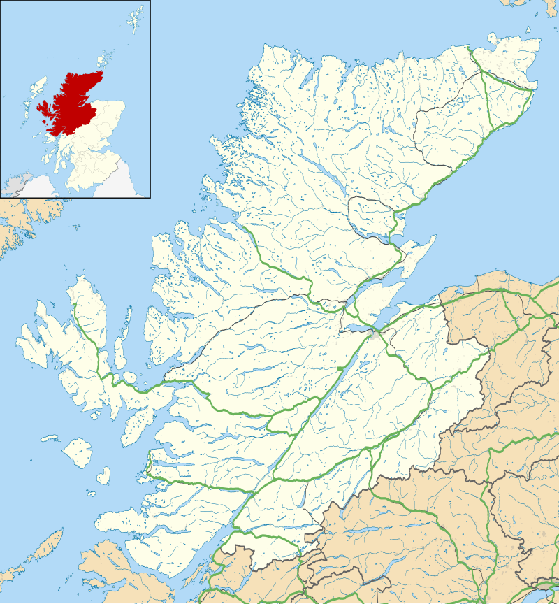
Locator Map Of Fort William
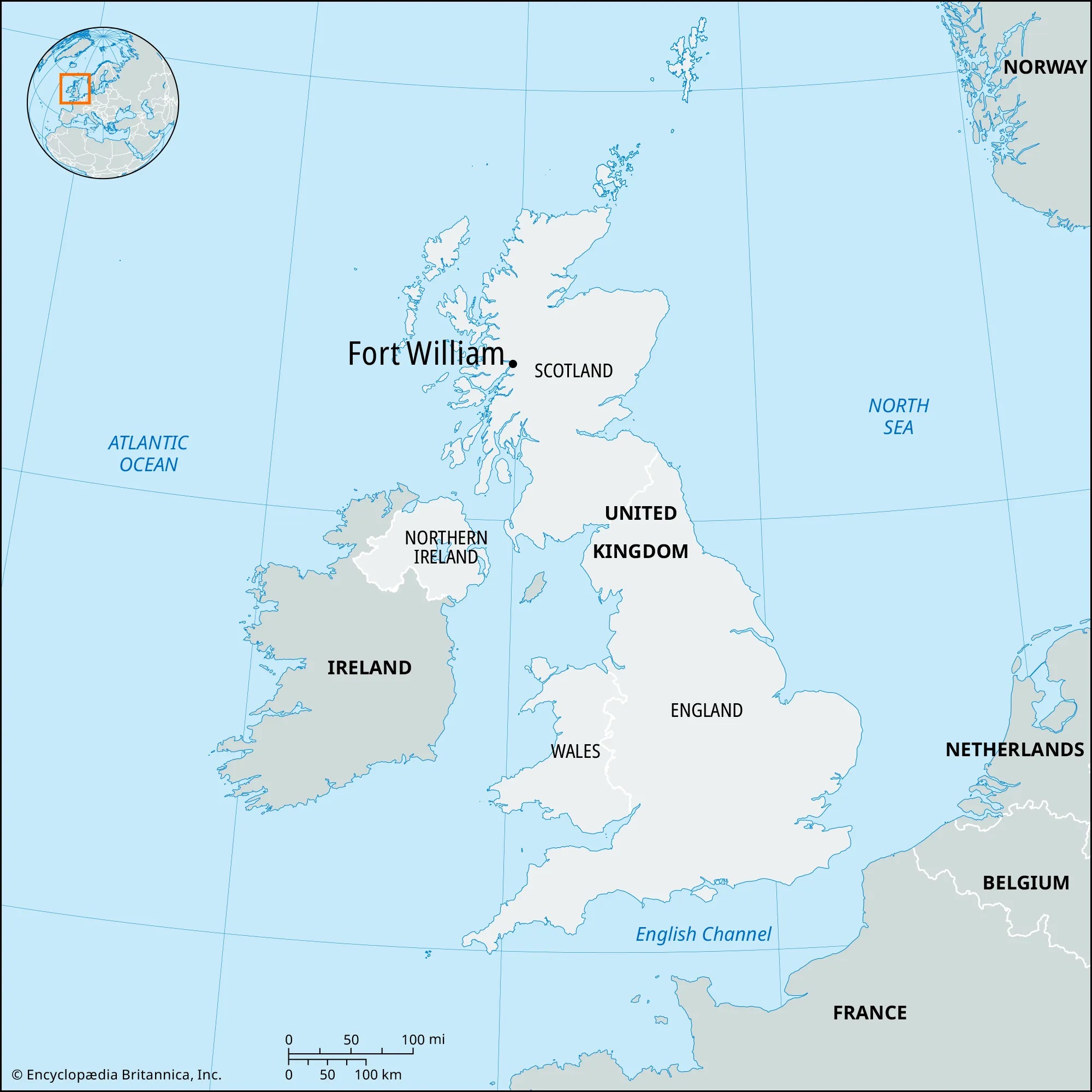
A locator map of Fort Williamprovides a geographical overview of where the town sits within Scotland and the wider UK, making it a vital tool for first-time visitors, planners, and researchers alike.
Fort William is nestled on the eastern shore of Loch Linnhe, at the foot of Ben Nevis, the UK’s highest mountain. It lies within the Highland Council Area, and is often described as the "Outdoor Capital of the UK."
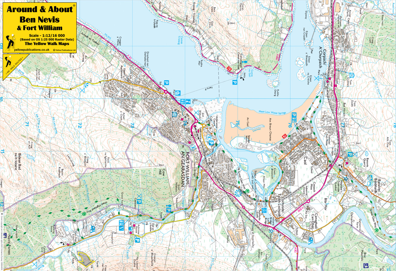
Fort William Rail Trail Map
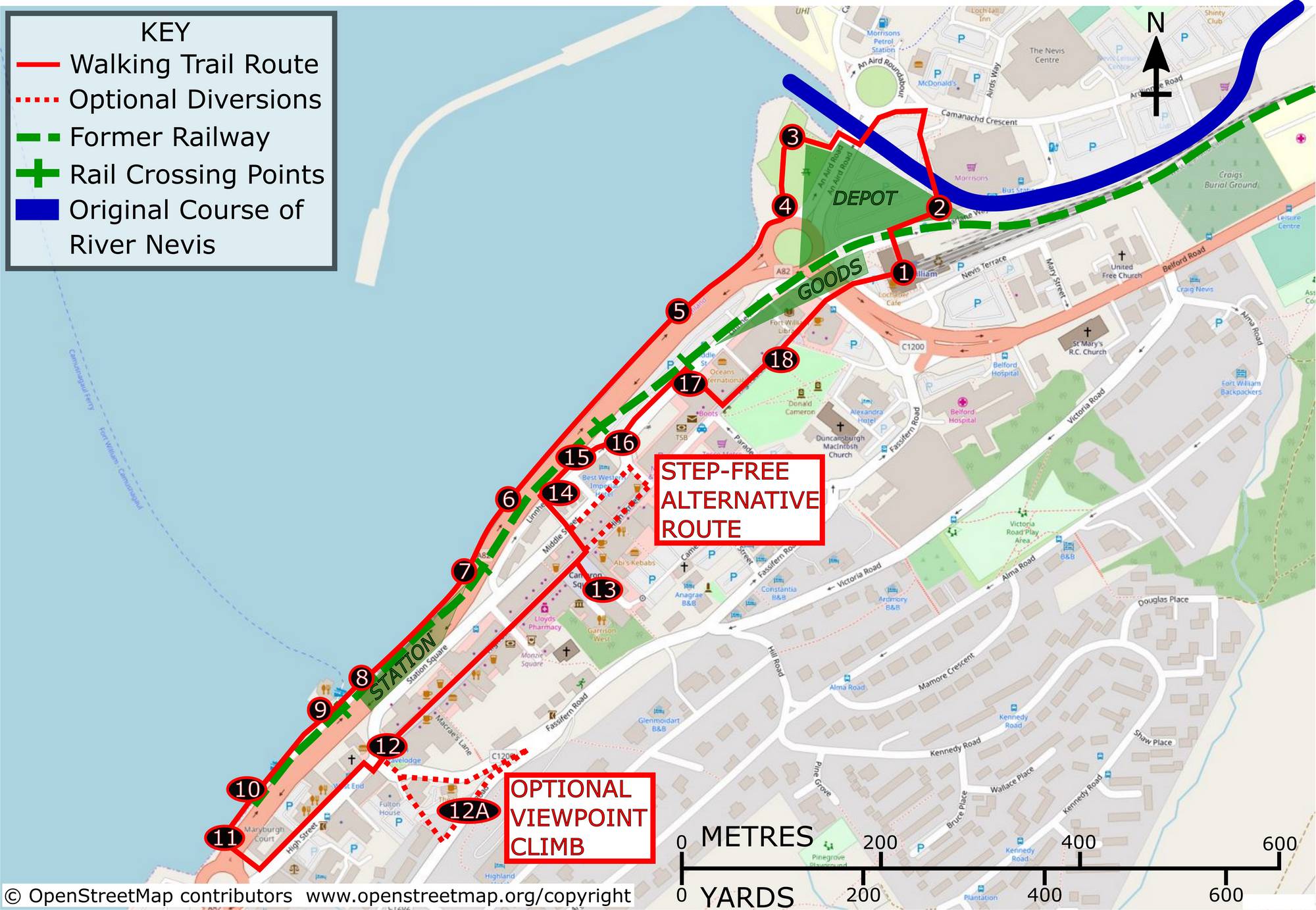
For walkers and cyclists exploring Fort William and the surrounding Lochaber region, the Fort William Rail Trail Mapis an essential resource. This map traces the old railway line that once connected the town to nearby industrial and coastal communities. Now repurposed as a scenic multi-use path, the trail offers safe, mostly flat terrainperfect for families, runners, and casual bikers.
- Highlights along the trailinclude views of Loch Linnhe, native woodland, and occasional wildlife sightings.
- The route is well-maintainedand includes interpretive signagethat reveals historical context about Fort William's railway and industrial past.
- Ideal for those looking to enjoy a gentle, scenic alternativeto mountain hikes.
Look for trail access points near the train station, An Aird, or the Blar Mòr area, and check local signage for route extensions toward Caol or Corpach.
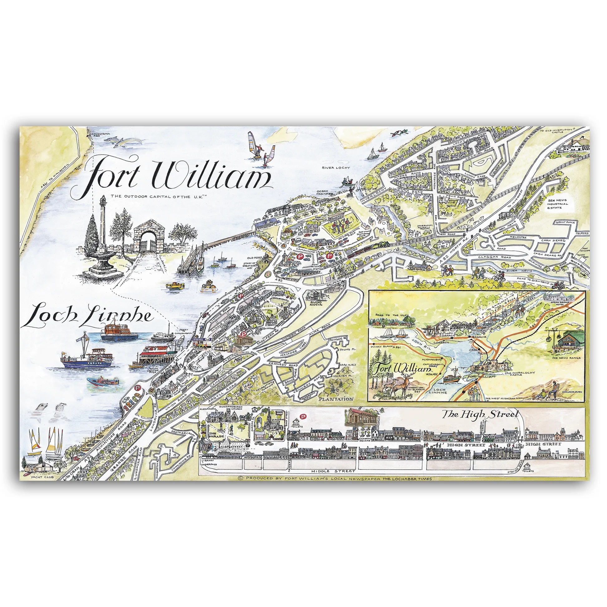
Fort William / An Gearasdan Vector Street Map
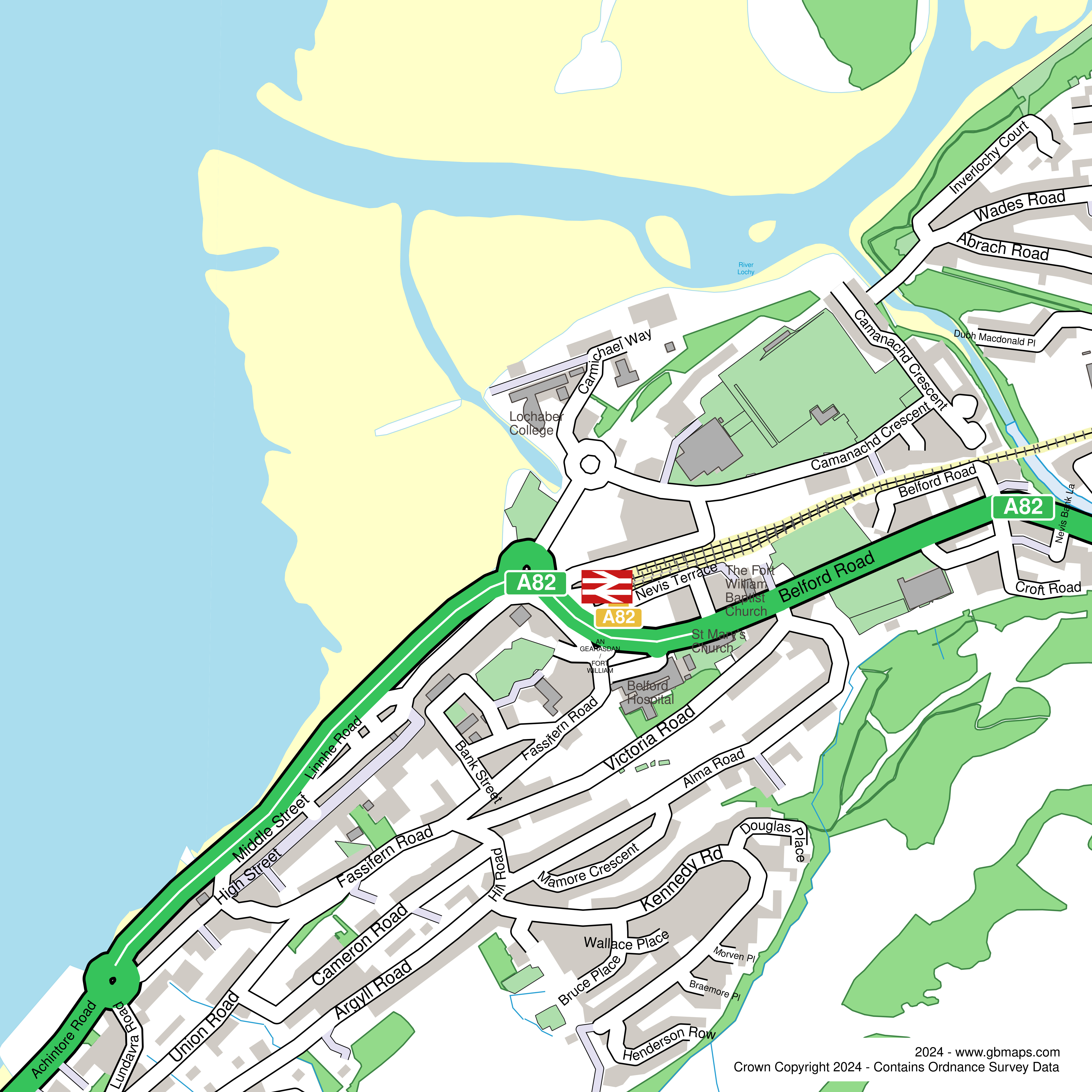
The Fort William / An Gearasdan Vector Street Mapis a modern, highly detailed map that offers a clear street-level view of the town and its Gaelic heritage. “An Gearasdan,” meaning The Garrison, reflects the town's historic role as a British military outpost during the Jacobite uprisings.
This vector-based map is particularly useful for:
- Navigation through the town centre, with high-resolution detailideal for digital zooming or professional printing.
- Identifying key landmarks such as the Old Fort, West Highland Museum, bus and rail stations, and major accommodation hubs.
- Bilingual labeling (English and Gaelic), helping visitors connect with the region’s cultural roots.
Perfect for tourists, event planners, and local businessesalike, this map is available through the Highland Council and tourism outlets, and can also be integrated into visitor apps or printed guides.
Fort William BID Area Map
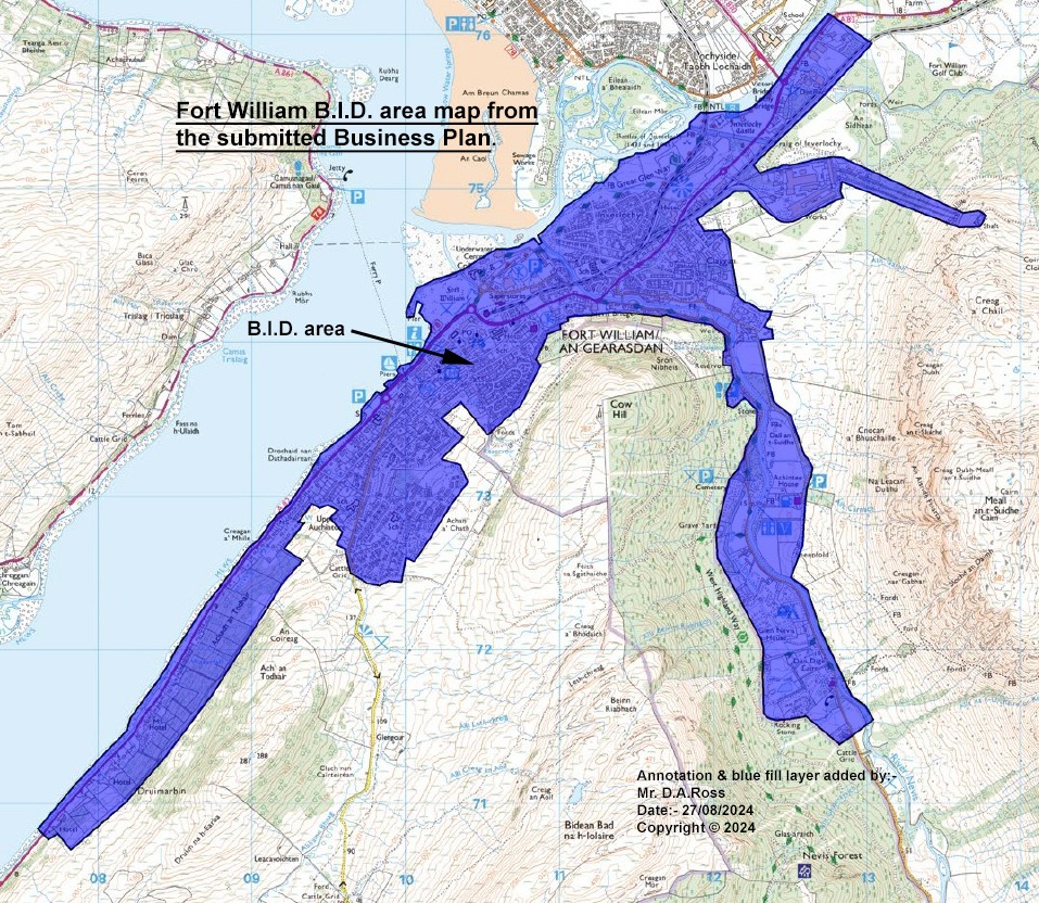
The Fort William Business Improvement District (BID) Area Map outlines the specific geographic zone covered by the town’s BID initiative, which aims to enhance the town centre’s appeal to both visitors and local residents.
Key features of the BID area map include:
- Boundaries of the commercial district, typically encompassing the High Street, surrounding roads, and waterfront.
- Identified zones for beautification projects, event planning, public art, and infrastructure improvements.
- A directory of participating businesses that contribute to the BID and benefit from its initiatives, including marketing support, wayfinding signage, and promotional events.
This map is helpful for:
- Visitors wanting to shop or dine within locally supported businesses.
- Investors and entrepreneurs exploring opportunities in Fort William’s economic heart.
- Event organizers looking to understand the designated areas for festivals, markets, and street activities.
Available online via the Lochaber Chamber of Commerceor the Fort William BID official site, the map often appears in visitor welcome packsand business planning materials.
Ben Nevis & Fort William Walking Map
Walking around Ben Nevisand Fort Williamis more than a hike-it's a full Highland experience. Whether you're an avid climber or a casual walker, the region offers trails for all levels, all set against jaw-dropping Scottish scenery.
Main Walking Routes:
- The Mountain Track (a.k.a. Tourist Path):
- Glen Nevis to Steall Falls Walk:
- North Face Trail to CIC Hut:
Navigation Tips:
- Use an Ordnance Survey Map (OS Explorer 392)for detailed topography
- Ben Nevis Walking Mapoverlays are available at the Glen Nevis Visitor Centre and local outdoor shops
- Check weather conditionsbefore climbing-Ben Nevis can be unpredictable year-round
Tourist Map Of Fort William: Your Key To Highland Adventure
A tourist map of Fort Williamisn’t just a piece of paper or digital tool-it’s your gateway to unlocking the dramatic landscapes, historic landmarks, and hidden gems of Scotland’s most adventurous town.
Whether you’re planning to summit Ben Nevis, trace the footsteps of Jacobite rebels, or sip whisky by the loch, the tourist map helps you navigate with confidence and curiosity.
What You’ll Find On A Fort William Tourist Map:
- Key Attractions:From the West Highland Museumand Old Fort ruinsto the Nevis Range Gondolaand the Jacobite Steam Train station, major points of interest are clearly marked and often include short descriptions.
- Walking & Hiking Trails:Paths through Glen Nevis, routes up Ben Nevis, and gentler strolls around Loch Linnheare laid out with difficulty levels, viewpoints, and estimated times-perfect for planning your day outdoors.
- Accommodations & Restaurants:B&Bs, hotels, campsites, and local eateries are flagged on most tourist maps, often accompanied by contact details or QR codes linking to reviews and bookings.
- Transport Connections:You’ll find rail stations, bus stops, ferry routes, car parks, and even taxi ranks-all essential for navigating this Highland hub.
- Heritage and History Highlights:A good tourist map will highlight Jacobite landmarks, clan history locations, WWII memorials like the Commando Memorial at Spean Bridge, and the Glenfinnan Monumentjust a short drive away.
- Local Services:Public toilets, medical facilities, tourist information centers, gear rental shops, and petrol stations are all clearly marked for convenience.
Related Reading: Map Of Glencoe - Key Landmarks, Roads & Natural Highlights
Things To Do In Fort William
Fort William isn’t just a stopover-it's a destination brimming with Highland charm, outdoor thrills, and cultural treasures. Here are the top 10 things to do in Fort William for all kinds of travelers:
1. Climb Ben Nevis
Take on the challenge of Britain’s highest mountain, standing at 1,345 meters (4,413 ft). The Mountain Track (also called the Tourist Path) is the most popular route, offering breathtaking views of Glen Nevis, while experienced climbers can tackle the North Face. In summer, it’s a bucket-list achievement; in winter, it becomes a serious mountaineering expedition.
2. Ride The Jacobite Steam Train
All aboard the Jacobite Steam Train, famously featured as the Hogwarts Express in the Harry Potterfilms. This iconic journey stretches from Fort William to Mallaig, passing over the stunning Glenfinnan Viaduct. It's often described as one of the greatest railway journeys in the world, especially for families and photographers.
3. Explore Glen Nevis And Steall Falls
Just minutes from town, Glen Nevis is a Highland paradise. Walk through lush meadows and ancient woodland to reach Steall Falls, one of Scotland’s tallest waterfalls, cascading 120 meters. The rope bridge crossing and dramatic mountain backdrop make this a photographer’s dream.
4. Visit The West Highland Museum
Step back into the drama of Highland history at the West Highland Museum, located in the heart of Fort William. Its impressive collection includes Jacobite relics, clan artifacts, and WWII memorabilia. It's a hidden gem for history buffs, with free entry and insightful exhibits.
5. Take The Nevis Range Gondola
Glide up the side of Aonach Mòr in the Nevis Range Mountain Gondola-the only one of its kind in the UK. At the top, you'll find viewpoints, walking trails, and even a café. In winter, it's a ski haven; in summer, a gateway to downhill biking and hiking.
6. Cruise On Loch Linnhe
Set sail on a guided boat tour of Loch Linnhe, where you can spot seals, dolphins, and seabirds against the dramatic Highland landscape. Sunset cruises are especially magical, offering a serene way to soak in Fort William’s coastal beauty.
7. Play A Round At Fort William Golf Club
For a slower pace, try a scenic round at Fort William Golf Club, nestled beneath Ben Nevis. This 18-hole course offers stunning views and a friendly local atmosphere-ideal for visitors seeking a relaxing day outdoors.
8. Catch A Film At Highland Cinema
Warm up after a day in the hills with a film at the Highland Cinema, a beautifully designed independent venue featuring a cozy café and wood-burning stove. It’s a community hub and a rare find in such a remote setting-perfect for families and couples alike.
9. Wander The Old Fort Remains
Visit the site where Fort William's history began-the remnants of the 17th-century fort built under Oliver Cromwell. Though little remains, interpretive panels and a waterfront location offer insight into the town’s military roots and the origin of its name.
10. Shop Local In The Town Centre
Stroll along the High Street where you’ll find Highland crafts, outdoor gear, tartan goods, and cozy cafés. Don’t miss the local delis and bakeries for traditional treats like shortbread, tablet, and haggis pies.
Want to visualize the best experiences in Fort William? This video highlights 14 of the top attractions in and around the town, including scenic hikes, iconic landmarks, and local favorites.
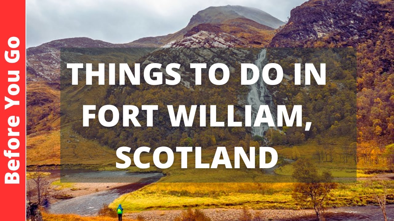
Fort William Scotland Travel Guide: 14 BEST Things To Do In Fort William, UK
10 Fascinating Fun Facts About Fort William
1. It’s Officially The Outdoor Capital Of The UK
From hiking and mountain biking to kayaking and snow sports, Fort William is a year-round adventure base. Its reputation as Britain's top outdoor destinationdraws thrill-seekers from all over the world.
2. Named After Royalty
The town gets its name from King William III, while its earlier name, Maryburgh, was in honor of Queen Mary II, his wife. The area’s royal naming roots highlight its strategic and political importance in post-Civil War Britain.
3. Born In 1654, Rebuilt In 1690, Reimagined In The 1860s
The original fort was constructed in 1654under Cromwell’s orders. It was rebuilt in stone by 1690. Ironically, by the 1860s, much of it was dismantled to make way for the expanding railway-a symbol of industrial growth overtaking military necessity.
4. Yes, That’s The Hogwarts Express
The Jacobite Steam Train, which runs between Fort William and Mallaig, famously starred as the Hogwarts Expressin the Harry Potterfilms. Crossing the Glenfinnan Viaduct, it offers one of the world’s most magical train journeys.
5. Haunted History At The West Highland Museum
Keep an ear out at the West Highland Museum, where the ghost of Edith MacGregor, a former caretaker who died in the 1960s, is said to still type away at her invisible desk. Ghostly or not, the museum itself is packed with Jacobite relics and Highland curiosities.
6. The Mountain Festival Celebrates The Wild Highlands
Held each February, the Fort William Mountain Festivalshowcases Highland adventure culture with workshops, film nights, guest speakers, and outdoor gear expos-a must-visit for adrenaline junkies and mountain lovers.
7. First In Britain To Light Streets With Hydroelectricity
In 1896, Fort William made history as the first town in Britain to illuminate its streets entirely using hydroelectric power, with water sourced from Loch Treig, deep within the hills.
8. Home To A Major Aluminium Industry
The British Aluminium Company Ltdestablished an aluminium smelter here in the 1920s, powered by hydroelectricity from a 15-mile tunnel under Ben Nevis. This move shaped the local economy for decades and brought industry to the Highlands.
9. There’s Another Fort William-In Canada
Fort William First Nation, located near Thunder Bay, Ontario, is an Ojibwa First Nation reservethat shares the same name. While the Canadian Fort William has Indigenous roots, the connection in name reflects the colonial footprint left by Britain.
10. Spean Bridge Was A Crucial WWII Training Ground
Just a short drive from Fort William, Spean Bridgewas a major WWII commando training area. New recruits trained in the harsh terrain and freezing lochs-some of the toughest environments the British Army could offer.
FAQs About Fort William Maps And The Region
Where Can I Buy A Good Fort William Map?
You can typically purchase high-quality Fort William maps at local outdoor shops in Fort William, bookshops, tourist information centers, and online retailers specializing in maps (e.g., Stanfords, Ordnance Survey website). Many outdoor enthusiasts suggest picking up an Ordnance Survey map for detailed navigation.
What Is Special About Fort William?
Fort William is special due to its designation as the "Outdoor Capital of the UK," offering unparalleled access to hiking (including Ben Nevis), mountain biking, and water sports. It also holds significant historical importance as a strategic military outpost during the Jacobite era. Its dramatic Highland scenery, including Loch Linnhe and surrounding glens, further adds to its allure.
Which Country Is Fort William In?
Fort William is located in Scotland, which is part of the United Kingdom.
Q: What Is The Best Map For Climbing Ben Nevis?
For climbing Ben Nevis, the Ordnance Survey Explorer Map OL13 (Ben Nevis & Fort William) at a 1:25,000 scale is widely recommended. It provides excellent detail for navigating the mountain's paths and features.
Are Digital Maps Reliable Enough For Fort William's Remote Areas?
While digital maps with GPS are incredibly useful, it's crucial to download them for offline use as mobile signal can be unreliable in many remote areas of the Highlands. Always carry a physical map as a backup.
What City Is Near Fort William?
Fort William is the largest town in the Lochaber area. Larger cities like Inverness are approximately 1.5 to 2 hours drive north, and Glasgow is about 2.5 to 3 hours drive south.
Where Is Fort William Found?
Fort William is found on the shores of Loch Linnhe in the western Scottish Highlands, at the foot of Ben Nevis, the UK's highest mountain. It is situated within the council area of Highland, Scotland.
Final Thoughts
A Fort William mapis more than just paper or pixels; it's a guide, a storyteller, and a safeguard. It empowers you to navigate this remarkable part of Scotland with confidence, ensuring you don't miss a single breathtaking vista or historical landmark.
From the intricate street patterns of the town to the challenging contours of its towering mountains, the right map transforms a mere visit into an immersive experience.
So, whether you're planning an epic ascent of Ben Nevis, a tranquil stroll along Loch Linnhe, or an exploration of the town's charming, history-rich streets, equip yourself with the right Fort William map and embark on an unforgettable Highland adventure.
Continue Reading: Inverness, Scotland - What Makes This Highland City Unique?

Callum Fraser
Author
Callum Fraser isn't just a writer about Scotland; he's a product of its rugged landscape and rich history. Born and raised in Perthshire, with the Highlands as his backyard, his love for the nation's stories was kindled by local storytellers and long walks through ancient glens.
This passion led him to pursue a degree in Scottish History from the University of Edinburgh. For over 15 years, Callum has dedicated himself to exploring and documenting his homeland, fusing his academic knowledge with essential, on-the-ground experience gained from charting road trips through the Cairngorms, hiking the misty Cuillins of Skye, and uncovering the secrets of traditional recipes in his family's kitchen.
As the Editor-in-Chief and Lead Author for Scotland's Enchanting Kingdom, Callum's mission is simple: to be your most trusted guide. He combines meticulous research with a storyteller's heart to help you discover the authentic magic of Scotland — from its best-kept travel secrets to its most cherished traditional recipes.
Latest Articles
Popular Articles