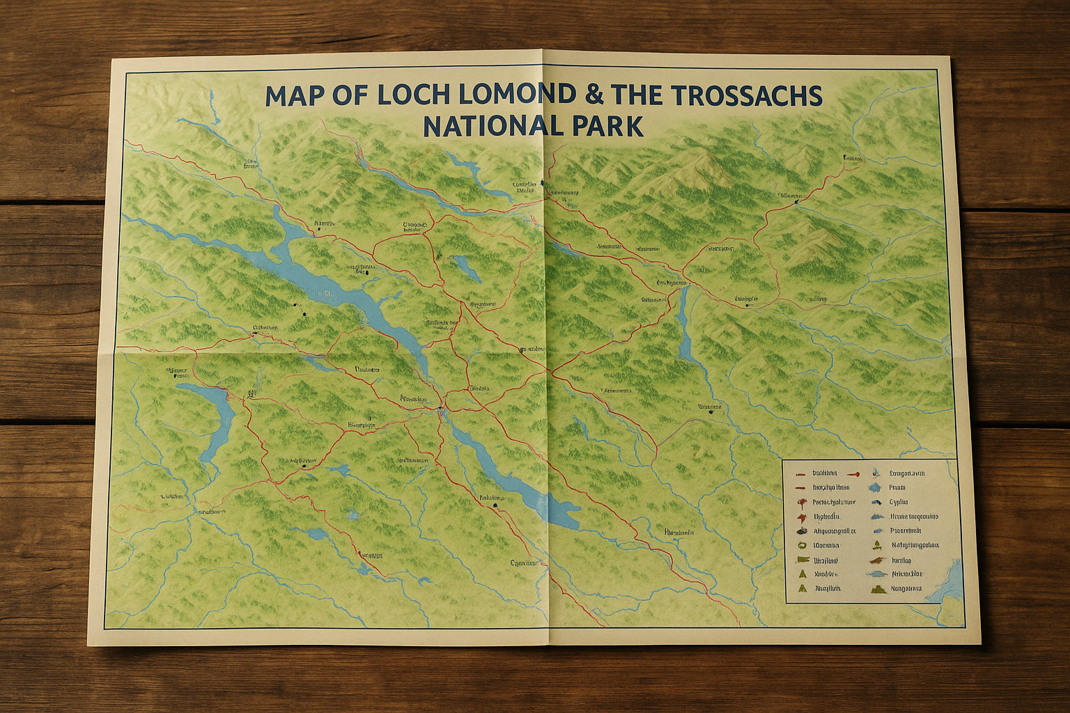
Map Of Loch Lomond & The Trossachs National Park
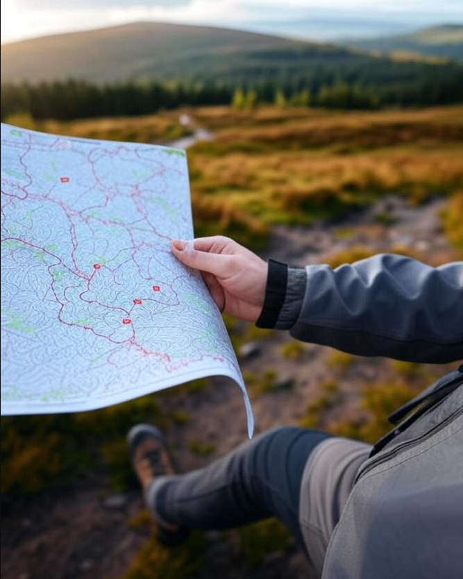
Plan your trip with a map of Loch Lomond & The Trossachs showing walking routes, scenic drives, lochs, and popular landmarks.
Author:Callum FraserNov 16, 202531.3K Shares428.7K Views
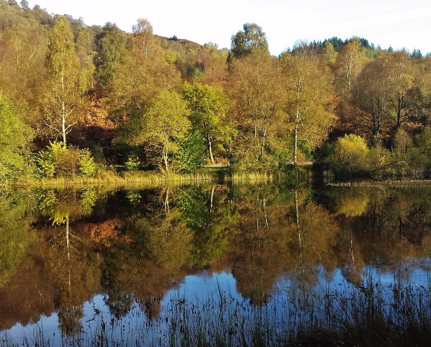
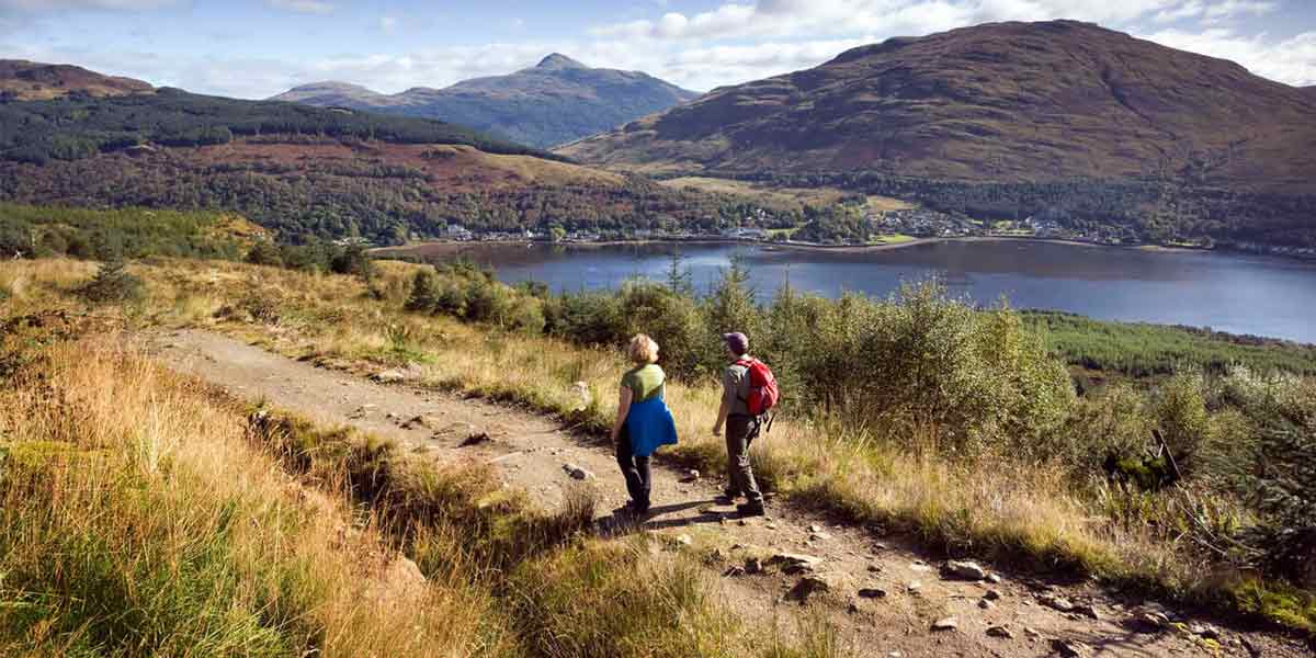
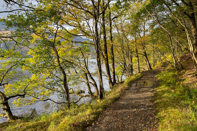
Loch Lomond & The Trossachs National Park is a peaceful and beautiful place in Scotland, filled with mountains, forests, and sparkling lochs. It’s a place where people go to walk, relax, take in the views, and enjoy the outdoors.
If you’re planning to visit, a good map can make all the difference. It helps you find the best trails, quiet picnic spots, scenic drives, and places to watch wildlife.
Quick Facts About Loch Lomond & The Trossachs National Park
- Location:Central Scotland
- Established:2002 (Scotland’s first national park)
- Size:1,865 square kilometres (720 square miles)
- Lochs:Over 20 large lochs, including Loch Lomond (the largest in Great Britain by surface area)
- Mountains:21 Munros (mountains over 3,000 ft)
- Forests:Includes Queen Elizabeth Forest Park and Argyll Forest
- Wildlife:Home to red deer, ospreys, pine martens, golden eagles, and red squirrels
- Popular Activities:Hiking, boating, cycling, wildlife watching, scenic drives
- Visitor Centres:Balloch, Callander, Aberfoyle, and Tyndrum
- Key Towns:Balloch, Callander, Killin, Aberfoyle, Arrochar, Crianlarich
- Major Trails:West Highland Way, Rob Roy Way, Great Trossachs Path
- Unique Feature:Offers both Highland and Lowland landscapes in one park
Geographical Overview Of Loch Lomond & The Trossachs National Park
Loch Lomond & The Trossachs National Park covers a large part of central Scotland. It stretches from the gentle Lowlands in the south to the rugged Highlands in the north. The park includes hills, glens, rivers, lochs (lakes), forests, and small villages.
One of its main features is Loch Lomond, the largest lake in Great Britain by surface area. The park also contains 21 Munros (mountains over 3,000 feet), 22 large lochs, and over 50 rivers and streams. The changing landscape gives visitors a taste of both Highland and Lowland scenery in one place.
History Of Loch Lomond & The Trossachs National Park
Loch Lomond & The Trossachs National Park was officially established in 2002, making it the first national park in Scotland. But the area’s history goes back much further thousands of years.
Early History
People have lived in this region since prehistoric times. Ancient burial mounds, standing stones, and hillforts still remain, offering tangible links to the distant past. The lochs and dense forests provided essential food, clean water, and vital shelter for these early communities, fostering a deep connection to the land. This rich heritage forms the very bedrock from which Scottish customs and traditionshave evolved, shaping a unique and resilient culture over millennia.
Clan History And Legends
In the medieval period, the area was home to powerful Scottish clans, including the MacGregors and MacFarlanes. One of the most famous local figures is Rob Roy MacGregor, a folk hero and outlaw born near Loch Katrine. Many trails and landmarks in the park still carry his name.
Romantic Influence
During the 18th and 19th centuries, poets and writers like Sir Walter Scotthelped make the region popular. His poem "The Lady of the Lake" was set on Loch Katrine, attracting visitors looking for Scotland’s "romantic wildness."
Preservation And National Park Status
As tourism grew, people began to see the need to protect the area’s natural beauty and cultural heritage. After decades of campaigning, the park was created in 2002 under the National Parks (Scotland) Act 2000.
Today, Loch Lomond & The Trossachs is not just a protected area, it’s a place where nature, history, and culture are preserved and shared with over 4 million visitors each year.
Towns On The Map Of Loch Lomond & The Trossachs National Park
Loch Lomond & The Trossachs National Park has no large cities, but there are several towns and villages marked on the map. These places offer places to stay, eat, shop, and start walks or drives into the park.
1. Balloch
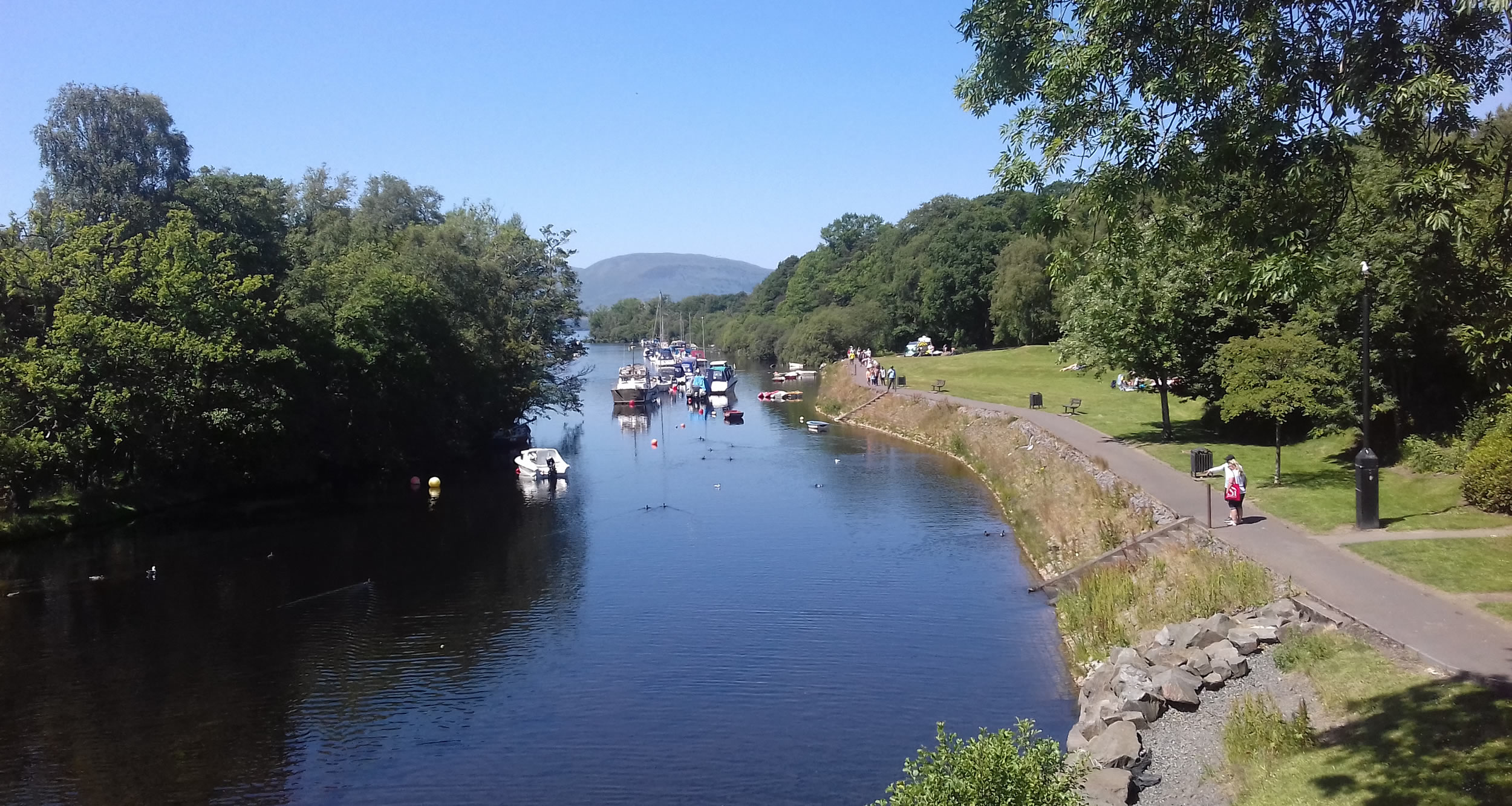
Balloch is often the first stop for visitors coming to the park. It sits at the southern tip of Loch Lomond and has good transport links, including a train station and main roads. The town has a visitor centre, restaurants, hotels, and shops. You can take boat trips from Balloch Pier or enjoy walks in Balloch Castle Country Park. It’s a great place to start your journey into the national park.
2. Callander
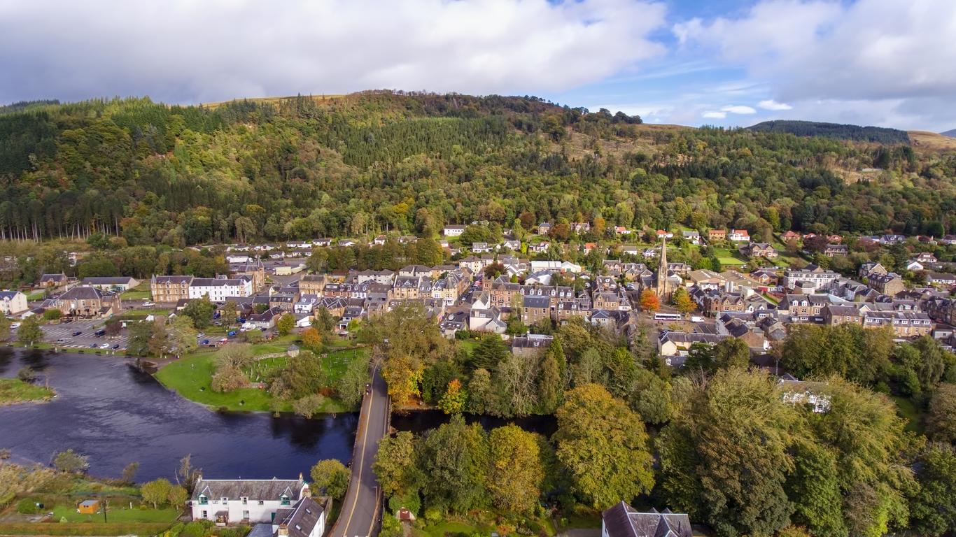
Callander is a popular tourist town in the eastern part of the park, often called the "Gateway to the Highlands." It has many cafes, shops, and places to stay. The town sits beside the River Teith and is close to many walking and cycling trails. Callander Crags and Bracklinn Falls are nearby and easy to reach on foot. It’s also a good base for visiting The Trossachs.
3. Aberfoyle
Aberfoyle is a small village surrounded by forests and hills. It’s known for its peaceful setting and access to Queen Elizabeth Forest Park. The Lodge Forest Visitor Centre is located here, offering walking trails, wildlife viewing, and an aerial adventure park. Aberfoyle has a few local shops, cafés, and cosy places to stay. It’s ideal for families and nature lovers.
4. Arrochar
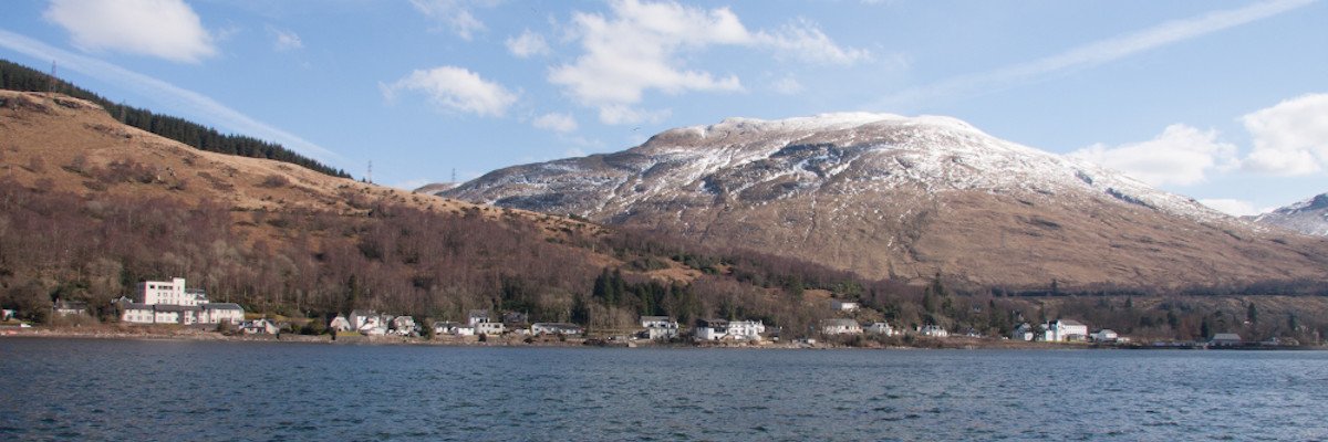
Arrochar is a village on the shores of Loch Long, close to the Arrochar Alps. It’s a favourite spot for hikers and climbers, especially those heading up The Cobbler (Ben Arthur). The village has inns, guesthouses, and small shops. From Arrochar, you can enjoy both mountain walks and lochside views. It also connects to Glen Croe and the famous Rest and Be Thankful viewpoint.
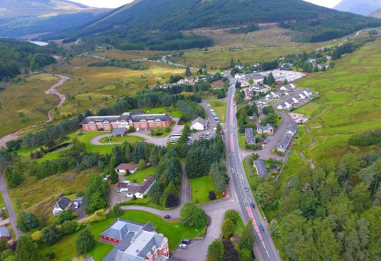
5. Crianlarich
Crianlarich is a small village located where several major roads and train lines meet. It’s often used as a stopover for people travelling between Glasgow and the Highlands. Despite its size, it has a train station, a few places to eat, and walking paths nearby. It's also a point on the West Highland Way, making it popular with long-distance walkers.
6. Killin
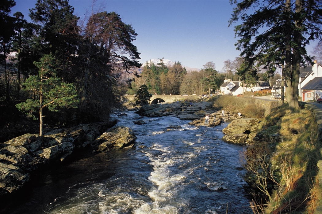
Killin sits at the western end of Loch Tay and is best known for the beautiful Falls of Dochart, which run through the centre of the village. It's a scenic and peaceful place with cafés, B&Bs, and walking trails nearby. Killin gives easy access to the Breadalbane region, including Munros like Ben Lawers and Meall nan Tarmachan.
7. Drymen
Drymen is a charming village near the south-eastern edge of Loch Lomond. It marks the start of the West Highland Way and is a popular stop for walkers. The village has traditional pubs, a small square, and a friendly atmosphere. It’s also close to Conic Hill, a popular short hike with great views over Loch Lomond.
8. Tyndrum
Tyndrum is a small but useful village in the northern part of the park. It lies on the A82 and has several cafés, outdoor shops, and a petrol station. It’s another key point on the West Highland Way and a common stop for travellers heading deeper into the Highlands. It’s not big, but it’s very convenient.
Regions On The Map Of Loch Lomond & The Trossachs National Park
The park is divided into four main regions, each with its character:
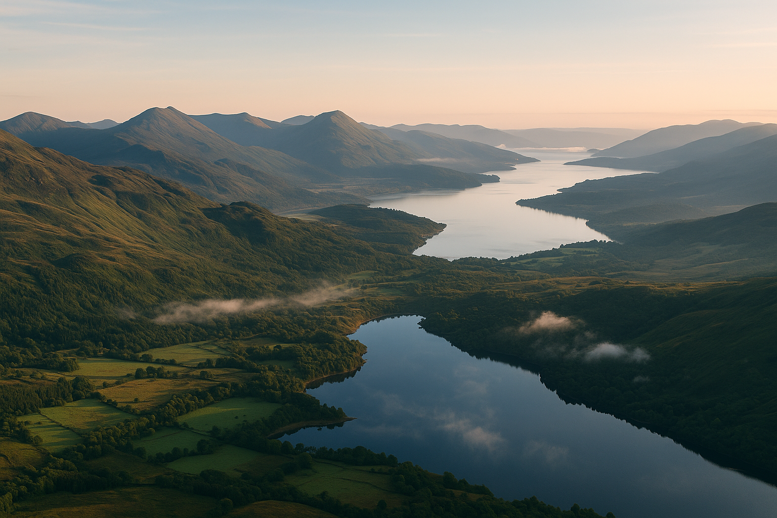
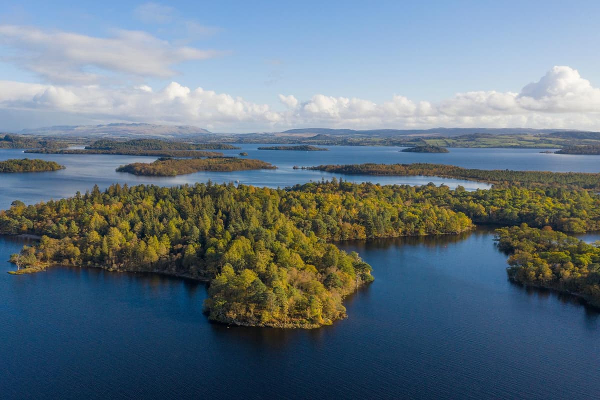
Loch Lomond
Loch Lomond is the most famous part of the park. It is the largest freshwater loch in Great Britain by surface area. The loch has over 30 small islands and is surrounded by rolling hills and scenic villages. Popular activities here include boat trips, kayaking, fishing, and walking. A map of this area shows islands, shoreline trails, viewpoints, and visitor centres. Wildlife such as ospreys, deer, and otters can often be spotted near the water.
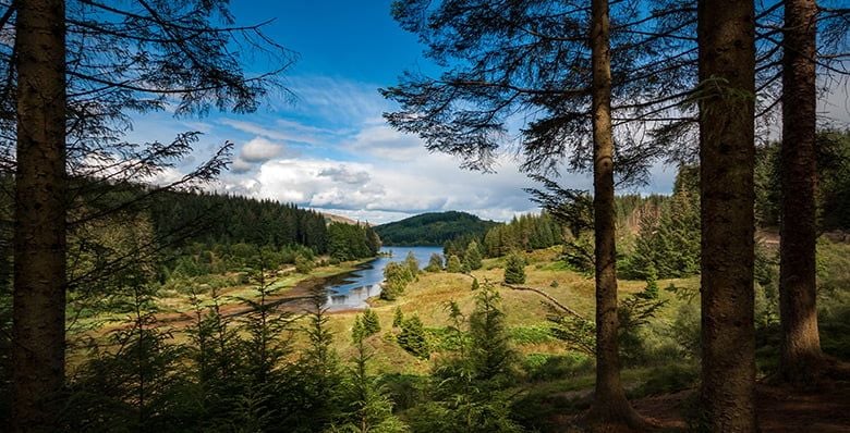
The Trossachs
The Trossachs region is known for its wooded hills, peaceful lochs, and winding roads. It’s often called the "Highlands in miniature" because it has a mix of landscapes just like the Scottish Highlandsbut on a smaller scale. The area includes places like Loch Katrine, Duke’s Pass, and Ben A’an. This region is popular for family walks, cycling, and picnicking. A good map highlights forest trails, scenic drives, and picnic spots throughout the Trossachs.
Breadalbane
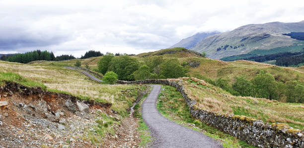
Breadalbane is the most rugged and mountainous part of the park. It sits in the northern area and includes several Munros (mountains over 3,000 feet), such as Ben More and Ben Lawers. This region is ideal for experienced hikers and climbers looking for a challenge. The landscape includes open moorland, rocky slopes, and quiet glens. Maps of Breadalbane help visitors navigate remote paths and high peaks safely.
Argyll Forest
Argyll Forest lies in the western part of the park and is known for its steep hills, deep glens, and ancient woodlands. This region is rich in wildlife and has a long history of farming, forestry, and clan life. Quiet lochs, forest tracks, and hidden waterfalls make this a peaceful part of the park to visit. A map of Argyll Forest shows winding roads, forest walks, and wildlife viewing areas.
Population Of Loch Lomond & The Trossachs National Park
The park is mostly rural, with a small population. Around 15,000 people live within its boundaries. Most residents live in small towns or scattered villages like Balloch, Callander, and Killin.
People who live in the park work in farming, tourism, forestry, or small local businesses. The peaceful setting and strong sense of community are a big part of the park’s charm.
Types Of Loch Lomond & The Trossachs National Park Map
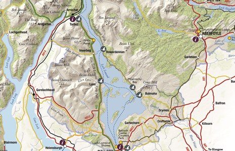
Maps of the national park come in different types. Some are printed, while others are digital and can be used on phones or GPS devices.
- Ordnance Survey Mapsare the most detailed and accurate. Look for OS Landranger (sheet 56 and 57) or Explorer maps (OL39, OL46, etc.).
- Visitor Mapsfrom the National Park Authority are useful for seeing towns, attractions, and main roads.
- Digital Maps and Appslike ViewRanger, OS Maps, or AllTrails help you follow routes using GPS. Download them in advance, as signal can be weak in some areas.
Landmarks And Points Of Interest
Loch Lomond & The Trossachs National Park is filled with famous landmarks and scenic spots. Adding these to your map will help you make the most of your visit.
Ben Lomond
One of Scotland’s most climbed Munros. The hike to the top is popular, and the views over Loch Lomond are stunning, especially on a clear day.
Loch Katrine
A peaceful loch known for boat cruises, walking paths, and family-friendly trails. The area is linked to writer Sir Walter Scott and offers a quiet escape.
The Cobbler (Ben Arthur)
A dramatic mountain in the Arrochar Alps, loved by hikers and climbers. Its sharp peaks and rugged look make it one of the park’s most iconic sights.
Falls Of Dochart
Located in the village of Killin, these waterfalls are a favourite photo spot. The rushing water over the rocks is especially beautiful after rain.
Conic Hill
A short hike with rewarding views over Loch Lomond and its islands. The trail starts near the village of Balmaha and is great for first-time walkers.
Balloch
A lively town at the southern edge of Loch Lomond. It has a visitor centre, Balloch Castle Park, shops, restaurants, and access to boat trips.
Aberfoyle
A small, charming village surrounded by forest. It’s a great base for walks, especially in Queen Elizabeth Forest Park, and a good place to see red squirrels.
Popular Walking And Hiking Routes On The Map
Walking is one of the best ways to enjoy the park. Trails are shown on most detailed maps, with route difficulty and distance clearly marked.
West Highland Way
A long-distance walking route that passes through the park from Drymen to Inverarnan. It follows loch shores and forest paths and is well-marked.
The Great Trossachs Path
A scenic route between Callander and Inversnaid. It takes you past lochs, woodlands, and hills. Suitable for walkers and cyclists.
Ben A’an Hike
A short, steep trail leading to one of the best viewpoints in the park. Perfect for those looking for a quick climb with big views.
Loch Ard Forest Trails
Flat and easy trails through woodland and around small lochs. Great for families, with picnic spots and wildlife along the way.
Rob Roy Way
Named after the famous Scottish folk hero, this long-distance route connects Drymen to Pitlochry. Parts of it run through the national park.
Best Scenic Drives Through The Park
If you prefer driving, the park offers several routes with breathtaking views. These roads can be marked on your map for easy navigation.
A82 Along Loch Lomond
A famous drive with loch views, especially between Balloch and Tarbet. Some parts are narrow, so take care and go slowly.
Duke’s Pass (A821)
A winding road between Aberfoyle and Loch Katrine. It passes through dense forest and hills, making it ideal for photos and short stops.
Three Lochs Forest Drive
A peaceful route through forest areas with views of Loch Drunkie, Loch Achray, and Loch Venachar. Open seasonally and sometimes one-way.
Wildlife-Watching Spots To Mark On Your Map
The national park is rich in wildlife, from birds of prey to deer and red squirrels. These places offer some of the best chances to see animals in their natural homes.
Loch Lomond Islands
Great for spotting water birds like herons, ospreys, and geese. Some islands are quiet enough to see otters or nesting birds.
Queen Elizabeth Forest Park
Located near Aberfoyle, this forest area is home to red deer, pine martens, and rare woodland birds. The visitor centre also has viewing spots and trails.
Inversnaid RSPB Reserve
A protected area by Loch Lomond, perfect for birdwatching. Golden eagles, peregrine falcons, and other birds live in the surrounding woods and cliffs.
Loch Arklet And Glen Etive
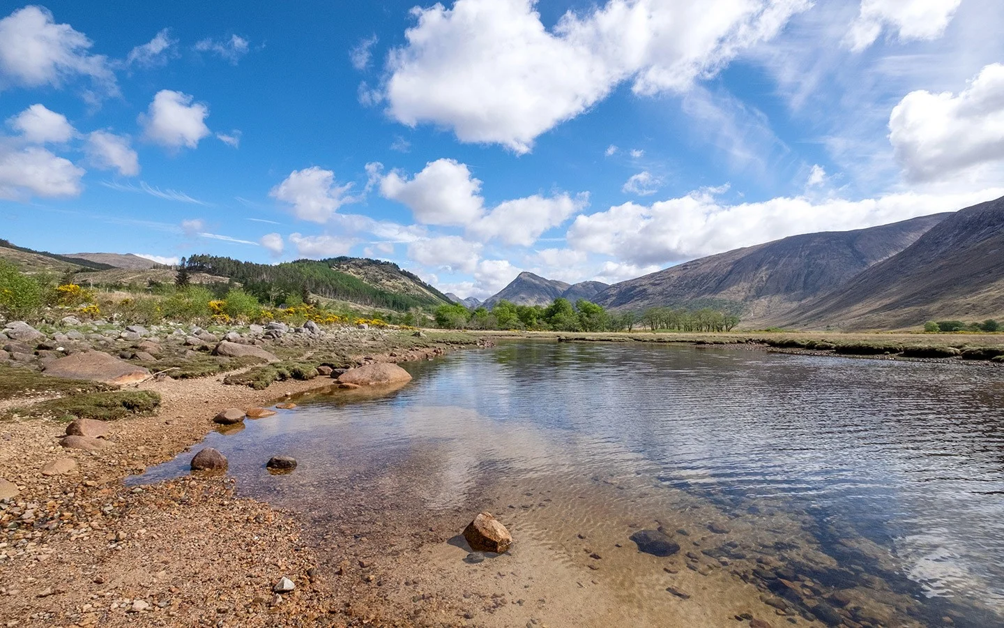
More remote areas that are peaceful and less visited. These spots are often great for seeing larger mammals and shy birds.
Tip:Early morning and sunset are the best times for wildlife watching. Bring binoculars and stay quiet to improve your chances.
Outdoor Activities To Mark On Your Map
Loch Lomond & The Trossachs National Park is a great place for outdoor fun. A good map helps you find safe areas for adventure while avoiding restricted zones. Here are some popular activities and what to look for on your map:
Kayaking And Canoeing
Loch Lomond is ideal for paddling. Many of its bays and small islands offer calm waters and beautiful scenery. Maps often show:
- Designated launch points
- Parking near slipways
- Water safety zones
- No-go areas or protected wildlife zones
Popular launch areas include Luss, Balmaha, and Milarrochy Bay. Always follow local water safety advice and respect wildlife.
Cycling Routes
The park has cycle paths for all levels, from gentle lochside rides to forest trails and mountain tracks. Maps highlight:
- National Cycle Route 7, which runs through the park
- Family-friendly trails near Loch Katrine, Callander, and Loch Ard
- Off-road and mountain biking routes
- Bike hire locations and parking spots
A map helps you pick the right trail for your skill level and find rest stops along the way.
Climbing And Bouldering
The rugged landscape is perfect for climbing. Some popular climbing spots marked on maps include:
- The Cobbler (Ben Arthur)- Well-known for rock climbing and great views
- Ben Narnain- A more technical climb, close to Arrochar
- Cruach Ardrainand other peaks in the Breadalbane area
Climbers should always carry a detailed OS map and check weather conditions before heading out.
Camping Zones
Camping is popular in the park, but it’s important to follow the rules. There are two main types of camping:
- Wild Camping- Allowed in certain areas under the Scottish Outdoor Access Code
- Permit Zones- Around parts of Loch Lomond, where camping requires a permit
- Campsites- Marked on most visitor maps with facilities like toilets, water, and waste disposal
Use a map to check where camping is allowed and avoid sensitive or restricted areas.
Facilities And Visitor Services On The Map
A well-marked map of Loch Lomond & The Trossachs National Parkdoesn’t just show trails and mountains it also helps you find important facilities that make your visit easier and more enjoyable. Here are the key features to look for:
Visitor Centres
Visitor centres provide maps, advice, leaflets, and local information. They often have toilets, cafés, and exhibits about the area. Key locations include:
- Balloch- Main gateway centre with a shop and displays
- Aberfoyle- Inside Queen Elizabeth Forest Park
- Callander- Near walking routes and local services
- Tyndrum- Small centre with local info and maps
These are useful starting points for planning your day.
Toilets And Parking Areas
Toilets and car parks are marked on most detailed visitor maps. You'll find them:
- Near popular walking routes like Ben A’an, Conic Hill, and Loch Katrine
- In towns like Balloch, Killin, and Arrochar
- At forest parks and picnic areas
Using your map to find these spots helps avoid last-minute stress.
Picnic Areas
Many areas around the park have designated picnic spots, often with:
- Benches and tables
- Rubbish bins or recycling points
- Nearby parking or viewpoints
Popular picnic locations include Loch Drunkie, Loch Venachar, and the shores of Loch Lomond.
Boat Launch Points
If you’re planning to kayak, canoe, or paddleboard, check your map for boat launch sites. These are usually found at:
- Luss
- Balmaha
- Milarrochy Bay
- Rowardennan
Some launch sites have nearby parking, toilets, or equipment hire.
Accessible Routes And Facilities
Some maps show wheelchair-accessible paths and facilities. These routes are:
- Flat, paved, and well-maintained
- Often found near visitor centres and loch shores
- Marked clearly on updated tourist maps
Look for paths at places like Balloch Castle Country Park, Loch Katrine, and Loch Ard.
Seasonal Tips And Map-Based Planning Advice
Spring (March To May)
Spring brings fresh greenery, blooming wildflowers, and active wildlife. It’s a great time for gentle walks and nature spotting.
- Look for forest trails and lochside paths on your map
- Mark picnic spots and nature reserves
- Bring binoculars for birdwatching
- Check if paths are muddy or closed after rain
Summer (June To August)
Summer is warm and lively, with long daylight hours. It’s also the busiest season, so planning is key.
- Use your map to find quieter paths and hidden lochs
- Avoid popular car parks at peak times
- Highlight swimming areas, shaded trails, and water refill points
- Start early or visit in the evening to miss the crowds
Autumn (September To November)
Autumn turns the forests golden and red. It’s cooler and less crowded, making it perfect for scenic walks and photography.
- Choose woodland trails to enjoy the autumn colours
- Mark lesser-known trails on your map for a peaceful walk
- Bring layers and check daylight times before heading out
- Watch for slippery paths after rain
Winter (December To February)
Winter brings snow to the hills and shorter days. It can be a peaceful time to visit, but conditions can change quickly.
- Stick to well-marked paths and lower-level routes
- Use maps with contour lines to avoid steep or icy ground
- Pack extra layers, food, and a torch
- Check forecasts and trail conditions before setting off
Extra Tips For All Seasons
- Always carry a paper map or offline digital version
- Use contour lines to understand hills, slopes, and valleys
- Mark shelters, toilets, and emergency contacts in advance
- Plan routes with turn-back options in case of bad weather
Planning with the right map helps you enjoy the park safely, no matter the season.
People Also Ask
What Are Loch Lomond And The Trossachs Famous For?
Loch Lomond is home to breath-taking scenery, craggy hills, steep mountain tops, sparkling lochs and beautiful villages with old brick work and charming locals.
What’s The Best Route To Drive Through The National Park?
The A82 offers stunning lochside views, while Duke’s Pass gives a scenic forest drive. Both are favourites for visitors.
Are There Good Beginner Trails On The Map?
Yes. Trails like the Loch Ard paths and Conic Hill are short, easy, and clearly marked on most maps.
Which Celebrity Bought An Island On Loch Lomond?
Broadcaster Kirsty Young has won the right to build a holiday lodge on Loch Lomond's 'Wallaby Island'. The former Desert Island Discs presenter and her husband, Nick Jones, bought the 103-acre Inchconnachan after it was put up for sale for offers over £500,000.
Final Thoughts
Using a detailed map of Loch Lomond & The Trossachs National Park can turn a good visit into a great one. It helps you plan better, stay safe, and enjoy more of what the park offers. Take time to plan your routes, note important places, and understand the landscape.
Jump to
Quick Facts About Loch Lomond & The Trossachs National Park
Geographical Overview Of Loch Lomond & The Trossachs National Park
History Of Loch Lomond & The Trossachs National Park
Towns On The Map Of Loch Lomond & The Trossachs National Park
Regions On The Map Of Loch Lomond & The Trossachs National Park
Population Of Loch Lomond & The Trossachs National Park
Types Of Loch Lomond & The Trossachs National Park Map
Landmarks And Points Of Interest
Popular Walking And Hiking Routes On The Map
Best Scenic Drives Through The Park
Wildlife-Watching Spots To Mark On Your Map
Outdoor Activities To Mark On Your Map
Facilities And Visitor Services On The Map
Seasonal Tips And Map-Based Planning Advice
People Also Ask
Final Thoughts

Callum Fraser
Author
Callum Fraser isn't just a writer about Scotland; he's a product of its rugged landscape and rich history. Born and raised in Perthshire, with the Highlands as his backyard, his love for the nation's stories was kindled by local storytellers and long walks through ancient glens.
This passion led him to pursue a degree in Scottish History from the University of Edinburgh. For over 15 years, Callum has dedicated himself to exploring and documenting his homeland, fusing his academic knowledge with essential, on-the-ground experience gained from charting road trips through the Cairngorms, hiking the misty Cuillins of Skye, and uncovering the secrets of traditional recipes in his family's kitchen.
As the Editor-in-Chief and Lead Author for Scotland's Enchanting Kingdom, Callum's mission is simple: to be your most trusted guide. He combines meticulous research with a storyteller's heart to help you discover the authentic magic of Scotland — from its best-kept travel secrets to its most cherished traditional recipes.
Latest Articles
Popular Articles