Map Of Loch Ness - Your Guide To Trails, Villages, And Landmarks
Unlock the magic of Loch Ness with our detailed map. Find the best trails, villages, and landmarks to create unforgettable memories.
Author:Callum FraserJun 04, 20252.6K Shares265.2K Views
Loch Ness is one of the most famous lakes in the world, located in the heart of the Scottish Highlands. It stretches over 23 miles and is surrounded by forests, hills, and quiet villages. Many people know Loch Ness because of the legend of the Loch Ness Monster, often called “Nessie,” but the area has much more to offer: beautiful nature, rich history, and local culture.
Having a detailed map of Loch Nesshelps visitors make the most of their time. A map can show you where to find walking trails, viewpoints, boat tours, castles, visitor centres, and peaceful spots away from the crowds.
Quick Facts About Loch Ness
- Location:Scottish Highlands, near Inverness
- Length:About 23 miles (37 km)
- Depth:Over 750 feet (230 metres) at its deepest point
- Famous For:The legend of the Loch Ness Monster ("Nessie")
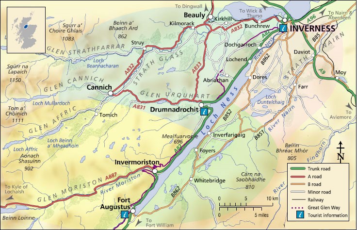
- Main Towns Nearby:Inverness, Fort Augustus, Drumnadrochit
- Popular Attractions:Urquhart Castle, Loch Ness Centre & Exhibition, boat cruises
- Activities:Walking, hiking, cycling, boat tours, wildlife watching
- Key Trails:Great Glen Way and South Loch Ness Trail
- Type of Water:Freshwater loch (lake)
- Fun Fact:Loch Ness holds more water than all the lakes in England and Wales combined
History Of Loch Ness
Loch Ness is not just famous for its size and mysterious monster it also has a rich and fascinating history that spans thousands of years. People have lived around the loch since ancient times, and it has played an important role in Scottish cultureand history.
Ancient Settlements And Formation
Loch Ness was formed during the last Ice Age, about 10,000 years ago. Huge glaciers slowly carved out the deep valley that now holds the lake. It is about 37 kilometers (23 miles) long and very deep up to 230 meters (755 feet) in some parts. Early people settled around the loch thousands of years ago, attracted by its fresh water and rich land. Archaeological finds suggest that Neolithic (Stone Age) communities lived nearby, leaving behind tools and evidence of early life.
The Role Of Scottish Gaelic
For many centuries, Scottish Gaelicwas the main language spoken around Loch Ness. Gaelic shaped the culture, place names, and stories of the Highlands. The name “Loch Nis” itself comes from Gaelic. This language was used by local clans to share history, traditions, and legends orally. Gaelic storytelling kept the culture alive, passing down tales of heroes, battles, and even mysterious creatures believed to live in the loch.
Clans And Medieval Times
During medieval times, the lands around Loch Ness were controlled by powerful Scottish clans, such as the Mackintoshes and Urquharts. These clans spoke Gaelic and played important roles in the history and politics of the Highlands. Castles like Urquhart Castle were built during this period and served as key defensive sites. Urquhart Castle, overlooking Loch Ness, was involved in many battles and skirmishes from the 13th century onward, marking it as a symbol of clan power and struggle.
The Legend Of The Loch Ness Monster
The deep, dark waters of Loch Ness have long inspired mystery and folklore. The famous Loch Ness Monster, or “Nessie,” is part of local legend that has been told in Gaelic for generations before gaining worldwide attention. The monster stories likely began as part of traditional Gaelic myths about water creatures and spirits that guarded the loch. These tales attracted attention from around the world, making Loch Ness one of Scotland’s most famous tourist spots.
Modern Importance And Culture
Today, Loch Ness remains a symbol of Scottish natural beauty and Gaelic heritage. The language and culture still influence the area’s place names, festivals, and local traditions. Visitors can experience both the natural wonders of the loch and its rich cultural history, learning about the Gaelic language and the people who have lived here for thousands of years.
Geographical Overview Of Loch Ness
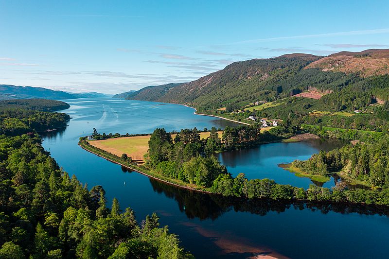
Loch Ness is a long, deep, freshwater lake in the Scottish Highlands. It stretches for about 23 miles (37 kilometres) from the town of Inverness in the north to Fort Augustus in the south. This makes it one of the largest and most famous lochs in Scotland.
Surrounded By Mountains And Forests
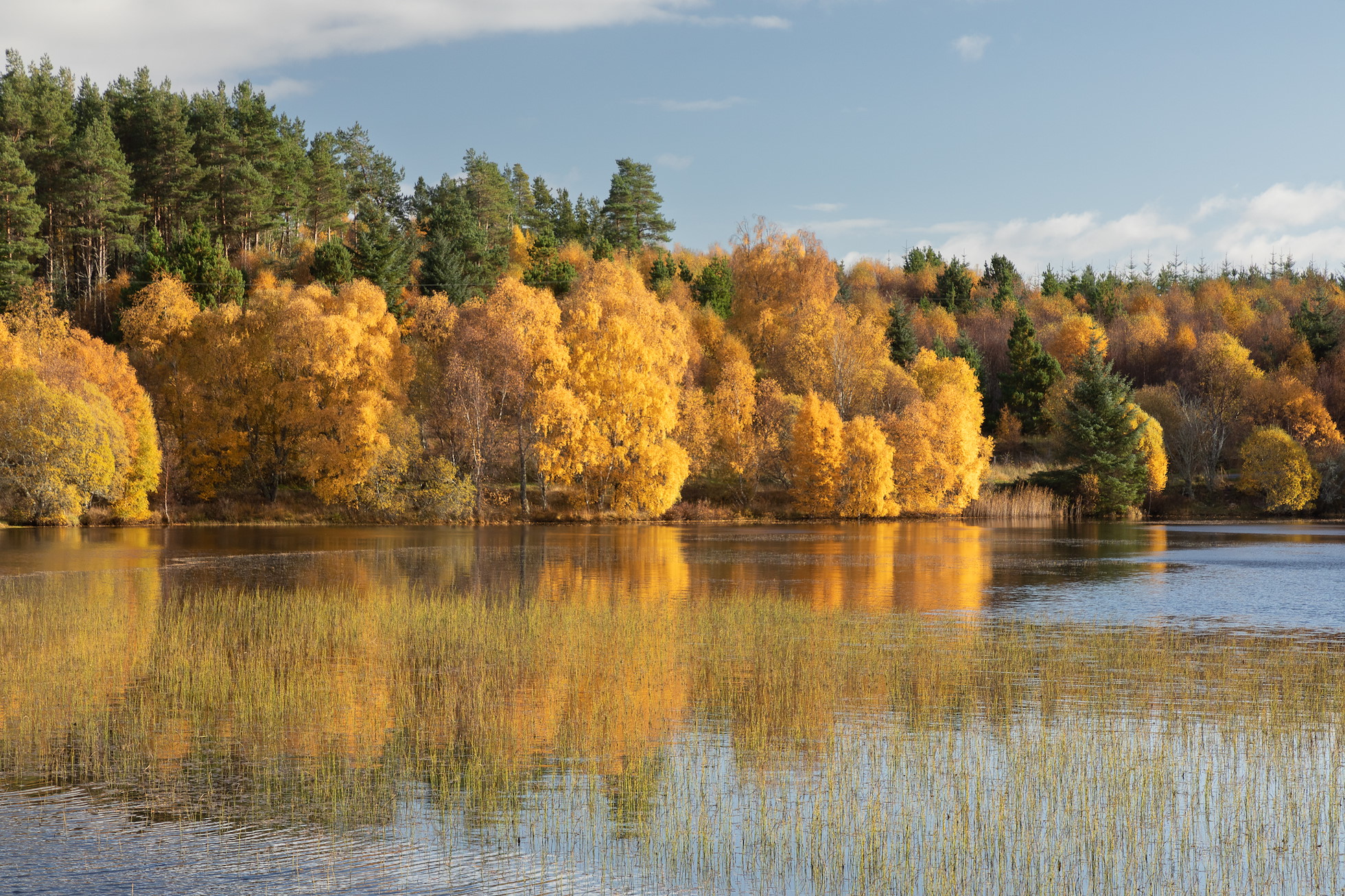
The loch lies in a natural valley called the Great Glen, which was formed by ancient glacial activity and fault lines. The area around the loch is full of steep hills, green forests, and quiet glens. These natural features give Loch Ness its wild and peaceful beauty, making it a favourite place for photographers, hikers, and nature lovers.
Rivers And Water Sources
Loch Ness is fed by several rivers and streams. The most important ones include:
- River Oich (from Loch Oich)
- River Moriston
- River Foyers
- River Enrick
These rivers bring in water from surrounding hills and nearby lochs. At the north end, the River Ness flows out of Loch Ness and passes through Inverness, eventually reaching the Moray Firth and the North Sea.
Weather And Climate
The area around Loch Ness has a mild and wet climate, thanks to the surrounding mountains and nearby sea. Rain is common throughout the year, and the loch rarely freezes, even in winter. Mist and low clouds often settle over the water, which adds to the mystery of the place especially when talking about the legend of Nessie, the Loch Ness Monster.
Strategic Location
Loch Ness is located on a major natural route through the Highlands called the Great Glen Fault Line. This route has been important for traveland trade since ancient times. Today, visitors can drive along the A82 road, which runs along the western side of the loch. There’s also the Caledonian Canal, which connects Loch Ness with other nearby lochs and waterways.
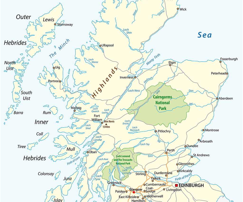
What Does A Map Of Loch Ness Show?
A good map of Loch Ness gives you a clear picture of what the area looks like and what you can see or do there. It helps visitors plan their trip and understand more about the loch and its surroundings. Here’s what you’ll usually find on a detailed map of Loch Ness:
Shape And Size Of The Loch
Loch Ness has a very long and narrow shape. It stretches about 37 kilometres (23 miles) from north to south and is only about 1.5 kilometres (1 mile) wide. The map will show this clearly, helping you see how the loch winds through the Highland landscape. Its slim shape makes it look almost like a river, but it is much deeper and calmer.
Depth Of Loch Ness
One of the most amazing things about Loch Ness is its depth. A good map may show the deepest parts, reaching 230 metres (755 feet). That makes it one of the deepest lakes in the United Kingdom. Some topographical or 3D maps even show how the bottom of the loch slopes down and rises again, which is helpful for divers, researchers, and boaters.
Surrounding Hills, Forests, And Valleys
Maps often show the terrain around the loch. You’ll see hills, mountains, woodlands, and valleys marked on the map. This helps walkers, hikers, and photographers find the best places for views. It also gives you an idea of how wild and natural the area really is. Places like the Great Glen and Loch Ness Forest are often highlighted.
Castles, Villages, And Landmarks
Important places around Loch Ness are also marked. A map will show:
- Urquhart Castle - a popular historic site on the western shore
- Fort Augustus - a scenic village at the southern tip
- Drumnadrochit - a village with museums about the Loch Ness Monster
- Inverness - the main city at the north end of the loch
Other landmarks like old churches, viewpoints, and heritage centres may also appear on more detailed maps.
Walking, Cycling, And Driving Routes
Good maps show paths and trails for walkers, hikers, and cyclists. You might see:
- The Great Glen Way - a famous long-distance walking and biking trail
- Local footpaths through forests and hills
- Roads like the A82, which follows the loch’s western shore
Top Attractions Marked On The Map
A good map of Loch Ness will highlight many well-known attractions around the loch. These places are perfect for learning, relaxing, taking photos, and enjoying the natural beauty of the Scottish Highlands. Here are some of the top attractions you'll often see marked on tourist maps:
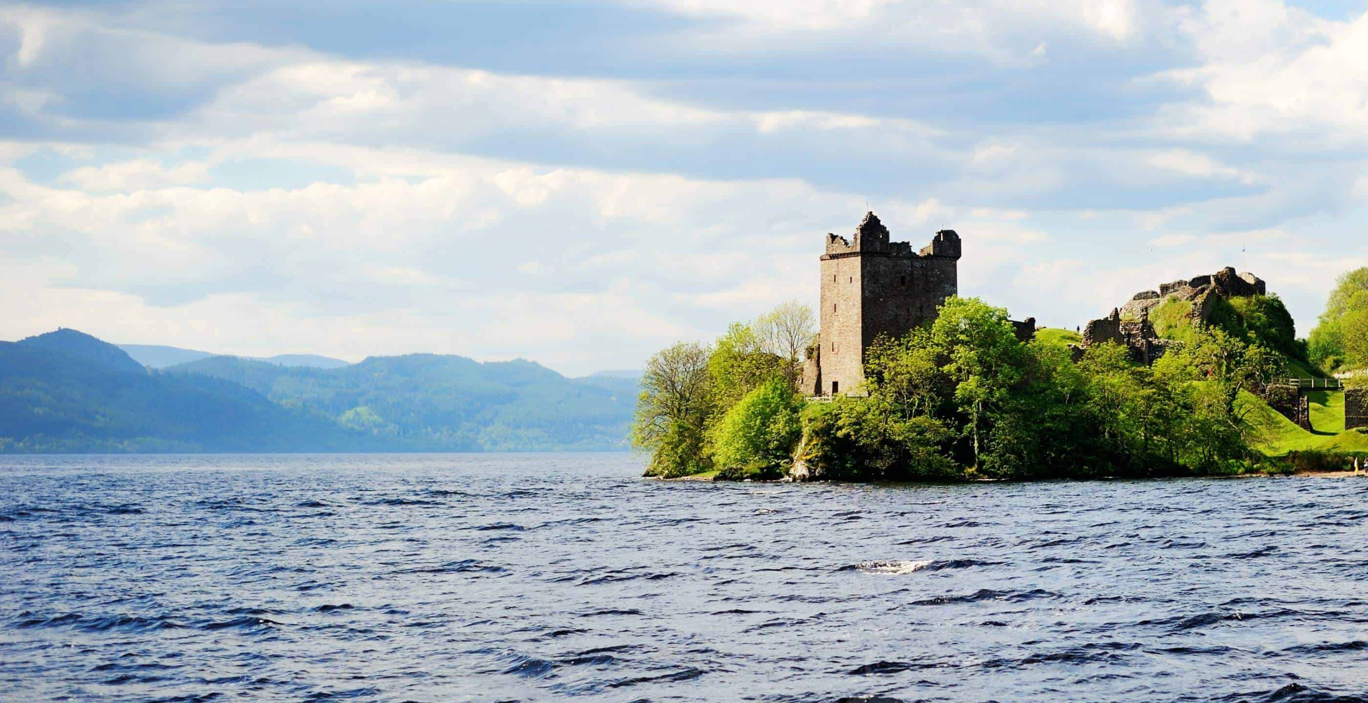
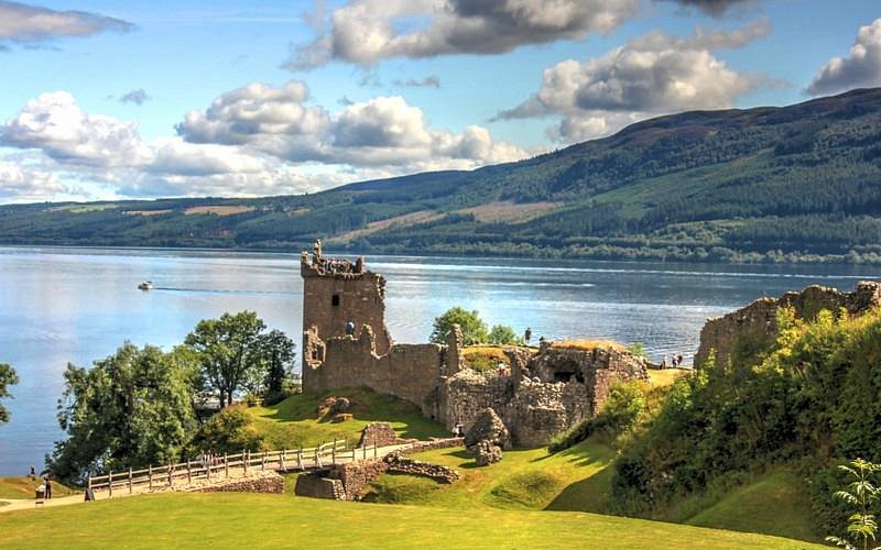
1. Urquhart Castle
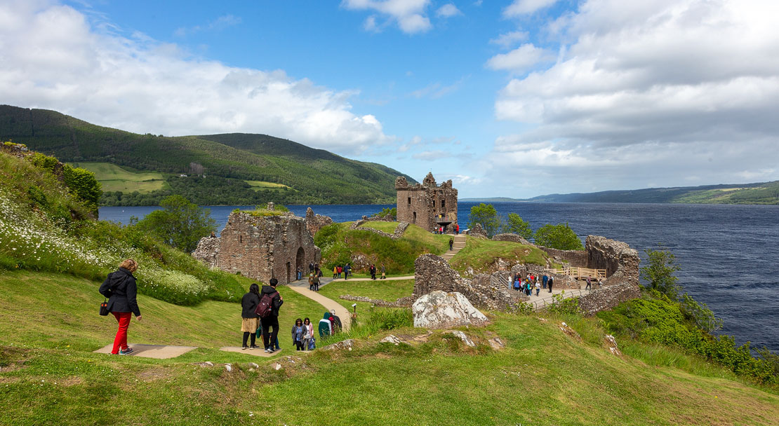
Located on the western shore of Loch Ness, Urquhart Castle is one of the most famous and photographed places in the area. The castle ruins sit on a small hill overlooking the loch, offering amazing views of the water. It's a great place to imagine what life was like in medieval Scotland.
2. Loch Ness Centre & Exhibition
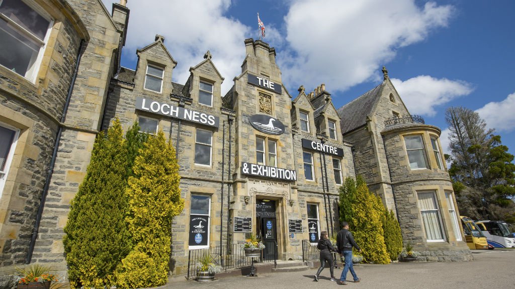
In the village of Drumnadrochit, you'll find the Loch Ness Centre & Exhibition. This popular attraction teaches visitors all about the science, history, and mystery of the loch. Inside, there are displays about the geology of Loch Ness, the search for the Loch Ness Monster, and stories from local people.
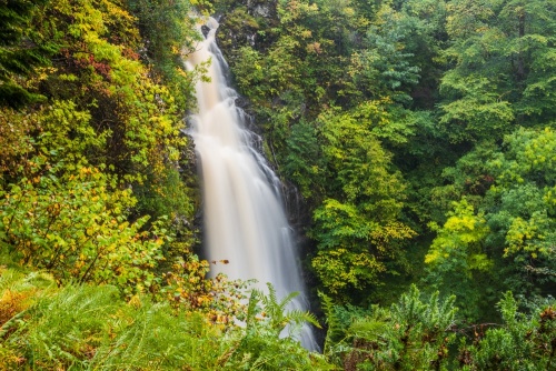
3. Falls Of Foyers
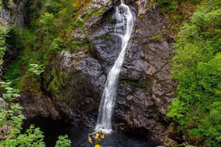
The Falls of Foyers is a beautiful waterfall located on the eastern side of Loch Ness. It's surrounded by forest and reached by a walking trail that goes through peaceful woodland. The waterfall drops about 50 feet (15 metres) into a deep gorge. It has inspired poets and artists for centuries, including the famous Scottish poet Robert Burns.
4. Dores Beach
Dores Beach is a quiet and scenic spot at the northern end of Loch Ness, close to the village of Dores. It’s a popular place for picnics, walks, and watching sunsets. From here, you get a wide view of the whole loch, which makes it a favourite spot for people who want to try and spot the Loch Ness Monster. The beach is also home to “Nessie Hunter” Steve Feltham, who has been living there in a van for years searching for signs of Nessie. It’s often shown on maps as a key point of interest.
5. Caledonian Canal
The Caledonian Canal is an impressive man-made waterway that connects Loch Ness to other lochs and rivers across the Highlands. It was built in the early 1800s and is still used by boats today. You’ll find locks, bridges, and towpaths that are fun to visit. Walking or cycling along the canal is a peaceful way to enjoy the landscape.
6. Fort Augustus
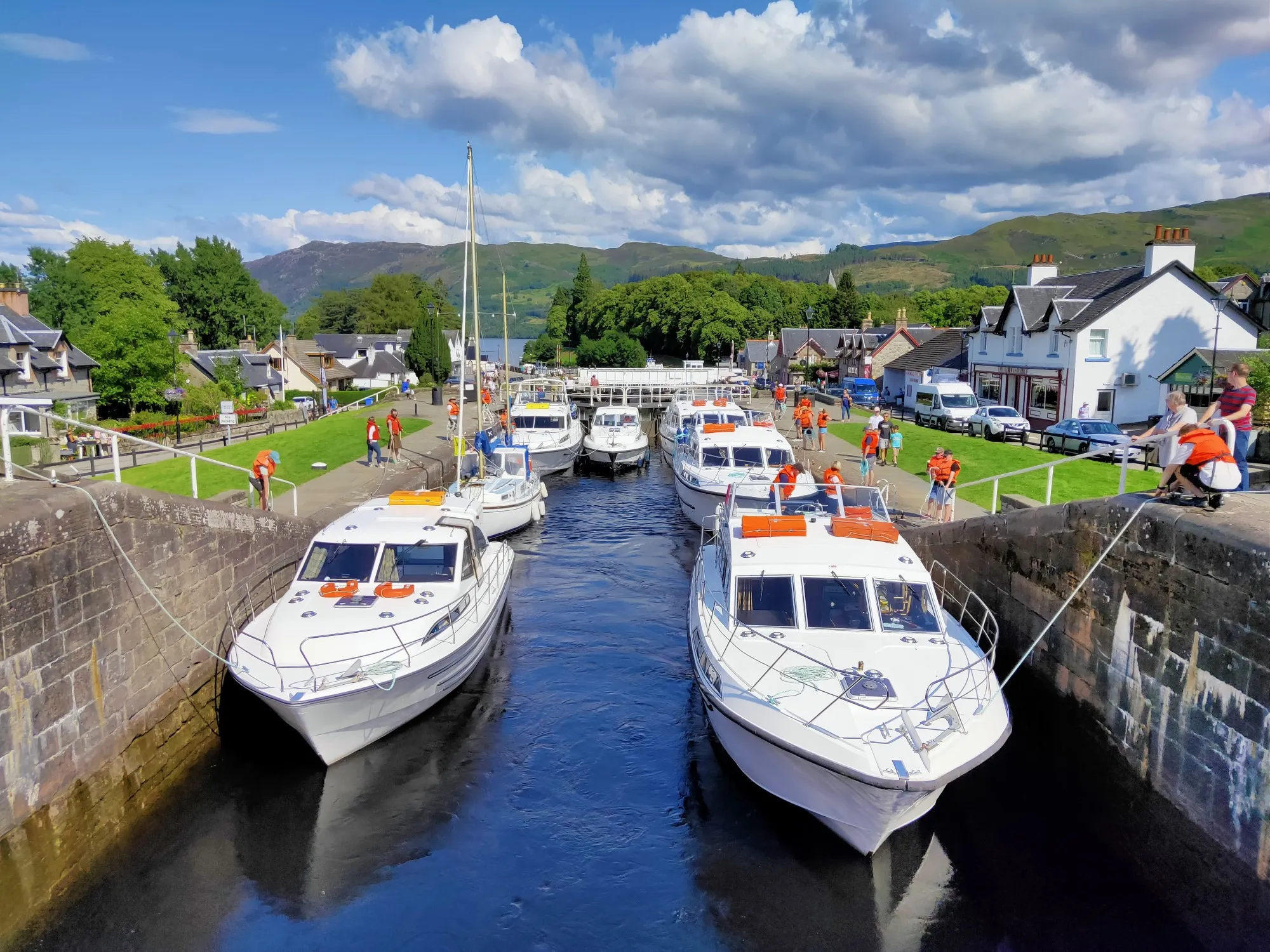
Located at the southern tip of Loch Ness, Fort Augustus is a charming village known for its lock system on the Caledonian Canal. Visitors can watch boats passing through the locks and explore the quaint town filled with shops, cafes, and beautiful views. It’s a great base for boat trips on the loch.
7. Nessieland
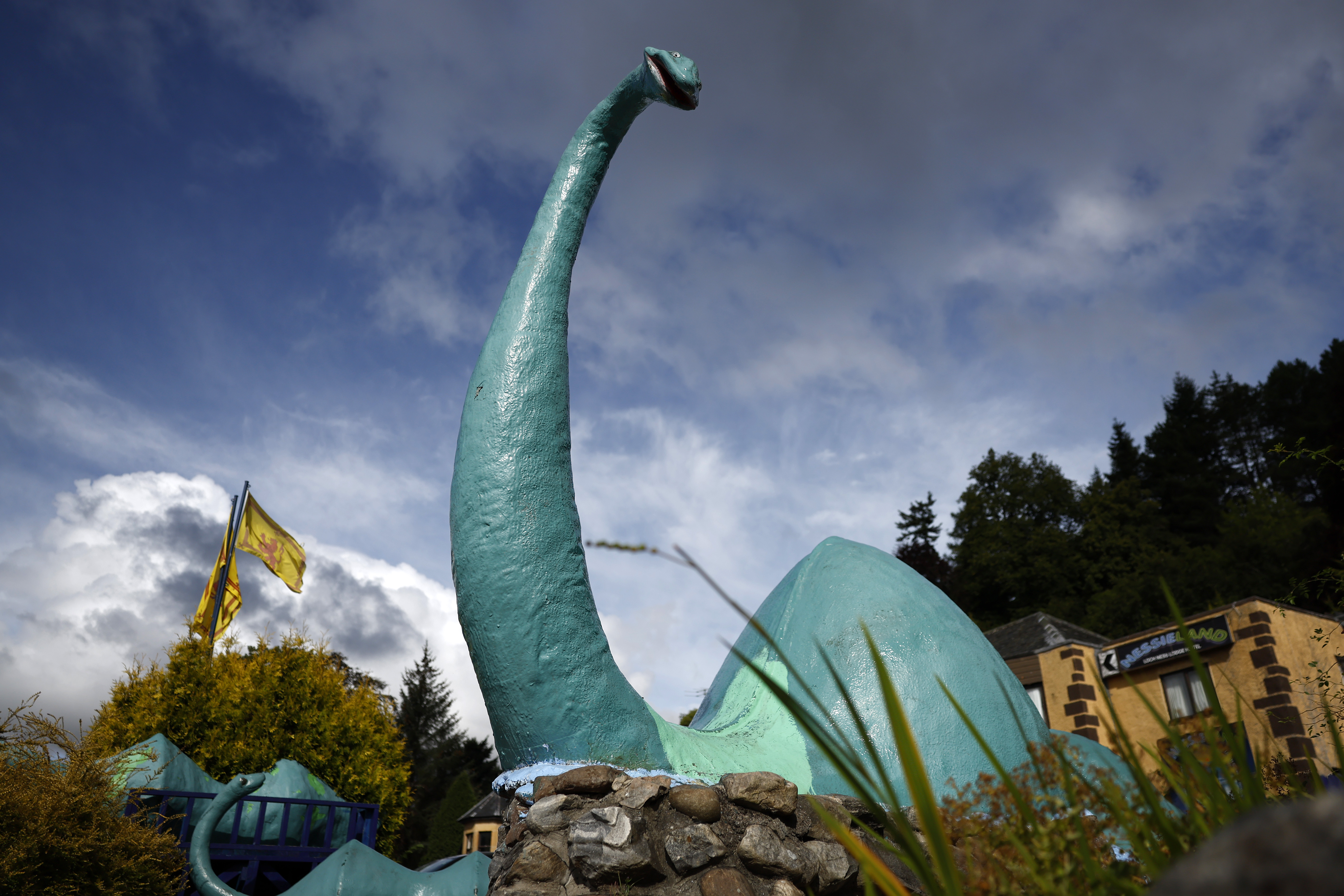
Near Drumnadrochit, Nessieland is a family-friendly visitor attraction dedicated to the Loch Ness Monster legend. It features interactive displays, Nessie-themed activities, and a gift shop. It’s especially fun for children and those interested in the mythical side of Loch Ness.
8. The Jacobite Steam Train
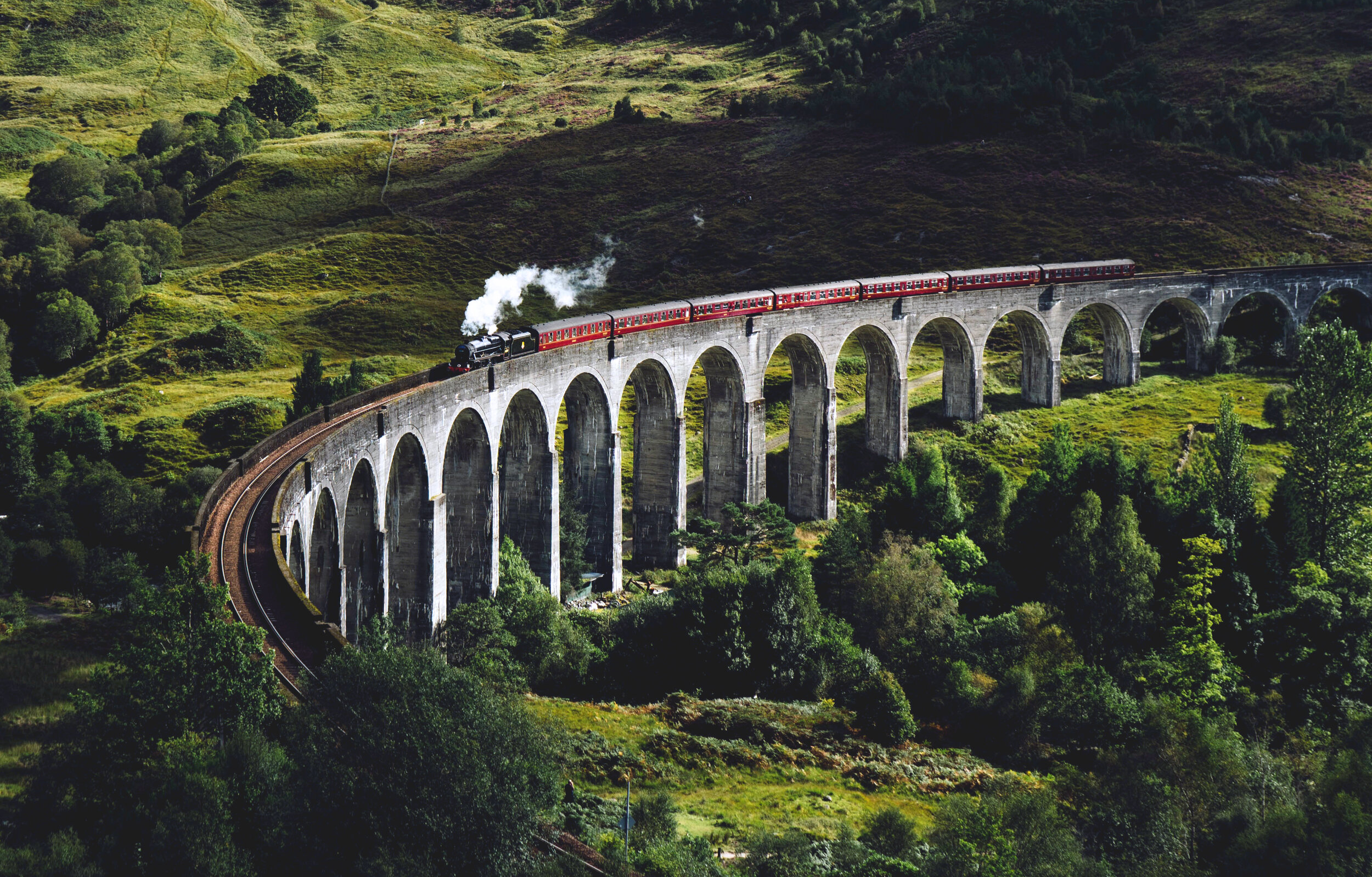
While not directly on Loch Ness, the Jacobite Steam Train runs nearby and offers one of the most scenic train rides in Scotland. It travels through the Highlands and crosses the famous Glenfinnan Viaduct (seen in the Harry Potter films), making it a popular excursion for tourists.
9. Falls Of Divach
Another beautiful waterfall located near Loch Ness, the Falls of Divach is a quieter and less visited spot. It’s part of a peaceful nature walk starting near the village of Abriachan and leads to the spot where the River Divach flows into Loch Ness.
10. Bona Lighthouse
At the northern end of the loch, near Inverness, the Bona Lighthouse sits beside the water and offers picturesque views of the loch meeting the sea. It’s a nice spot for photography and a peaceful walk along the shore.
11. Abriachan Forest Trust
Just west of Loch Ness, this community-run forest offers walking trails, picnic spots, and educational activities. The forest provides spectacular views over Loch Ness and is a great place for nature lovers to explore away from the main tourist spots.
Villages And Towns Around Loch Ness
Fort Augustus
Fort Augustus is located at the very southern end of Loch Ness. This small town is famous for its impressive canal locks on the Caledonian Canal. Visitors come here to watch boats moving through the locks, which is a unique experience. Fort Augustus also offers beautiful views of the loch and surrounding hills. The town has shops, cafes, and places to stay, making it a convenient spot for visitors.
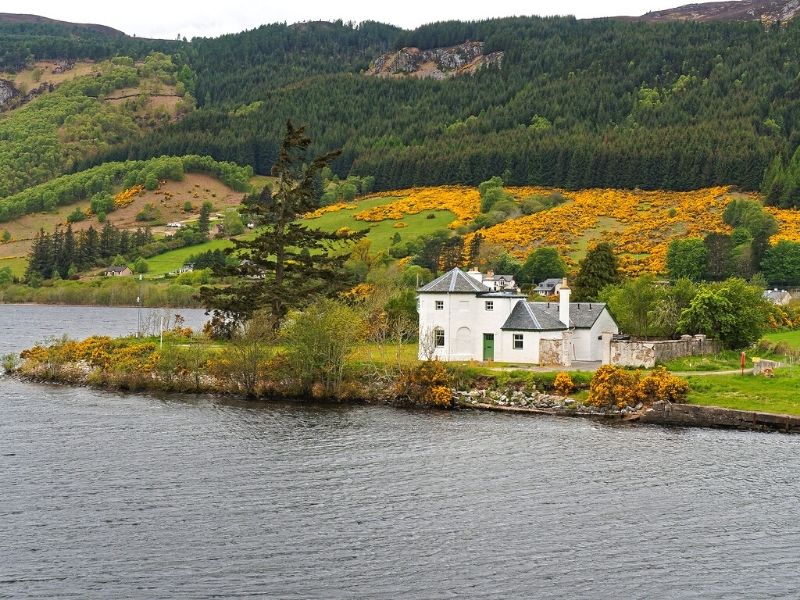
Drumnadrochit
Drumnadrochit sits on the western shore of Loch Ness. It is well known because it is close to Urquhart Castle, one of the most popular historical sites near the loch. The village also hosts the Loch Ness Centre and Exhibition, which shares stories about the loch’s history and the famous monster legend. Drumnadrochit has several hotels, restaurants, and shops, making it a lively place to visit.
Invermoriston
Invermoriston is a small, peaceful village located near the western shore of Loch Ness. It is famous for its old stone bridge, which adds to the village’s charm. Invermoriston offers good walking trails for visitors who enjoy nature and fresh air. This village is a quieter stop where visitors can enjoy local culture and a slower pace.
Foyers
Foyers is a village on the eastern side of Loch Ness. It is well known for the stunning Falls of Foyers, a beautiful waterfall surrounded by forests. The village has a friendly community and provides a nice place to relax after exploring the falls or hiking in the nearby woodland areas. It’s a great choice for visitors who want to connect with nature.
Dores
Dores is a small village close to Inverness at the northern end of Loch Ness. It is a quiet place popular with people who like walking and picnics. The village gives easy access to the loch’s northern shore, where visitors can enjoy peaceful beaches and beautiful views. Dores offers a few local places to eat and stay, making it a pleasant stop for travelers
Road And Trail Access Around Loch Ness
A82 Road
The A82 is the main road along the western shore of Loch Ness. It connects Inverness, the largest city nearby, to Fort Augustus at the southern end of the loch. This road offers beautiful views of the water and the surrounding hills, making it a scenic drive. It is also the most convenient way to access many attractions and villages along the loch.
Loch Ness 360° Trail
The Loch Ness 360° Trail is a circular walking and cycling route that goes all the way around Loch Ness. It passes through forests, villages, and hills, allowing visitors to experience different landscapes and peaceful spots. The trail is well-marked and suitable for people of various fitness levels.
Great Glen Way
The Great Glen Way is a long-distance trail stretching about 79 miles (127 km). It follows the Caledonian Canal and the western shore of Loch Ness, linking Fort William to Inverness. The path is popular with hikers and runners who want to enjoy stunning Highland scenery, including forests, lochs, and mountains.
South Loch Ness Trail
The South Loch Ness Trail runs along the quieter, less busy eastern side of the loch. It offers peaceful walking paths through woods and hills, perfect for nature lovers seeking solitude. The trail is less developed but marked on detailed maps, ideal for calm and slower-paced exploration.
Best Boat Routes And Water Access Points On Loch Ness
Fort Augustus Boat Tours
Fort Augustus, located at the southern tip of Loch Ness, is a key departure point for boat tours. These guided trips allow visitors to enjoy views of the loch, learn about its history, and maybe hear tales of the legendary Loch Ness Monster. Boats vary from small cruises to larger tour boats.
Drumnadrochit Boat Tours
Drumnadrochit, near Urquhart Castle, offers several boat tour options. These tours provide close-up views of the loch’s shores and surrounding hills. They often include expert commentary about the local wildlife and historical sites, making them a great way to learn while enjoying the water.
Inverness Boat Tours
Inverness, the closest city to the loch’s northern end, also offers boat tours that explore parts of Loch Ness. These tours give a different perspective of the loch’s vastness and connect visitors to the Caledonian Canal, highlighting Scotland’s impressive waterways.
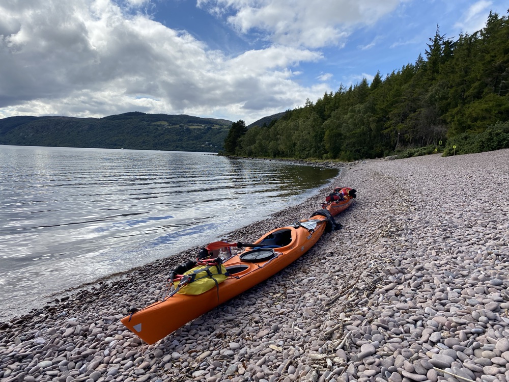
Kayak And Canoe Launch Points
For paddling enthusiasts, there are several marked launch points around Loch Ness. These spots allow kayakers and canoeists to enter the water safely and explore the loch at their own pace. Paddlers should be experienced and prepared for changing weather, as the loch is large and can be challenging.
Fishing Access Points
Fishing is popular on Loch Ness, and maps mark designated fishing areas where anglers can try catching local fish species like trout and salmon. These spots are chosen to protect the environment and fish populations. Fishing licenses and local rules must be followed to preserve the loch’s natural beauty.
Wildlife And Natural Features Shown On The Map
Red Deer
Red deer are often seen in the hills surrounding Loch Ness. These large mammals are common in the Scottish Highlands and can sometimes be spotted grazing or moving through the landscape. Maps may mark areas where red deer are frequently seen, helping visitors plan wildlife viewing trips.
Golden Eagles And Ospreys
The skies above Loch Ness are home to impressive birds of prey like golden eagles and ospreys. These powerful birds soar high over the loch and forests, hunting for fish and small mammals. Some maps highlight good spots for birdwatching, especially near cliffs and open woodland.
Otters
Otters live along the shoreline and in the loch’s rivers. These playful mammals are shy but occasionally seen swimming or resting near the water. Maps might show quiet, protected areas where otters are known to live, providing opportunities for visitors to spot them without disturbing their habitat.
Red Squirrels
The woodlands around Loch Ness are home to red squirrels, a native species of Scotland. Unlike their grey cousins, red squirrels are less common and protected by conservation efforts. Maps often indicate forests or nature reserves where red squirrels can be seen, making them great places for a peaceful walk.
Nature Reserves And Protected Areas
Many maps mark nature reserves and protected zones around Loch Ness. These areas help preserve the natural habitat and wildlife. Visitors interested in nature and wildlife watching can use these map details to find the best locations for safe and respectful observation.
Types Of Loch Ness Maps
Tourist Maps
These maps focus on showing popular attractions, places to stay, restaurants, and other services. They are perfect for visitors who want an easy overview of the area’s highlights.
Topographic Maps
Topographic maps show detailed land shapes, hills, valleys, and elevation changes. These are useful for hikers or anyone interested in the landscape’s physical features.
Trail Maps
Trail maps highlight walking and cycling paths around Loch Ness. They usually include information about the length and difficulty of each trail, helping outdoor enthusiasts pick the right route.
Nautical Charts
These maps are made for boaters and show water depths, navigation routes, and hazards. If you plan to explore Loch Ness by boat or kayak, nautical charts are essential.
How To Read A Map Of Loch Ness
Symbols
Maps use symbols or icons to show important places like castles, viewpoints, trails, and facilities such as parking or restrooms. Learning these symbols helps you quickly spot what you want to visit or use.
Contour Lines
Contour lines on the map represent elevation changes. When lines are close together, it means the land is steep. Lines that are far apart show flatter areas. Understanding this helps you prepare for hills or easier paths.
Scale
The scale on a map shows how distance on the map relates to real distance on the ground. This helps you estimate how far places are from each other, so you can plan your time and travel better.
Legends
A legend explains all the symbols and colors on the map. Before starting your trip, check the legend to understand what each mark means. This will make reading the map easier and more accurate.
Getting comfortable with these map features will make your visit to Loch Ness smoother and more fun.
Using A Map To Plan Your Visit
- Pick Your Route:Whether you plan to drive, bike, or hike, a map helps you find the safest and most scenic routes. Knowing the roads and trails can save time and avoid confusion.
- Choose Stops:Maps help you identify key stops like castles, viewpoints, or picnic areas. Planning these makes your trip more organized and enjoyable.
- Find Rest Spots:Locating villages, cafés, restrooms, and parking on the map ensures you can take breaks when needed, making your day more comfortable.
- Stay Safe:Using a map reduces the risk of getting lost, especially on forest trails or less-traveled roads. It’s smart to carry a paper map as a backup in case your phone loses signal or battery in remote areas.
Things To Do Around Loch Ness
- Visit Urquhart Castle:Explore the ruins of Urquhart Castle, perched on the western shore. It offers fantastic views over Loch Ness and a glimpse into Scotland’s medieval history.
- Learn at Loch Ness Centre & Exhibition:Stop by the Loch Ness Centre in Drumnadrochit to learn about the loch’s geology, history, and the famous Loch Ness Monster legend through interactive exhibits.
- Walk the Great Glen Way:Take a section or all of the Great Glen Way, a long-distance trail that follows the loch’s western side, offering stunning landscapes and peaceful nature.
- Enjoy Falls of Foyers:Visit the Falls of Foyers on the eastern shore. This impressive waterfall is surrounded by walking trails through beautiful woodland.
- Relax at Dores Beach:Spend some quiet time at Dores Beach, located at the northern end of the loch. It’s perfect for picnics, gentle walks, and watching the sunset.
- Take a Boat Tour:See Loch Ness from the water by joining a boat tour. Tours usually start from Fort Augustus or Drumnadrochit and provide great views and stories about the loch.
- Explore Fort Augustus: Visit the village of Fort Augustus at the southern tip of Loch Ness. Watch boats pass through the Caledonian Canal locks and enjoy local shops and cafes.
- Go Fishing:Try your hand at fishing in Loch Ness. The loch is home to trout and salmon. Remember to check local rules and get a fishing permit.
- Cycle Around the Loch:Rent a bike and ride parts of the Loch Ness 360° Trail. This circular route offers varied terrain and beautiful scenery for cyclists of all levels.
- Spot Wildlife: Look out for wildlife like red deer, ospreys, and red squirrels in the forests and hills surrounding Loch Ness. Many areas are peaceful spots for nature watching.
These activities highlight the natural beauty, history, and culture around Loch Ness, making it a great destination for all kinds of visitors. If you're planning a tour of Scotland, including Loch Ness will add a memorable experience filled with stunning landscapes and rich heritage.
People Also Ask
What Is The Best Map To Use For Visiting Loch Ness?
The best map for visiting Loch Ness is a detailed local map that shows walking paths, car parks, viewpoints, attractions, and nearby towns. O
Where Is Loch Ness Located?
ScotlandLoch Ness, lake, lying in the Highland council area, Scotland. With a depth of 788 feet (240 metres) and a length of about 23 miles (36 km), Loch Ness has the largest volume of fresh water in Great Britain.
Is The Loch Ness Map Suitable For Family Trips?
Yes, family-friendly maps show picnic areas, parking, playgrounds, and shorter walking paths. These are great for families looking to explore safely and easily.
Why Is Loch Ness So Famous?
Loch Ness is best known for claimed sightings of the cryptozoological Loch Ness Monster, also known affectionately as "Nessie" (Scottish Gaelic: Niseag).
What Is The Population Of Loch Ness?
Loch Ness is a large freshwater lake and does not have a population itself, as it is a body of water.
Final Thoughts
Loch Ness is a place where nature, history, and legend come together. It’s not just about the mystery of Nessie; there are ancient ruins, quiet loch-side towns, deep forests, and long scenic routes to enjoy.
It points out attractions, paths, parking, and services, making your visit smoother and more enjoyable. By understanding the land around the loch, you also connect more deeply with the local history and people. A simple map turns a visit into a full experience.
Jump to
Quick Facts About Loch Ness
History Of Loch Ness
Geographical Overview Of Loch Ness
What Does A Map Of Loch Ness Show?
Top Attractions Marked On The Map
Villages And Towns Around Loch Ness
Road And Trail Access Around Loch Ness
Best Boat Routes And Water Access Points On Loch Ness
Wildlife And Natural Features Shown On The Map
Types Of Loch Ness Maps
How To Read A Map Of Loch Ness
Using A Map To Plan Your Visit
Things To Do Around Loch Ness
People Also Ask
Final Thoughts

Callum Fraser
Author
Callum Fraser isn't just a writer about Scotland; he's a product of its rugged landscape and rich history. Born and raised in Perthshire, with the Highlands as his backyard, his love for the nation's stories was kindled by local storytellers and long walks through ancient glens.
This passion led him to pursue a degree in Scottish History from the University of Edinburgh. For over 15 years, Callum has dedicated himself to exploring and documenting his homeland, fusing his academic knowledge with essential, on-the-ground experience gained from charting road trips through the Cairngorms, hiking the misty Cuillins of Skye, and uncovering the secrets of traditional recipes in his family's kitchen.
As the Editor-in-Chief and Lead Author for Scotland's Enchanting Kingdom, Callum's mission is simple: to be your most trusted guide. He combines meticulous research with a storyteller's heart to help you discover the authentic magic of Scotland — from its best-kept travel secrets to its most cherished traditional recipes.
Latest Articles
Popular Articles