Map Of Tobermory Mull - Local Guide To What’s Where
Plan your walk through Tobermory Mull with a map that highlights where to go, what to see, and local tips for getting the most from your visit.
Author:Callum FraserJun 04, 2025559 Shares37.2K Views
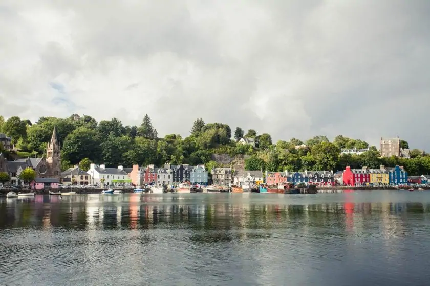
Tobermory, the main town on the Isle of Mull, draws visitors in with its rainbow-coloured buildings, calm harbour waters, and rich local charm. But if you want to enjoy the area, a good map of Tobermory can make all the difference.
It’s not just about finding streets and landmarks, it’s about connecting with the place on a deeper level. If you're visiting for a day or planning a longer stay, understanding how Tobermory is laid out will help you make the most of every moment.
Quick Facts About Tobermory, Mull
- Location: Northeast coast of the Isle of Mull, Inner Hebrides, Scotland
- Founded: 1788 as a fishing port by the British Fisheries Society
- Famous For: Colourful harbourfront, wildlife, and filming location for Balamory
- Main Attractions: Tobermory Distillery, Mull Aquarium, shops, local seafood, boat tours
- Wildlife Spotting: Seals, otters, puffins, and even sea eagles nearby
- Transport: Accessible via ferry from Oban to Craignure, then 45-min drive to Tobermory
- Local Language: English; some Gaelic signage and heritage
- Best Time to Visit: May to September (warmer, drier months with more wildlife activity)
- Nearby Islands: Calve Island (visible from harbour), Staffa, Iona (short trips away)
- Map Tip: Most key spots are within walking distance of the harbour
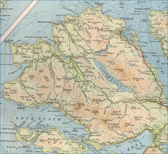
Geographical Overview Of Tobermory Mull
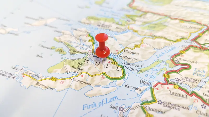
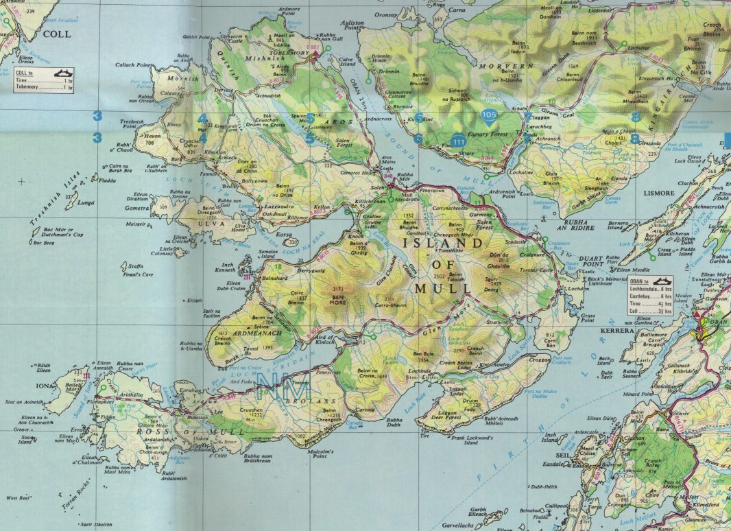
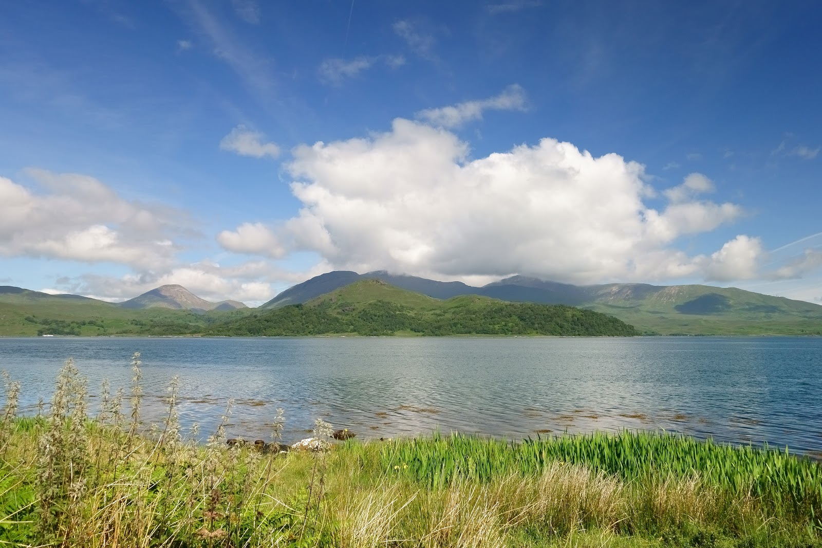
Tobermory is a small town located on the Isle of Mull, which is part of the Inner Hebrides islands off the west coast of Scotland. The town sits on the northeast coast of the island, facing the Sound of Mull a narrow sea channel that separates Mull from the mainland and the Isle of Ulva.
The area around Tobermory is known for its natural beauty. It has a mix of rugged coastline, sandy beaches, and hills covered in green forests and wildflowers. The harbour is a natural bay, which makes it a safe and calm place for fishing boats and small yachts.
The climate here is mild, thanks to the warming effect of the Gulf Stream. This means that even though it’s far north, Tobermory doesn’t get extremely cold in winter. The town and surrounding area are perfect for outdoor activities like hiking, bird watching, and boat trips.
Capital Of Tobermory Mull
Tobermory is not only a town but also the main and largest settlement on the Isle of Mull. It is often considered the island’s capital because it serves as the central hub for business, tourism, and transportation.
The town’s harbour is the main entry point for visitors arriving by ferry. It is home to many shops, restaurants, and local services that support both the local people and tourists.
As the capital, Tobermory also hosts important facilities like the local council office, health center, and schools. It acts as the cultural and social center of Mull, with community events, markets, and festivals taking place here regularly.
Map Of Tobermory Mull Cities
The Isle of Mull is a large island, but it does not have many cities or big towns. Tobermory is the only real town on the island and serves as its capital. Most of the rest of Mull is made up of small villages and rural homes spread across the landscape. Unlike many Scottish citieswith busy streets and tall buildings, Mull offers a quieter, more peaceful way of life.
Here are some important places to know on the map of Mull:
- Tobermory: This is the largest town and the main hub of the island. Tobermory has colorful buildings along the harbor, shops, restaurants, and many places to stay. It is the center for business, tourism, and local events.
- Craignure: A small village on the east coast, Craignure is important because it has the ferry terminal connecting Mull to the Scottish mainland. It is often the first stop for visitors arriving by ferry. Though small, Craignure offers basic services like a shop, a café, and accommodations.
- Fionnphort: Located on the southwest coast of Mull, Fionnphort is a quiet village known mainly for its ferry link to the Isle of Iona. Many visitors use Fionnphort as the starting point to visit Iona, famous for its historic abbey.
- Dervaig: Situated inland on the northwest part of Mull, Dervaig is a small village known for its local church and friendly community. It is surrounded by farmland and hills, making it a peaceful place away from the busier coastal areas.
Because Mull is mostly rural, these villages are much smaller than Tobermory. Most have fewer than a few hundred residents, creating a close-knit community feel. Tobermory remains the heart of the island, providing the most services, shops, and attractions for visitors and locals alike.
Regions On The Map Of Tobermory Mull

Northern Mull
Northern Mull is where Tobermory, the island’s main town, is located. This area is the busiest part of Mull because it has the most shops, restaurants, and services. Around Tobermory, you’ll find green forests and rolling hills that are perfect for walking or hiking.
The coastline here is beautiful with rocky cliffs and calm bays. There are many trails that offer great views of the sea and the nearby islands. Wildlife like eagles and otters are often spotted in this part of Mull. Northern Mull combines natural beauty with the convenience of a small town.
Western Mull
Western Mull is known for its rough, rocky coastline and peaceful beaches. It is less crowded and quieter than the north. Small villages and farms are spread out across this region, giving it a calm, countryside feel.
Visitors enjoy Western Mull for its untouched nature and wildlife. Seals, seabirds, and sometimes whales can be seen near the coast. The beaches here are perfect for quiet walks, and the hills offer peaceful spots for picnics. It’s a great place to relax away from the busier parts of the island.
Southern Mull
Southern Mull covers the area around the village of Fionnphort and includes the small nearby island called Iona. This region is important for history and religion.
Iona is famous for its ancient monastery and is a place many people visit for quiet reflection and to learn about early Scottish history. Southern Mull also has beautiful beaches and wild hills, but the main attraction is the peaceful, spiritual atmosphere. Ferries from Fionnphort connect visitors to Iona, making this region easy to access for day trips.
Eastern Mull
Eastern Mull includes Craignure, a village that acts as the main gateway between Mull and the Scottish mainland. The ferry terminal in Craignure is where most people arrive or leave the island.
This area has some of Mull’s main roads and provides important services such as shops, accommodations, and transport links. Eastern Mull is a practical region for travelers. Beyond the village, the countryside has farms, forests, and quiet roads ideal for cycling and driving tours.
Central Mull
Central Mull is mostly countryside made up of farms, hills, and open land. This region is less populated and offers a peaceful rural atmosphere.
Wildlife lovers appreciate Central Mull for its nature reserves and open spaces. You can find deer, wild birds, and many plants native to the area. The landscape here is perfect for hiking or simply enjoying the quiet beauty of the island’s heart. Though there are few villages, the farmland and hills show a traditional way of life on Mull.
Population Of Tobermory Mull
Tobermory itself is a small town with a population of around 1,000 people. The entire Isle of Mull has a population of roughly 3,000 to 3,200 residents. The population size keeps the island peaceful and quiet, with a strong sense of community.
Most people in Tobermory work in tourism, fishing, or local services like shops and schools. The town’s population can increase significantly during the tourist season, especially in summer, when visitors come to enjoy the natural beauty and attractions.
Despite its small size, Tobermory has all the important amenities needed for daily life. The friendly locals and relaxed pace of life make it a special place to live or visit.
Currency Of Tobermory Mull
The currency used in Tobermory and the whole Isle of Mull is the British Pound Sterling (£). This is the official money used across the United Kingdom, including Scotland, England, Wales, and Northern Ireland.
You will find coins and banknotes in various values, such as £1, £5, £10, and higher. Most shops, restaurants, and hotels in Tobermory accept cards, but it’s a good idea to have some cash, especially when visiting smaller villages or rural areas on Mull. Currency exchange services are available in larger towns or at airports if you come from outside the UK.
Dialing Code Of Tobermory Mull
If you want to call someone in Tobermory, you will need to use the UK’s country code, which is +44. After this, you dial the local area code for Mull, which is (0)1680.
For example, if you are calling a phone number in Tobermory from outside the UK, you would dial:+44 1680 followed by the local number.
If you are calling within the UK but outside Mull, you just dial 01680 and then the local number. This dialing code helps route phone calls directly to the Mull area.
Language Of Tobermory Mull
The main language spoken in Tobermory and on the Isle of Mull is English. Most people on the island speak English for everyday conversation, business, and education.
However, you may also hear some Scottish Gaelic, which is the traditional language of the Highlands and Islands of Scotland. While not widely spoken in daily life by everyone, Gaelic is still important culturally, and you might see signs and place names in both English and Gaelic.
Visitors will have no trouble communicating in English anywhere on Mull.
Flag Of Tobermory Mull
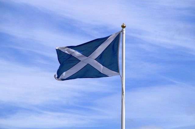
Tobermory itself does not have a unique flag, but the Isle of Mull is part of Scotland, so the Scottish flag is commonly used here. The Scottish flag, called the Saltire or St. Andrew’s Cross, is a blue background with a white diagonal cross.
This flag represents the whole country of Scotland, including the Isle of Mull. It is often flown on public buildings, at events, and in towns like Tobermory.
Sometimes, local community groups or organizations might have their own symbols or banners, but the Scottish Saltire is the main flag you will see on Mull.
Government Of Tobermory Mull
Tobermory and the Isle of Mull are part of Scotland, which means they are governed by the Scottish Government and also the UK Government. Local matters on Mull are managed by the Argyll and Bute Council, the local authority responsible for services like schools, roads, and waste collection.
The island does not have its separate government but follows Scottish laws and policies. Local community councils exist on Mull to represent the views of residents and help with smaller decisions. For bigger issues, decisions come from the Scottish Parliamentin Edinburgh.
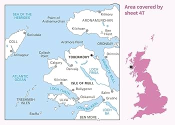
Total Area Of Tobermory Mull
The Isle of Mull is one of the largest islands in Scotland. It covers about 875 square kilometers (338 square miles). Tobermory is the main town on the island, but it only takes up a small part of this area.
This size makes Mull large enough to have a variety of landscapes, including forests, hills, beaches, and small villages. The area is mostly rural, with wide open spaces and natural beauty.
Types Of Tobermory Mull
The Isle of Mull offers different experiences depending on what you want:
- Town Life:Tobermory is the main town with shops, restaurants, and a busy harbor.
- Rural Countryside:Most of the island is made up of quiet farmland, hills, and forests.
- Coastal Areas:Mull has many beaches and rocky shores where you can enjoy sea views.
- Wildlife Areas:There are places where you can see animals like eagles, otters, and deer.
- Historic Sites:Mull has castles, old churches, and places important to Scottish history.
This variety means visitors can enjoy nature, culture, or local life on the island.
Tobermory Mull’s Borders And Neighboring Countries
Tobermory is located on the Isle of Mull, which is an island off the west coast of Scotland. Being an island, Mull doesn’t have land borders with other countries or islands.
Nearby islands include:
- Isle of Iona:Just southwest of Mull, famous for its ancient abbey.
- Isle of Staffa:Known for its unique rock formations.
- Mainland Scotland:Across the water to the east, connected by ferry.
The closest country is Scotland itself, which is part of the United Kingdom. The surrounding waters are part of the Atlantic Oceanand the Inner Hebrides sea area.
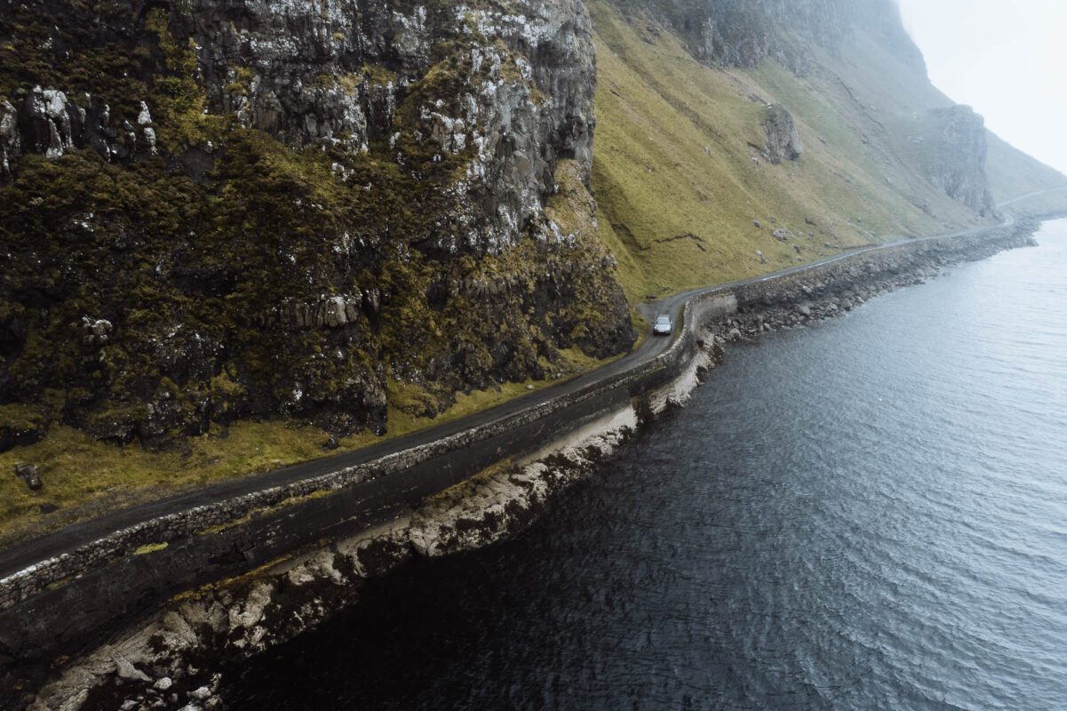
Major Roads And Routes
A849 Road
The A849 is the main road on the island. It runs from the town of Tobermory in the north down the east side to Craignure. Craignure is important because it has the ferry terminal. From here, you can catch a ferry to Oban on the Scottish mainland. This road is the busiest and connects many important places on Mull.
A848 Road
The A848 runs on the west side of the island. It connects smaller villages and ends at Calgary Bay, a popular spot for visitors. This road is quieter and passes through beautiful countryside and coastlines. It is great for those who want to see the more peaceful parts of Mull.
B8035 Road
The B8035 serves the southern area of Mull. It links the village of Fionnphort, which is near the ferry to the island of Iona, with the rest of Mull. This road is useful for travelers interested in visiting historical and religious sites on Iona.
Ferries
Ferries are very important for transportation on and off Mull. The main ferry connects Mull to Oban on the mainland. There are also ferries that go to nearby islands like Iona. The map shows these ferry routes, helping you plan trips between islands or to the mainland.
Local Buses
There are bus services on Mull that run between towns and villages. These buses are less frequent compared to city buses but are a good option if you don’t have a car. Check the schedule in advance because buses may not run every day or often.
Walking And Cycling Paths
The map also marks trails and paths for walking and cycling. These paths let you explore the island naturally and healthily. Many paths go through forests, hills, and along the coast, offering beautiful views and close contact with nature.
Climate Map Of Tobermory Mull
- Mild temperatures:Because of the ocean, Mull has mild winters and cool summers.
- Rainfall:The island receives regular rainfall, especially in autumn and winter. Summers are often drier but can still have showers.
- Wind:It can be windy, especially along the coast, due to its exposure to Atlantic weather systems.
- Daylight:Summers have long daylight hours, making it great for outdoor activities. Winters have shorter days with less sunlight.
- Microclimates:Different parts of Mull may have slight variations in weather because of hills and coastlines.
A climate map helps visitors know what to expect and pack suitable clothes when visiting Tobermory and Mull.
Natural Wonders On The Map
1. Loch Na Keal National Scenic Area
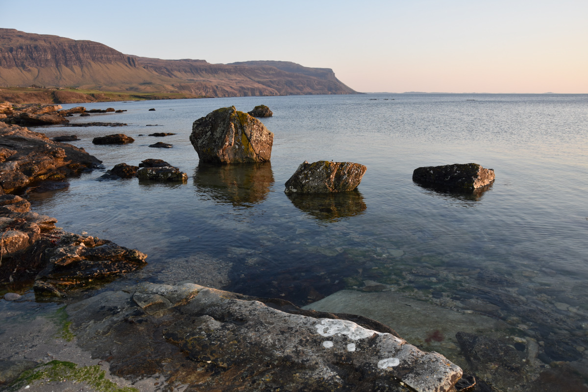
Loch na Keal covers a large part of western Mull. It is a protected area known for its beautiful mix of mountains, forests, and sea lochs (narrow sea inlets). You can use the map to find hiking paths that take you through quiet woodlands and up hills where you can see stunning views. Many animals live here, like red deer, golden eagles, and seals. This area is peaceful and wild, perfect for anyone who loves nature.
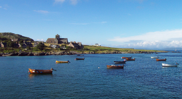
2. Isle Of Iona
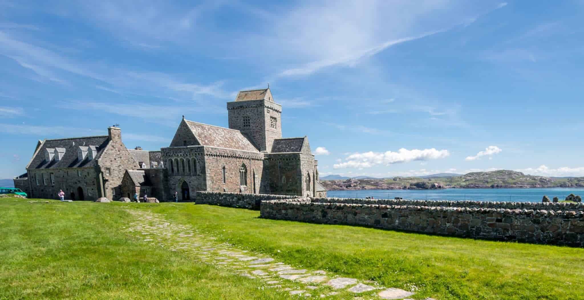
The small island of Ionalies just off the southern coast of Mull. It is famous for its calm, sandy beaches and rolling green hills. The map shows the ferry route from Fionnphort on Mull to Iona, making it easy to visit. Iona is also known for its quiet, natural beauty and peaceful walks along the shore or through fields. Visitors often enjoy the fresh sea air and chance to see seabirds and seals.
3. Calgary Bay
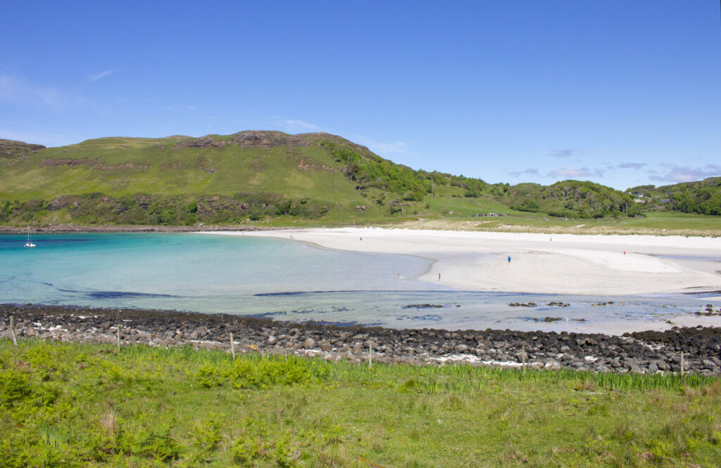
Calgary Bay is one of the most popular natural spots on Mull’s west coast. The map shows its white sandy beach and clear blue water. Calgary Bay is great for swimming, picnics, and simply relaxing by the sea. Nearby woodlands and hills offer walking trails with views over the bay. The natural scenery here is some of the best on the island, and the beach is often quiet even in summer.
4. Ben More
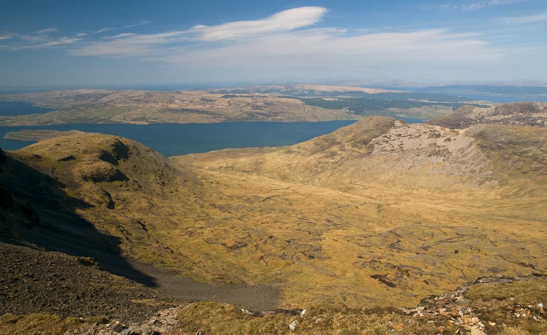
Ben More is the highest mountain on the Isle of Mull, reaching over 960 meters (3,150 feet). It is shown clearly on the map with hiking trails leading to the summit. Climbing Ben More is a favorite activity for visitors who enjoy challenging walks and mountain views. From the top, you can see across Mull, to nearby islands, and sometimes even the Scottish mainland on a clear day. The mountain is covered in heather and rocky areas, making the climb exciting and rewarding.
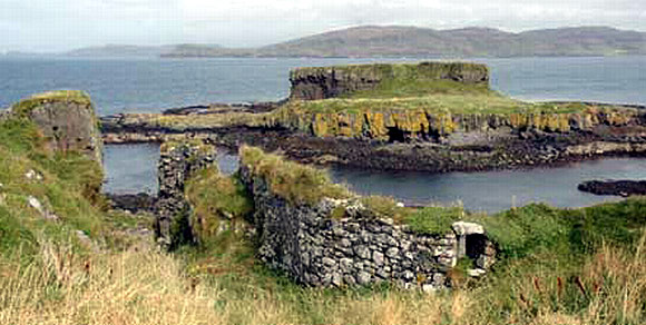
5. Duart Castle And Surrounding Woodland
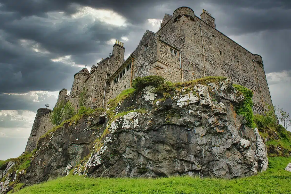
Near Tobermory town, Duart Castle stands on a cliff overlooking the sea. The map shows the castle’s location and the thick woods around it. The surrounding natural area is great for walks, with paths leading through forests and along the rocky coast. Wildlife like otters, birds, and sometimes deer live here. The views of the sea and cliffs near the castle are beautiful and peaceful.
6. Fionnphort And Iona Sound
At the southern tip of Mull, the village of Fionnphort lies close to Iona Sound, the narrow waterway between Mull and Iona. The map marks this area clearly. This coastline is rocky and wild, with sea birds flying overhead and seals often resting on the shore. The calm waters make it a good spot for boating or quiet walks by the water. It’s a less crowded area, perfect if you want to enjoy nature in peace.
7. Loch Spelve
Loch Spelve is a quiet sea loch on the southern part of Mull. It is shown on the map as a calm, sheltered area surrounded by hills and forest. The loch is home to many water birds and sometimes seals. Nearby walking paths let visitors enjoy views across the water and the chance to spot wildlife. Loch Spelve is a peaceful place, far from busy roads or towns.
8. Gribun Bay
Gribun Bay is a small, hidden bay on Mull’s southwest coast. The map shows its steep cliffs and clear blue water. The area is good for hiking, swimming, and enjoying quiet nature. The cliffs here are home to nesting seabirds, and the water is clean and inviting. Paths from Gribun Bay lead up to high points with fantastic views of the sea and surrounding hills.
9. Staffa Island
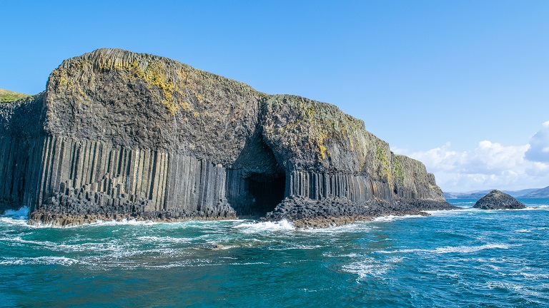
Just off the northwest coast of Mull, Staffa Island is world-famous for its unusual basalt columns. These columns formed from ancient volcanic lava and create a stunning natural pattern along the cliffs. The most famous spot on Staffa is Fingal’s Cave, a large sea cave with incredible acoustics and a unique hexagonal rock formation.
10. Loch Frisa
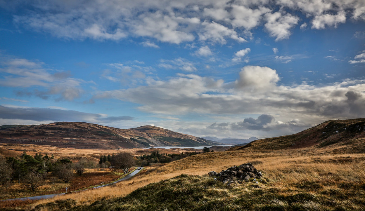
Loch Frisa is one of the biggest freshwater lakes on the Isle of Mull, located near the center of the island. This calm loch is popular for fishing, especially for trout and salmon. Small boats can be used on the loch, offering a peaceful way to enjoy the water. Around Loch Frisa, you’ll find hills covered with forests, giving a feeling of calm and privacy.
11. Treshnish Isles
The Treshnish Isles are a group of small islands located to the west of Mull. These islands are famous for their large seabird colonies. During the spring and summer, puffins, razorbills, guillemots, and other seabirds come here to nest in big numbers. The islands are also home to seals and other marine life.
12. Carsaig And The Ardtornish Peninsula
The Carsaig area on the west coast of Mull is known for its wild, rugged coastline. Here, visitors find tall cliffs, rocky sea stacks, and crashing waves that create dramatic views. The Ardtornish Peninsula nearby has beautiful gardens and several walking paths along the coast. From here, you can enjoy views of the islands to the west, including Staffa and the Treshnish Isles.
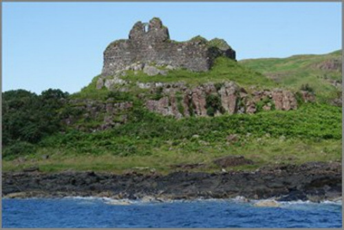
13. Lochbuie
Lochbuie is a small, quiet village located on the south side of Mull. The area around Lochbuie offers lovely sandy beaches and a rugged, natural coastline. One of the highlights here is Moy Castle, a ruined castle that stands near the shore and gives a glimpse into Mull’s history. The beaches and cliffs nearby are good places for birdwatching, as many sea and land birds live in the area.
How To Use A Map Of Tobermory Mull For Travel
1. Find Key Locations
Start by looking for important places on the map. This includes the town of Tobermory, ferry terminals where you can catch boats, small villages, and popular spots like beaches and mountains. Knowing where these places are helps you decide where to go and what to see during your trip. For more help planning your journey, keep in mind useful Scotland travel tipsthat can make your visit smoother and more enjoyable.
2. Check Roads And Routes
Look at the roads shown on the map to plan how you will travel. You can find the best routes for driving, cycling, or walking. Some roads are main roads, while others are smaller and quieter. Using the map helps you avoid getting lost and saves time by choosing the fastest or most scenic routes.
3. Locate Services
Maps often show useful services such as shops, restaurants, places to park your car, and tourist information centers. Knowing where these are on the map makes it easier to find food, buy supplies, or get help if you need it while visiting the island.
4. Plan Outdoor Activities
Check the map for hiking trails, nature reserves, beaches, and other outdoor spots. The map will help you find places where you can enjoy walking, swimming, or watching wildlife. Planning these activities with a map helps you make the most of Mull’s beautiful nature.
5. Understand Distances
Use the map to see how far places are from each other. This helps you estimate how long it will take to travel from one spot to another. Understanding distances means you can plan your day better and avoid rushing or spending too much time on the road.
6. Stay Safe
Knowing your way with a map is important for safety. Mull has many quiet, rural areas where there are fewer people and less phone signal. Using a map helps you avoid getting lost and find your way back to the main towns or ferry points easily. If you’re planning to travel to Scotland, having a good map is one of the best tools for exploring places like Mull safely and confidently.
People Also Ask
What Are The Best Maps For Walking Around Tobermory?
The best maps are those designed for walkers, available at the Visitor Centre and local shops. They show paths, steps, and trails with useful landmarks like benches, viewpoints, and restrooms.
Is Tobermory Easy To Navigate Without A Map?
The main street is easy to walk, but the upper town, woodland paths, and coastal trails can be confusing without a map. A map helps you find quiet paths and hidden gems.
What Is The Meaning Of Tobermory?
The name Tobermory is derived from the Gaelic Tobar Mhoire, meaning “Mary's well” which refers to a well located nearby which was dedicated in ancient times to the Virgin Mary.
Final Thoughts
Tobermory may look small on the map, but the experience it offers is anything but limited. With the right map in hand, you can turn a short visit into a rich journey filled with local stories, quiet corners, and breathtaking views.
Maps in Tobermory aren’t just about getting from point A to point B; they’re about understanding the town’s rhythm, routes, and roots.
Jump to
Quick Facts About Tobermory, Mull
Geographical Overview Of Tobermory Mull
Capital Of Tobermory Mull
Map Of Tobermory Mull Cities
Regions On The Map Of Tobermory Mull
Population Of Tobermory Mull
Currency Of Tobermory Mull
Dialing Code Of Tobermory Mull
Language Of Tobermory Mull
Flag Of Tobermory Mull
Government Of Tobermory Mull
Total Area Of Tobermory Mull
Types Of Tobermory Mull
Tobermory Mull’s Borders And Neighboring Countries
Major Roads And Routes
Climate Map Of Tobermory Mull
Natural Wonders On The Map
How To Use A Map Of Tobermory Mull For Travel
People Also Ask
Final Thoughts

Callum Fraser
Author
Callum Fraser isn't just a writer about Scotland; he's a product of its rugged landscape and rich history. Born and raised in Perthshire, with the Highlands as his backyard, his love for the nation's stories was kindled by local storytellers and long walks through ancient glens.
This passion led him to pursue a degree in Scottish History from the University of Edinburgh. For over 15 years, Callum has dedicated himself to exploring and documenting his homeland, fusing his academic knowledge with essential, on-the-ground experience gained from charting road trips through the Cairngorms, hiking the misty Cuillins of Skye, and uncovering the secrets of traditional recipes in his family's kitchen.
As the Editor-in-Chief and Lead Author for Scotland's Enchanting Kingdom, Callum's mission is simple: to be your most trusted guide. He combines meticulous research with a storyteller's heart to help you discover the authentic magic of Scotland — from its best-kept travel secrets to its most cherished traditional recipes.
Latest Articles
Popular Articles