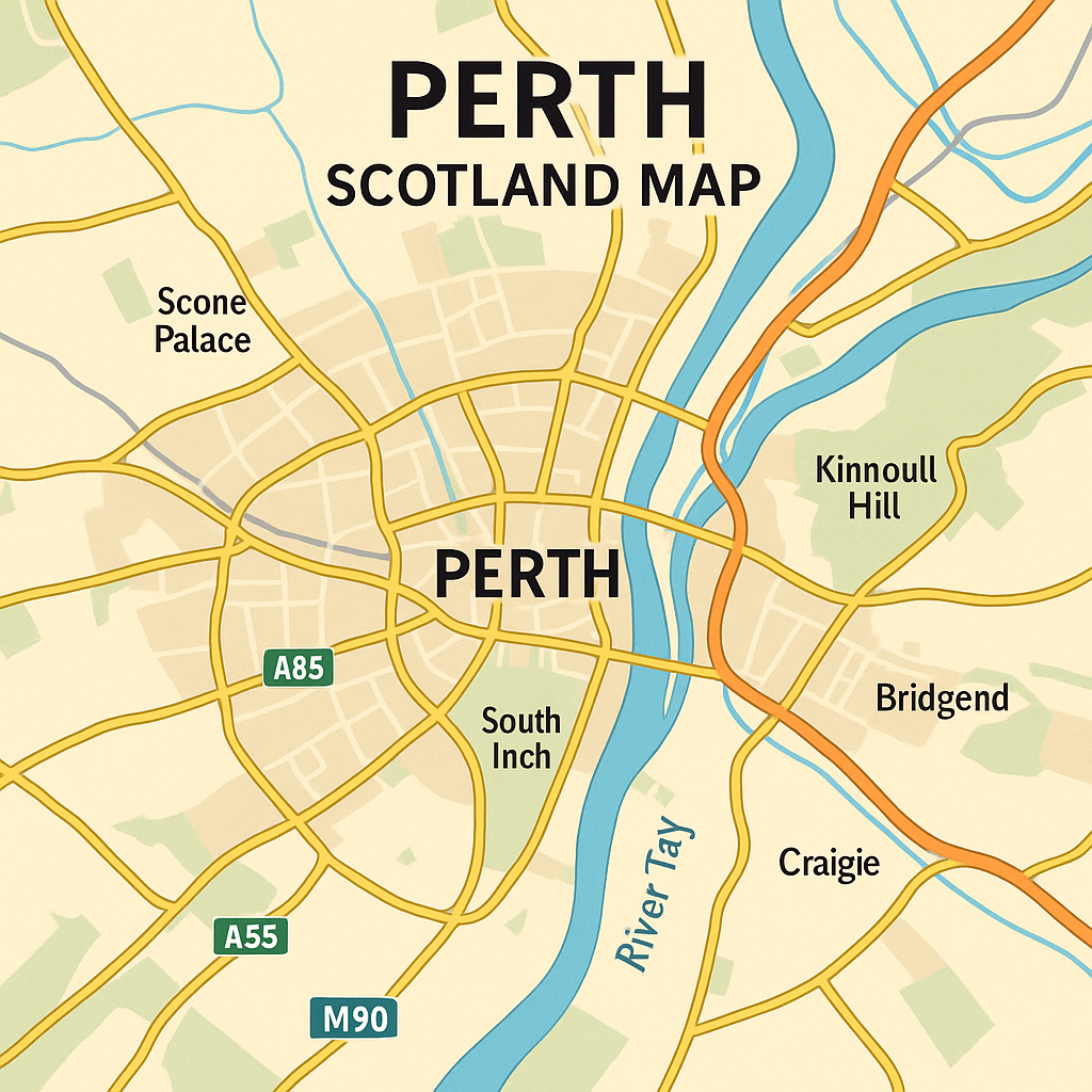
Perth Scotland Map - City Centre, Attractions, And Nearby Towns
Find your way through Perth’s history and nature with a simple map of the centre, key attractions, and relaxing nearby escapes.
Author:Callum FraserDec 09, 202534K Shares523.4K Views
Perth Scotland Map: Overview Of The Fair City
Perth is a small city in the middle of Scotland. People call it “The Fair City.” It sits next to the River Tay and has both old buildings and newer areas. The city feels peaceful, with plenty of open spaces that show its history and modern life.
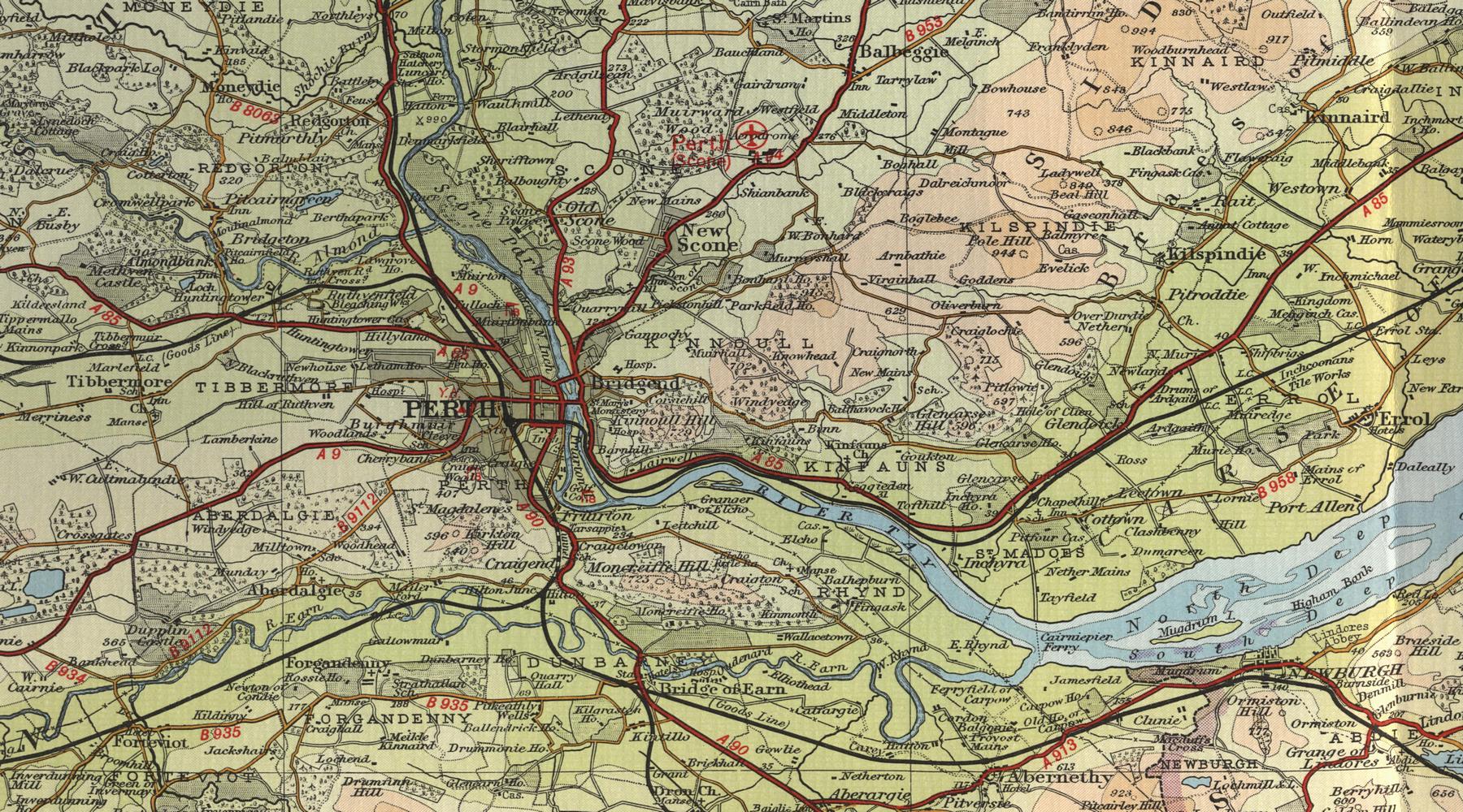
A Perth Scotland Maphelps you understand the city better. It shows how the streets, parks, and river fit together and how Perth links to the countryside nearby. These features affect how people live and travelaround the area.
Quick Facts About Perth, Scotland
- Location:Central Scotland, on the banks of the River Tay
- Nicknamed:The Fair City
- Population:47,893 people
- History:Once the ancient capital of Scotland
- Transport:Well connected by road, rail, and bus
- Green Spaces:Home to parks like the North Inch and South Inch
- Culture:Has museums, art galleries, and a theatre
- Shopping:Features both small local shops and large retail stores
- Nearby Areas:Close to Scone Palace, Kinnoull Hill, and the Highlands
- Weather:Mild, with cool summers and damp winters
- Events:Hosts the Perth Festival of the Arts and seasonal markets
History Of Perth, Scotland
Perth has a long history shaped by the River Tay, which helped early people travel and trade here. By the 1100s it had become a busy royal town.
In the Middle Ages, Perth was one of Scotland’s most important places. Kings were crowned nearby at Scone Palace, where the Stone of Destiny was kept as a symbol of rule. In 1210, King William the Lion made Perth a royal burgh, letting it hold markets and grow through trade and skilled crafts.
Perth supported Protestant change during the Reformation in the 1500s. Later, in the 1700s and 1800s, new bridges and railways boosted the city’s role as a market centre, with industries like linen, whisky, and leather.
Perth remains proud of its royal past and regained official city status in 2012.
Geographical Overview Of Perth, Scotland

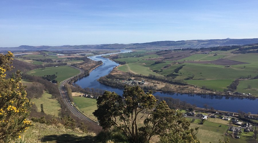
Perth is a small city in central Scotland. It sits on the banks of the River Tay, which is the longest river in Scotland. The city is surrounded by beautiful countryside, rolling hills, and farmland.
Perth is part of the Perth and Kinross council area. It lies about 43 miles north of Edinburgh and 22 miles west of Dundee. Its central location makes it easy to travel to other parts of Scotland. Roads, buses, and trains connect Perth to many towns and cities.
The land around Perth is rich and green, making it a good area for farming. The nearby Highlands begin just to the north, offering views of mountains and wide open spaces. Perth’s location gives it a mix of natural beauty and easy access to modern services.
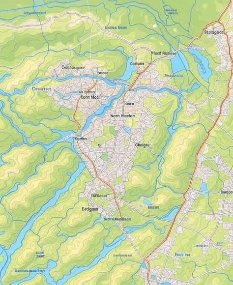
Map Of Towns And Villages In Perth, Scotland
Scone
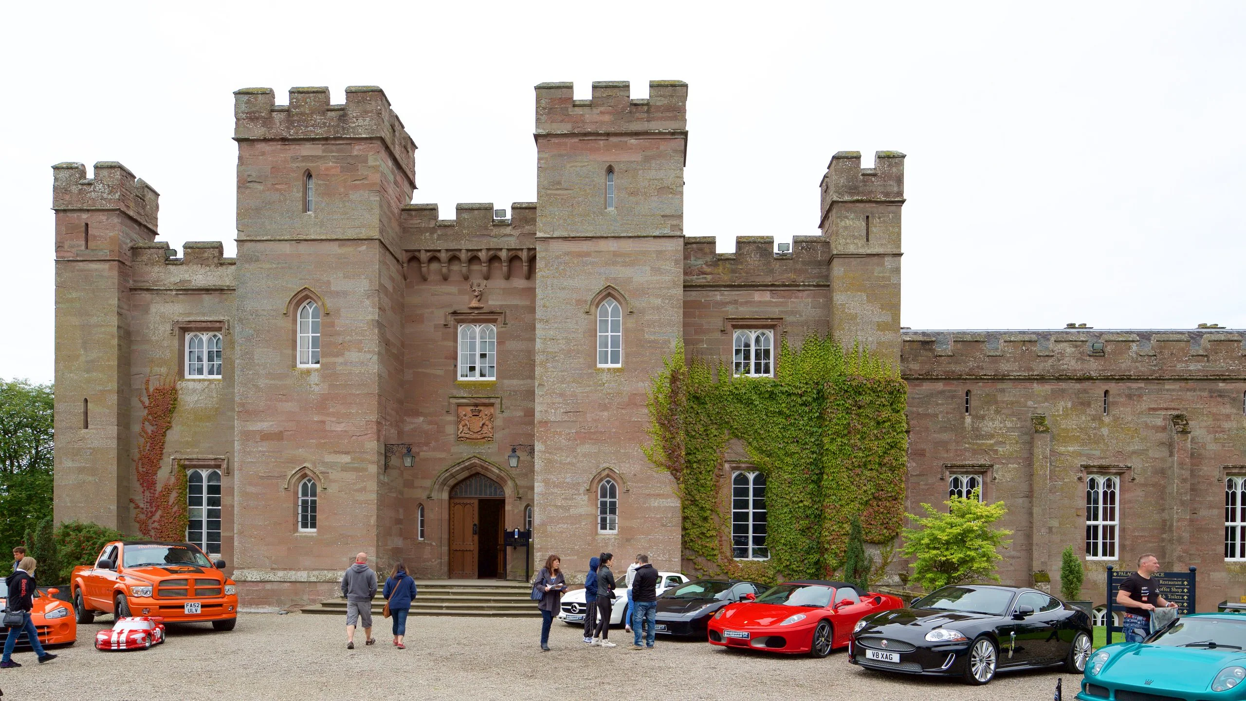
Scone is one of the most famous villages near Perth. It’s only a 10-minute drive from the city. Scone is best known for Scone Palace, a grand building where many Scottish kings were crowned long ago.
Today, the palace is open to visitors and has beautiful gardens and a museum inside. The village itself is quiet and mostly residential, with a primary school, small shops, and parks.
Bridge Of Earn
Bridge of Earn lies to the south of Perth and is often seen as a commuter village. It has a peaceful atmosphere with open green spaces and easy access to the M90 motorway.
This makes it a great choice for people who work in nearby cities but want to live in the countryside. The village has shops, cafes, and a few walking trails along the river.
Crieff
Crieff is a larger town located west of Perth. It's well known for The Famous Grouse Experience, a whisky visitor centre located at Glenturret Distillery. Crieff also has lovely walking paths and views of the hills.
The nearby Drummond Castle Gardensare a major attraction, famous for their neat design and beautiful flowers. The town also has schools, shops, and sports facilities, making it a lively place to stay.
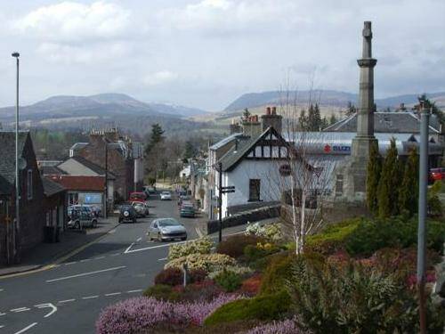
Auchterarder
Auchterarder is a long, narrow town close to the famous Gleneagles Hotel and Golf Course. Many people visit this area for golf or to enjoy luxury accommodation. The town itself has a friendly high street with local shops, bakeries, and cafés. It’s also a popular place to live because of its quiet surroundings and access to nature.
Blairgowrie And Rattray
These two towns sit side-by-side, just north of Perth. Together, they form one of the larger population centres in the area. Blairgowrie and Rattray are famous for raspberry farming, and every summer, berry-picking is a popular activity. The River Ericht flows through the town, and there are lovely riverside walks and parks. It’s also a gateway to the Cateran Trail, a well-known long-distance walking route.
Kinross
Kinross is located south of Perth and is best known for its location next to Loch Leven, a large freshwater loch surrounded by a nature reserve. Visitors come here for birdwatching, cycling, and peaceful walks. A boat trip to Loch Leven Castle, where Mary Queen of Scots was once held, is a favorite activity. The town has schools, supermarkets, and easy access to the motorway.
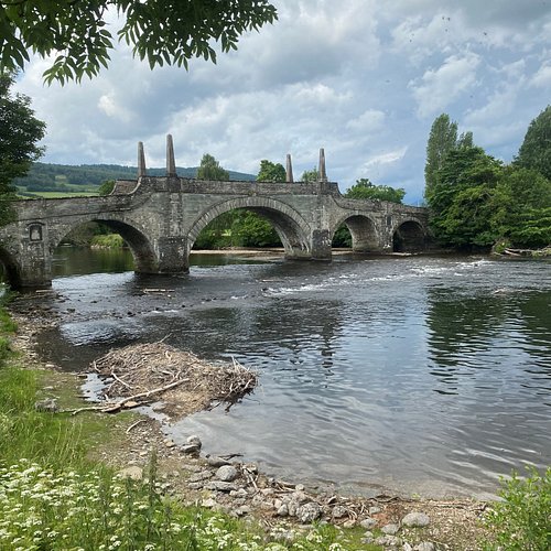
Aberfeldy
Aberfeldy lies near the River Tay and is surrounded by green hills and forests. It’s a small town but full of charm, with independent shops, a cinema, and the Dewar’s Aberfeldy Distillery. The town is also popular for outdoor activities like kayaking, white-water rafting, and hill walking. Nearby, the Birks of Aberfeldy, a forest walk made famous by the poet Robert Burns, offers lovely views and quiet trails.
Pitlochry

Pitlochry is a beautiful tourist town north of Perth, often visited for its traditional buildings, outdoor activities, and natural beauty. It has small hotels, tea rooms, and shops along its main street. The town sits on the River Tummel and is close to attractions like the Pitlochry Dam and Fish Ladder, as well as nearby forests and hills perfect for hiking.
Pitlochry Walking Map
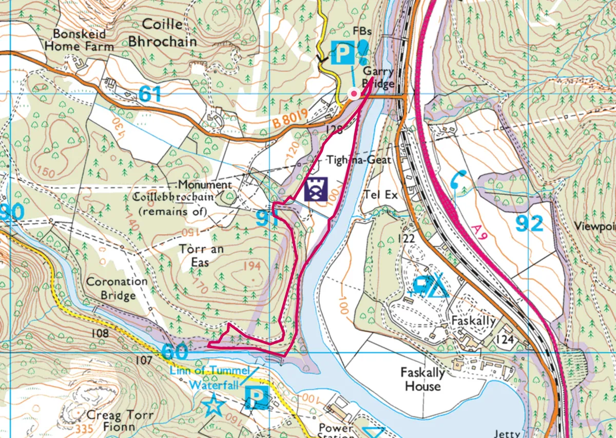
Pitlochry is a lovely town in Highland Perthshire, known for its peaceful scenery, riverside views, and nearby woodlands. A Pitlochry walking map helps you find the best local paths for a relaxing day out, from easy walks to more challenging hill routes.
Some popular walks include the Ben Vrackie trail, which offers wide views across the valley, and the Faskally Forest paths, known for their colorful trees, especially in autumn. You can also follow riverside trails along the Tummel or visit the Pitlochry Dam and Fish Ladder.
A good map shows the starting points, path lengths, elevation, and nearby car parks or picnic spots. These maps are available in local shops, online, or at the Pitlochry Visitor Centre.
Regions On The Map Of Perth, Scotland
Perth is made up of different areas, and each one has something special to offer. Some parts are busy and full of things to do, while others are calm and quiet, great for families or people who enjoy nature. Learning about these areas helps you understand how Perth works and what makes each part different.
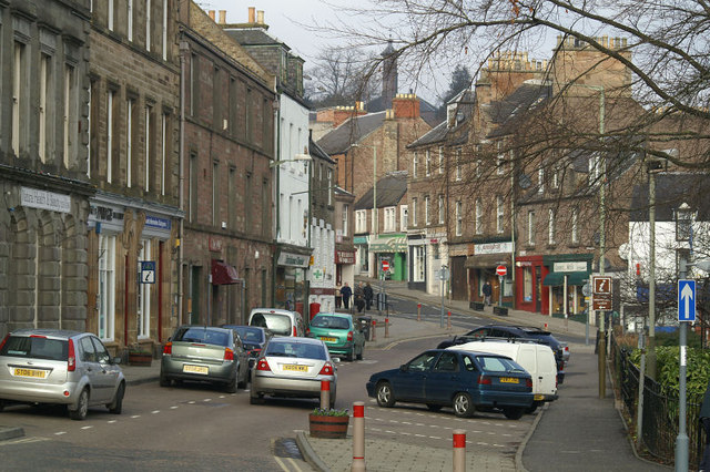
City Centre
The City Centre is the busiest part of Perth. It’s where you’ll find most of the shops, cafés, restaurants, and hotels. This is also where the main bus and train stations are, so it’s easy to get in and out of the city. Many tourists spend time here because there are also museums, galleries, and old buildings to see.
North Muirton
North Muirton is a quiet area north of the city centre. Many families live here because it has schools, children’s playgrounds, and small shops nearby. The streets are not too busy, so it feels safe and calm. This area is also close to the River Tay, which means people can enjoy walks by the water or have picnics in nearby green spaces.
Craigie
Craigie is a calm and mostly residential area to the south of the city centre. It has many houses, green parks, and quiet streets. Families and older people like living here because it feels safe and peaceful. There is a strong sense of community, where neighbours know each other. Craigie has both old and new houses, and local buses make it easy to get to other parts of Perth.
Bridgend
Bridgend is a lovely area just across the River Tay from the City Centre. It has great views of the river and nearby hills. One of the main attractions here is Kinnoull Hill, which is perfect for walking and enjoying nature. The houses in Bridgend are often older and well cared for, giving the area a classic feel.
Letham
Letham is one of the biggest housing areas in Perth. Most of it is made up of homes, and many families live here. It has schools, parks, health services, and community centres. People in Letham enjoy a strong local community where many have lived for a long time. There are good bus routes that make it easy to travel to other parts of Perth.
Population Of Perth, Scotland
Perth's latest official population figure from Scotland’s 2022 Census shows 47,893 residents, with 23,516 males and 24,377 females, making the gender split slightly more female than male.
The population is broken down by age into three groups:
- Children aged 0-17: 8,631 people (about 18%)
- Adults aged 18-64: 29,596 people (around 62%)
- Seniors aged 65 and over: 9,670 people (close to 20%)
This means Perth has a balanced mix of families and working-age adults, with a notable portion of older residents. The city’s workforce primarily works in sectors like education, healthcare, retail, hospitality, and local services, while others work in nearby farms, tourism, and small businesses.
Currency Of Perth, Scotland
The currency used in Perth, as in the rest of Scotland, is the British Pound Sterling (GBP). It is usually written with the symbol £.
You can use Scottish or English banknotes in Perth. Both are accepted in shops, restaurants, and banks. Credit and debit cards are also widely used, and contactless payments are common.
ATMs are easy to find throughout the city, especially in the city centre, shopping areas, and outside banks.
Dialing Code Of Perth, Scotland
The telephone dialing code for Perth is 01738 if you're calling from within the UK.
If you're calling from outside the UK, you must add the international dialing code for the UK first, which is +44, and then remove the first zero from the local code. So you would dial +44 1738 followed by the local number.
For example:
- Inside the UK: 01738 123456
- Outside the UK: +44 1738 123456
Language Of Perth, Scotland
The main language spoken in Perth is English. Most people use Scottish English, which has its accent and sometimes includes Scottish words.
Some older residents may still use Scots, which is a traditional language used in parts of Scotland. You may also hear some Scottish Gaelic language, but it is not commonly spoken in Perth, more so in the Highlands and islands.
People in Perth are usually friendly and helpful, and they speak clearly, although the Scottish accentmay sound different if you’re visiting from abroad.
Tourist Attractions On The Map Of Perth, Scotland
Your map becomes more helpful when you add important places to visit. These attractions are great for learning, relaxing, and taking in the beauty of Perth, many of which are among the best places to visit in Scotland.
St John’s Kirk
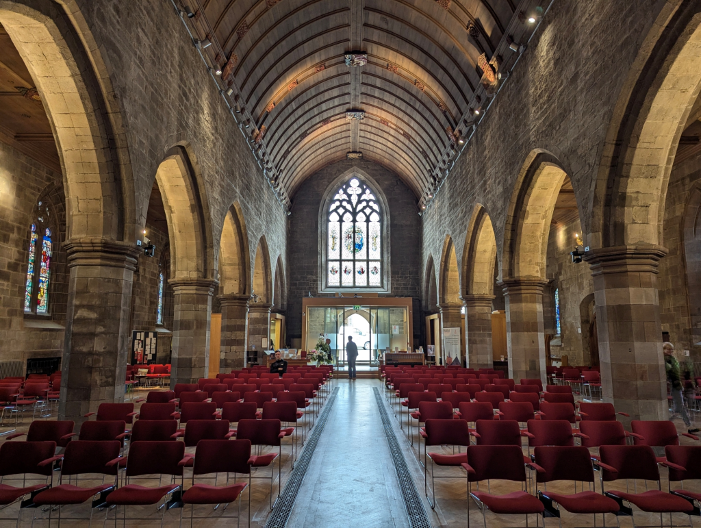
St John’s Kirk is the oldest building in Perth. It was first built in the 1100s and has been a place of worship for hundreds of years. The church has beautiful stained-glass windows and a tall tower. It’s in the city centre and easy to visit on foot. People often come here to enjoy its peaceful setting and learn about its long history.
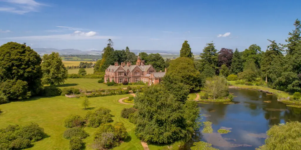
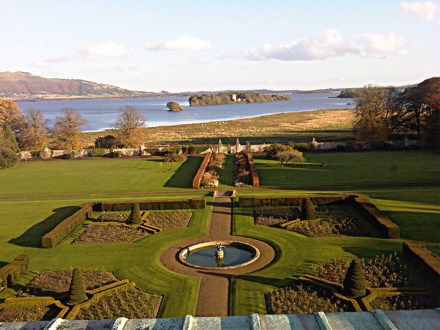
Scone Palace
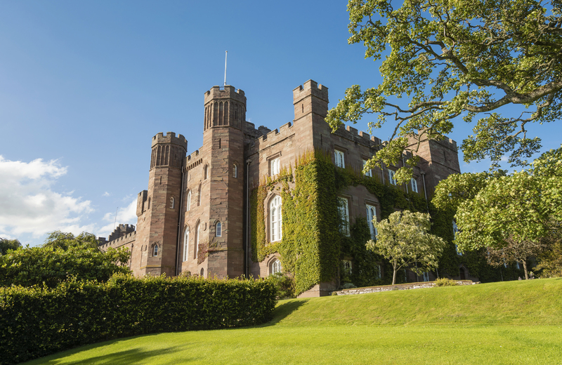
Scone Palace is a grand and historic building just outside the city. It was where many Scottish kings were crowned, including Macbeth. The palace is surrounded by gardens and parkland where peacocks roam freely. Inside, you can see old furniture, paintings, and rooms that tell the story of Scotland’s royal past. It’s a great spot for families, photographers, and anyone who enjoys castles.
Perth Museum & Art Gallery

This museum is one of the oldest in the UK. It’s in a large, old building near the city centre. Inside, you’ll find displays about Perth’s history, including fossils, old coins, and paintings. There are also special exhibits that change throughout the year. It’s a great place to visit on a rainy day and is fun for both adults and children.
Moncreiffe Hill
Moncreiffe Hill is a quiet woodland area just south of the city. It has peaceful walking trails that lead to views of the River Earn and old hill forts. The paths are soft, green, and surrounded by trees.
It’s managed by the Woodland Trust and home to many animals like deer and birds. If you want a quiet walk with fewer people, this is a good choice. It’s also great for spotting wildlife or having a calm picnic with family or friends.
Perth Lade Walk
The Perth Lade Walk follows a man-made water channel called a lade, which used to power mills. Now, it’s a quiet walking route through the city that feels like a nature trail.
It’s perfect for a peaceful walk, even though it's close to roads and houses. There are trees, flowers, and places to rest. It’s flat and easy to walk, so it's good for people of all ages. It also connects many parts of the city.
Branklyn Garden
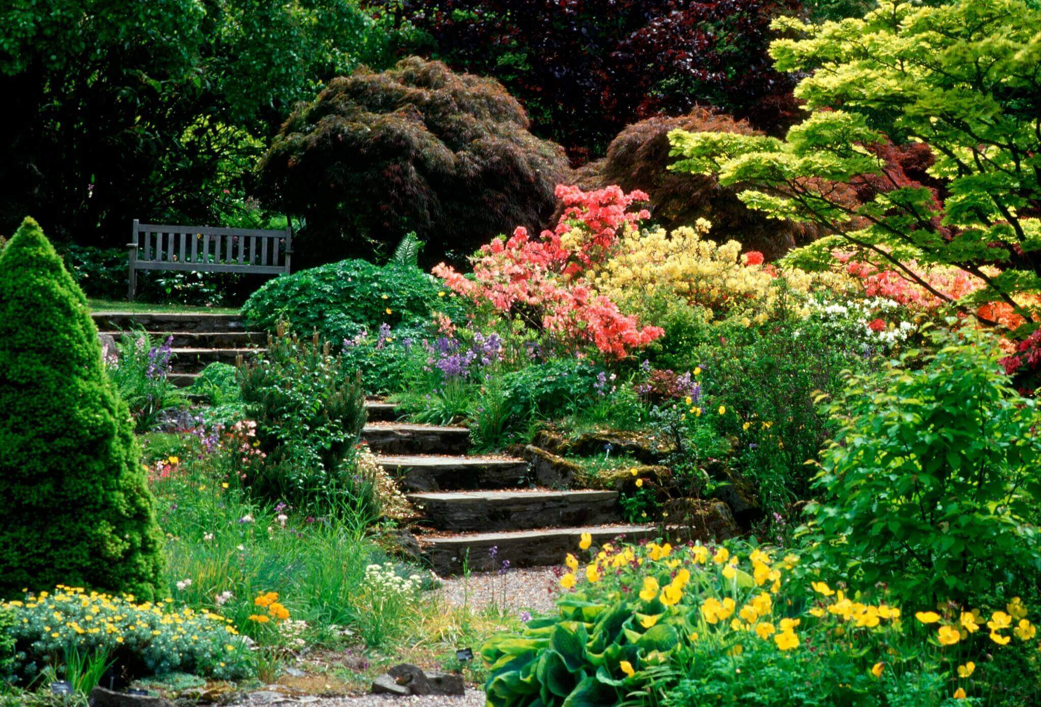
Branklyn Garden is a small but beautiful garden near the edge of the city. It’s full of rare flowers, trees, and plants from around the world. Garden lovers will enjoy the peaceful paths and colourful views, especially in spring and summer. It also has a tearoom and great views looking down on Perth.
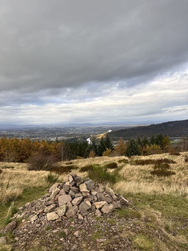
Kinnoull Hill Tower
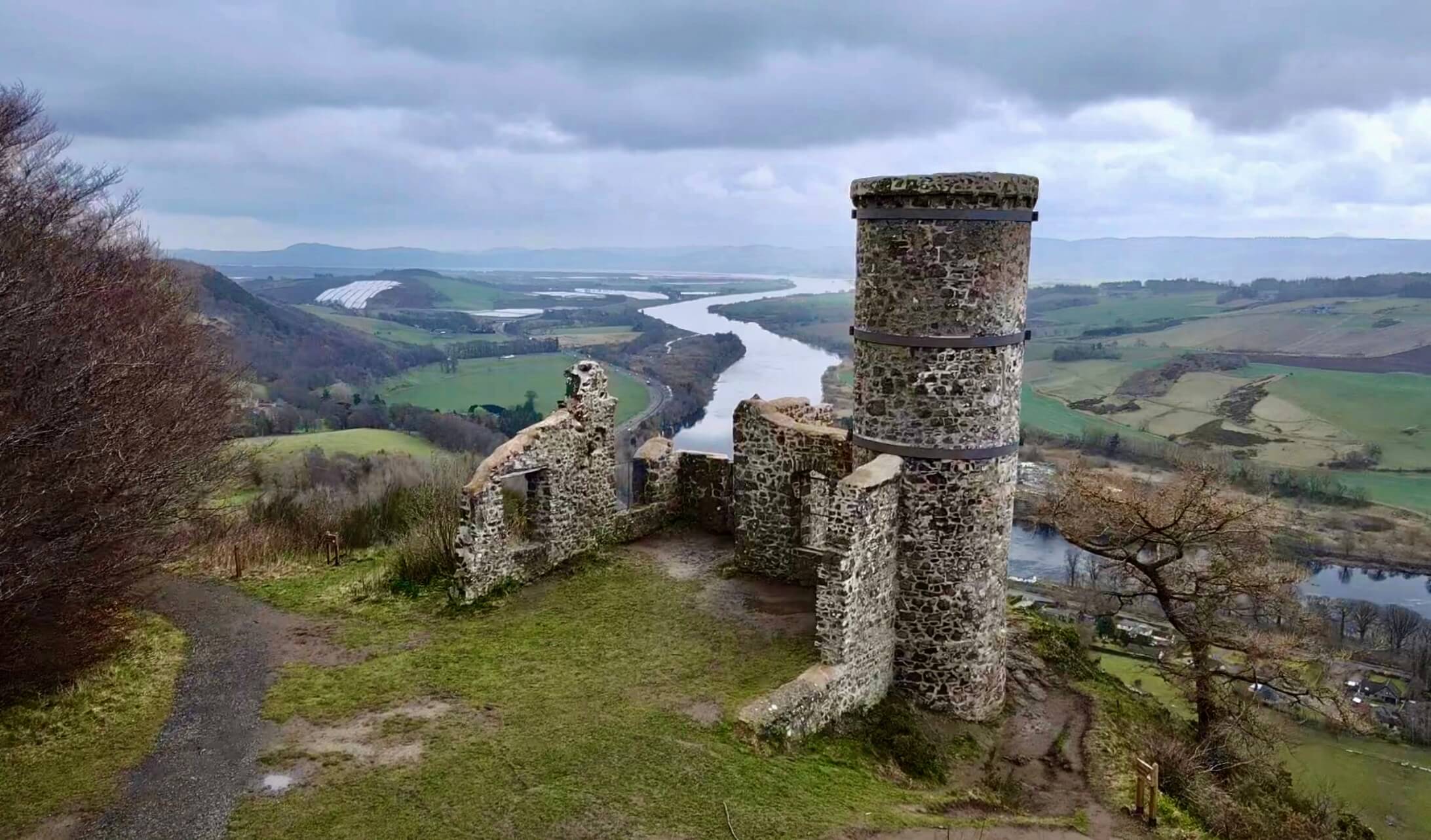
Kinnoull Hill is one of the best places in Perth to enjoy nature. It’s just outside the city and is part of a woodland park made up of five hills. You can hike up to Kinnoull Tower, a small stone lookout with amazing views of the River Tay.
The walking trails go through forests filled with red squirrels and birds. There are easy paths for families and steeper ones for experienced walkers. From the top, you can see far across the countryside. It’s one of the top natural wonders in Perth.
Fergusson Gallery
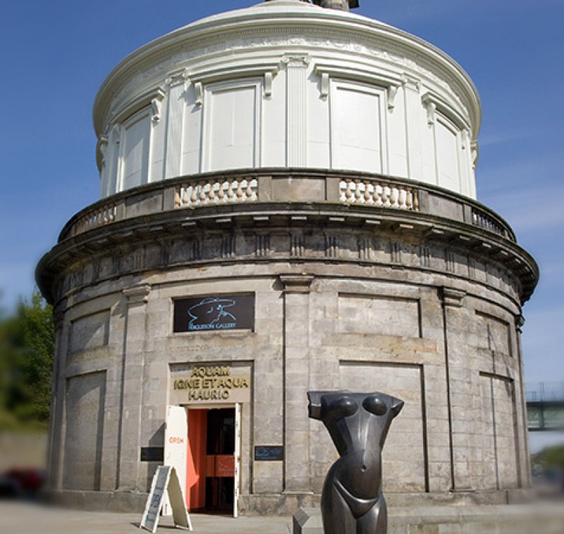
This gallery is inside a former water tower and focuses on the life and work of JD Fergusson, a famous Scottish artist. The building is unusual and eye-catching. Inside, you’ll find bold, colourful paintings and sculptures. It’s a nice stop if you enjoy modern art or want to see something different.
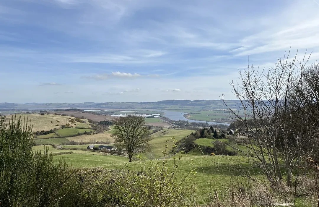
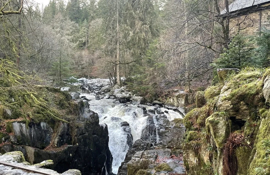
River Tay
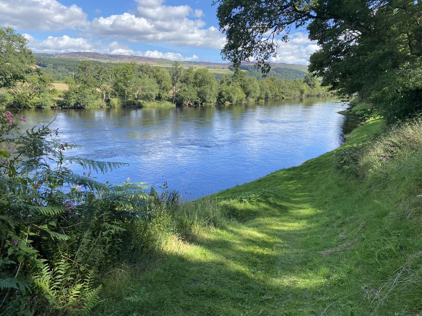
The River Tay runs right through Perth and is Scotland’s longest river. Its calm waters have shaped the city’s life for hundreds of years. The river has helped with transport, fishing, and farming, and it's still important today. It adds beauty to the city and draws visitors all year round.
People enjoy walking along the riverside paths, especially in the morning or evening. You can see boats on the water and birds like swans or ducks. Fishing is allowed in some areas, especially for salmon. The views are peaceful, making the river a perfect place for a break from the busy town centre.
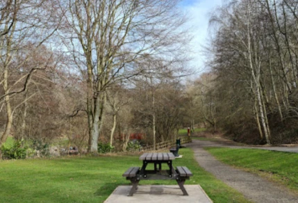
North Inch Park
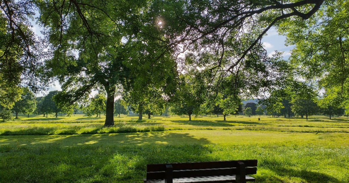
North Inch Park is a large green space beside the River Tay. It is one of Perth’s oldest parks and offers wide-open lawns, walking paths, and great river views. The park is used by locals for sports, walking dogs, or just enjoying the fresh air.
It’s also a place for public events like funfairs or festivals. There’s a golf course nearby and seats where you can sit and relax. North Inch is very close to the city centre, so it’s easy to reach on foot. It’s a peaceful place with a lot of history and space to enjoy.
South Inch Park
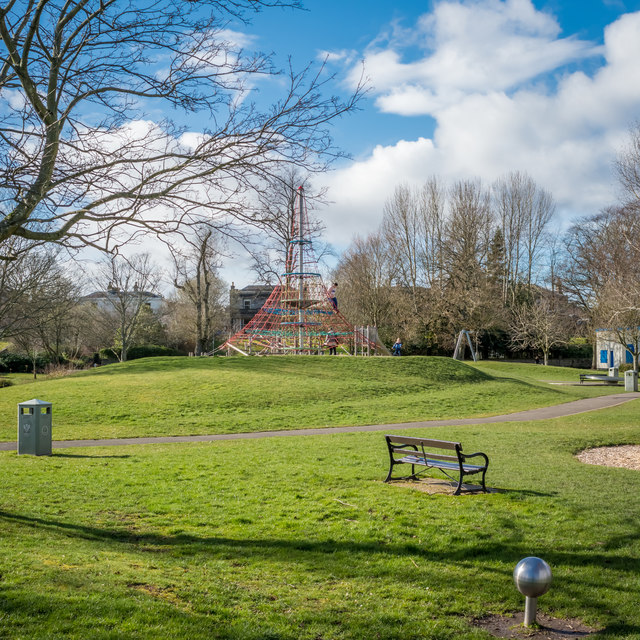
South Inch Park is another big green area in the city. It’s just a few minutes’ walk from the shopping streets. It has open spaces, a duck pond, play areas for kids, and many trees for shade.
People come here to picnic, walk their dogs, or play sports like football. Families enjoy the playground and watching ducks at the pond. There are benches all around, and it’s a good place to rest or meet friends. It’s calm, tidy, and very family-friendly.
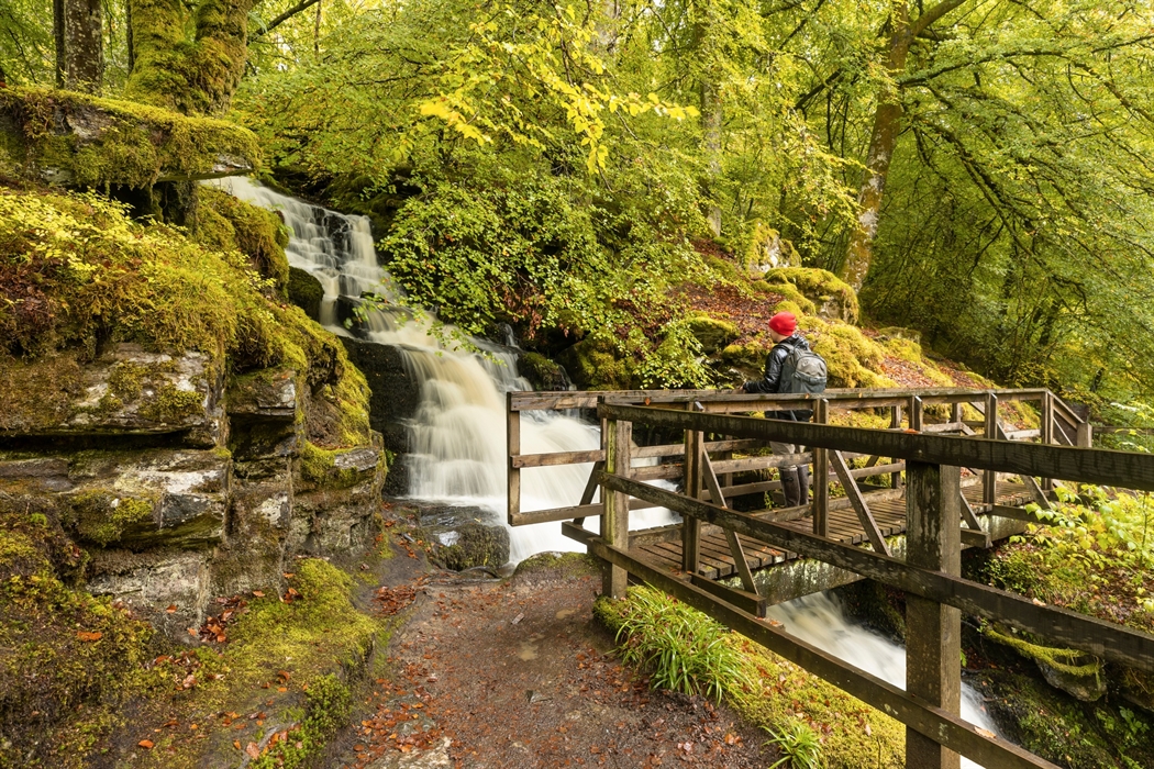
Tay Forest Park (Near Perth)
Tay Forest Park is just north of Perth and is perfect for a day out. It has big forests, quiet lochs, and viewpoints where you can see far across the hills. It's not inside the city, but it's worth the short drive.
Some spots have visitor centres and maps, and there are lots of trails to explore. Wildlife like red squirrels, deer, and birds live here. If you want to experience wild Scottish nature, this is a great place near Perth.
Quarrymill Woodland Park

Quarrymill Woodland Park is a lovely area with trees, walking paths, and picnic spots. It’s located just north of Perth and is popular for short walks with family or pets.
The park has bridges, a small stream, and benches along the trail. In spring and summer, it’s full of wildflowers and butterflies. It’s not far from Scone Palace, so you can visit both in one trip. It’s quiet, safe, and full of natural charm.
Deuchny Wood
Deuchny Wood is on the edge of Perth and offers peaceful forest walks. It connects with Kinnoull Hill and has tall pine trees, narrow paths, and open glades. It’s a place where you feel truly close to nature.
There are many walking and mountain biking paths, some steep and some easy. It’s also home to deer, owls, and other woodland animals. If you like quiet trails with very few people around, this is a perfect spot to visit.
Huntingtower Community Woodland
This small woodland area sits west of the city near Huntingtower Castle. It was planted by the local community and offers a short but peaceful walk. It’s ideal for kids or anyone looking for a quick nature break.
The area is flat and easy to walk through. You’ll see native plants and hear birds singing. There are signs explaining the types of trees and flowers. It’s not a big tourist spot, but it’s a charming hidden gem near the city.
Transport Maps And Getting Around Perth
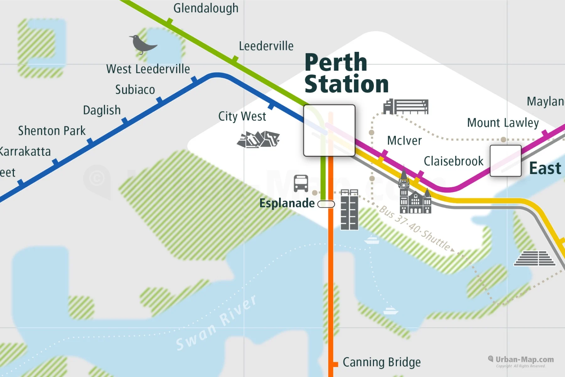
Perth is a small and easy-to-navigate city. If you're walking, taking the bus, or using a car, getting around is simple. Here are the main transport options and what you should know about each one:
Perth Train Station
Perth’s train station is just a short walk south of the city centre. Trains from here go to major cities like Edinburgh, Glasgow, Dundee, and Inverness. It’s a good option for day trips or if you're arriving from another part of Scotland. Inside the station, there are ticket machines, waiting areas, and a small café. Train times and a Scotland railway mapare available at the station or online.
Bus Network In Perth
Perth has a reliable network of local and regional buses. Local buses help people move between neighbourhoods like Letham, Craigie, and North Muirton, while regional buses go to nearby towns such as Crieff, Kinross, and Pitlochry. Most buses leave from the Perth Bus Station, close to the city centre. You can get maps and timetables at the station or on the Perth & Kinross Council website.
Walking Routes
Perth is a very walkable city. The city centre is mostly flat, making it easy for people of all ages to walk between shops, cafés, parks, and the riverfront. Signposts help guide you to the main attractions, and many streets are pedestrian-friendly. Walking maps are often available at visitor centres and hotels.
Bicycle Paths
There are cycle-friendly roads and bike paths in and around Perth. You can cycle along the River Tay, through North Inch Park, or use quieter back roads. Some main roads have marked lanes for cyclists. If you enjoy cycling, Perth is a good base for longer countryside rides as well. Bike hire shops and route maps can be found in town.
Major Roads And Driving In Perth
Perth is connected by several important roads:
- A9links Perth to Inverness and Stirling.
- A85leads west toward Crieff and Oban.
- M90goes south toward Edinburgh.
These roads make it easy to reach Perth by car or coach. Inside the city, traffic is usually light, and parking is available in car parks and on some streets. A detailed road map of Scotlandhelps with directions, especially if you're visiting rural areas around Perth.
Types Of Perth, Scotland Maps
Not everyone needs the same kind of map. Some people want to walk around, others want to drive, and some just want to see where the tourist spots are. That’s why different types of maps help with different things. Here are the most helpful kinds of maps you might use in Perth:
Online Interactive Maps
These are the maps you use on your phone, tablet, or computer. You can zoom in to see small streets, search for places like cafés, museums, or toilets, and even follow your location with GPS. They are great when you're walking around the city and need quick help finding something. Google Maps is a good example of this.
Printable Walking Maps
These maps can be printed out or picked up at a tourist centre. They show walking routes, city streets, and important spots like parks, statues, and buildings. They are good for people who like exploring on foot. If your phone battery dies, it’s handy to have a paper map as a backup.
Historical Map Overlays
These maps show what Perth looked like in the past, sometimes as far back as the 1800s. You can compare old streets and buildings with what is there today. They’re useful if you enjoy history or want to see how the city has changed over time.
Tourist Attraction Maps
These are often free at hotels, train stations, or visitor centres. They highlight the best places to visit, such as art galleries, castles, gardens, and walking paths. They usually use symbols or pictures to make it easy to follow. These maps are made for visitors and show what’s fun or interesting nearby.
Transport And Road Maps
These maps show the main roads in and around Perth, along with bus stops, train stations, and driving routes. They are helpful if you’re driving, taking the bus, or planning a day trip out of town. Some maps also include cycling paths.
Where To Find The Best Maps Of Perth, Scotland
- Perth Museum and Art Gallery- Offers both modern and historical maps for sale.
- VisitScotland Centres- Staff can provide free tourist maps.
- Perth & Kinross Council Website- Printable PDFs of transport, planning, and visitor maps.
- National Library of Scotland- Free historical map access online.
- Local Bookshops- Sell walking route maps and tourist guides.
Some places also offer bilingual maps (English and Gaelic) for added cultural interest.
Interesting Facts About Perth, Scotland
- Perth was once the ancient capital of Scotland and an important royal center.
- The nearby Scone Palace is where Scottish kings were crowned on the Stone of Destiny.
- Perth is known as the “Fair City”, a name made popular by the novel Fair Maid of Perth by Sir Walter Scott.
- The city gave its name to Perth, Australia, in 1829 when it was chosen by settlers in Western Australia.
- The River Tay, which runs through Perth, is Scotland’s longest river.
- Perth is home to one of the oldest museums in the UK, the Perth Museum, established in 1824.
- The city was once a key trading hub, especially for wool, salt, and salmon.
- The Black Watch Museum in Perth tells the story of one of Scotland’s most famous military regiments.
- Perth is surrounded by scenic landscapes, making it a popular base for hill walks and countryside getaways.
- St John’s Kirk, one of Perth’s oldest churches, has been standing since the 12th century.
People Also Ask
What Is Perth Most Well-known For?
Perth, the sun-kissed capital of Western Australia, is often known for its endless beaches, sprawling parklands, and laid-back lifestyle. But there's so much more to this vibrant city than its picture-perfect natural beauty. From the arts and sport to its busy food scene, Perth has its unique charm.
How Do I Read A Grid Reference On A Perth, Scotland Ordnance Survey Map?
Each square on an Ordnance Survey map has a unique grid reference. Learning the grid system helps you find locations precisely for hiking or exploring.
Does The Perth, Scotland Map Show Places To Stay And Eat?
Tourist maps often include icons for hotels, B&Bs, restaurants, and cafes, especially those in the city centre and along key travel routes.
Can I Use Google Maps To Explore Perth, Scotland, Offline?
Yes, you can download the Perth area from Google Maps and access it offline, which is handy for navigating without Wi-Fi or mobile data.
Final Thoughts
Perth has many interesting places, from well-known spots and walking routes to quiet areas and nearby towns. A clear map makes it easier to enjoy these places and plan your time well.
A Perth map helps you move around with ease and find what matters most to you. It's a helpful way to see more of the city and enjoy your visit fully.
Jump to
Perth Scotland Map: Overview Of The Fair City
Quick Facts About Perth, Scotland
History Of Perth, Scotland
Geographical Overview Of Perth, Scotland
Map Of Towns And Villages In Perth, Scotland
Pitlochry Walking Map
Regions On The Map Of Perth, Scotland
Population Of Perth, Scotland
Currency Of Perth, Scotland
Dialing Code Of Perth, Scotland
Language Of Perth, Scotland
Tourist Attractions On The Map Of Perth, Scotland
Transport Maps And Getting Around Perth
Types Of Perth, Scotland Maps
Where To Find The Best Maps Of Perth, Scotland
Interesting Facts About Perth, Scotland
People Also Ask
Final Thoughts

Callum Fraser
Author
Callum Fraser isn't just a writer about Scotland; he's a product of its rugged landscape and rich history. Born and raised in Perthshire, with the Highlands as his backyard, his love for the nation's stories was kindled by local storytellers and long walks through ancient glens.
This passion led him to pursue a degree in Scottish History from the University of Edinburgh. For over 15 years, Callum has dedicated himself to exploring and documenting his homeland, fusing his academic knowledge with essential, on-the-ground experience gained from charting road trips through the Cairngorms, hiking the misty Cuillins of Skye, and uncovering the secrets of traditional recipes in his family's kitchen.
As the Editor-in-Chief and Lead Author for Scotland's Enchanting Kingdom, Callum's mission is simple: to be your most trusted guide. He combines meticulous research with a storyteller's heart to help you discover the authentic magic of Scotland — from its best-kept travel secrets to its most cherished traditional recipes.
Latest Articles
Popular Articles